The best walks and hikes around Pantà de Camarasa
4.5
(289)
2,020
hikers
107
hikes
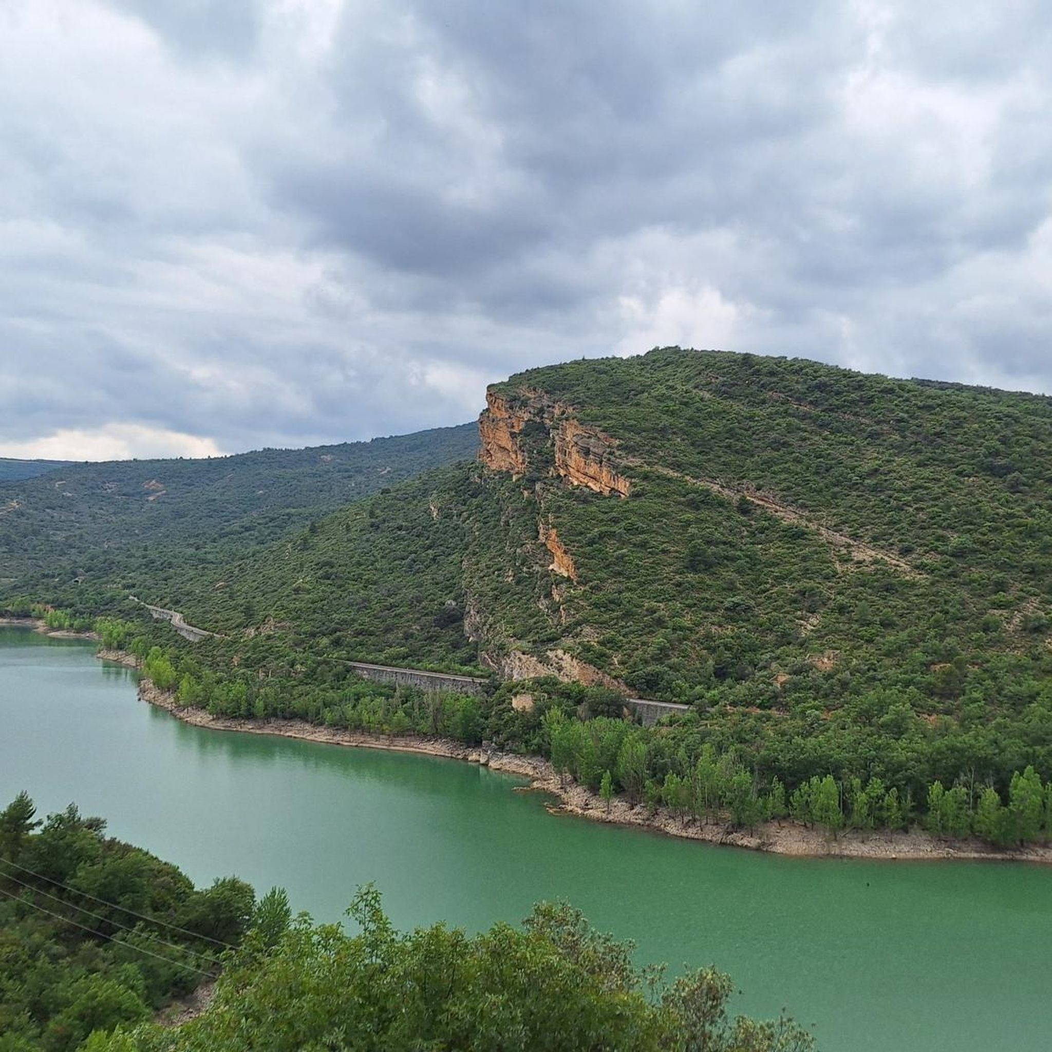
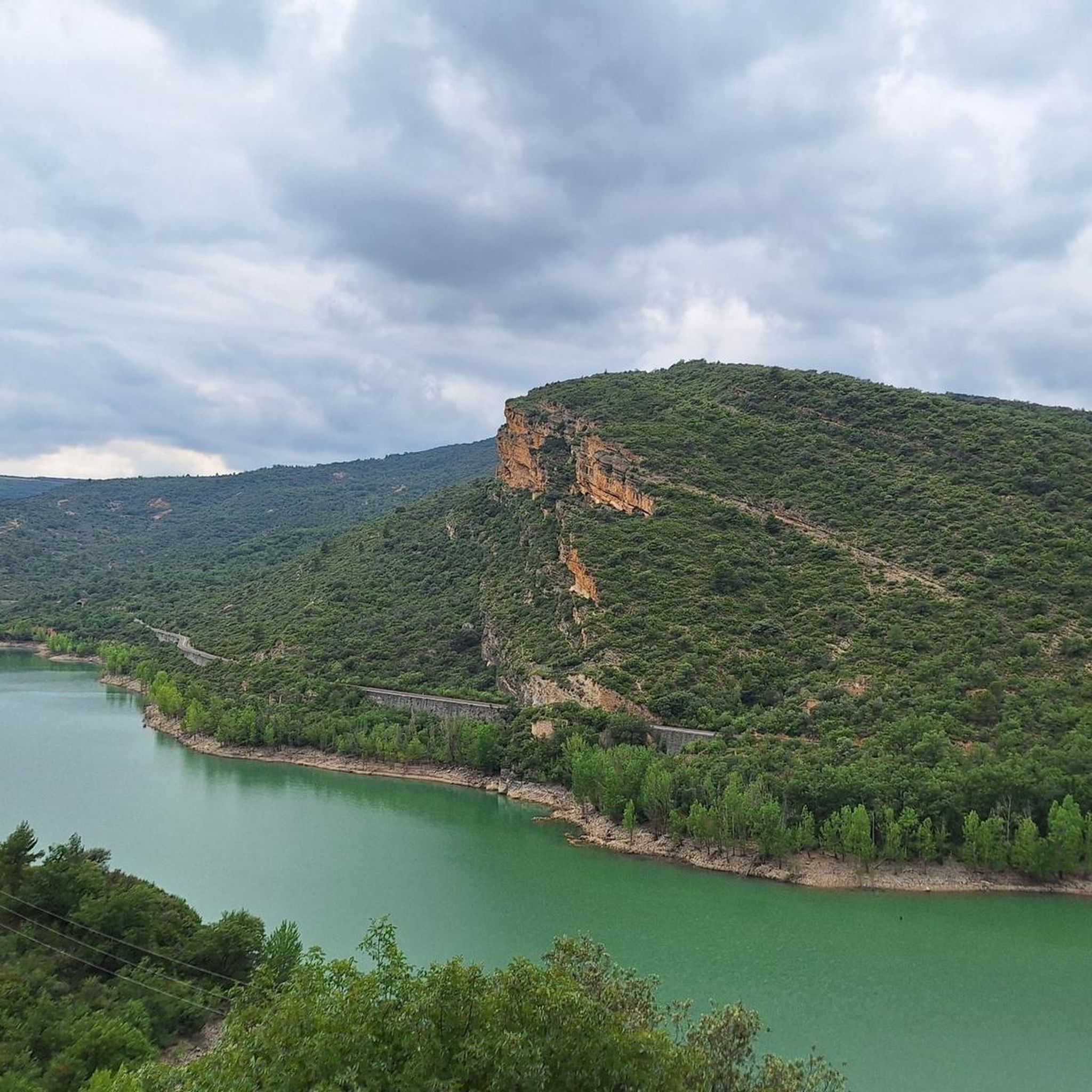
Hiking trails around Pantà de Camarasa are characterized by the reservoir's waters, surrounding hills, and varied terrain. The region features a mix of forested areas, open paths, and elevated sections offering views of the landscape. The Noguera Pallaresa river flows through the area, influencing the local topography.
Best hiking trails around Pantà de Camarasa
- The most popular hiking route is Baronia de Sant Oïsme Loop, a 4.5 miles (7.3 km) trail that takes 2 hours 22 minutes to complete. This moderate circular walk offers views of the surrounding hills.
- Another top favourite among local hikers is Hermitage and Castle of Oroners — La Noguera, an easy 3.6 miles (5.7 km) path. This trail features historical points of interest and takes about 1 hour 41 minutes.
- Local hikers also love the Río Noguera Pallaresa y Fontllonga i Ametlla — circular por la Sierra de Montsec d'Ares, a 12.4 miles (20.0 km) trail leading through the Sierra de Montsec d'Ares, often completed in about 6 hours 52 minutes.
- Hiking around Pantà de Camarasa is defined by reservoir views, river paths along the Noguera Pallaresa, and hills offering panoramic viewpoints. The network offers options for easy hikes as well as more challenging routes.
- The routes in Pantà de Camarasa are highly rated by the komoot community with an average score of 4.5 stars from over 300 reviews. More than 2000 hikers have used komoot to explore Pantà de Camarasa's varied terrain.
Last updated: June 25, 2026
5.0
(3)
13
hikers
7.32km
02:22
320m
320m
Hike the moderate 4.5-mile Route Baronía de San Oísmo — La Noguera, featuring the Suspension Bridge and views of the Camarasa Reservoir.
4.3
(3)
8
hikers
5.75km
01:42
170m
170m
Easy hike. Great for any fitness level. Easily-accessible paths. Suitable for all skill levels.

Sign up for free
Hard hike. Very good fitness required. Mostly accessible paths. Sure-footedness required.
1.52km
00:27
40m
40m
Easy hike. Great for any fitness level. Easily-accessible paths. Suitable for all skill levels.
4.7
(13)
74
hikers
5.25km
01:54
320m
320m
Moderate hike. Good fitness required. Easily-accessible paths. Suitable for all skill levels.
Get access to more routes and recommendations from other explorers.
Sign up for free
Already have an account?
Our route recommendations are based on thousands of hikes, rides, and runs completed by other people on komoot.
Start today with a free account
Your next adventure awaits.
Login or Signup

Tips from the Community

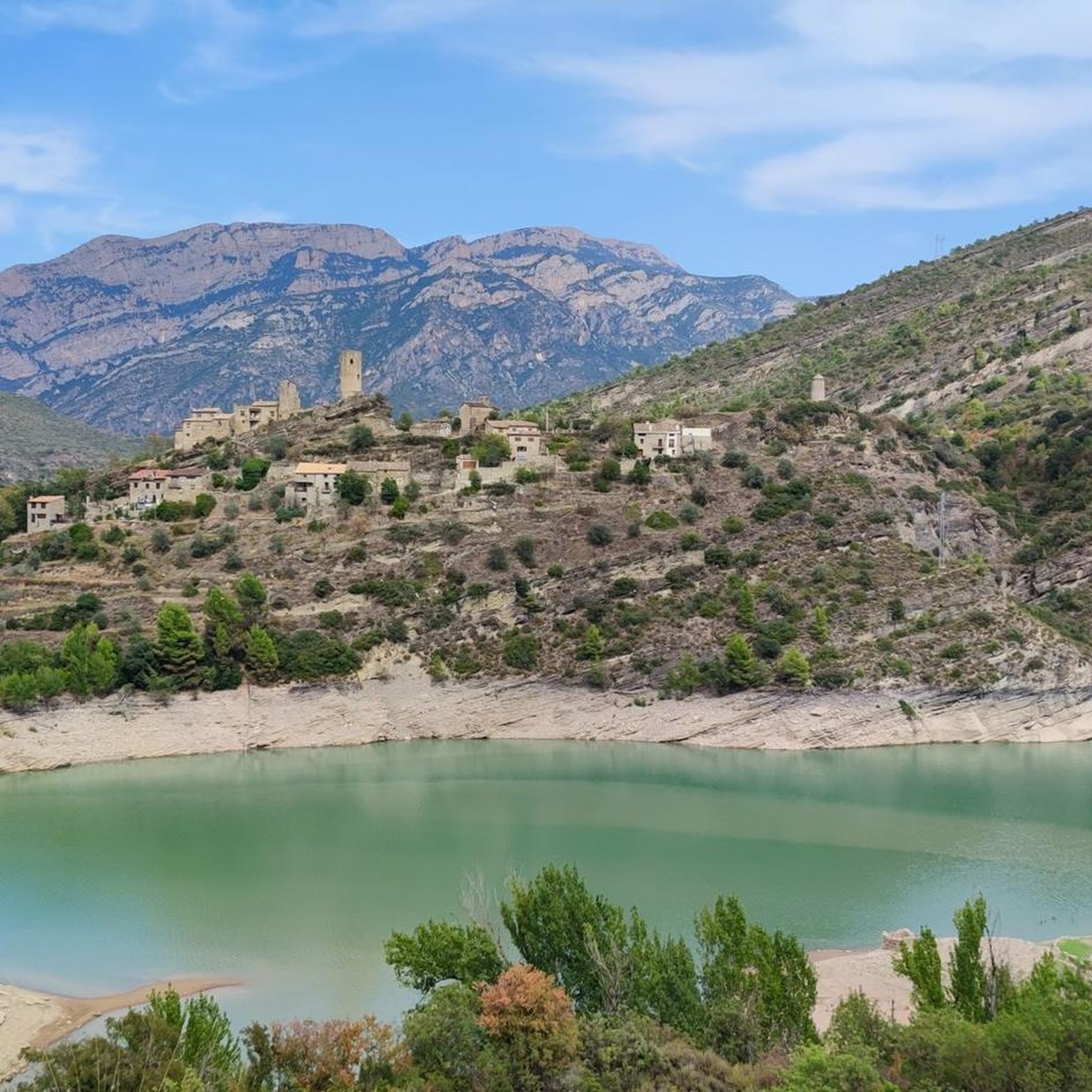
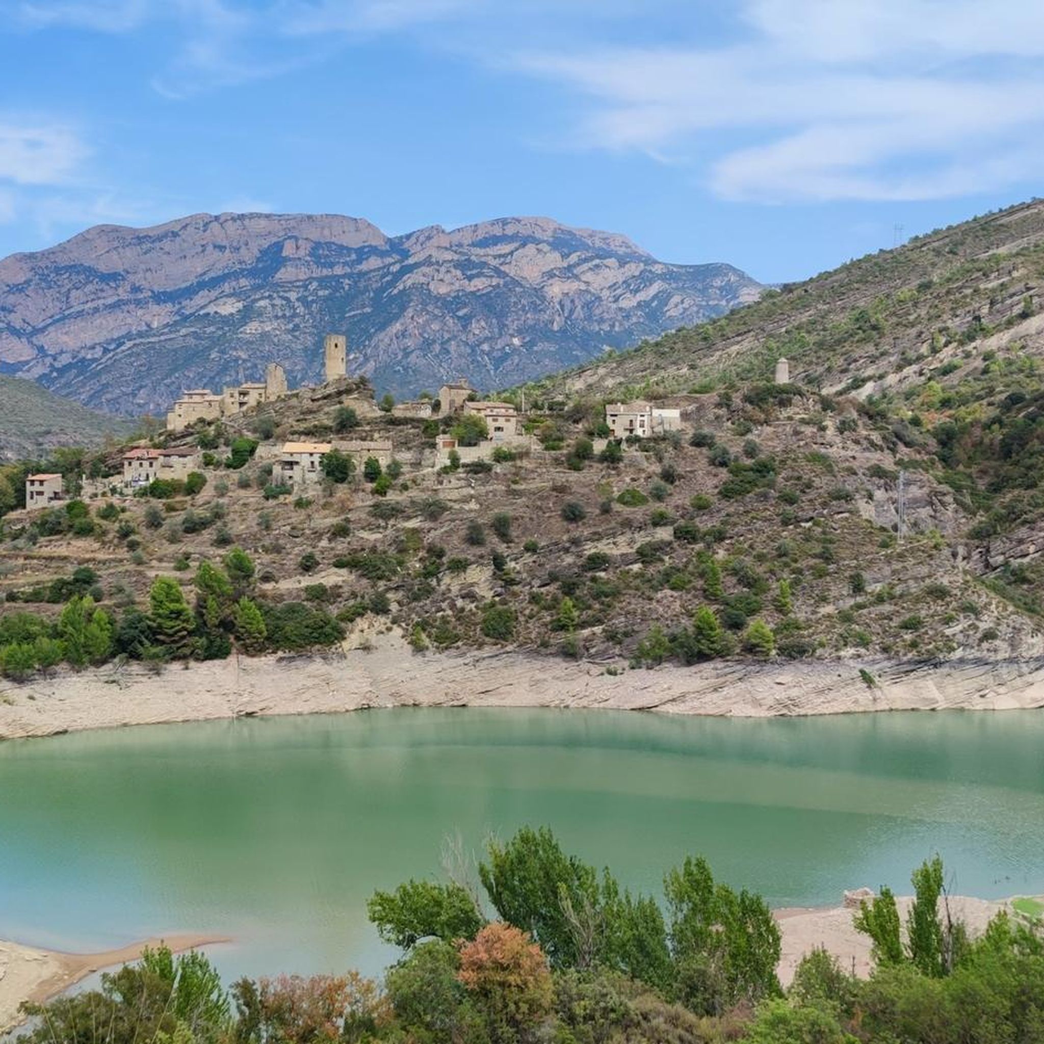
Small town that is located below Montsec d'Ares, and that is made up of a few houses governed by a church, that of Santa Maria de l'Ametlla.
0
0
Before reaching the narrowest point of the Terradets pass, there appears this set of kilometers where the river has formed a narrow gorge that, as the path rises, gives very beautiful views of the area.
0
0

With magnificent views of Camarasa and the Segre River, at this point we will find the Cova del Tabac, a monumental cave where we will find ancient cave paintings damaged by acts of vandalism. The cave was formed by karst phenomena, meaning that water infiltrated through the stone over millions of years. As a curiosity, we know that the name Cova del Tabac comes from the powder that centuries ago was extracted from it to mix with tobacco.
1
0
Built in the same stone of the mountain. Romanesque style church dating from the 11th century.
1
0
Ruins of the old Oroners Castle that was found in 1986 thanks to the doctoral thesis of Mr. Francesc Fité y Llevaot. Nice views from this point to the Camarasa reservoir.
1
0
Views of the Barony of Sant Oisme
1
0
At this point we will find the Cova del Tabac, a monumental cave where we will find ancient cave paintings damaged by acts of vandalism. The cave was formed by karst phenomena, meaning that water infiltrated through the stone over millions of years. As a curiosity, we know that the name of Cova del Tabac comes from the dust that was extracted from it back in the day to mix it with tobacco.
1
0
Fortaleza de Sant Oísmo, in the municipality of Camarasa, county of La Noguera.
1
0
Frequently Asked Questions
How many hiking trails are available around Pantà de Camarasa?
There are over 110 hiking trails in the Pantà de Camarasa region. These routes vary in difficulty, offering options for easy strolls, moderate treks, and more challenging expeditions.
Are there easy hiking trails suitable for beginners or families?
Yes, Pantà de Camarasa offers a good selection of easy trails. There are 30 routes classified as easy, perfect for a relaxed walk. For a shorter, family-friendly option, consider the Baronía de San Oísmo route, which is just over 1.5 km long and takes less than 30 minutes.
What are the typical durations for hikes in this area?
Hiking durations vary widely. You can find short walks like the Baronía de San Oísmo at under 30 minutes, to moderate trails taking a couple of hours, and longer, more challenging routes that can extend up to 7 hours or more, such as those leading through the Sierra de Montsec d'Ares.
Are there any circular walks in Pantà de Camarasa?
Yes, many of the trails around Pantà de Camarasa are circular, allowing you to start and end at the same point. A popular moderate circular option is the Cova del Tabac loop from Presa de Camarasa, which offers diverse scenery over 5.25 km.
What is the best season for hiking around Pantà de Camarasa?
The best seasons for hiking in Pantà de Camarasa are typically spring and autumn. During these times, the weather is milder, and the natural scenery is vibrant, with blooming flora in spring and rich colors in autumn. Summer can be very hot, making early morning or late afternoon hikes preferable, while winter can bring colder temperatures, especially at higher elevations.
Are dogs allowed on the hiking trails?
Generally, dogs are welcome on most hiking trails in the Pantà de Camarasa region. However, it's always recommended to keep them on a leash, especially in areas with wildlife or near livestock, and to clean up after them. Always check specific trail regulations if posted.
Where can I park when visiting Pantà de Camarasa for hiking?
Parking is typically available at key access points around the reservoir and near popular trailheads. Look for designated parking areas near villages like Camarasa or close to the dam (Presa de Camarasa). It's advisable to arrive early during peak season to secure a spot.
What kind of wildlife might I encounter while hiking?
The Pantà de Camarasa region is home to diverse wildlife. You might spot various bird species, including raptors soaring above the cliffs. Mammals such as wild boar, deer, and smaller creatures like squirrels and rabbits are also present, though often shy. Keep an eye out for reptiles and amphibians near the water.
What do other hikers enjoy most about the trails in Pantà de Camarasa?
The area is highly rated by the komoot community, with an average score of 4.5 stars from over 300 reviews. Reviewers often praise the stunning reservoir views, the peaceful river paths along the Noguera Pallaresa, and the varied terrain that offers both gentle walks and challenging climbs with panoramic viewpoints.
Are there any challenging hikes for experienced trekkers?
Yes, for experienced hikers seeking a challenge, Pantà de Camarasa offers 20 difficult routes. These trails often feature significant elevation gains and longer distances. An example is the Río Noguera Pallaresa y Fontllonga i Ametlla — circular por la Sierra de Montsec d'Ares, a 20 km route with substantial elevation changes.
What kind of terrain can I expect on the trails?
The terrain around Pantà de Camarasa is quite varied. You'll find a mix of well-trodden paths, rocky sections, forested areas, and open tracks. Trails often follow the contours of the reservoir, ascend hills for viewpoints, or wind along the Noguera Pallaresa river, providing a diverse hiking experience.
Are there any viewpoints or scenic spots along the trails?
Absolutely. The region is known for its panoramic viewpoints, especially from elevated sections of the trails. Many routes offer stunning vistas of the Pantà de Camarasa reservoir, the Noguera Pallaresa river, and the surrounding hills and mountains, including parts of the Sierra de Montsec d'Ares.
Most popular routes around Pantà de Camarasa

Get inspired with the komoot mobile app


Explore more
Browse the best Hikes in other regions.
