The best running trails around Estany de Cavallers
5.0
(1)
430
runners
32
runs
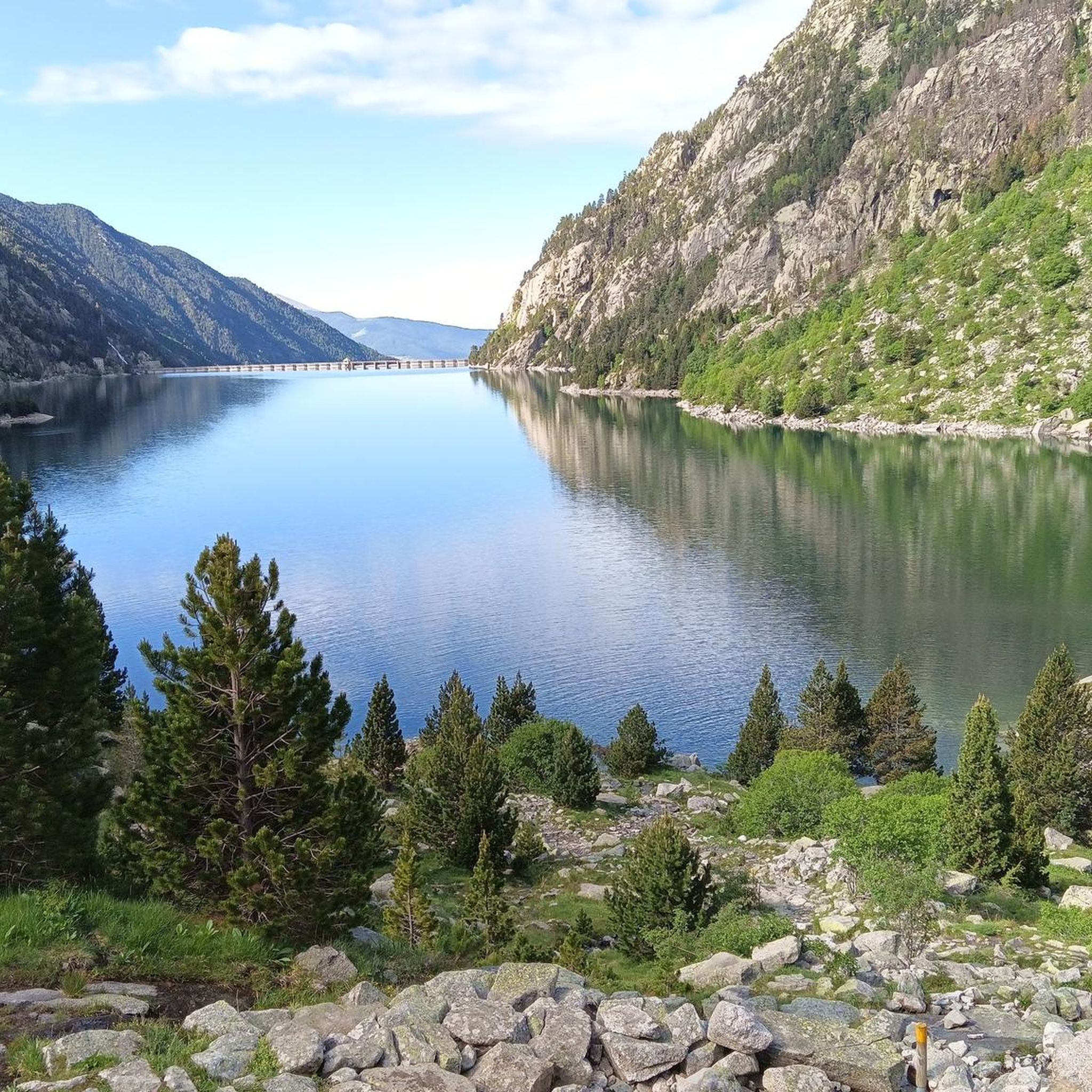
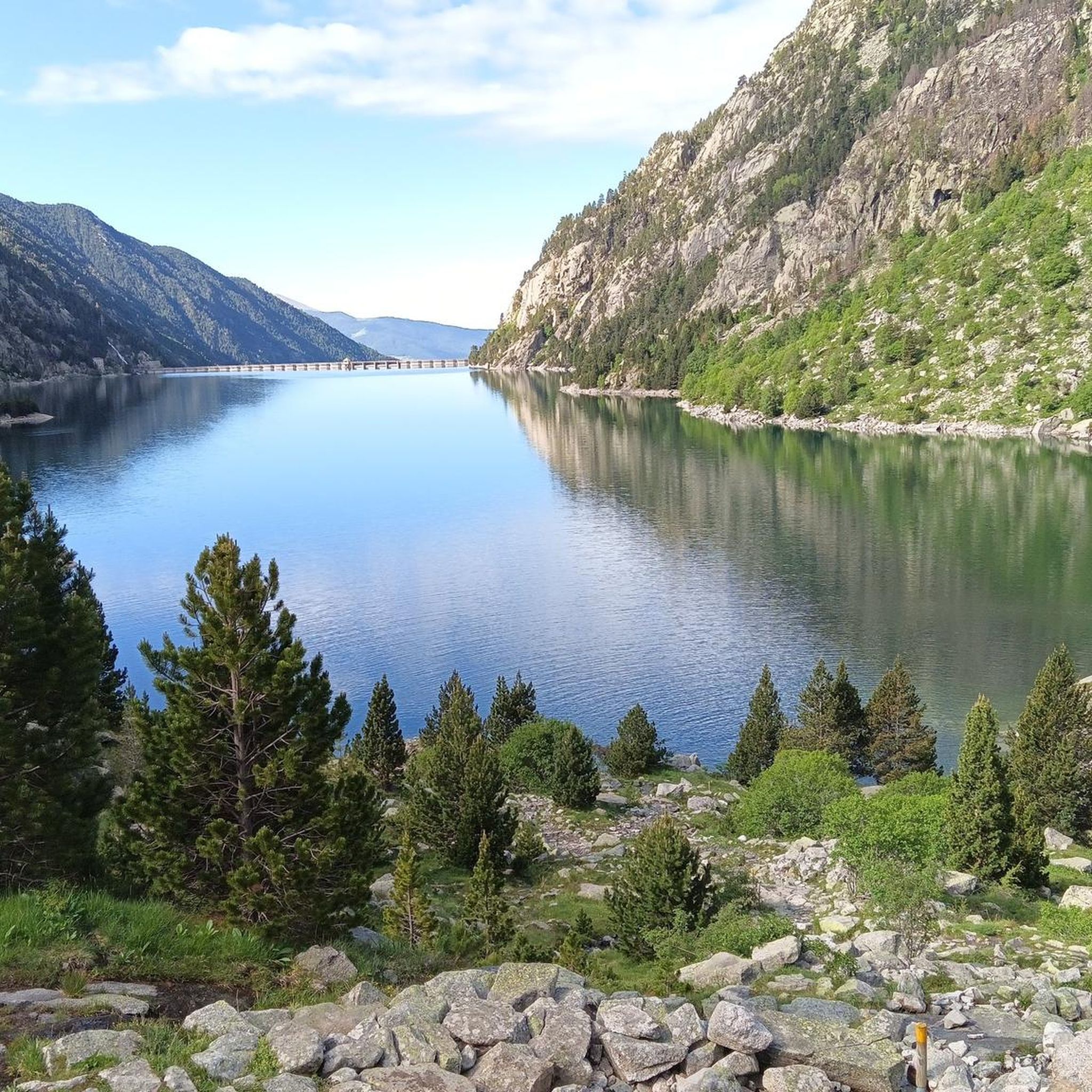
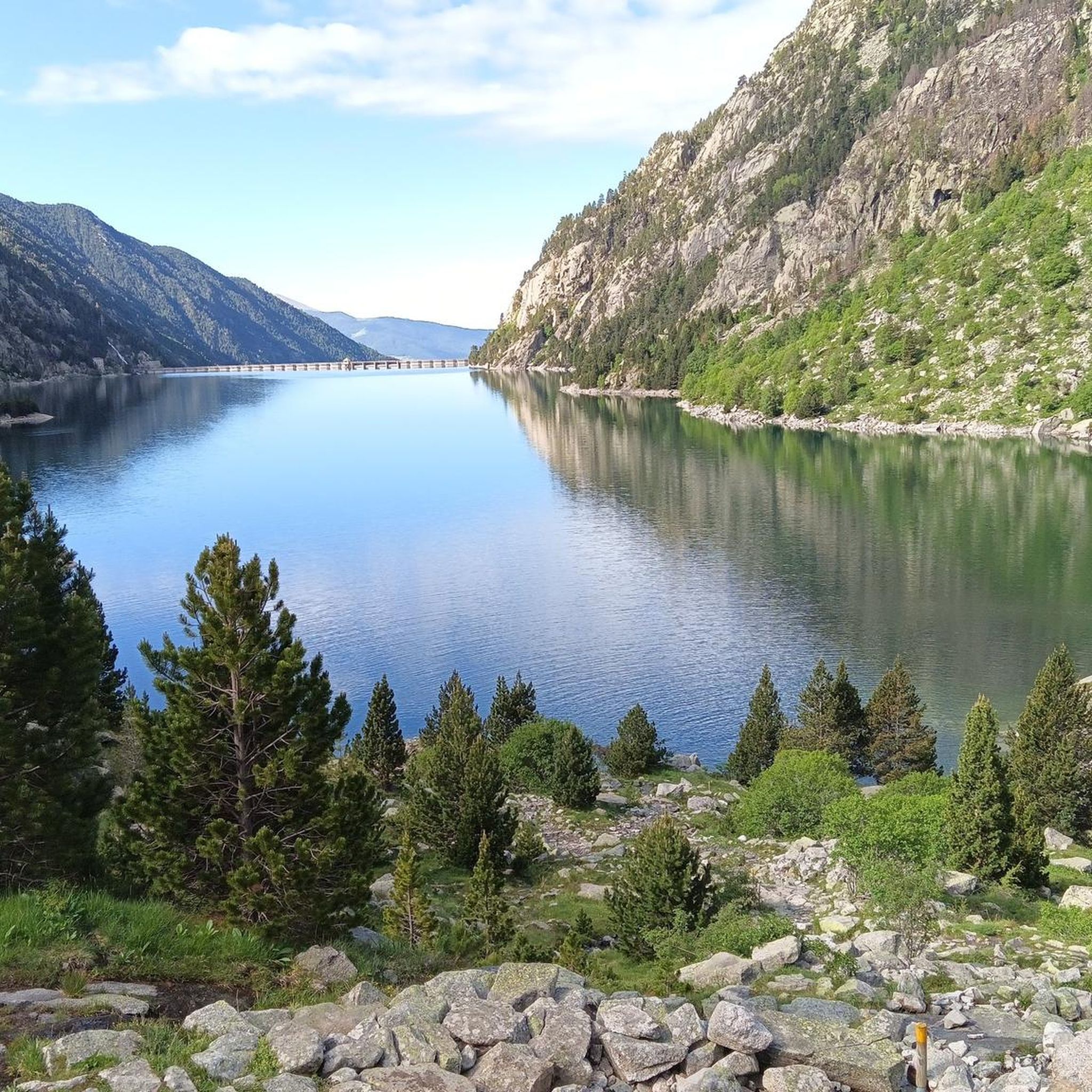
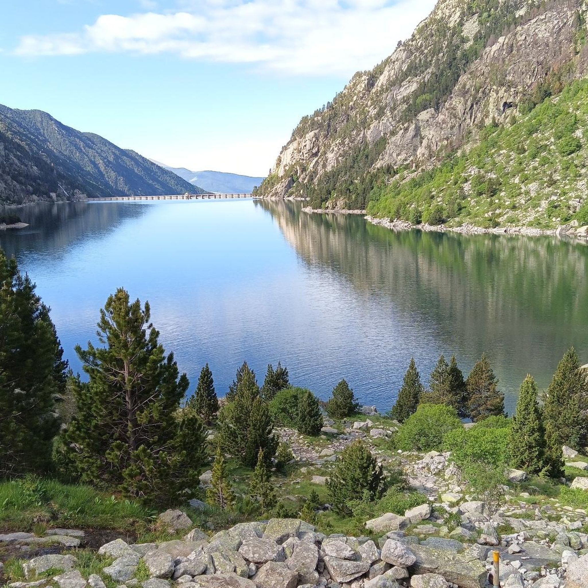
Jogging routes around Estany de Cavallers traverse a landscape defined by high Pyrenean mountains and rocky terrain, sculpted by ancient glaciers. The region features the large artificial lake, Estany de Cavallers, situated at an altitude of approximately 1,784 meters. Numerous smaller lakes and small mountain rivers like El Riuet d'Estany Negre are prominent features, offering varied scenery for runners. Panoramic views of the Boí Valley are also accessible from many trails.
Best jogging routes around Estany de Cavallers
- The most…
Last updated: September 28, 2026
5
runners
Hard run. Good fitness required. Sure-footedness, sturdy shoes and alpine experience required.
7
runners
Hard run. Very good fitness required. Sure-footedness, sturdy shoes and alpine experience required.

33
runners
14.0km
01:55
530m
530m
Hard run. Very good fitness required. Mostly paved surfaces. Suitable for all skill levels.
16
runners
10.3km
01:19
360m
360m
Hard run. Very good fitness required. Mostly paved surfaces. Suitable for all skill levels.
24
runners
13.2km
02:05
460m
460m
Hard run. Very good fitness required. Sure-footedness, sturdy shoes and alpine experience required.
Get access to more routes and recommendations from other explorers.
Already have an account?
Our route recommendations are based on thousands of hikes, rides, and runs completed by other people on komoot.
Start today with a free account
Your next adventure awaits.

Tips from the Community

Beautiful lake, located in a very bucolic basin
0
0
Very beautiful waterfall with spectacular "giant's pothole" type pools.
0
0
Artificial lake, starting point for many trips in the area
0
0

The Estany de Llebreta is a glacial lake in the Parc Nacional d'Aigüestortes i Estany de Sant Maurici. Completely surrounded by forest, it lies at an altitude of 1,619 meters at the foot of the Tuc de Llebreta. There are even trout in the water, which is up to twelve meters deep. A beautiful hiking destination that even younger children can easily reach.
0
0

Espot serves as a starting point for numerous routes in the Aigüestortes and Estany de Sant Maurici National Park. From here, it is possible to see the Valle de Boí and the Presa de Cavallers, which we can cross by means of a bridge to explore.
1
0
The Sant Nicolau river has its origin in the Estany Llong and is fed by the waters of at least twelve lakes during its brief journey until it reaches the Noguera del Tor. Despite its short length, its force is intense, as it crosses one of the most captivating valleys of the Aigüestortes National Park. This valley is surrounded by imposing mountains and forests that have a particular charm.
0
0
Quieter than Estany Long. The path from Estany Llong to Estany Redó takes less than 30 minutes.
0
0
The trail is well marked and moderate. The stretch from Estany Llong to Estany Redó is a bit steeper and more exhausting. The views are awesome!
0
0
Frequently Asked Questions
How many running routes are available around Estany de Cavallers?
There are over 25 dedicated running routes in the Estany de Cavallers area, offering a wide range of options for different fitness levels and preferences.
What kind of terrain can I expect on the jogging trails in Estany de Cavallers?
The jogging trails around Estany de Cavallers are characterized by high Pyrenean mountains and rocky terrain, shaped by ancient glaciers. You'll encounter diverse landscapes, from paths around the large artificial lake to routes featuring numerous smaller glacial lakes and mountain rivers like El Riuet d'Estany Negre. Many routes also offer panoramic views of the Boí Valley.
Are there any less strenuous running options for beginners or those seeking a moderate pace?
While many routes in Estany de Cavallers are rated as difficult, there are moderate options available. For instance, the area around the main lake offers paths suitable for a less strenuous run. The guide mentions options for various ability levels, though specific 'easy' routes are not highlighted in the data, focusing more on moderate to challenging trails.
What are some notable landmarks or natural features I might see while running in the area?
Runners can enjoy several impressive sights. The Presa de Cavallers (dam) itself is a significant landmark, offering unique perspectives of the reservoir. You'll also encounter numerous crystalline lakes, such as Estanys de Travessany and de les Monges, and small mountain rivers. The dramatic high Pyrenean mountains provide a majestic backdrop throughout your run.
Are there any circular running routes around Estany de Cavallers?
Yes, there are several circular routes. For example, the Estany de Llebreta – Sant Esperit Waterfall loop from la Vall de Boí is a difficult 14 km path featuring diverse terrain and a waterfall. Another option is the Sant Nicolau Loop – La Llebreta Lake loop from Riu de Sant Nicolau, a 10.3 km trail through mountainous landscapes and past lakes.
Is there parking available near the jogging routes?
Yes, there are convenient parking areas located near the Presa de Cavallers (dam), which serves as a primary starting point for many routes around Estany de Cavallers. This makes it easily accessible for runners arriving by car.
What is the best time of year to go jogging in Estany de Cavallers?
The region's high Pyrenean location suggests that late spring, summer, and early autumn are generally the best times for jogging, when trails are most likely to be clear of snow and ice, and the weather is more favorable. Always check local conditions before planning your run.
Are there any mountain refuges or places to stay overnight along the longer trails?
Yes, the Refugi Ventosa i Calvell is a prominent mountain refuge in the area, often serving as a destination or waypoint for several trails, including the 'Route of the Marmot'. It's in a stunning location and can be a fantastic place for an overnight stay during multi-day runs or hikes.
What do other runners say about the trails in Estany de Cavallers?
The running routes in Estany de Cavallers are highly rated by the komoot community, with an average score of 5.0 stars. Over 300 runners have used komoot to explore the varied terrain, often praising the majestic scenery and the challenge of the Pyrenean landscapes.
Are there any routes that feature waterfalls?
Yes, the Estany de Llebreta – Sant Esperit Waterfall loop from la Vall de Boí is a difficult 14 km route that specifically features a waterfall, alongside beautiful lake views and diverse terrain.
Can I find challenging running trails in Estany de Cavallers?
Absolutely. The region is known for its challenging routes, with 23 out of 27 listed tours rated as difficult. Trails like the Pantano de Cavallers — Parque Nacional de Aigüestortes i Estany de Sant Maurici, a 5 km difficult trail, offer significant elevation changes. For a more strenuous challenge, the Punta Alta de Comalesbienes Loop Trail (not listed in guide data but mentioned in research) is a difficult 9.1-mile hike.
Are there any routes that offer views of the Boí Valley?
Yes, many trails in the Estany de Cavallers area provide expansive panoramic views of the Boí Valley. For example, the View of the Vall de Boí loop from Sant Joan de Boí is a 13.45 km difficult route specifically designed to showcase these stunning vistas.
Most popular routes around Estany de Cavallers

Get inspired with the komoot mobile app


Explore more
Browse the best Running Trails & Routes in other regions.
