The best running trails around Embalse de El Villar
4.3
(3)
424
runners
27
runs
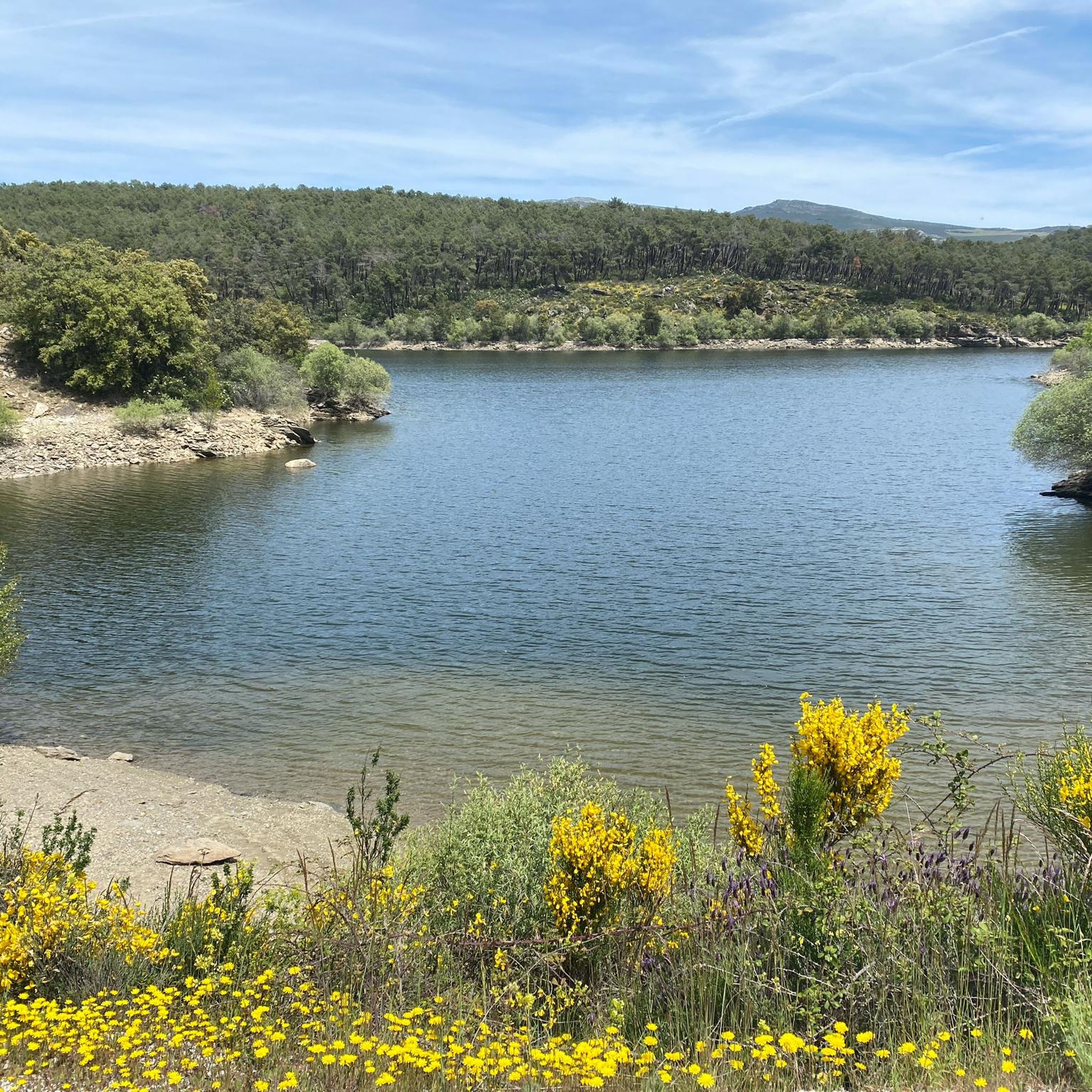
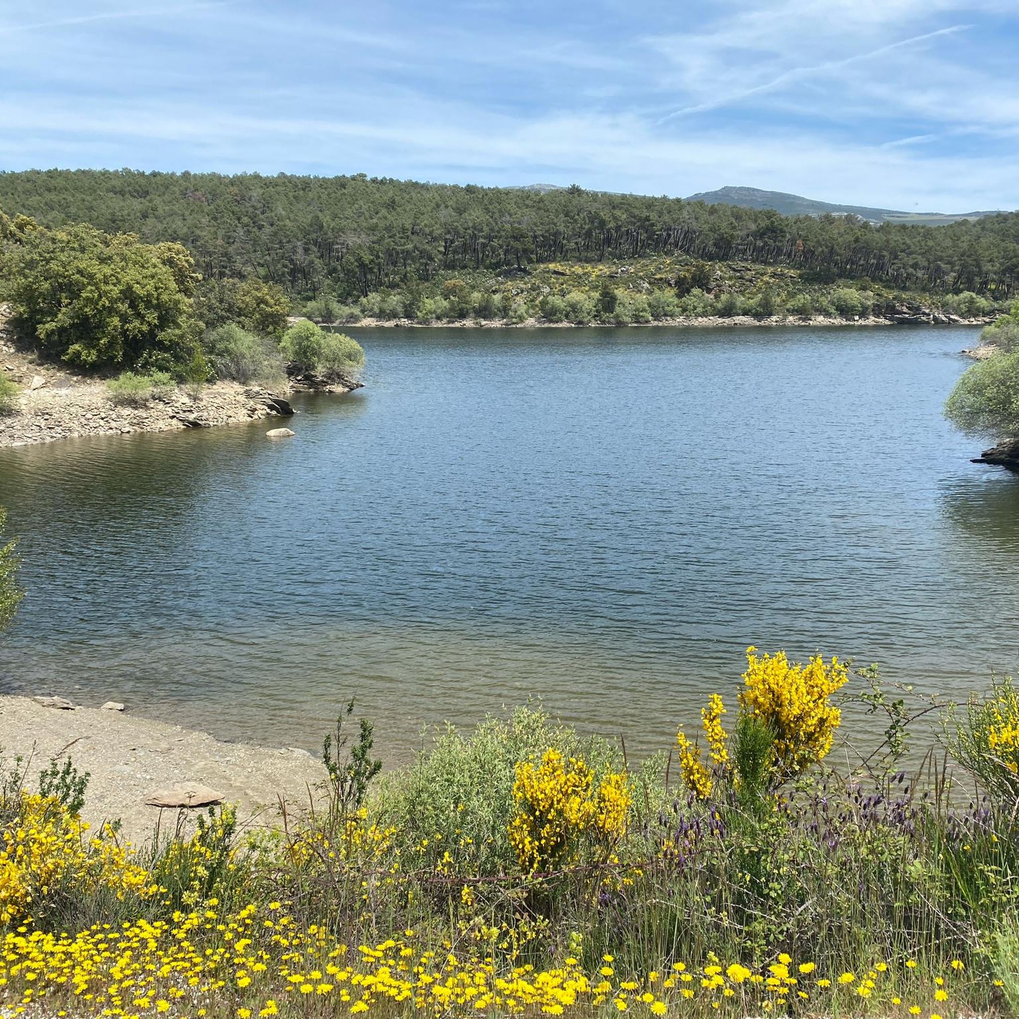
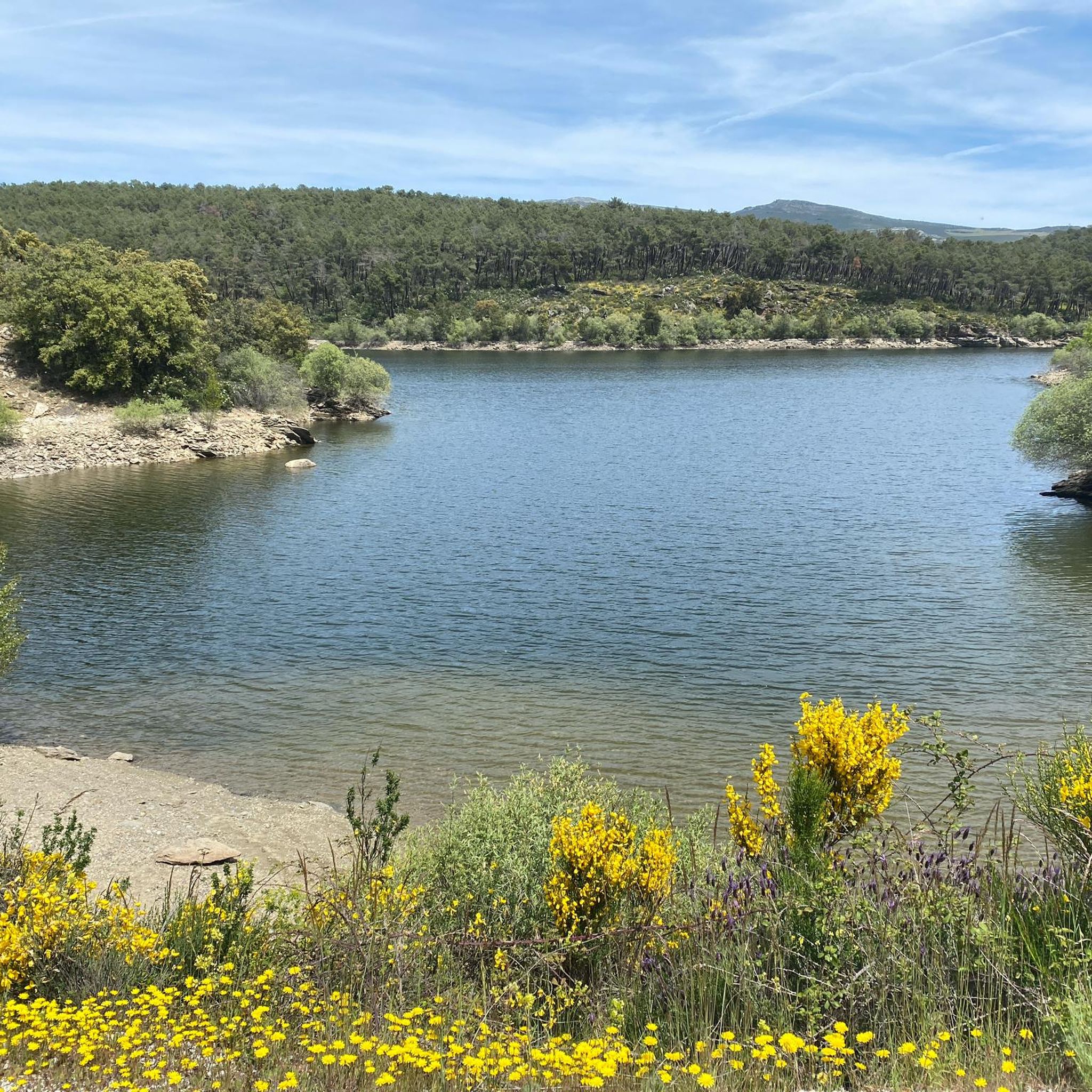
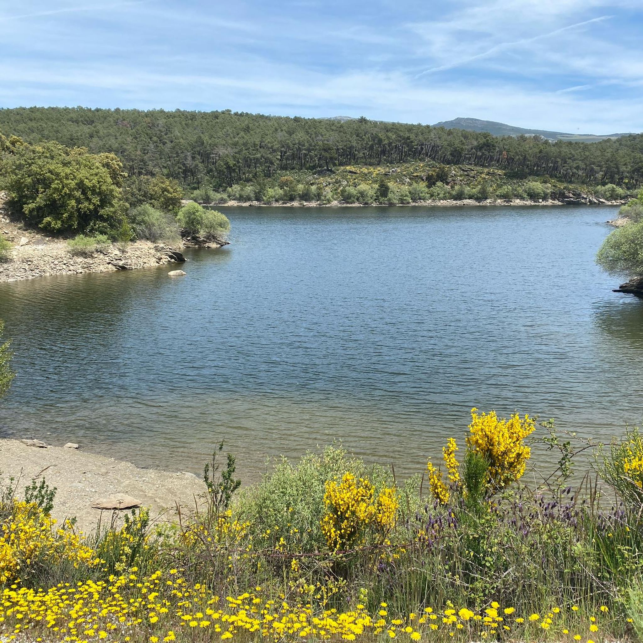
Jogging around Embalse de El Villar offers diverse natural landscapes, centered around the tranquil reservoir fed by the Lozoya River. The region features varied forest environments, including extensive pine forests and areas rich in oaks and holm oaks. Rolling mountains provide a range of elevation changes, from relatively flat paths along the water to more challenging inclines. Well-defined trails cater to different fitness levels, making it suitable for various jogging intensities.
Best jogging routes around Embalse de El Villar
- The…
Last updated: June 28, 2026
26
runners
34.5km
05:22
1,440m
1,440m
Hard run. Very good fitness required. Sure-footedness, sturdy shoes and alpine experience required.
14
runners
12.3km
01:52
500m
500m
Hard run. Very good fitness required. Sure-footedness, sturdy shoes and alpine experience required.

Sign up for free
4
runners
10.2km
01:16
130m
130m
Moderate run. Good fitness required. Mostly paved surfaces. Suitable for all skill levels.
7
runners
12.7km
01:23
170m
170m
Moderate run. Good fitness required. Mostly paved surfaces. Suitable for all skill levels.
7
runners
5.20km
00:38
80m
80m
Moderate run. Good fitness required. Mostly paved surfaces. Suitable for all skill levels.
Get access to more routes and recommendations from other explorers.
Sign up for free
Already have an account?
Our route recommendations are based on thousands of hikes, rides, and runs completed by other people on komoot.
Start today with a free account
Your next adventure awaits.
Login or Signup

Tips from the Community

After the effort of the climb you get the reward of satisfaction.
0
0

Wonderful views and surroundings
0
0

The Senda de las Gariñas is a circular path 6.5 km long. The route crosses part of the forest mass known as the Gariñas forest and reaches the Puentes Viejas reservoir, where we find the riverside landscape. The forest is made up mostly of resin pine, although as we approach the banks of the reservoir we also find ash trees and Montpellier maples.
0
0

Forest mass known as the Gariñas forest and reaches the Puentes Viejas reservoir, where we find the riverside landscape. The forest is made up mostly of resin pine, although as we approach the banks of the reservoir we also find ash trees and Montpellier maples.
0
0

On the banks of the Lozoya River at the beginning of the El Atazar reservoir we find this forest populated with pine, ash and Montpellier maple. Leafy, it creates a cozy natural intimacy that collects us in its bed as we pass through its paths.
0
0
On the banks of the Lozoya River at the beginning of the El Atazar reservoir we find this forest populated with pine, ash and Montpellier maple. Leafy, it creates a cozy natural intimacy that collects us in its bed as we pass through its paths.
0
0

This town of just over 100 inhabitants owes its name to the number of oaks and cistus that populate the area. Within its municipal term is the unpopulated area of El Villar (from which one of the Lozoya reservoirs takes its name). However, currently nothing remains of this place.
2
0
Cervera de Buitrago is a pretty town of stone houses that claims to be a fishing town. Thanks to the Lozoya River and the construction of the El Atazar reservoir in the 20th century, the inhabitants were able to benefit from this industry to supply themselves and do business with the surrounding towns. Today there is an important yacht club where you can practice all kinds of marine sports.
2
0
Frequently Asked Questions
How many running routes are available around Embalse de El Villar?
There are over 30 dedicated running routes around Embalse de El Villar, catering to various fitness levels. These include 1 easy route, 17 moderate routes, and 12 difficult trails, ensuring options for every runner.
Are there any easy jogging routes suitable for beginners or families?
Yes, while many routes offer a challenge, there is at least one easy route available. For a moderate option that's relatively shorter and offers pleasant views, consider the Cervera de Buitrago Beach loop from Cervera de Buitrago, which is 5.2 km long and features reservoir views.
What kind of landscapes can I expect to see while running in this region?
Runners in Embalse de El Villar will experience diverse natural landscapes. You'll find extensive pine forests, as well as areas rich in oaks, holm oaks, and poplars. Many routes offer picturesque views of the Embalse de El Villar reservoir and the Lozoya River, set against the backdrop of the rolling mountains of the Sierra Norte.
Are there any circular running routes around Embalse de El Villar?
Yes, many of the running trails in the area are circular, allowing you to start and finish at the same point. For example, the Mirador de Buitrago – Palacio del Bosque loop from Gandullas is a moderate 12.7 km circular route offering varied scenery.
What do other runners think about the trails in Embalse de El Villar?
The running routes in Embalse de El Villar are highly rated by the komoot community, with an average score of 4.0 stars. Over 400 runners have explored the varied terrain, often praising the picturesque reservoir views, diverse forests, and the range of difficulty levels available.
Are there any running routes that offer panoramic viewpoints?
Absolutely. The mountainous terrain of the Sierra Norte provides numerous opportunities for scenic vistas. The Mirador de Buitrago – Palacio del Bosque loop from Gandullas is a moderate route that includes a viewpoint, offering expansive views of the surrounding landscape.
What is the best time of year to go jogging around Embalse de El Villar?
The region offers pleasant conditions for running throughout much of the year. Spring and autumn provide mild temperatures and vibrant natural colors. Summer can be warm, but the varied forests, including extensive pine forests, offer shaded routes. Winter running is also possible, with the landscape taking on a different, tranquil beauty.
Are the running trails well-marked?
The region boasts well-defined trails that are generally suitable for jogging and trail running. These paths vary in length and difficulty, ensuring a good experience for various fitness levels.
Can I find routes that combine forest running with water views?
Yes, the unique geography of Embalse de El Villar, with the reservoir fed by the Lozoya River and surrounded by forests, means many routes offer a blend of both. You can enjoy shaded paths through pine and oak forests alongside refreshing waterside sections with stunning reservoir vistas.
Are there any challenging running routes for experienced trail runners?
Yes, for experienced trail runners seeking a challenge, there are 12 difficult routes available. These often feature significant elevation changes and longer distances, providing a demanding workout amidst the beautiful Sierra Norte landscape.
What kind of elevation changes can I expect on the running routes?
The routes around Embalse de El Villar, situated in the Sierra Norte, feature rolling mountains. This means you can find a range of elevation changes, from relatively flat paths along the water's edge to more challenging inclines and descents, suitable for different jogging intensities.
Most popular routes around Embalse de El Villar

Get inspired with the komoot mobile app


Explore more
Browse the best Running Trails & Routes in other regions.
