The best mountain hikes around Estany de Travessany
4.5
(2)
17
hikers
3
hikes
Mountaineering routes around Estany de Travessany traverse a high-alpine environment characterized by rugged granite peaks, numerous glacial lakes, and challenging ascents. The region is part of the Pyrenees, offering a landscape shaped by ancient glaciers, with steep valleys and exposed ridges. These routes often involve significant elevation gain, leading to panoramic views of the surrounding mountain ranges and pristine water bodies.
Best mountaineering routes around Estany de Travessany
- The most popular mountaineering route is Punta Alta Summit – Presa de…
Last updated: July 4, 2026
5.0
(1)
2
hikers
12.4km
05:38
640m
640m
Hard mountaineering route. Very good fitness required. Sure-footedness, sturdy shoes and alpine experience required.
6
hikers
Moderate mountaineering route. Good fitness required. Mostly accessible paths. Sure-footedness required.

Sign up for free
4.0
(1)
9
hikers
16.1km
05:42
570m
570m
Hard mountaineering route. Very good fitness required. Mostly accessible paths. Sure-footedness required.
Our route recommendations are based on thousands of hikes, rides, and runs completed by other people on komoot.
Start today with a free account
Your next adventure awaits.
Login or Signup
Popular around Estany de Travessany
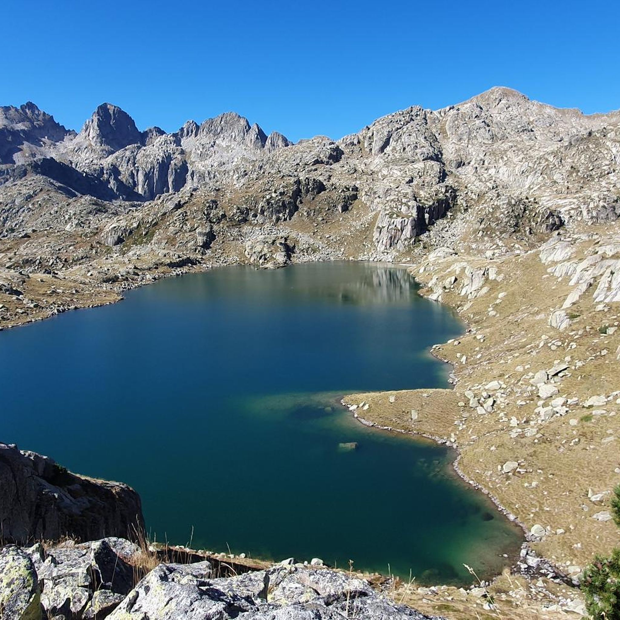
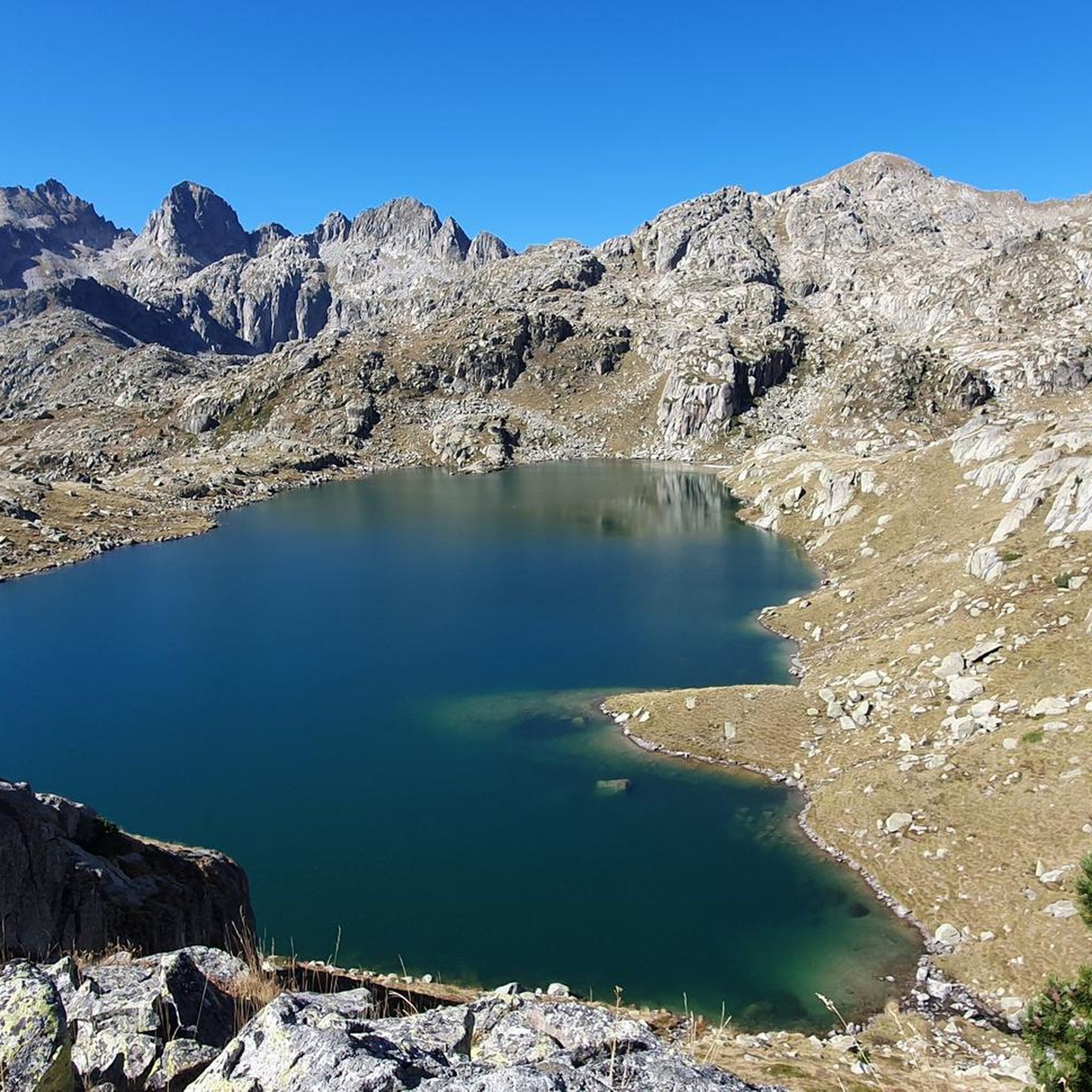
Tips from the Community

This refuge is named after the Restanca lake, next to which it is located. It is located at an altitude of 2010 metres in the Alto Arán. It has capacity for 80 guests, divided into six rooms. It also has hot water showers, food service and a bar.
1
0

Lake Obago is a lake of glacial origin located at 2,236 m in the municipality of Alto Arán, in the Valle de Arán region. Lake Obago is one of the largest lakes in the Cirque de Colomers, a glacial cirque of more than 50 lakes crowned by peaks that exceed 2,500 meters, such as the Tuc de Ratera (2,861 m) or the Gran Tuc de Colomers (2,933 meters).
0
0
Lake Mayor de Colomers is a lake of glacial origin located at 2128 m in the municipality of Alto Arán, in the Valle de Arán region. Lake Mayor de Colomers is one of the largest lakes in the Cirque de Colomers, a glacial cirque of more than 50 lakes crowned by peaks that exceed 2,500 meters, such as the Tuc de Ratera (2,861 m) or the Gran Tuc de Colomers (2,933 meters). ). The Colomers refuge is located near the lake.
0
0

The lake of Còth de Baish can be seen from the pass of the same name, at an altitude of 2,190 metres. From the pass it is possible to descend to the lake to admire it up close.
0
0

One of the smallest, but also very flirtatious.
3
0
In my opinion, the most beautiful lake on the tour.
2
0
Frequently Asked Questions
How many mountaineering routes are available around Estany de Travessany?
The komoot community has mapped and rated over 9 mountaineering routes in the Estany de Travessany area. These routes offer a range of experiences, from moderate to difficult, exploring the high-alpine environment of the Pyrenees.
Are there any beginner-friendly mountaineering routes in Estany de Travessany?
While most routes in Estany de Travessany are rated as difficult, there are a couple of moderate options suitable for those with some mountaineering experience. For example, the Long Lake of Colomèrs – Lake Major of Colomers loop from Arriu dera Montanheta is a 4.8-mile trail that takes about 2 hours 55 minutes, offering a less strenuous introduction to the region's glacial lakes.
What is the best time of year for mountaineering around Estany de Travessany?
The best time for mountaineering in Estany de Travessany is typically from late spring to early autumn (June to September) when the snow has largely melted from higher elevations, and weather conditions are generally more stable. Always check local weather forecasts and trail conditions before heading out, as high-alpine environments can be unpredictable.
Are there any circular mountaineering routes in the area?
Yes, several routes in Estany de Travessany are circular, allowing you to return to your starting point without retracing your steps. A notable option is the Estany Major de Colomèrs loop from Refugi de Colomèrs, a moderate 7.1-mile route that offers stunning views of the glacial lakes.
What kind of gear should I bring for mountaineering in Estany de Travessany?
Given the high-alpine and rugged nature of the Estany de Travessany region, it's essential to be well-prepared. You should bring sturdy mountaineering boots, appropriate layers of clothing for varying weather, rain gear, sun protection, sufficient water and food, a map and compass or GPS device, and a first-aid kit. For more challenging routes, consider bringing a helmet and ice axe, especially early in the season.
Is parking available near the trailheads for these routes?
Parking availability varies by trailhead. Many popular starting points, such as Pantà de Cavallers or Refugi de la Restanca, typically have designated parking areas, though they can fill up quickly during peak season. It's advisable to arrive early, especially for longer routes like the Punta Alta Summit – Presa de Caballers loop from Pantà de Cavallers.
Are permits required for mountaineering in Estany de Travessany?
Generally, permits are not required for day mountaineering in the Estany de Travessany area, which is part of the Aigüestortes i Estany de Sant Maurici National Park. However, if you plan to stay overnight in refuges or engage in specific activities, it's always best to check the official park regulations for any updates or specific requirements.
What do other mountaineers enjoy most about the routes in Estany de Travessany?
The routes in Estany de Travessany are highly rated by the komoot community, with an average score of 4.8 stars. Reviewers often praise the breathtaking panoramic views from summits, the pristine beauty of the numerous glacial lakes, and the challenging yet rewarding nature of the ascents. The rugged granite peaks and diverse high-mountain terrain are frequently highlighted as key attractions.
Are there any less crowded alternatives to the most popular trails?
While routes like the Punta Alta Summit are popular, you can find quieter experiences by exploring other challenging trails. Consider the Besiberri Sud 3023m – Estany Gémena de Dalt loop from Riu de Sant Nicolau, a difficult 9-mile route that offers a significant climb and a sense of solitude amidst the high peaks.
Can I find food or drink options near the mountaineering routes after my hike?
Yes, there are mountain refuges strategically located throughout the region, such as Refugi de la Restanca, which often provide food, drinks, and accommodation. These can be excellent spots to refuel and relax after a challenging day on the trails, especially after completing routes like the Restanca Refuge – Montardo Summit Cairn loop from Refugi de la Restanca.
What are the conditions like for winter mountaineering in Estany de Travessany?
Winter mountaineering in Estany de Travessany is for experienced and well-equipped individuals only. The region experiences heavy snowfall, avalanche risk, and extreme cold. Routes become significantly more challenging, requiring specialized gear such as crampons, ice axes, and avalanche safety equipment, along with advanced navigation skills. It's crucial to consult local mountain guides and avalanche forecasts before attempting any winter ascents.
Most popular routes around Estany de Travessany

Get inspired with the komoot mobile app


Explore more
Browse the best Mountain Hikes & Routes in other regions.
