The best walks and hikes around Estany Negre de Peguera
4.5
(970)
7,789
hikers
110
hikes
Hiking around Estany Negre de Peguera offers trails through a high-mountain landscape characterized by glacial lakes, granite peaks, and alpine meadows within the Pyrenees. The region features a network of paths connecting various tarns and mountain refuges, providing diverse terrain for hikers. Elevations vary, with routes often traversing rocky sections and open valleys. This area is part of a larger protected natural park, ensuring preserved natural environments.
Best hiking trails around Estany Negre de Peguera
- The most popular hiking route…
Last updated: June 25, 2026
5.0
(2)
14
hikers
5.27km
01:59
240m
230m
Hike the moderate 3.3-mile Carros de Foc: Peguera Lakes Loop, gaining 781 feet in Aigüestortes i Estany de Sant Maurici National Park.
5.0
(2)
12
hikers
7.84km
03:20
470m
470m
Hike the moderate 4.9-mile (7.8 km) Carros de Foc segment from Refugi Josep Maria Blanc to Pic de Monestero for stunning Pyrenean views.

Sign up for free
Moderate hike. Good fitness required. Mostly accessible paths. Sure-footedness required.
17.8km
07:56
1,130m
1,140m
Hard hike. Very good fitness required. Mostly accessible paths. Sure-footedness required.
5.0
(3)
20
hikers
Moderate hike. Good fitness required. Mostly accessible paths. Sure-footedness required.
Get access to more routes and recommendations from other explorers.
Sign up for free
Already have an account?
Our route recommendations are based on thousands of hikes, rides, and runs completed by other people on komoot.
Start today with a free account
Your next adventure awaits.
Login or Signup
Tips from the Community

breathtaking view
0
0
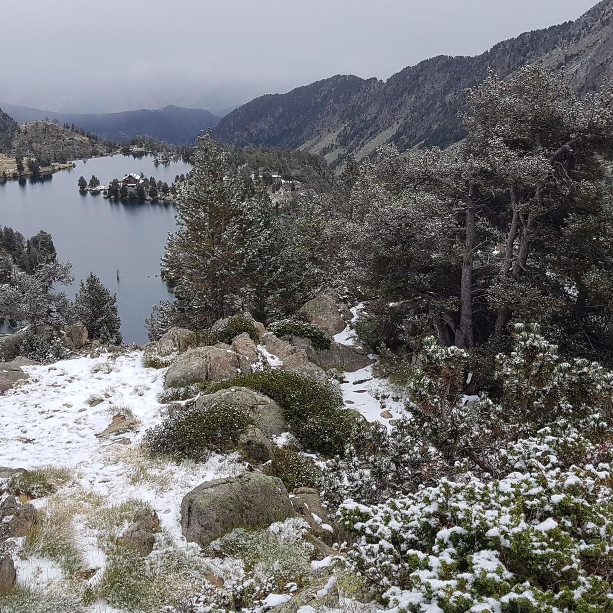
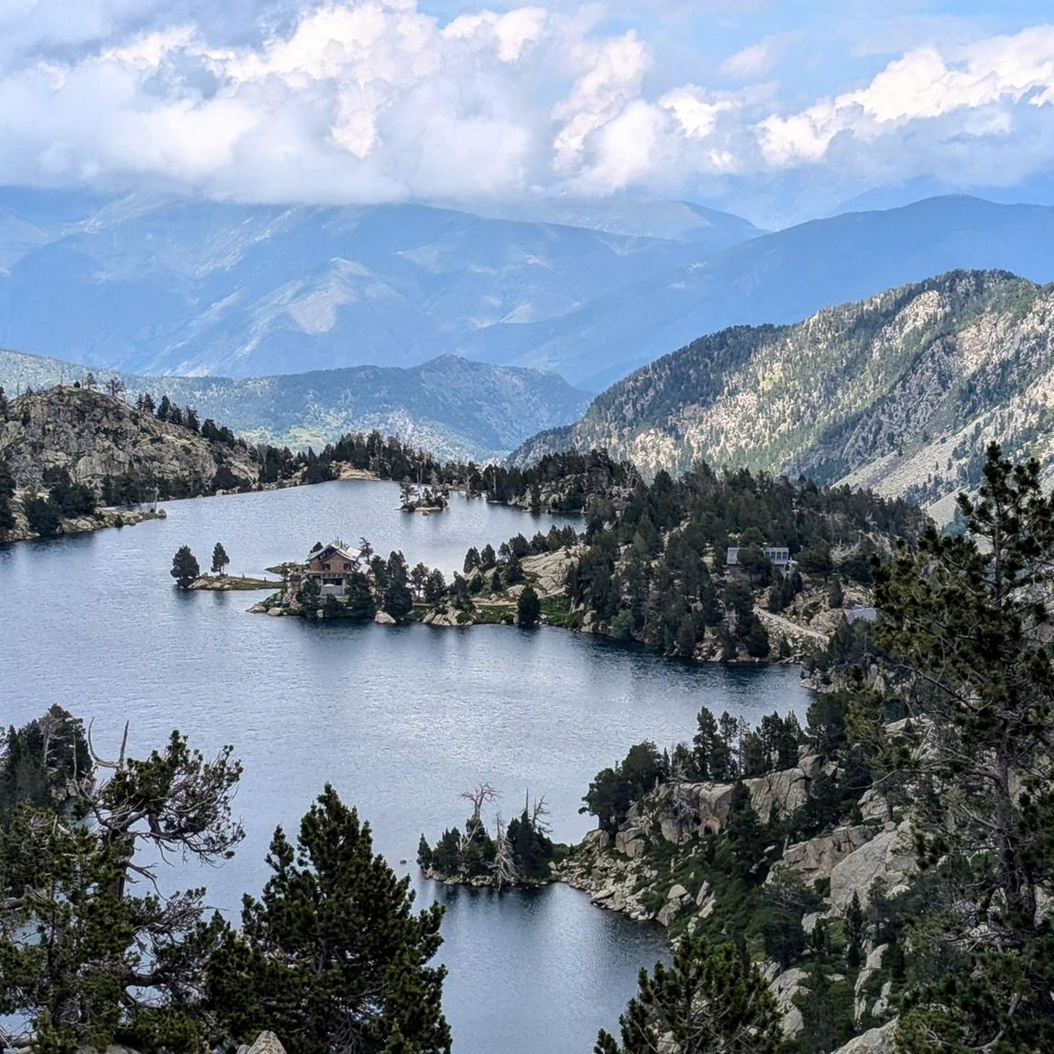
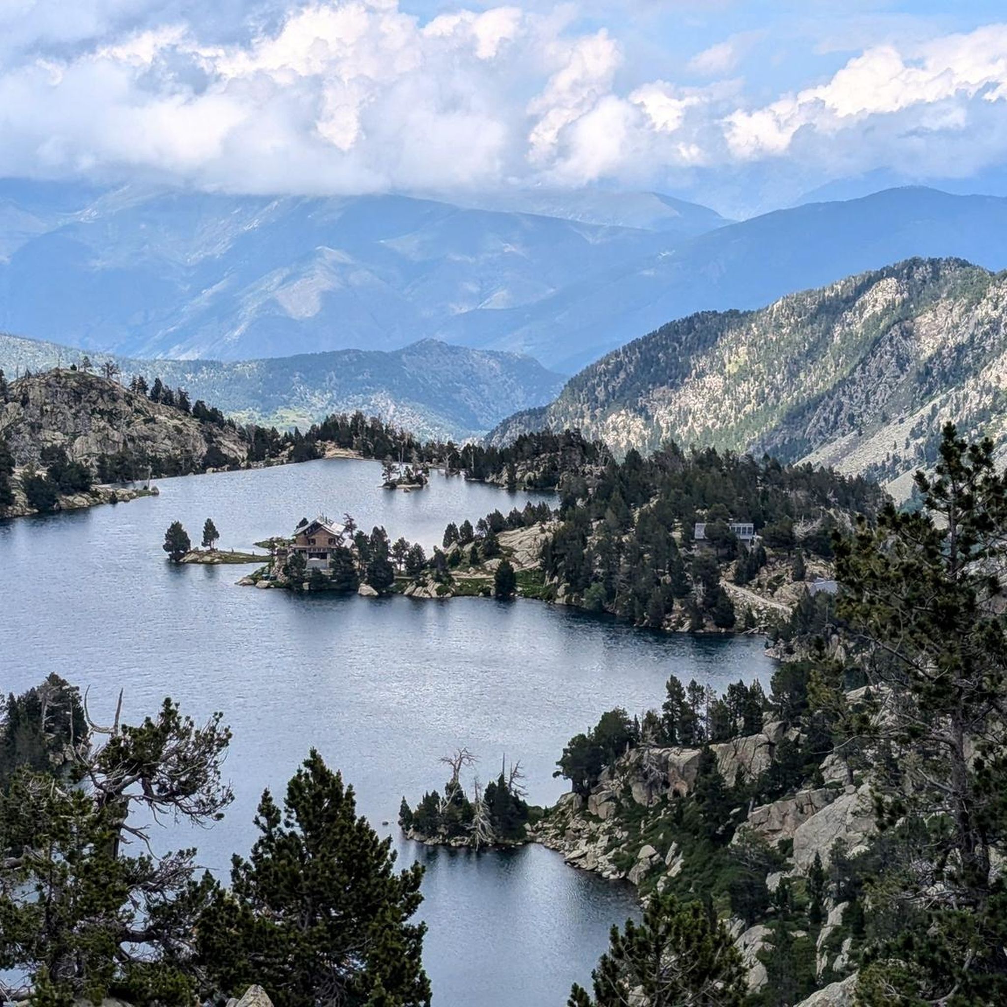
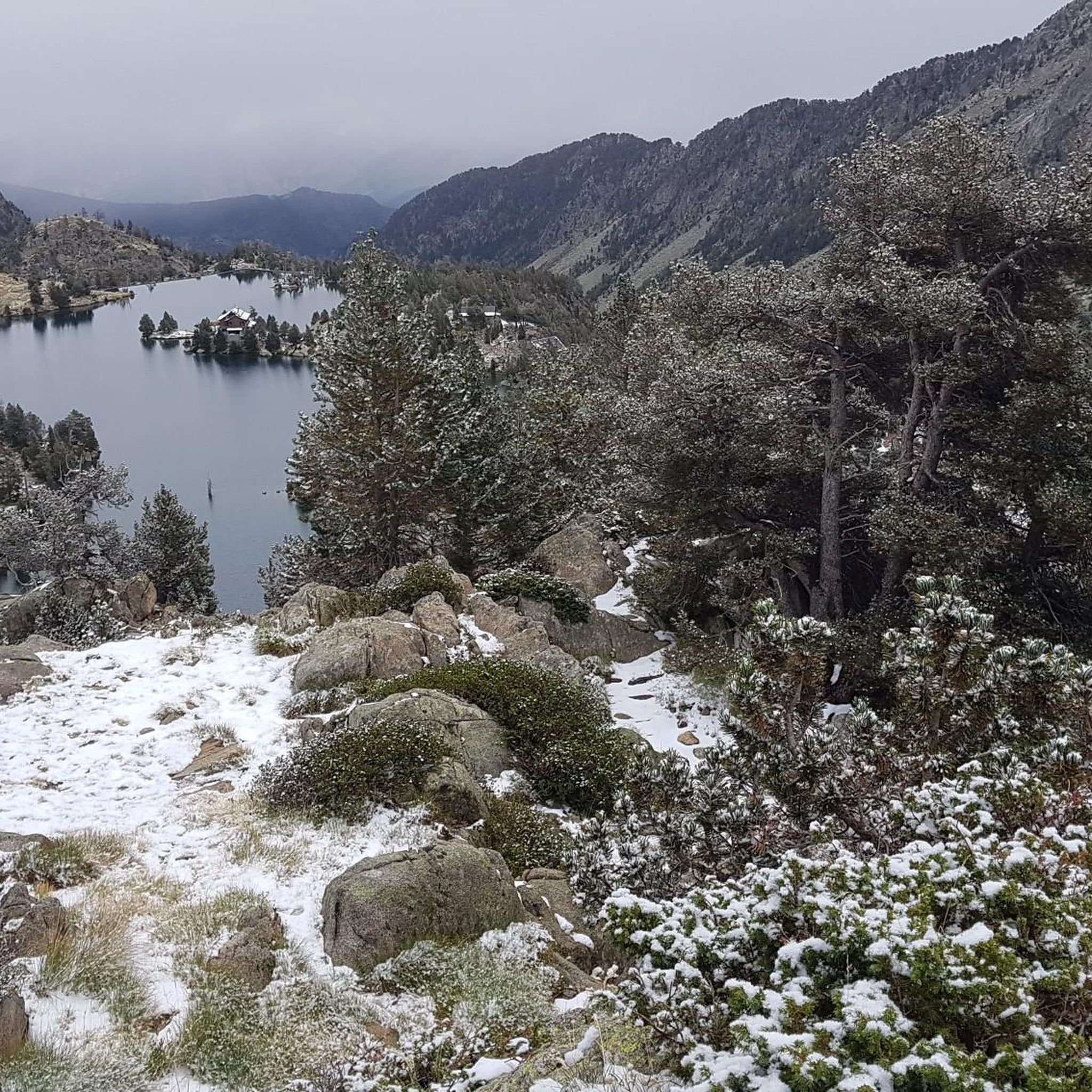
the further you walk from the Refugio JM Blanc, the more beautiful the view becomes!
0
0

The location of this refuge makes it unique. It can be accessed from Prat de Pierro (all via track) or from Espot (this option is shorter but steeper).
1
1

The Colomina refuge is located at an altitude of 2,425 metres, at the head of the Vall Fosca, next to the lake of the same name. It has 40 places to stay overnight, hot showers and food service, always subject to reservation.
0
0

Incredible views a little beyond the JM Blanch refuge
0
0

It is located at 2,180 m between the Ratera lake and the Gran d'Amitges lake.
1
0
It is 2877 meters high. From the top you can enjoy privileged views of the entire National Park.
1
0
Frequently Asked Questions
What are the difficulty levels of hikes around Estany Negre de Peguera?
The Estany Negre de Peguera region offers a wide range of hiking difficulties. You'll find approximately 10 easy routes, 55 moderate routes, and 44 difficult routes, catering to various experience levels from casual walkers to experienced mountaineers.
Are there suitable hikes for beginners around Estany Negre de Peguera?
Yes, beginners can find suitable options. There are around 10 easy routes available. For instance, the Carros de Foc: Peguera Lakes Loop is a moderate route that explores the scenic lakes and is a good introduction to the area's beauty, though it requires a reasonable fitness level.
When is the best time of year to go hiking in Estany Negre de Peguera?
The best time for hiking in Estany Negre de Peguera is typically from late spring to early autumn (June to September). During these months, the snow has usually melted from higher elevations, and the weather is generally more stable, offering pleasant conditions for exploring the alpine meadows and glacial lakes.
What essential gear should I bring for hiking in this region?
Given the high-mountain environment, it's essential to be well-prepared. We recommend bringing sturdy hiking boots, layered clothing suitable for changing weather, rain gear, sun protection, a map and compass (or GPS device), sufficient water, and high-energy snacks. Trekking poles can also be very helpful on rocky or steep sections.
What are the conditions like for winter hiking in Estany Negre de Peguera?
Winter hiking in Estany Negre de Peguera can be challenging and requires specialized equipment and experience. Trails are often covered in deep snow, and avalanche risk can be significant. Access to many areas may be restricted. It is advisable to consult local conditions and forecasts, and consider hiring a mountain guide for winter excursions.
Is wild swimming permitted in the lakes around Estany Negre de Peguera?
Many of the glacial lakes in the Pyrenees, including those around Estany Negre de Peguera, are popular for wild swimming. However, water temperatures are very cold, even in summer. Always check local regulations, especially within the national park boundaries, as rules can vary. Be mindful of the fragile alpine ecosystem.
Where can I find the most scenic viewpoints in Estany Negre de Peguera?
The entire region is incredibly scenic, characterized by granite peaks and glacial lakes. Routes that ascend to higher elevations, such as the Carros de Foc: Refugi Josep Maria Blanc to Pic de Monestero, offer panoramic views of the surrounding alpine environment. The area around Refugi Josep Maria Blanc itself provides stunning vistas of multiple tarns.
Are there circular hiking trails in Estany Negre de Peguera?
Yes, there are several circular hiking trails available. A popular option is the Carros de Foc: Peguera Lakes Loop, which allows you to explore the beautiful lakes of the Peguera valley without retracing your steps. Another challenging circular route is the Josep Maria Blanc Refuge – Estany Tort de Peguera loop from Tuc de Saburó.
What do other hikers enjoy the most about hiking in Estany Negre de Peguera?
The area is highly rated by the komoot community, with an average score of 4.5 stars from over 840 reviews. Hikers frequently praise the stunning high-mountain scenery, the pristine glacial lakes, and the challenging yet rewarding trails that offer a true Pyrenean experience. The network of mountain refuges is also a highlight for many.
Are there mountain refuges available for overnight stays?
Yes, the region is part of a larger network of trails, including the Carros de Foc, which connects several mountain refuges. The Refugi Josep Maria Blanc is a prominent refuge in the area, serving as a base for many hikes, including the ascent to Pic Muntanyó. These refuges offer accommodation and meals, but booking in advance is highly recommended, especially during peak season.
Can I hike with my dog in Estany Negre de Peguera?
Hiking with dogs in the Pyrenees, especially within protected areas like the national park, often comes with specific regulations. While generally allowed on trails, dogs may need to be kept on a leash to protect wildlife and livestock. Always check the most current rules for the specific section of the park you plan to visit to ensure compliance.
Most popular routes around Estany Negre de Peguera

Get inspired with the komoot mobile app


Explore more
Browse the best Hikes in other regions.
