The best walks and hikes around Embalse de Mansilla
4.5
(24)
172
hikers
8
hikes
Hiking around Embalse de Mansilla offers a variety of trails centered around the reservoir in the Sierra Rioja Alta region. The landscape is characterized by the expansive waters of the Embalse de Mansilla, surrounded by rolling hills and dense forests, providing diverse terrain for outdoor activities. Hikers can expect paths that traverse along the reservoir's edge, ascend into the nearby mountains, and pass through traditional villages. The area provides opportunities for both leisurely walks and more challenging hikes with significant…
Last updated: July 4, 2026
5.0
(1)
1
hikers
25.4km
07:07
480m
480m
This difficult 15.8-mile circular hike around Embalse de Mansilla offers panoramic views and historical insights in La Rioja.
4.0
(1)
7
hikers
8.71km
02:36
270m
270m
Moderate hike. Good fitness required. Easily-accessible paths. Suitable for all skill levels.

Sign up for free
4
hikers
7.98km
02:47
450m
450m
Moderate hike. Good fitness required. Easily-accessible paths. Suitable for all skill levels.
4.0
(1)
7
hikers
15.1km
04:20
370m
370m
Moderate hike. Good fitness required. Easily-accessible paths. Suitable for all skill levels.
5.0
(3)
16
hikers
26.9km
10:26
950m
950m
Hard hike. Very good fitness required. Mostly accessible paths. Sure-footedness required.
Get access to more routes and recommendations from other explorers.
Sign up for free
Already have an account?
Our route recommendations are based on thousands of hikes, rides, and runs completed by other people on komoot.
Start today with a free account
Your next adventure awaits.
Login or Signup


Tips from the Community

These are exemplary trees, the Urbion yews.
0
0
Well maintained, where Sergio, the lonely eagle, has lived for 20 years. It's worth chatting with him.
0
0
Place where the Urbi'on Valley route begins
0
0

Ventrosa is a village that in 2019 had only 55 inhabitants. Perhaps its size is what helps to create such an idyllic environment. Between its magnificent landscapes, rocks, forests and high meadows are interspersed.
0
0

Wonderful to cycle on the little-used road along the reservoir.
2
0

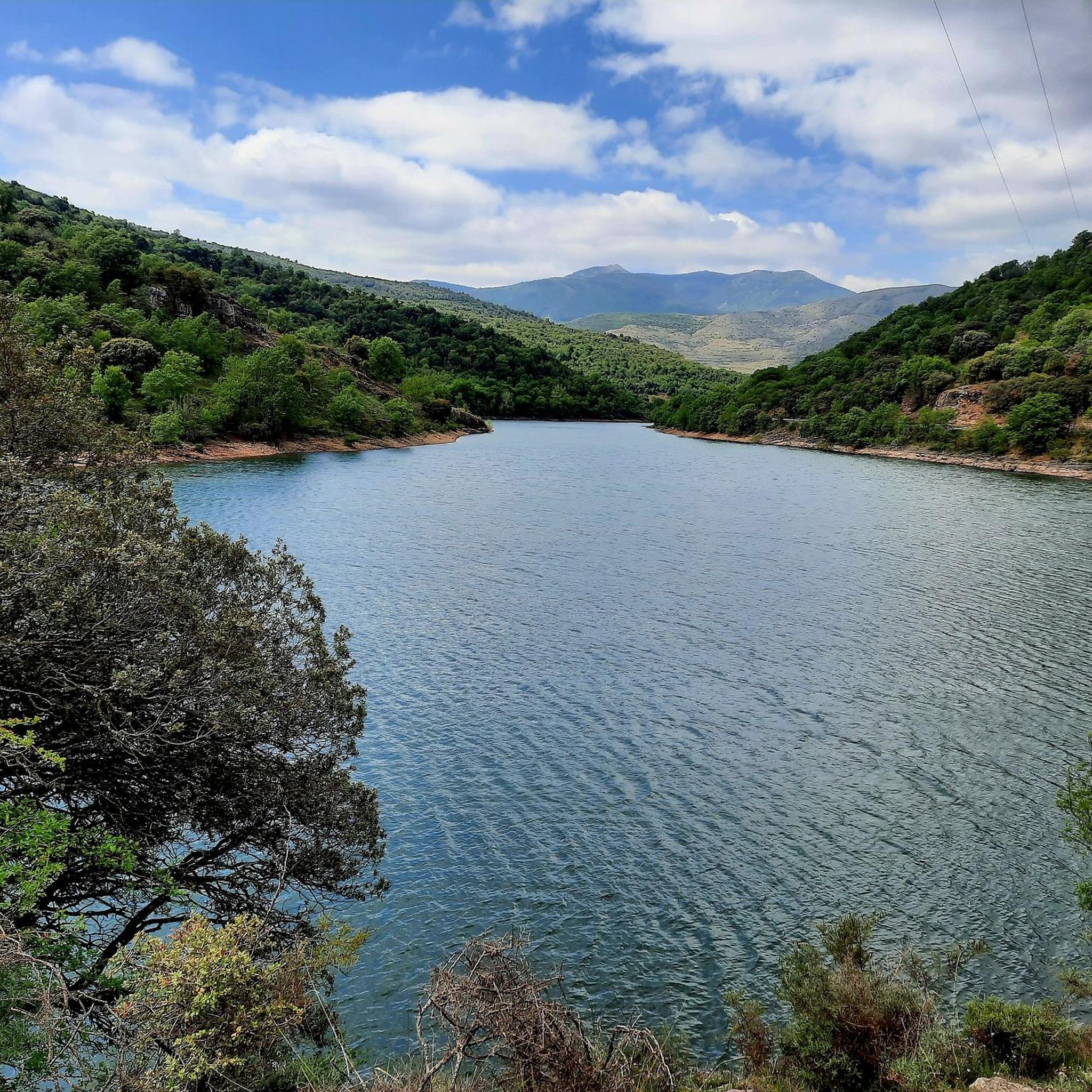
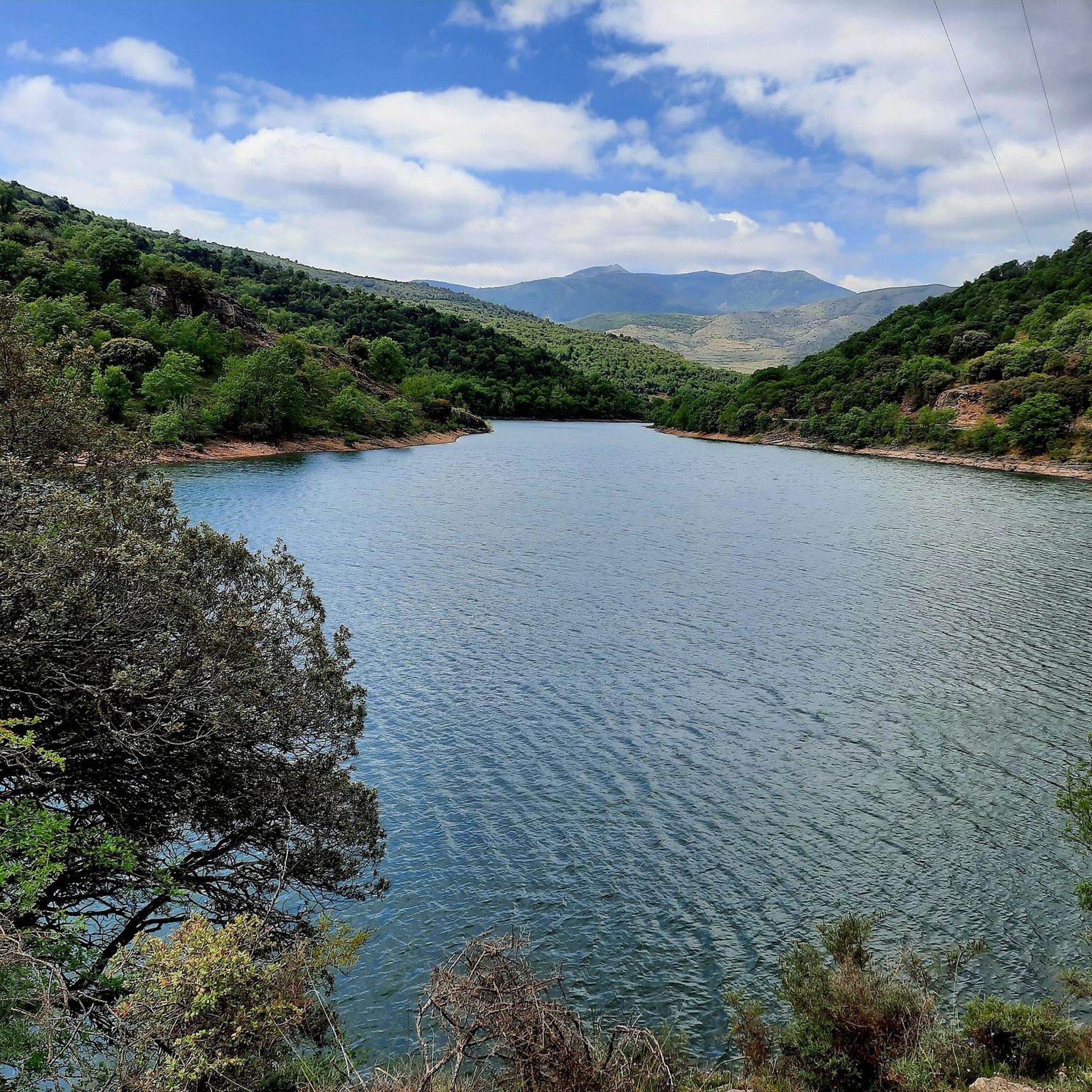
The Mansilla reservoir is located on the Najerilla river, a tributary of the Ebro river. Its waters hide the old town of Mansilla de la Sierra, whose church and some other buildings are visible when it is low.
0
0

In addition to the Church of the Assumption, it has a rural house and beautiful houses belonging to families who returned from Latin America with money, the 'indianos'. Cool off in the Fountain of the 4 Pipes.
0
0
The Church of Nuestra Señora de la Asunción is a construction made of ashlar masonry and reddish stone, characteristic of the area.
1
0
Frequently Asked Questions
How many hiking trails are available around Embalse de Mansilla?
There are 8 distinct hiking routes around Embalse de Mansilla, offering a range of experiences from moderate walks to more challenging treks. The komoot community has explored these trails over 140 times, providing valuable insights and ratings.
Are there easy hiking trails suitable for beginners or families?
While the area primarily features moderate to difficult trails, some sections of longer routes can be adapted for easier walks. For a moderate option that explores a charming village and its surroundings, consider the Viniegra de Abajo loop from Viniegra de Abajo, which is about 8 km long.
What kind of terrain can I expect on hikes around Embalse de Mansilla?
The terrain around Embalse de Mansilla is diverse, characterized by paths along the reservoir's edge, ascents into rolling hills, and trails through dense forests. You'll find a mix of well-trodden paths and more rugged sections, typical of the Sierra Rioja Alta region.
Are there any circular hiking routes?
Yes, several routes are designed as loops. A prominent example is the Mansilla Reservoir Loop, a challenging 25.4 km trail that offers extensive views of the reservoir and surrounding hills. Another option is the Tacudia Mountain Refuge loop from Tramborríos, a moderate 9.1 km route through forested slopes.
Can I bring my dog on the hiking trails?
Generally, dogs are welcome on most hiking trails in the Embalse de Mansilla area. However, it's always recommended to keep them on a leash, especially in areas with livestock or protected wildlife. Please ensure you clean up after your pet to preserve the natural environment for everyone.
What is the best time of year to go hiking in Embalse de Mansilla?
Spring and autumn are often considered the best seasons for hiking around Embalse de Mansilla. During these times, the weather is typically mild, and the landscape is vibrant with spring blooms or autumn colors. Summer can be warm, making early morning or late afternoon hikes preferable, while winter may bring snow to higher elevations, requiring appropriate gear.
Are there challenging hikes for experienced hikers?
Absolutely. For experienced hikers seeking a challenge, the area offers routes with significant elevation gain and longer distances. The The Yews of Urbión – Laguna de Urbión loop from Tramborríos is a difficult 26.9 km trail with nearly 1000 meters of ascent, providing a strenuous and rewarding experience.
Where can I find good viewpoints of the reservoir?
Many trails offer excellent viewpoints of Embalse de Mansilla. The extensive Mansilla Reservoir Loop, for instance, provides continuous panoramic views of the water and the surrounding landscape as it traces the reservoir's edge.
What do other hikers say about the trails here?
The trails around Embalse de Mansilla are highly rated by the komoot community, with an average score of 4.6 out of 5 stars from over 17 reviews. Hikers often praise the diverse scenery, the tranquility of the forests, and the rewarding views of the reservoir.
Are there options for shorter walks?
Yes, if you're looking for a shorter outing, consider routes like the San Lorenzo (2,271 m) – San Lorenzo loop from Collado de las Tres Cruces. This moderate 4.7 km loop offers a taste of the region's beauty without requiring a full day's commitment.
Is there public transport access to the hiking areas?
Public transport options directly to the trailheads around Embalse de Mansilla can be limited. It is generally recommended to travel by car to access the starting points of most hikes, especially for routes that begin in more remote villages or mountain passes.
Where can I park when hiking around Embalse de Mansilla?
Parking is typically available in or near the villages that serve as starting points for the trails, such as Viniegra de Abajo or Tramborríos. For specific routes, check the tour details on komoot for recommended parking locations, which are often indicated by other hikers.

Get inspired with the komoot mobile app


Explore more
Browse the best Hikes in other regions.
