The best road cycling routes around Carnavanaghan
667
riders
160
rides
Road cycling routes around Carnavanaghan traverse a diverse drumlin landscape characterized by rolling hills and serene waterways. This undulating topography provides varied terrain, from gentle slopes to more challenging climbs, suitable for different cycling preferences. The region features expansive forests, open parklands, and historical sites, creating a varied and engaging environment for cyclists.
Best road cycling routes around Carnavanaghan
- The most popular road cycling route is Lottie's Café – Scarva Village loop from Armagh, a 29.7 miles (47.8 km)…
Last updated: May 10, 2026
17
riders
47.8km
02:13
480m
480m
Moderate road ride. Good fitness required. Mostly well-paved surfaces and easy to ride.
14
riders
66.3km
02:56
670m
670m
Moderate road ride. Good fitness required. Mostly well-paved surfaces and easy to ride.

Sign up for free
9
riders
51.5km
02:06
310m
310m
Moderate road ride. Good fitness required. Mostly well-paved surfaces and easy to ride.
7
riders
115km
04:59
810m
810m
Moderate road ride. Good fitness required. Mostly well-paved surfaces and easy to ride.
3
riders
49.6km
02:22
640m
640m
Moderate road ride. Good fitness required. Mostly well-paved surfaces and easy to ride.
Get access to more routes and recommendations from other explorers.
Sign up for free
Already have an account?
Our route recommendations are based on thousands of hikes, rides, and runs completed by other people on komoot.
Start today with a free account
Your next adventure awaits.
Login or Signup

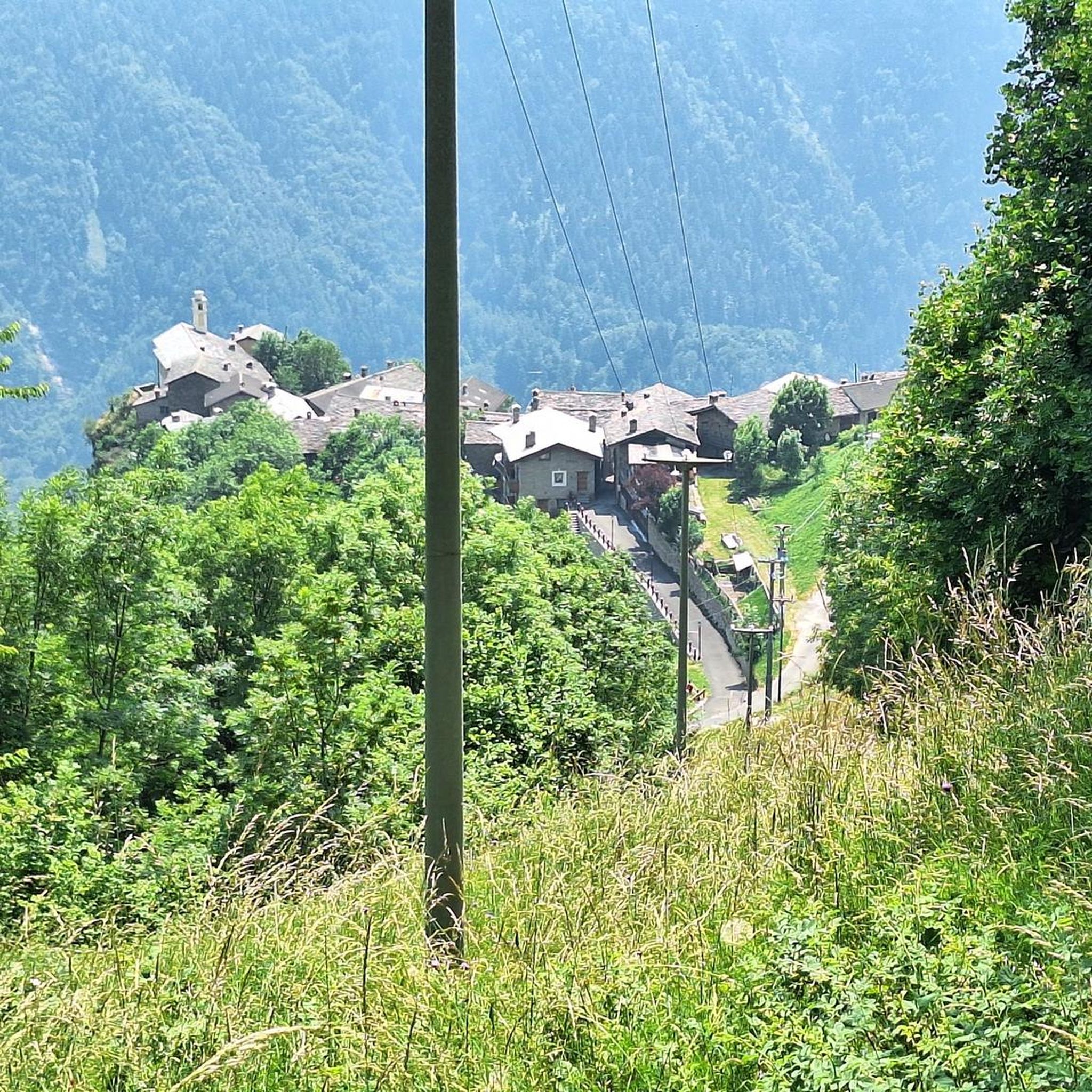
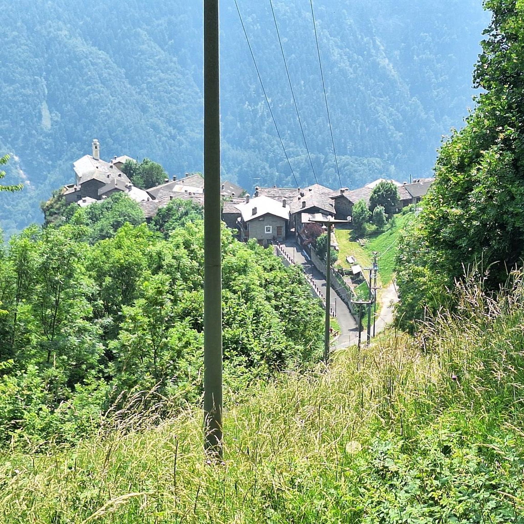
Tips from the Community

Quiet canal section south of Poyntzpass, where the towpath runs tightly along the narrow water. The bank is lightly overgrown with low trees and hedges, giving the stretch an intimate, green impression. The water is mostly still, forming a straight line through the open agricultural landscape. An even, traffic-free segment ideal for quiet miles on the towpath.
1
0

Nice little cafe in the village of Scarva right alongside the Newry canal towpath, great for brekkie, lunch or just topping up the hydration.
0
0

Hollie Berrie is a good place for refreshments on the route at Scarva
0
1

The Newry Canal Path offers exactly what many cyclists want on a tour: a relaxed route that runs through green landscapes and is shielded from any city traffic for almost 25 km. The path is smooth and well maintained throughout, which makes it ideal for longer stretches without a break - you can really rack up the miles here and enjoy the peace and quiet of nature at the same time. A highlight is that the canal path is not only easy to ride, but also allows some charming glimpses of the surrounding area. The trees form a green roof over the path in places, and the silence is only occasionally interrupted by the rippling of the water or a passing bird. Here you have the feeling that with every meter you get further away from the noise of the city and instead find a little more nature. A good alternative for commuters and recreational cyclists alike to get to your destination stress-free or just switch off and let yourself drift.
1
0
The small town of Scarva, nestled between green meadows and the quiet canal, offers a welcome break on my bike tour through Northern Ireland. Here you cycle on well-maintained paths past historic bridges and small villages that give you the feeling that time has stood still. The British flags fluttering along the side of the road remind you that you are in a culturally special area - a detail that reflects the identity of the region. The route is easy to cycle, the surrounding landscape is gently rolling, which makes for pleasant cycling. The view of wide fields and rolling hills invites you to slow down now and then and take in the peace and quiet. A special feature of Scarva is the annual Orange Order March, which transforms the village into a kind of open-air stage once a year and keeps the traditions of this region alive.
1
0
The Maghery Footbridge on the edge of Lough Neagh offers a small moment of peace in the midst of the expansive landscape. As you cross the bridge, your gaze glides over the gentle waters of the largest lake in the British Isles. In good weather, the clouds are impressively reflected on the surface of the water, making the scene look almost like a painting. Even when the sky is cloudy, the lake has a special atmosphere that invites you to linger rather than to quickly pass by. The paths around the bridge are mostly flat, but you should be prepared for occasional sections with unpaved surfaces. This could be a bit slippery, especially in wet weather, but this is not a problem. The connection to the National Cycle Network, Route 94, also offers you many other opportunities to explore the area. A little tip: Maghery itself does not have much to offer apart from the bridge, but a short detour to the nearby Oxford Island nature reserve is definitely worth it. This means you can easily combine a visit to the bridge with a larger circular tour.
2
0
In the middle of the quiet residential area of Annagh Meadows, just a stone's throw from Tandragee Road, the Annagh Pillbox suddenly appears - a relic from the dark days of the Second World War. Its massive concrete walls and narrow loopholes tell of a time when defence along the River Bann was a top priority here. Today it seems a little out of place, surrounded by manicured gardens and modern houses, but that is precisely what gives it a special aura. The interpretive panel next to the bunker is worth a look - it brings you a little closer to the events of that time and reminds you how close the war was here too. The pillbox itself is in remarkably good condition, which is probably thanks to the care taken by the local council. It is worth a short detour to explore this historic corner and pause for a moment. You might wonder what it must have been like back then, when the view from here still extended unobstructed to the river, where you once had to keep an eye on the course of the Bann Line.
0
0
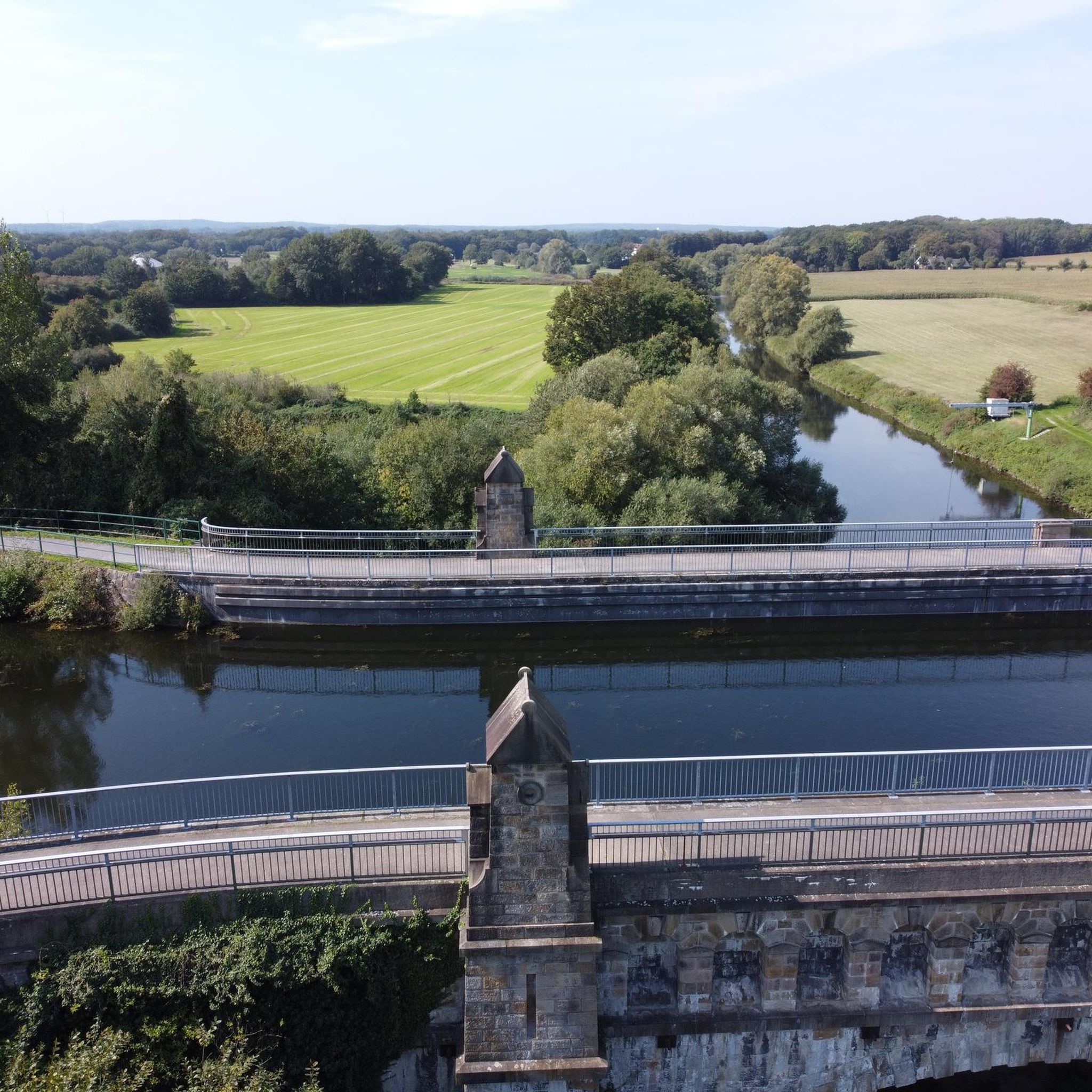
The dam is easy to cross and from there you have a great view over the lake and the rolling hills that surround it. The peaceful atmosphere is only occasionally interrupted by the gentle rippling of the water. The reservoir provides fresh drinking water to the surrounding area and the trout fishery here is controlled by the Armagh Angling Club - so it's an interesting spot for anglers. Even if you're not here to fish, the scenery is simply relaxing and it's worth stopping for a few minutes and looking around. The roads around the lake are easy to drive on but there might be a few potholes in places - nothing that would stop a real cyclist. Overall a nice stop to enjoy nature and take a quick breather before moving on.
2
0
Frequently Asked Questions
How many road cycling routes are available around Carnavanaghan?
There are over 160 road cycling routes around Carnavanaghan, catering to various skill levels. You'll find a good mix, with approximately 30 easy routes, over 120 moderate routes, and a few challenging options for experienced cyclists.
What kind of terrain can I expect on road cycling routes in Carnavanaghan?
The region is characterized by a diverse drumlin landscape, offering an undulating topography with rolling hills and serene waterways. This means you can expect varied terrain, from gentle slopes perfect for a leisurely ride to more challenging climbs that will test your endurance. Routes often wind through forested areas like Gosford Forest Park and past scenic spots such as the Seagahan Reservoir.
Are there any family-friendly road cycling options in Carnavanaghan?
While specific 'family-friendly' road cycling routes are not explicitly categorized, the region's diverse terrain includes routes with gentler slopes, which can be suitable for families with older children or those looking for a less strenuous ride. Gosford Forest Park, with its varied paths, might offer suitable sections for a family outing, though specific road cycling routes within it would need to be checked for suitability.
What interesting landmarks or attractions can I see along the road cycling routes?
Many routes offer scenic views and pass by significant landmarks. You could cycle past the impressive Gosford Castle, a magnificent 19th-century country house, or the historic Tassagh Viaduct. The Seagahan Reservoir also offers picturesque views, and some routes allow you to cycle across its dam wall.
Are there any circular road cycling routes available?
Yes, many of the road cycling routes around Carnavanaghan are designed as loops, allowing you to start and finish at the same point. For example, the The Barn Pantry loop from Armagh is a popular circular route, as is the Gosford Castle – Scarva Village loop from Armagh, which takes you past the historic castle.
What do other road cyclists enjoy most about cycling in Carnavanaghan?
The area is highly rated by the komoot community, with an average score of 5.0 stars. Cyclists often praise the varied drumlin landscape, which provides a good mix of challenges and scenic beauty. The routes through forested areas like Gosford Forest Park and past historical sites are particularly appreciated for enhancing the cycling experience.
Are there options for longer, more challenging road cycling routes?
Absolutely. While many routes are moderate, the region's undulating drumlin landscape provides opportunities for more extended and challenging rides with significant elevation gains. For instance, the 'Cavan-Monaghan Road Cycling' route, though not specifically listed in the guide, is known to be over 230 km with substantial climbing, indicating the potential for similar long-distance challenges in the broader area.
Can I find routes that include stops at cafes or villages?
Yes, several routes are designed to pass through or near villages and local establishments. The Lottie's Café – Scarva Village loop from Armagh is a prime example, connecting to a local café and passing through Scarva Village, making it ideal for a refreshment stop during your ride.
What is the best time of year to go road cycling in Carnavanaghan?
The region's diverse landscape is enjoyable throughout much of the year. Spring and autumn generally offer pleasant temperatures and beautiful scenery, with changing foliage in the forested areas. Summer provides longer daylight hours. While winter cycling is possible, conditions can be more challenging due to colder weather and potentially wet roads, so checking local forecasts is always recommended.
Are there any routes that offer particularly scenic viewpoints?
Many routes in the Carnavanaghan area offer stunning views, especially given the rolling drumlin landscape. Cycling across the dam wall of Seagahan Reservoir provides panoramic vistas over the lake and surrounding hills. Additionally, the Ring of Gullion, an Area of Outstanding Natural Beauty nearby, features Slieve Gullion mountain, which offers breathtaking views from its higher points, though specific road cycling access to these viewpoints would vary by route.
How long do road cycling routes typically take to complete?
The duration of routes varies significantly based on distance, elevation, and your cycling pace. Many moderate routes, such as the The Barn Pantry – Gosford Castle loop from Armagh (50 km), can take around 2 hours to 2 hours 30 minutes. Longer routes, like the Newry Canal Towpath – Derrymore House loop from Armagh (62 km), might take closer to 3 hours or more.
Most popular routes around Carnavanaghan
Most popular attractions around Carnavanaghan

Get inspired with the komoot mobile app


Explore more
Browse the best Road cycling routes in other regions.
