The best road cycling routes around Dromore
1.0
(1)
305
riders
25
rides
Road cycling around Dromore features a landscape characterized by rolling countryside, numerous loughs, and rural villages. The region offers a mix of flat sections near water bodies and gentle to moderate climbs through agricultural land. Road cyclists can expect varied terrain, from quiet country lanes to routes passing through small settlements. The area's physical features provide diverse settings for road cycling.
Best road cycling routes around Dromore
- The most popular road cycling route is Ballyronan and Moneymore loop from Lough…
Last updated: May 13, 2026
1.0
(1)
3
riders
42.4km
01:48
240m
240m
Easy road ride. Great for any fitness level. Mostly well-paved surfaces and easy to ride.
11
riders
46.6km
01:59
350m
350m
Moderate road ride. Good fitness required. Mostly well-paved surfaces and easy to ride.

Sign up for free
9
riders
108km
04:38
840m
840m
Moderate road ride. Good fitness required. Mostly well-paved surfaces and easy to ride.
8
riders
105km
04:33
790m
790m
Moderate road ride. Good fitness required. Mostly well-paved surfaces and easy to ride.
7
riders
34.6km
01:28
240m
240m
Easy road ride. Great for any fitness level. Mostly well-paved surfaces and easy to ride.
Get access to more routes and recommendations from other explorers.
Sign up for free
Already have an account?
Our route recommendations are based on thousands of hikes, rides, and runs completed by other people on komoot.
Start today with a free account
Your next adventure awaits.
Login or Signup
Popular around Dromore
Tips from the Community

Nice little cafe in the village of Scarva right alongside the Newry canal towpath, great for brekkie, lunch or just topping up the hydration.
0
0

Hollie Berrie is a good place for refreshments on the route at Scarva
0
1

The small town of Scarva, nestled between green meadows and the quiet canal, offers a welcome break on my bike tour through Northern Ireland. Here you cycle on well-maintained paths past historic bridges and small villages that give you the feeling that time has stood still. The British flags fluttering along the side of the road remind you that you are in a culturally special area - a detail that reflects the identity of the region. The route is easy to cycle, the surrounding landscape is gently rolling, which makes for pleasant cycling. The view of wide fields and rolling hills invites you to slow down now and then and take in the peace and quiet. A special feature of Scarva is the annual Orange Order March, which transforms the village into a kind of open-air stage once a year and keeps the traditions of this region alive.
1
0
The Maghery Footbridge on the edge of Lough Neagh offers a small moment of peace in the midst of the expansive landscape. As you cross the bridge, your gaze glides over the gentle waters of the largest lake in the British Isles. In good weather, the clouds are impressively reflected on the surface of the water, making the scene look almost like a painting. Even when the sky is cloudy, the lake has a special atmosphere that invites you to linger rather than to quickly pass by. The paths around the bridge are mostly flat, but you should be prepared for occasional sections with unpaved surfaces. This could be a bit slippery, especially in wet weather, but this is not a problem. The connection to the National Cycle Network, Route 94, also offers you many other opportunities to explore the area. A little tip: Maghery itself does not have much to offer apart from the bridge, but a short detour to the nearby Oxford Island nature reserve is definitely worth it. This means you can easily combine a visit to the bridge with a larger circular tour.
2
0
From the shore at Maghery, the view falls directly on Coney Island, which lies quietly in Lough Neagh. The rough waters of the lake, which are constantly in motion, create a special atmosphere that alternates between calm and turmoil. The cool breeze carries the scent of the wild vegetation on the shore, while the sound of the waves sets the tone for the moment. Coney Island itself seems almost untouched, a small spot in the vastness of the lake that seems to tell stories of times gone by. It may be tempting to imagine what it would be like to row there and explore the island. But from here it remains a place of longing in the distance - close enough to arouse curiosity, but far enough to keep a certain mystery. The view is impressive, but on stormy days you realize that nature can be rough here. Perhaps not the ideal place for a long rest, but a place that is worth a moment's pause before continuing on the path.
1
0

Scarva (from Irish: Scarbhach meaning "shallow place, rough ford" is a small village in the parish of Aghaderg, County Down, Scarva is known as the location of the "Sham Fight" Pageant on 13 July every year. The Pageant attracts thousands of members of the Royal Black Preceptory, who come to act out a symbolic dramatised re-enactment of the Battle of the Boyne.
2
0

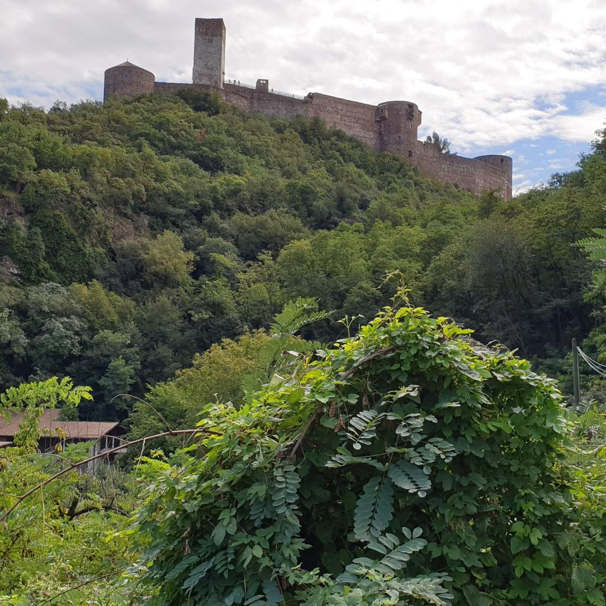
Built in the early 17th century for Sir Toby Caulfield, who was given land during the Plantation. Park up your bike and take some time to explore the ruins by foot. Keep an eye out for the murder holes which give an idea of its grim history, as well as the Caulfield Coat of Arms in a prominent position above the doorway.
0
0
Petrol station 200 or so metres away if you wish to restock snacks or fill the bidons
0
0
Frequently Asked Questions
How many road cycling routes are available around Dromore?
There are over 25 road cycling routes around Dromore, catering to various skill levels. You'll find 5 easy routes, 15 moderate routes, and 5 challenging options to explore the region's diverse landscape.
What kind of terrain can I expect on road cycling routes in Dromore?
Road cycling around Dromore features a landscape characterized by rolling countryside, numerous loughs, and rural villages. You can expect a mix of flat sections near water bodies and gentle to moderate climbs through agricultural land, primarily on quiet country lanes.
Are there any easy road cycling routes suitable for beginners in Dromore?
Yes, Dromore offers several easy road cycling routes. An excellent option is the Ballyronan and Moneymore loop from Lough Neagh, an easy 42.4 km trail offering pleasant views of Lough Neagh. Another easy route is the Lough Neagh – View of Lough Neagh loop from Mullanahoe, which is 34.6 km.
Where can I find challenging long-distance road cycling routes in Dromore?
For those seeking a challenge, Dromore has several longer, more demanding routes. Consider the Parkanaur House – Brantry Lough loop from Clonoe, a difficult 113.5 km route with significant elevation gain. Another moderate but lengthy option is the Scarva Village – Lottie's Café loop from Clonoe Park & Ride, which covers 105.3 km.
Are there any scenic viewpoints or attractions along the road cycling routes?
Yes, Dromore's routes often pass by scenic spots and points of interest. You might encounter the Maghery Footbridge at Lough Neagh, offering beautiful lake views, or the historic Mountjoy Castle. The Ardboe High Cross is another notable landmark you could see.
What do other road cyclists say about the routes in Dromore?
Over 350 road cyclists have explored Dromore's varied terrain using komoot. Users often praise the region for its quiet country lanes, the picturesque views of the loughs, and the charming rural villages encountered along the way.
Are there any loop road cycling routes around Dromore?
Many of the road cycling routes in Dromore are loops, providing a convenient way to start and finish in the same location. Examples include the Ballyronan and Moneymore loop from Lough Neagh and the Roughan Lough – Tullyleek Loughs loop from Clonoe Park & Ride.
What is the best time of year for road cycling in Dromore?
The best time for road cycling in Dromore is generally from spring through autumn, when the weather is milder and the countryside is in full bloom. Summer offers the longest daylight hours, while spring and autumn provide pleasant temperatures and fewer crowds. Always check local weather forecasts before heading out.
Are there any routes that pass by Lough Neagh?
Yes, several routes offer views of or pass near Lough Neagh, one of the prominent features of the region. The Ballyronan and Moneymore loop from Lough Neagh and the Lough Neagh – View of Lough Neagh loop from Mullanahoe are excellent choices for lakeside cycling.
What are the road conditions like on Dromore's cycling routes?
Road cycling routes in Dromore primarily utilize quiet country lanes. While generally well-maintained, conditions can vary, especially in rural areas. Cyclists should be prepared for typical rural road surfaces, which may include some uneven sections or agricultural debris, particularly after wet weather.
Are there any facilities or marinas along the cycling routes?
Some routes may pass by facilities. For instance, the The Battery Marina is a highlight in the region that could be incorporated into a ride or visited nearby.
Most popular routes around Dromore
Most popular attractions around Dromore

Get inspired with the komoot mobile app


Explore more
Browse the best Road cycling routes in other regions.
