The best running trails around Lochan na Stainge
5.0
(3)
234
runners
8
runs
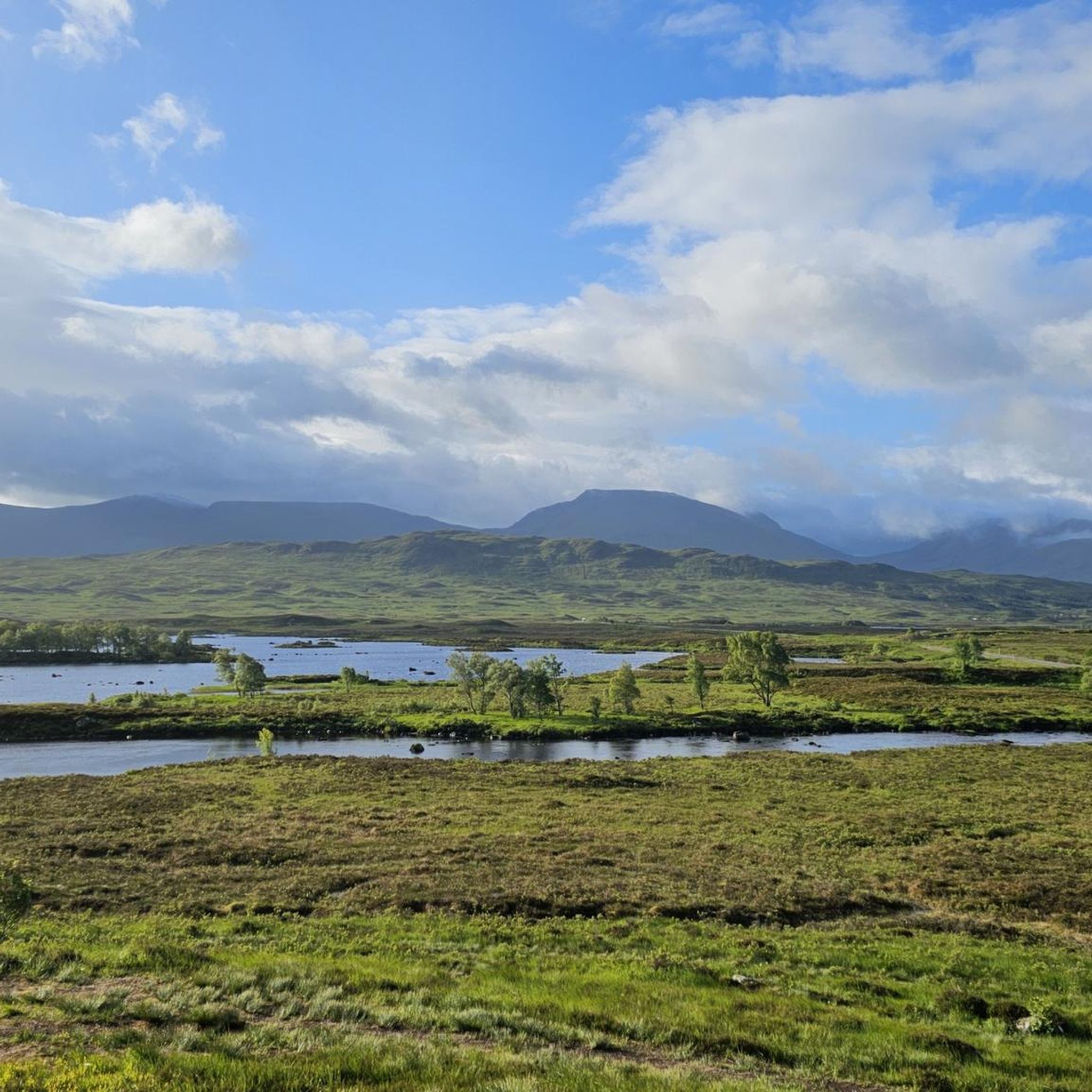
Jogging routes around Lochan na Stainge traverse the expansive Rannoch Moor in the Scottish Highlands, an area characterized by open moorland, numerous lochs, and rocky outcrops. The terrain features heather and grasses, with the Black Mount hills forming a dramatic backdrop. This region offers an extensive network of paths, providing a sense of wilderness and tranquility for runners.
Best jogging routes around Lochan na Stainge
- The most popular jogging route is Beinn Achaladair and Beinn a'Chreachain ridge run, a…
Last updated: October 2, 2026
32
runners
22.3km
03:52
1,200m
1,200m
Hard run. Very good fitness required. Sure-footedness, sturdy shoes and alpine experience required.
28
runners
15.3km
01:59
410m
410m
Hard run. Very good fitness required. Mostly paved surfaces. Suitable for all skill levels.

5.0
(1)
36
runners
16.6km
04:17
1,120m
1,120m
Hard run. Very good fitness required. Sure-footedness, sturdy shoes and alpine experience required.
22.6km
04:10
1,160m
1,160m
Hard run. Very good fitness required. Sure-footedness, sturdy shoes and alpine experience required.
5.0
(1)
54
runners
Hard run. Very good fitness required. Mostly paved surfaces. Suitable for all skill levels.
Get access to more routes and recommendations from other explorers.
Already have an account?
Our route recommendations are based on thousands of hikes, rides, and runs completed by other people on komoot.
Start today with a free account
Your next adventure awaits.
Popular around Lochan na Stainge
Tips from the Community

Rannoch Moor is one of Europe's last great, untouched wildernesses in the Scottish Highlands. The approximately 130 square kilometre, peaty moorland landscape fascinates with vast heathlands, deep bogs, rivers, and lonely lochs. The famous West Highland Way long-distance trail and the West Highland Line railway cross this rough, magical plain. It is flanked by majestic mountain peaks such as the iconic Buachaille Etive Mòr.
3
0

Imposing sight, especially when the weather is changeable.
0
0
Imposing landscape. On the West Highland Way, you walk into the valley and out the other side.
0
0

Excellent ridge route, a little exposed in places.
0
0
Not as exciting as it's neighbour but still worthwhile.
0
0
Frequently Asked Questions
What kind of terrain can I expect on running routes around Lochan na Stainge?
The terrain around Lochan na Stainge, situated within Rannoch Moor, is characterized by expansive moorland, often boggy in places, with numerous lochs and rocky outcrops. You'll find paths covered with heather and various grasses, offering a rugged and picturesque environment for running. The majestic Black Mount hills provide a dramatic backdrop to many trails.
Are there many running trails available in the Lochan na Stainge area?
Yes, the Lochan na Stainge area offers a network of paths suitable for various outdoor pursuits, including running. There are currently 9 documented running routes available, all of which are considered difficult due to the challenging Highland terrain.
What are some of the more challenging running routes near Lochan na Stainge?
For experienced runners seeking a challenge, the area offers several demanding routes. One popular option is the Beinn Achaladair and Beinn a'Chreachain ridge run, a difficult 22.3 km (13.8 miles) trail with significant elevation gain. Another challenging path is the Devil's Staircase – Kingshouse Hotel loop from Allt nan Giubhas, which spans 34.3 km (21.3 miles) and includes sections of the renowned West Highland Way.
Are there any circular running routes in the Lochan na Stainge region?
Yes, several routes in the area are loops. For instance, the Stob Ghabhar and Stob a'Choire Odhair trail running loop from Loch Tulla is a 16.6 km (10.3 miles) circular trail through mountainous terrain. Another option is the View of Glencoe Valley – Red Downhill Trail loop from Creag Dubh, a 7.7 km (4.8 miles) difficult loop.
What do other runners say about the trails around Lochan na Stainge?
The running routes around Lochan na Stainge are highly regarded by the komoot community, holding an average rating of 5.0 stars from over 2 reviews. Runners often praise the wild, open landscapes, breathtaking mountain vistas, and the profound sense of wilderness and tranquility the area offers.
Can I find sections of the West Highland Way for running near Lochan na Stainge?
Absolutely. The area around Lochan na Stainge incorporates sections of the renowned West Highland Way, providing well-established and popular trails for runners. For example, the Devil's Staircase – Kingshouse Hotel loop from Allt nan Giubhas includes parts of this famous long-distance path.
Are there any specific landmarks or natural features to look out for while jogging in the area?
While jogging around Lochan na Stainge, you'll be immersed in the raw beauty of Rannoch Moor. Key features include the vast open moorland itself, numerous small lochs and lochans, and the commanding presence of the Black Mount hills, which form a dramatic backdrop. The River Bà flows through Lochan na Stainge, adding to the serene natural scenery.
What is the best time of year to go running around Lochan na Stainge?
The scenery around Lochan na Stainge is ever-changing with the seasons. While the area offers a profound sense of wilderness year-round, winter can bring an 'Arctic' ambiance with snow-covered mountains. For less challenging conditions, late spring to early autumn generally offers milder weather, though the moorland can be boggy at any time, so appropriate footwear is always recommended.
Are the running routes around Lochan na Stainge suitable for beginners?
Currently, all documented running routes directly around Lochan na Stainge are classified as difficult. These trails often involve significant elevation gain and rugged, sometimes boggy, moorland terrain. While the broader Rannoch Moor area has some easier paths, the specific routes listed for Lochan na Stainge are best suited for experienced runners.
What should I wear for running on the trails in Lochan na Stainge?
Given the rugged and often boggy moorland terrain, it's essential to wear appropriate gear. Sturdy trail running shoes with good grip are highly recommended. Layered clothing suitable for changeable Scottish Highland weather, including waterproofs, is advisable. Be prepared for potentially wet and windy conditions, even in summer.
Is there parking available near the running routes?
While specific parking details for each route are best checked on individual komoot tour pages, the remote nature of Rannoch Moor means parking options might be limited or informal. It's advisable to plan your start point and check for designated parking areas or safe roadside spots in advance, especially near popular trailheads or along the West Highland Way.
Are there any shorter running options for a quick jog?
While most listed routes are longer and more challenging, the wider Rannoch Moor area does offer some shorter options. For example, the 'View of Loch Tulla loop from Loch Tulla' is an easy 2.8 km (1.8 miles) trail that can be completed in about 45 minutes, offering scenic views and a more relaxed jogging experience.
Most popular routes around Lochan na Stainge

Get inspired with the komoot mobile app


Explore more
Browse the best Running Trails & Routes in other regions.
