The best running trails around Loch Mealt
3.0
(1)
195
runners
3
runs
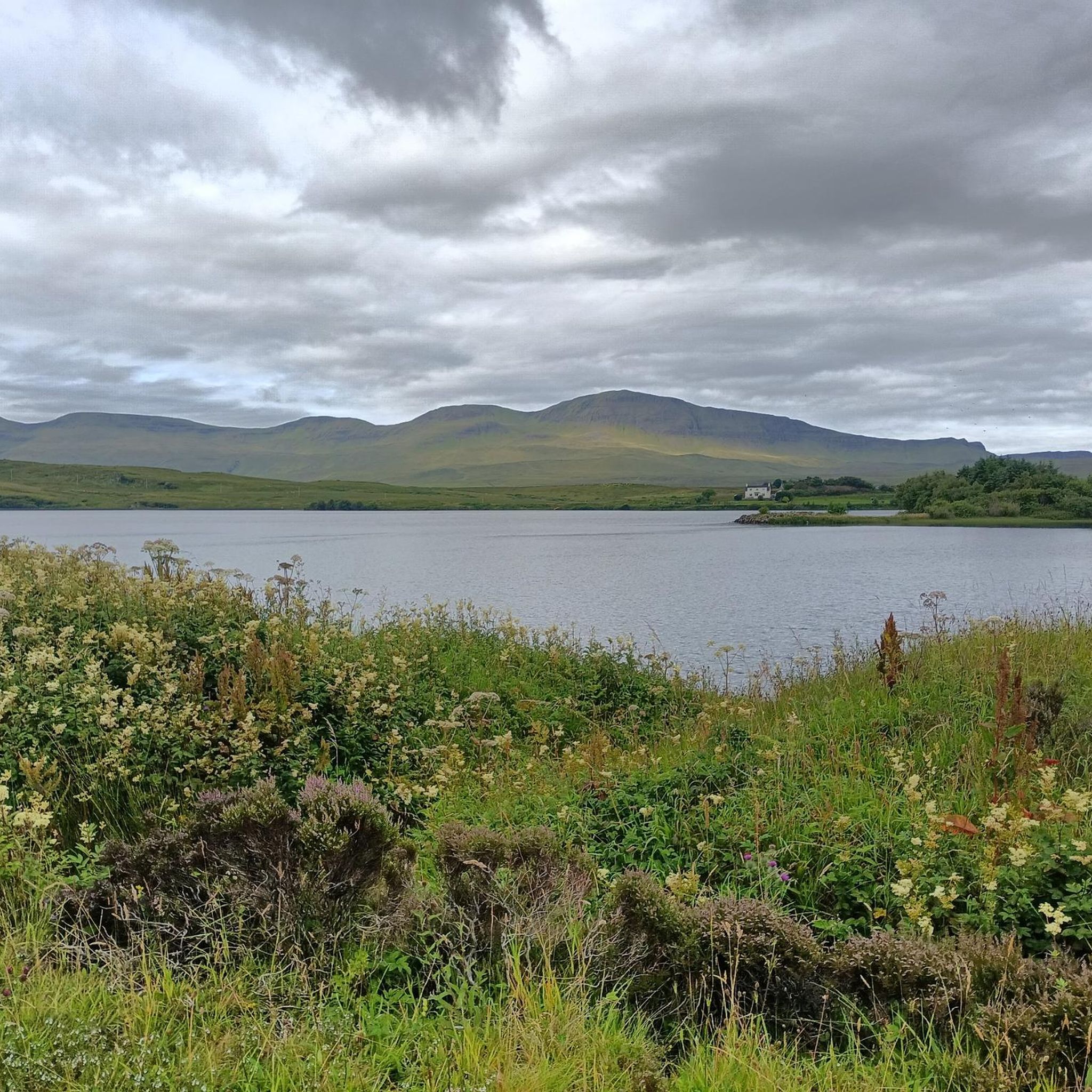
Jogging around Loch Mealt offers routes through varied terrain on the Isle of Skye. The area features coastal paths, historical industrial remnants, and dramatic landforms such as the Quiraing. Runners can expect a mix of relatively flat sections and more challenging ascents. The landscape is characterized by its unique geological formations and proximity to the sea.
Best jogging routes around Loch Mealt
- The most popular jogging route is Diatomite Railway Remains – Old Diatomite Railway Bridge loop from Lealt,…
Last updated: October 25, 2026
3.0
(1)
7
runners
10.7km
01:10
120m
120m
Moderate run. Good fitness required. Mostly paved surfaces.
8
runners
8.43km
00:54
100m
100m
Hard run. Good fitness required. Sure-footedness, sturdy shoes and alpine experience required.

179
runners
11.4km
02:00
520m
520m
Hard run. Very good fitness required. Sure-footedness, sturdy shoes and alpine experience required.
Our route recommendations are based on thousands of hikes, rides, and runs completed by other people on komoot.

Tips from the Community


Fir Bhreugach is a striking rock formation in the Quiraing area on the Isle of Skye. The name comes from Gaelic and means approximately "the false man" or "the deceiver", referring to the unusual, almost human-like silhouette of the rocks. Like many formations on the Trotternish Peninsula, Fir Bhreugach was formed by landslides and erosion, which are constantly changing the landscape. Today, it is a less well-known but fascinating part of the Quiraing, contributing to the mysterious, almost mythical atmosphere of this unique landscape.
0
0

Wonderful landscape, magnificent views, great hiking!
0
0

This stretch is part of the old railway line that connected the diatomite mine with the coast. If you are higher up you can see the whole length still in the vegetation.
0
0

Loch Langaig is a lake in Scotland. It is located on the north side of Trondheim in Skye. It is located on the left side of the A855, near the location of Flødigerairy. Loch Droighin, Loch Hasco, Loch Fada, Loch Leumnambradh and Loch Sheanta are nearby. This lake is a whopping 3.2 ha (7.9 acres). Its circumference is 0.7 km (0.4 mi) and it is about 242 metres (800 ft) long at its straightest point. There is no island in this lake. The water surface of the lake is about 107 m (350 ft) above sea level and about 0.8 km (0.5 mi) from the sea. No one lives near Loch Langaig, so there are no roads leading to this lake.
0
0

See predicted reports, but watch out for the mosquitoes!!!!
1
0
Beautiful views, but best to be enjoyed by bike
0
0

Fir Bhreugach is a 1,076 ft (328 m) high summit north of the Quirang. It's not the highest point around but its position affords amazing views south onto the landslip and the stunning landscape here.
1
0
Frequently Asked Questions
What kind of terrain can I expect on running trails around Loch Mealt?
The running trails around Loch Mealt offer a diverse experience, featuring coastal paths, historical industrial remnants, and dramatic landforms like the Quiraing. You'll find a mix of relatively flat sections and more challenging ascents, all set against the unique geological formations and proximity to the sea on the Isle of Skye.
Are there any easy jogging routes suitable for beginners near Loch Mealt?
While the listed routes are generally moderate to difficult, the area does offer sections that are less strenuous. For a moderate option that follows historical paths, consider the Diatomite Railway Remains – Old Diatomite Railway Bridge loop from Lealt, which is 6.6 miles (10.6 km) long.
Are there any circular jogging routes around Loch Mealt?
Yes, several routes are designed as loops. For instance, the Flodigarry loop from Quirang is a moderate 5.3-mile (8.5 km) path offering views of the Quiraing landscape and coastal stretches. Another option is the The Quiraing & Meall na Suiramach loop from Flodigarry, a more challenging 7.1-mile (11.4 km) trail.
What is the best time of year for running near Loch Mealt?
The Isle of Skye's weather can be unpredictable. Spring and autumn often offer cooler temperatures and fewer midges, making them ideal for running. Summer can be pleasant but also brings more tourists and potential for midges. Winter running is possible but requires appropriate gear for colder, wetter, and potentially windier conditions.
What should I wear for jogging near Loch Mealt in winter?
For winter jogging around Loch Mealt, it's crucial to dress in layers. Waterproof and windproof outer layers are essential, along with thermal base layers. Good quality trail running shoes with grip are recommended for potentially wet and uneven terrain. Don't forget a hat, gloves, and a headlamp if running in low light.
Are there any challenging running trails for experienced runners?
Absolutely. The The Quiraing & Meall na Suiramach loop from Flodigarry is classified as difficult, covering 7.1 miles (11.4 km) with significant elevation gain, leading through the iconic Quiraing landslip and the slopes of Meall na Suiramach.
Can I find viewpoints along the running tracks around Loch Mealt?
Many of the routes, especially those traversing the Quiraing and coastal areas, offer spectacular viewpoints. The Flodigarry loop from Quirang, for example, provides stunning vistas of the dramatic Quiraing landscape and the sea.
What do other runners enjoy most about jogging in Loch Mealt?
The area is highly rated by the komoot community, with an average score of 3.0 stars. Runners often praise the unique geological formations, the dramatic coastal scenery, and the opportunity to explore historical industrial features while enjoying a good workout.
Is it possible to spot wildlife while running near Loch Mealt?
Yes, the Isle of Skye is rich in wildlife. While running, you might spot various bird species, including seabirds along the coast. Keep an eye out for red deer in the more remote areas, and if you're lucky, you might even catch a glimpse of seals or otters near the shoreline.
Are there any cafes or pubs near the jogging routes for a post-run refreshment?
While specific establishments directly on the trails are limited, the villages and hamlets surrounding Loch Mealt and the wider Trotternish peninsula, such as Staffin or Flodigarry, offer options for cafes, pubs, and eateries where you can refuel after your run.
Are the running routes around Loch Mealt accessible by public transport?
Public transport on the Isle of Skye, particularly in more rural areas like Loch Mealt, can be infrequent. It's advisable to check local bus timetables in advance if you plan to rely on public transport to reach the trailheads. Many runners opt for personal vehicles or taxis for greater flexibility.

Get inspired with the komoot mobile app


Explore more
Browse the best Running Trails & Routes in other regions.
