The best MTB trails around Fiume Oglio
4.2
(1436)
5,999
riders
679
rides
Mountain biking around Fiume Oglio offers diverse terrain, from the Alpine peaks where the river originates to the flatlands of the Po Valley. The region features the UNESCO World Heritage site of Valle Camonica, known for its verdant environment, and the scenic Lake Iseo. Riverine parks like Parco Oglio Nord and Sud provide protected natural reserves with ancient woodlands and varied flora and fauna, ideal for exploring on two wheels. This varied landscape ensures a range of mountain bike trails…
Last updated: October 4, 2026
4.2
(11)
31
riders
36.6km
02:29
80m
80m
Moderate mountain bike ride. Good fitness required. Suitable for all skill levels.
4.2
(19)
81
riders
60.5km
03:56
210m
210m
Moderate mountain bike ride. Good fitness required. Suitable for all skill levels.

59
riders
Easy mountain bike ride. Great for any fitness level. Suitable for all skill levels.
4.0
(2)
8
riders
Moderate mountain bike ride. Good fitness required. Suitable for all skill levels.
9
riders
31.9km
01:38
60m
60m
Easy mountain bike ride. Great for any fitness level. Suitable for all skill levels.
Get access to more routes and recommendations from other explorers.
Already have an account?
Our route recommendations are based on thousands of hikes, rides, and runs completed by other people on komoot.
Start today with a free account
Your next adventure awaits.

Tips from the Community

Pontevico is an Italian municipality of about 7,150 inhabitants located at the southern end of the province of Brescia, in Lombardy. The village stands in a historically strategic position along the Oglio river, which marks the natural border with the province of Cremona. The name derives from the Latin Pons Vici, which literally means "bridge of the village". The municipal territory is predominantly flat and includes the hamlets of Bettegno, Campazzo, Chiesuola and Toro. Local economy is historically divided between a strong agricultural vocation and an industrial textile development linked to the Bassa Bresciana district. The center is about 32 kilometers from the provincial capital Brescia and is easily reachable by car via the A21 motorway or by the Brescia-Cremona railway line.
0
0


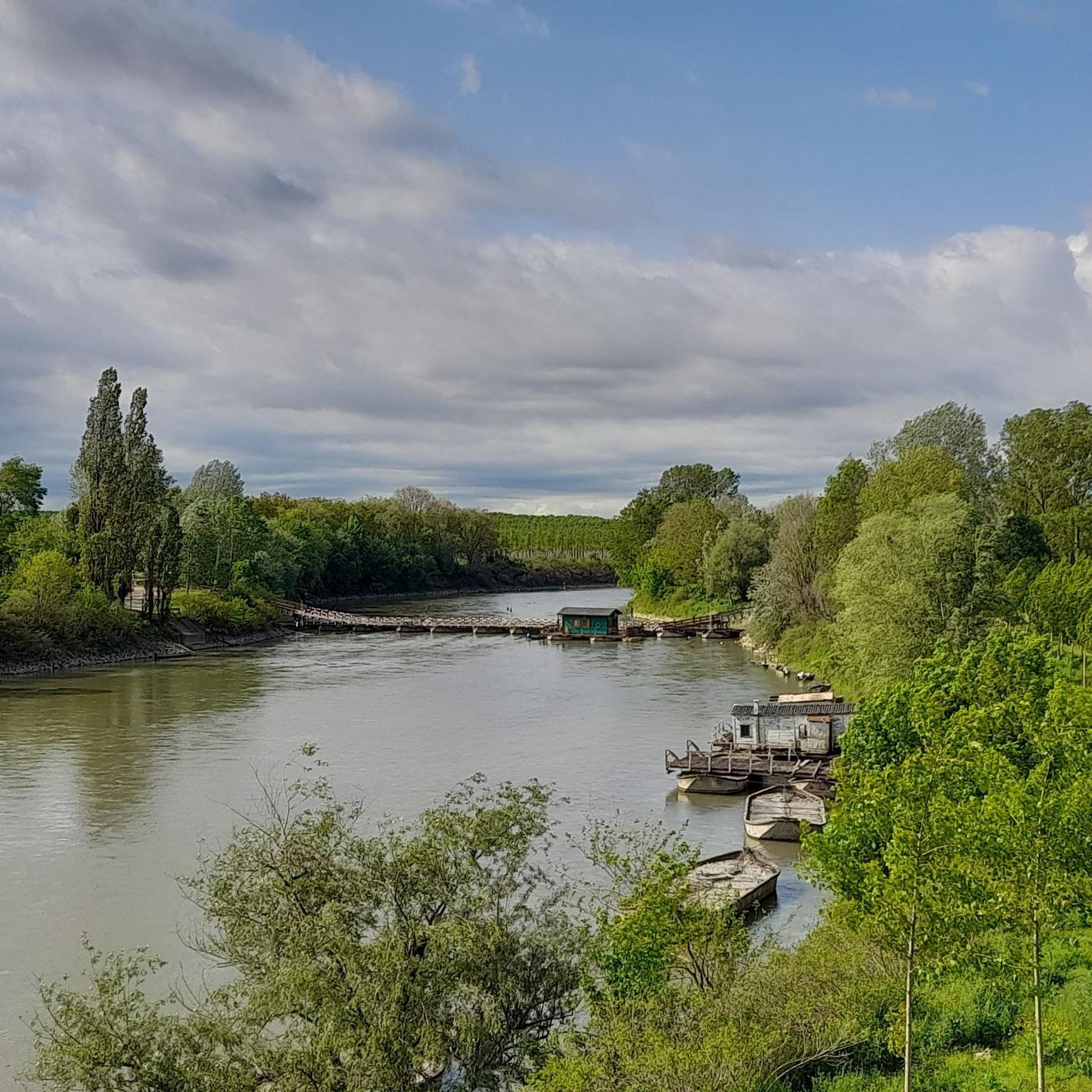
Old Bridge, we are in the North Oglio Park
0
0

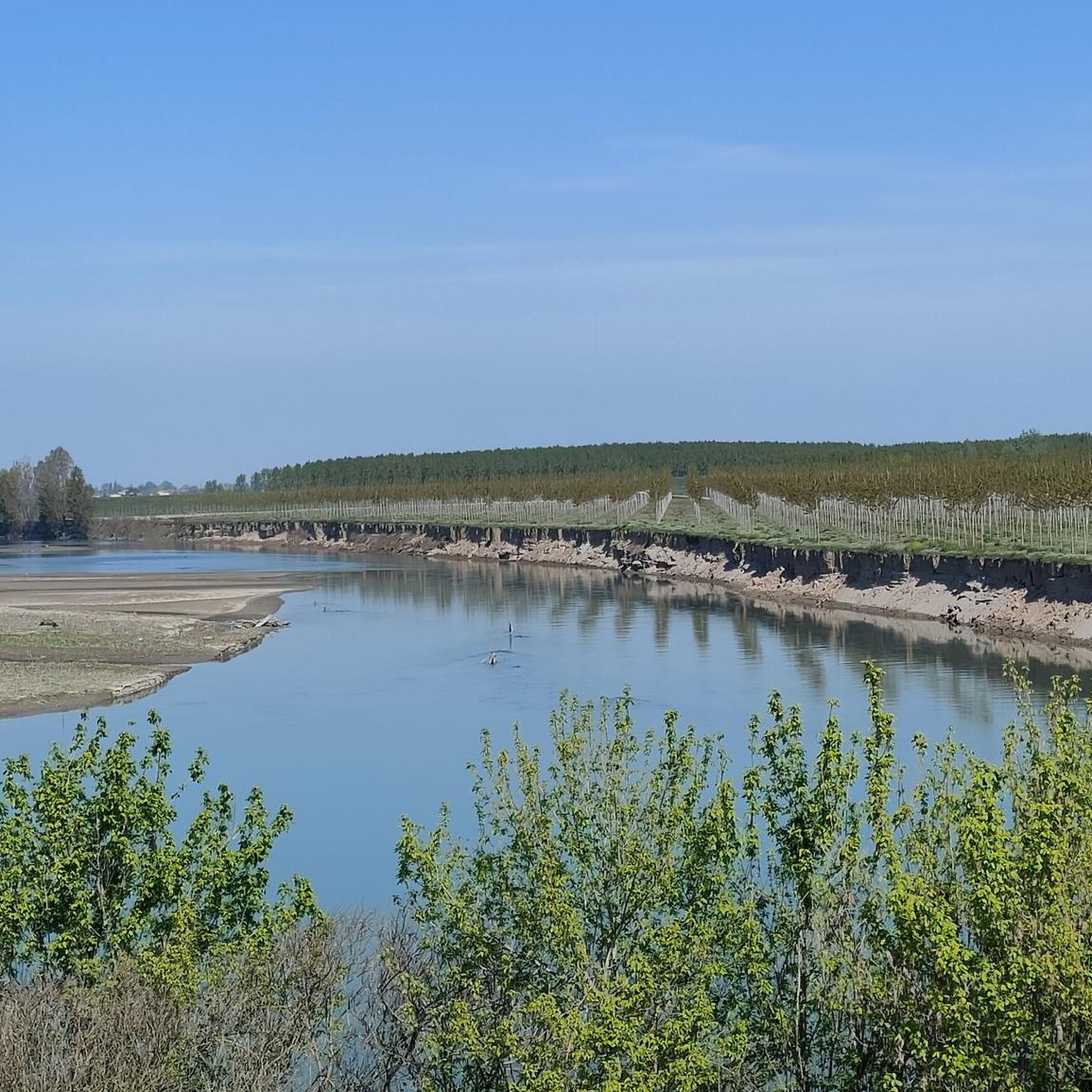
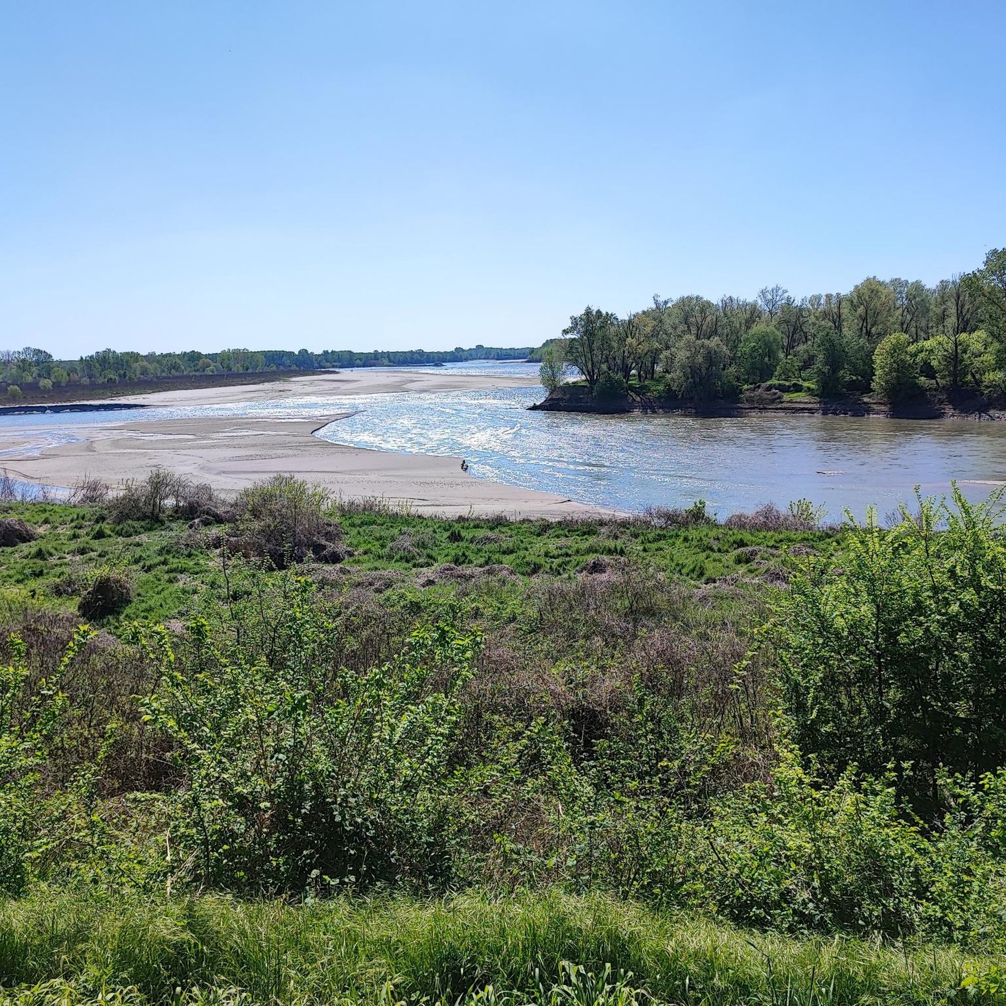
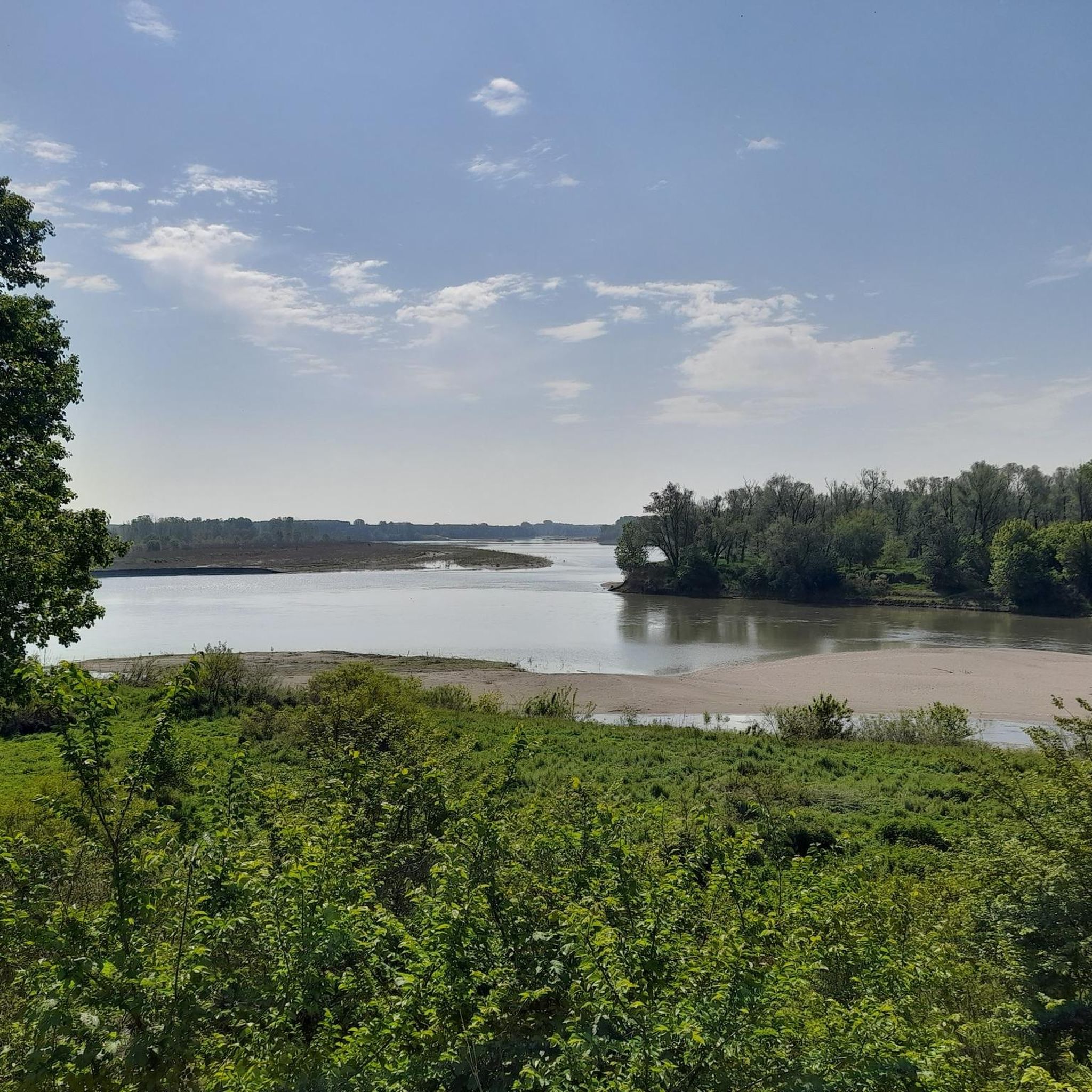
Splendid view of the Oglio from here
0
0

Beautiful panoramic view of the Oglio
1
0

Very beautiful, almost entirely shaded and cool. In some places, the vegetation is very lush, but there are alternative routes. As always, there are the inevitable fallen tree trunks along the way. One in particular is 15 cm in diameter, but you can climb over it. Have a good trip!
1
0

❌Lost path, brambles and nettles 2m high DANGEROUS!!❌
1
0
The Madonnina dell'Oglio is a satellite sanctuary of Santa Maria del Fonte in Caravaggio, dedicated to the famous apparition
1
0
Frequently Asked Questions
How many mountain bike trails are available around Fiume Oglio?
There are nearly 650 mountain bike trails around Fiume Oglio, catering to various skill levels. This includes 247 easy routes, 348 moderate routes, and 53 difficult routes, ensuring options for everyone from beginners to experienced riders.
What kind of terrain can I expect on mountain bike trails in Fiume Oglio?
The terrain around Fiume Oglio is incredibly diverse, ranging from the Alpine peaks where the river originates, through the verdant Valle Camonica, past Lake Iseo, and into the flatlands of the Po Valley. You'll encounter everything from challenging mountainous sections to more accessible riverine paths, often through ancient woodlands and protected natural reserves. Some sections may involve varying surfaces, including potential mud, making them ideal for mountain bikes.
Are there any family-friendly mountain bike trails in the Fiume Oglio region?
Yes, Fiume Oglio offers numerous family-friendly mountain bike routes, particularly in the flatter sections along the river and through regional parks. These routes are generally less challenging and provide a pleasant experience for all ages. An example of an easy route is the Santuario dei Campi Veri loop from Urago d'Oglio, which is 19.3 km long.
What natural landmarks or points of interest can I see while mountain biking around Fiume Oglio?
The Fiume Oglio region is rich in natural beauty. You can explore the UNESCO World Heritage site of Valle Camonica, known for its prehistoric rock carvings, or enjoy the scenic views around Lake Iseo. Along the river, you might encounter various bridges, such as the Pontoon bridge on the River Oglio or the Monticelli d'Oglio Cycle Bridge. There are also tranquil spots like the Small Beach on the Oglio Riverbank and the picturesque Oglio River near Pontevico.
Are there any circular mountain bike routes in Fiume Oglio?
Yes, many mountain bike routes in Fiume Oglio are designed as loops, offering convenient starting and ending points. A popular moderate option is the Lungo il fiume Oglio da Soncino — Giro ad anello, which follows the Oglio river for 36.6 km. Another great choice is the Strone River Park – Trail Along the Strone River loop from Robecco-Pontevico, a 47.4 km moderate path.
What is the best time of year for mountain biking in Fiume Oglio?
The Fiume Oglio region offers good mountain biking conditions for much of the year. Spring and autumn generally provide pleasant temperatures and vibrant scenery, ideal for exploring. Summer can be warm, especially in the lower valleys, but routes near Lake Iseo or in higher alpine areas offer cooler options. Winter riding is possible in the lower elevations, but higher mountain trails may be inaccessible due to snow.
What do other mountain bikers enjoy most about Fiume Oglio?
The Fiume Oglio region is highly rated by the komoot community, with an average score of 4.2 stars from over 1,200 reviews. Reviewers often praise the diverse landscapes, from riverine paths to lakeside views, and the extensive network of trails that cater to all skill levels. The combination of natural beauty and well-maintained routes makes it a favorite among local and visiting mountain bikers.
Are there any challenging mountain bike trails for experienced riders?
Absolutely. While many routes are easy to moderate, Fiume Oglio also offers challenging trails, particularly in the upper reaches of the river towards the Alpine peaks. For experienced riders seeking a longer, more demanding adventure, consider the Pontevico Castle – Bridge over the Oglio in Ostiano loop from Canneto sull'Oglio, a difficult 133.3 km route with significant elevation changes.
Can I find mountain bike routes that pass through natural parks or protected areas?
Yes, the Fiume Oglio flows through several regional parks and protected natural reserves, such as Parco Oglio Nord and Parco Oglio Sud. These areas feature ancient woodlands and diverse wildlife, offering a unique natural experience. The Bosco del Lusignolo – Strone River Park loop from Robecco-Pontevico is a moderate 36.3 km route that takes you through such a beautiful parkland setting.
Are there opportunities for other outdoor activities besides mountain biking in the Fiume Oglio area?
Yes, the Fiume Oglio region is a multisport destination. Beyond cycling, you can enjoy trekking, sport fishing, and fly fishing. Canoeing and kayaking are popular ways to explore the river's streams and observe local wildlife. The presence of Lake Iseo also provides opportunities for various water sports. For more information on water sports, you can visit visitbrescia.it.
What is the Ciclovia del Fiume Oglio and how does it relate to mountain biking?
The Ciclovia del Fiume Oglio is a renowned cycle path, recognized as 'the most beautiful cycle path in Italy' in 2019. This extensive route follows the Oglio River from the Tonale Pass down to the Po River, traversing Valle Camonica, Lake Iseo, and Franciacorta. While generally suitable for various bikes, some sections may be ideal for mountain bikes due to varying terrain, offering a fantastic way to experience the region's diverse landscapes.
Most popular routes around Fiume Oglio
Most popular attractions around Fiume Oglio

Get inspired with the komoot mobile app


Explore more
Browse the best MTB trails in other regions.
