The best walks and hikes around Lake Cava Increa
4.4
(572)
7,385
hikers
316
hikes
Hiking around Lake Cava Increa centers on an urban park in Brugherio, Lombardy, featuring a large artificial lake, which was formerly a quarry. The park provides significant green space within an urban setting, offering accessible trails suitable for various fitness levels. Paths generally loop around the lake or connect from nearby towns. The terrain is largely flat, making it ideal for easy walks.
Best hiking trails around Lake Cava Increa
- The most popular hiking route is Parco Increa – loop…
Last updated: June 27, 2026
1.67km
00:26
10m
10m
Easy hike. Great for any fitness level. Easily-accessible paths. Suitable for all skill levels.
15
hikers
2.57km
00:40
10m
10m
Easy hike. Great for any fitness level. Easily-accessible paths. Suitable for all skill levels.

Sign up for free
3.8
(5)
69
hikers
8.64km
02:13
40m
40m
Moderate hike. Good fitness required. Easily-accessible paths. Suitable for all skill levels.
19
hikers
Easy hike. Great for any fitness level. Easily-accessible paths. Suitable for all skill levels.
15
hikers
8.50km
02:13
60m
60m
Moderate hike. Good fitness required. Easily-accessible paths. Suitable for all skill levels.
Get access to more routes and recommendations from other explorers.
Sign up for free
Already have an account?
Our route recommendations are based on thousands of hikes, rides, and runs completed by other people on komoot.
Start today with a free account
Your next adventure awaits.
Login or Signup


Tips from the Community

The Naviglio Martesana cycle path (also called Naviglio Piccolo) is a cycle-pedestrian route of about 36 kilometers that connects the center of Milan with the Adda river, reaching up to Trezzo sull'Adda or Cassano d'Adda. Completely flat and asphalted, it is an ideal itinerary for families, urban cyclists, and cycle tourists of all levels.
0
0

The course of the Naviglio Martesana in Cernusco is also a Park. It extends across the entire width of the territory of Cernusco sul Naviglio, from the border with Cassina de'Pecchi to that with Vimodrone.
0
0
The Martesana cycle path starts from Cassina de' Pomm at the corner of via Melchiorre Gioia and extends for 30 km passing through the municipalities of Cologno Monzese, Vimodrone, Cernusco sul Naviglio, Cassina dei Pecchi, Bussero, Gorgonzola, Gessate, Inzago and Cassano d'Adda.
1
0
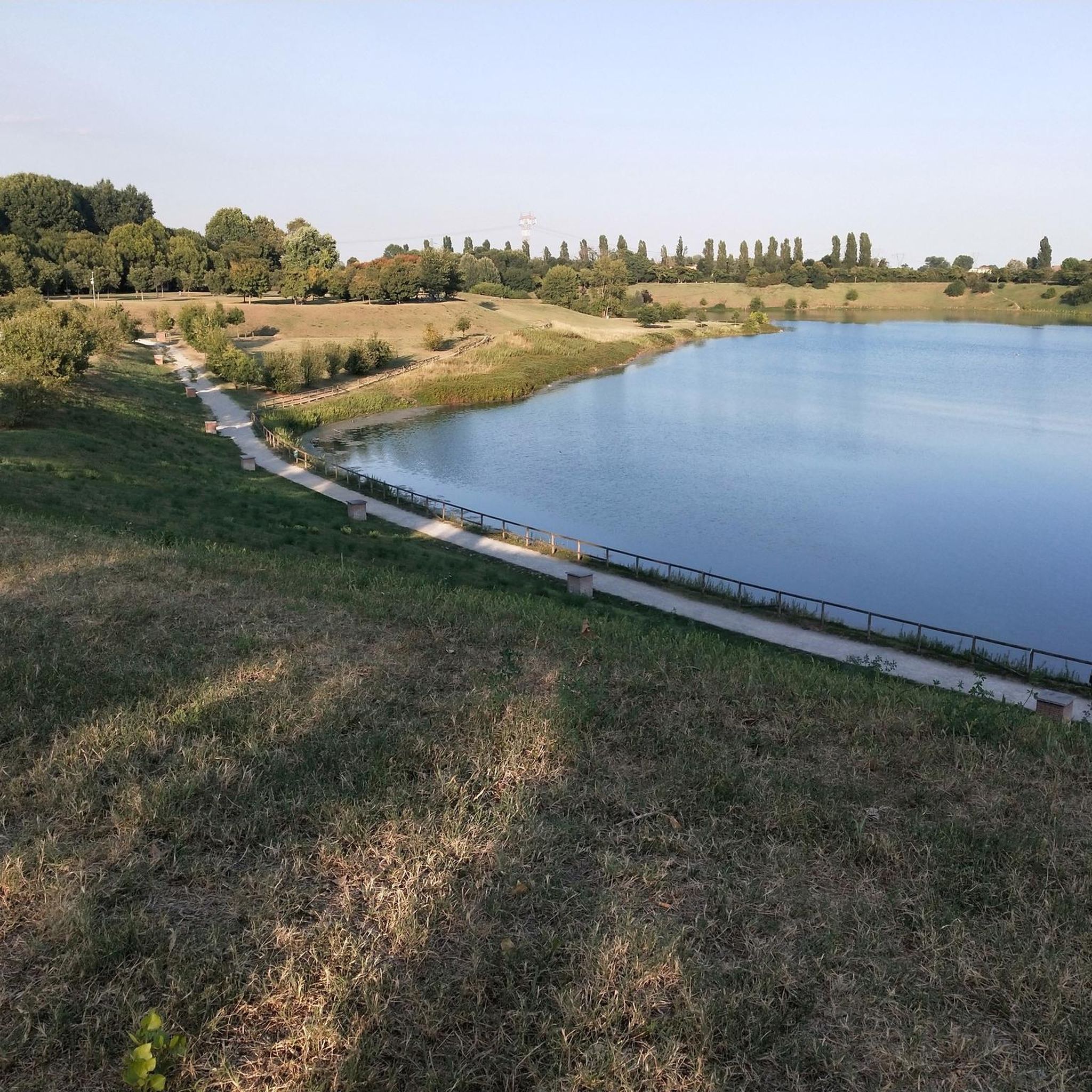
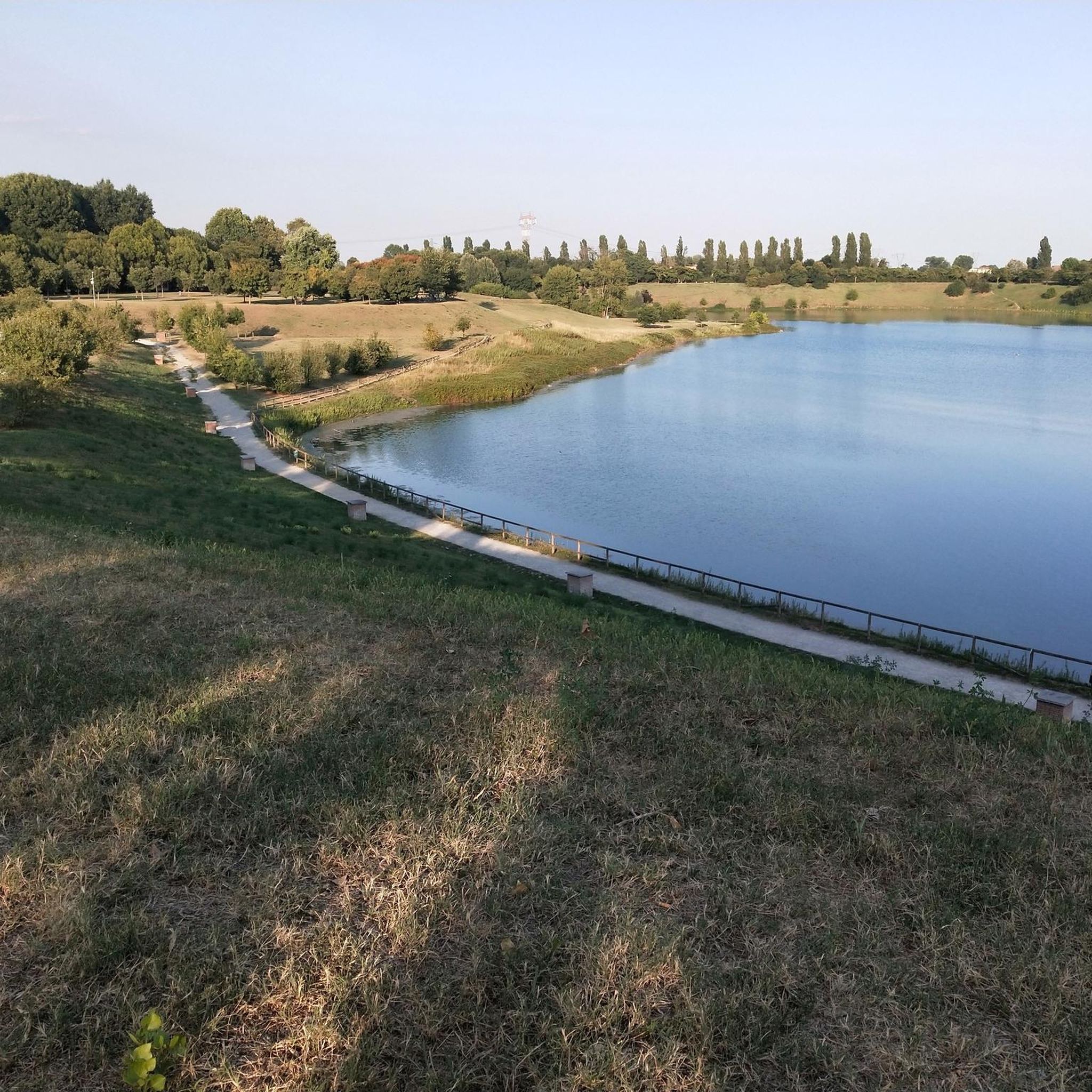
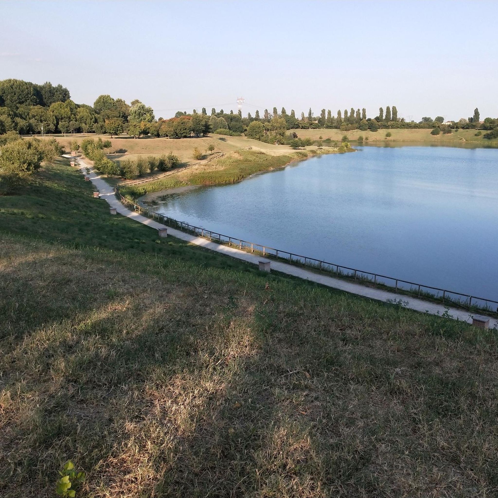
The Increa Park covers an area of approximately 330,000 sq m (33 hectares) in the southeastern part of the municipality of Brugherio and borders the municipality of Cernusco to the southeast and a stretch of the eastern ring road to the northwest. Where the park is today, there was once an agricultural area, which from the 1960s was the site of sand and gravel extraction activities; then, in 1985, thanks to the variant to the PRG and the agreement between the municipality of Brugherio and some private quarry owners, environmental recovery interventions began, aimed at the creation of a public equipped park including green areas and a small lake. In 1987 the area was acquired by the municipal heritage and in the following twenty years the works were carried out which have led today to having the largest green lung in Brugherio and the surrounding area.
1
0
The Increa Park covers an area of approximately 330,000 sq m (33 hectares) in the southeastern part of the municipality of Brugherio and borders the municipality of Cernusco to the southeast and a stretch of the eastern ring road to the northwest. Where the park is today, there was once an agricultural area that, from the 1960s, was the site of sand and gravel extraction activities; then, in 1985, thanks to the amendment to the PRG and the agreement between the municipality of Brugherio and some private quarry owners, environmental recovery interventions began, aimed at creating a public equipped park including green areas and a small lake. In 1987, the area was acquired by the municipal heritage and in the following twenty years, the works were carried out that have led today to the largest green lung in Brugherio and its surroundings.
1
0

Villa Alari, recently renovated, is a Rococo-style villa built in the 13th century
0
0
The Naviglio Martesana cycle path is a 30-35 km long cycle-pedestrian route that connects Milan (Cassina de' Pomm/via Melchiorre Gioia area) to Trezzo sull'Adda, running along the canal of the same name. It is a predominantly asphalted, flat, easy and suitable-for-everyone itinerary, which crosses parks, rural areas, and historic noble villas from the 17th-18th centuries.
0
0
The 18th-century Villa Alari Visconti in Saliceto is among the "villas of delight" in the Milanese area, one of the most worthy of special mention. Construction began in 1703 and was completed in 1719. However, given the vastness of the project, entrusted in its entirety to the Roman architect Giovanni Ruggeri, and the certainty of the date of consecration of the chapel dedicated to Saint Hyacinth, the completion date can reasonably be moved to 1725, the year in which the stucco and fresco decorations were finally completed. The complex stands on the edge of town, north of the Martesana Canal, and is laid out along a longitudinal axis; towards the historic center of Cernusco, a courtyard flanked by two wings and enclosed by a taller central body; the rear façade, considered the main façade, overlooks the garden with access to the Martesana Canal. The central body was used for residential purposes, while the side buildings with adjoining rustic courtyards were used for services and agricultural activities. (source: FAI)
0
0
Frequently Asked Questions
How many hiking trails are available around Lake Cava Increa?
There are over 290 hiking routes around Lake Cava Increa, primarily focusing on easy walks within the urban park setting. The area offers a significant green space with accessible paths suitable for various fitness levels.
Are the trails around Lake Cava Increa suitable for families with children?
Yes, the trails around Lake Cava Increa are generally easy and accessible, making them ideal for families with children. The park's largely flat terrain and well-maintained paths provide a pleasant environment for all ages.
Can I bring my dog on the hikes around Lake Cava Increa?
Increa Park is a popular spot for dog walkers. While the guide doesn't specify exact rules, it's generally accepted that dogs are welcome on the trails, likely on a leash, given the urban park environment. Always ensure responsible pet ownership.
What kind of terrain can I expect on the trails around Lake Cava Increa?
The terrain around Lake Cava Increa is largely flat and accessible, consisting of well-maintained paths. It's an urban park, so you can expect easy walking surfaces, making it suitable for casual strolls and light hikes rather than rugged mountain trekking.
Are there any circular hiking routes around Lake Cava Increa?
Yes, circular routes are a defining feature of hiking around Lake Cava Increa. A popular option is the Parco Increa – loop tour, which offers a quick circuit around the lake. Other routes, like Parco Increa Lake loop from Brugherio, also provide extended circular explorations.
What are the notable natural features or landmarks to see while hiking?
While hiking around Lake Cava Increa, you'll encounter the prominent artificial lake, which is the park's centerpiece. The park also features unique elements from its past, such as a 'bird snare' (roccolo) made of lime trees, three monumental plane trees, and what is reported to be Italy's longest recycled plastic bench. The nearby Cascina Increa offers a glimpse into Renaissance rural architecture.
Is there parking available for hikers at Lake Cava Increa?
Yes, given its urban park setting, there are typically parking facilities available near Increa Park for visitors. It's advisable to check local signage upon arrival for specific parking areas and regulations.
How can I reach Lake Cava Increa using public transport?
Lake Cava Increa is located in Brugherio, Lombardy, and is accessible from nearby towns like Brugherio or Cernusco sul Naviglio. Public transport options, such as local buses, would connect these towns to the park, offering a convenient way to arrive without a car.
Are there any facilities or places to eat within or near Increa Park?
Yes, Increa Park provides amenities for visitors. You can find rest areas, including covered spaces, and there is a bar within the park that hosts events and offers food and refreshments, making it a convenient stop during your hike.
What do other hikers say about their experience at Lake Cava Increa?
The hiking routes around Lake Cava Increa are highly rated by the komoot community, with an average score of 4.5 stars from over 600 reviews. Hikers often praise the accessibility, the scenic views of the artificial lake, and the peaceful green spaces within an urban environment.
What is the best time of year to go hiking at Lake Cava Increa?
Lake Cava Increa offers pleasant hiking conditions throughout much of the year due to its accessible trails and urban park nature. Spring and autumn provide comfortable temperatures and vibrant scenery, while summer can be enjoyable, especially in the mornings or evenings. Winter walks are also possible, though the park's natural features might be less vibrant.
Is swimming allowed in Lake Cava Increa?
No, swimming is not permitted in Lake Cava Increa. While the artificial lake is a prominent and scenic feature of the park, it is not designated for recreational swimming.
Are there longer or more challenging hikes available beyond the main park loops?
While the core of Lake Cava Increa offers easy loops, some routes extend from nearby towns, providing slightly longer explorations. For instance, the Parco Increa Lake loop from Cernusco sul Naviglio is a moderate 8.5 km path, offering a more extended experience while still maintaining the park's generally gentle elevation changes.
Most popular routes around Lake Cava Increa

Get inspired with the komoot mobile app


Explore more
Browse the best Hikes in other regions.
