The best walks and hikes around Lake del Miserin
4.5
(1388)
7,481
hikers
116
hikes
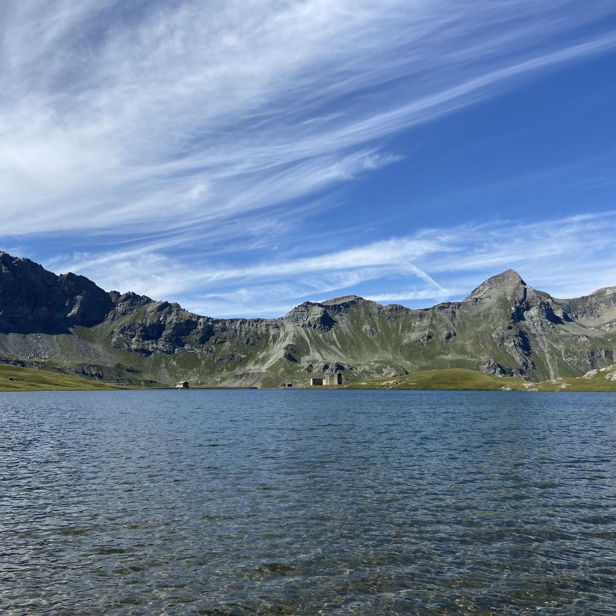
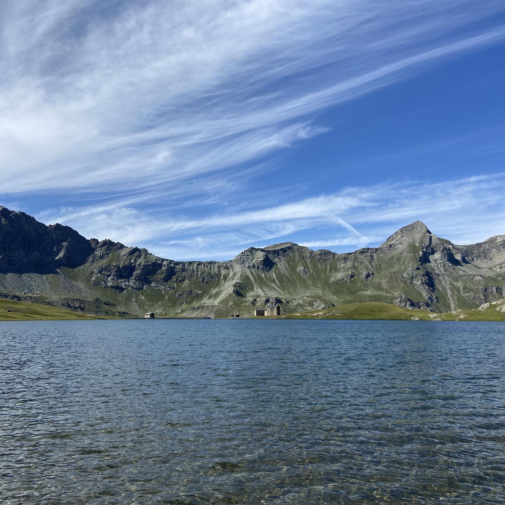
Hiking around Lake del Miserin offers diverse trails within the Champorcher Valley, situated at an elevation of 2,588 meters. The region is characterized by alpine scenery, clear waters, and varied terrain, including steep ascents and traverses through valleys. It is nestled within a wide basin, providing views of surrounding peaks and forming part of the Mont Avic Park. The Ayasse stream originates from the lake's waters and flows through the valley.
Best hiking trails around Lake del Miserin
- The most…
Last updated: September 28, 2026
5
hikers
1.99km
00:38
10m
10m
Hard hike. Great for any fitness level. Sure-footedness, sturdy shoes and alpine experience required.
8
hikers
11.7km
07:20
1,450m
1,450m
Hard hike. Very good fitness required. Sure-footedness, sturdy shoes and alpine experience required.

4.7
(42)
205
hikers
9.76km
03:52
500m
500m
Hard hike. Good fitness required. Sure-footedness, sturdy shoes and alpine experience required.
4.8
(12)
62
hikers
11.4km
05:02
680m
680m
Hard hike. Very good fitness required. Mostly accessible paths. Sure-footedness required.
4.8
(5)
25
hikers
15.4km
06:18
900m
900m
Hard hike. Very good fitness required. Sure-footedness, sturdy shoes and alpine experience required.
Get access to more routes and recommendations from other explorers.
Already have an account?
Our route recommendations are based on thousands of hikes, rides, and runs completed by other people on komoot.
Start today with a free account
Your next adventure awaits.
Popular around Lake del Miserin

Tips from the Community

Full ascent starting from la Cort near the hamlet Petit Monblanc
0
0


Ascent passable from the Chemin du Roi and descent from the path on Lake Miserin, with intermittent and difficult cyclability for the first half.
0
0

A nice ride even on a gravel bike; the road is very dusty and sandy due to heavy vehicles working at altitude, but still easy to ride. The last 2 km or so before the lake have 3-4 killer sections due to the combination of steepness and rocks. Congratulations to anyone who manages to stay on the bike (without a motor); that wasn't my case.
0
0
A nice ride even on a gravel bike; the road is very dusty and sandy due to heavy vehicles working at altitude, but still easy to ride. The last 2 km or so before the lake have 3-4 killer sections due to the combination of steepness and rocks. Congratulations to anyone who manages to stay on the bike (without a motor); that wasn't my case.
1
0

A suspension bike is required because the climb to the lake has a challenging surface.
0
0

Arrival time is 7:30 PM (dinner time). In the morning, rooms can be vacated at 9:30 AM. It's located along the mule track leading to Lake Miserin, making it very convenient. The facility is spacious, with both smaller rooms and mixed dormitories. They have showers, unlike other refuges in the area, and this is a plus. Good food and very friendly service. Prices are average for the area: a dorm with half board costs €56 per person, a private room €70 per person.
0
0
Excellent restaurant with very fair prices, excellent food quality, and friendly staff. I recommend wearing appropriate footwear because the trail features rocks that can be slippery, especially on wet ground.
0
0
Frequently Asked Questions
How many hiking trails are available around Lake del Miserin?
There are over 100 hiking routes around Lake del Miserin, catering to various skill levels. You'll find everything from shorter walks to challenging multi-day treks, with 3 easy, 48 moderate, and 58 difficult routes.
What notable landmarks or points of interest can I find near Lake del Miserin?
Near Lake Miserin, you can visit the historic Notre-Dame-des-Neiges sanctuary, a destination for an annual pilgrimage. The Rifugio Miserin is also located close by, offering a place for rest. Many routes pass through the Dondena basin, home to the Dondena Refuge, which was originally a hunting home. The area is also part of the Mont Avic Park, known for its preserved natural beauty.
What do other hikers enjoy most about the trails around Lake del Miserin?
The trails around Lake del Miserin are highly rated by the komoot community, with an average score of 4.6 stars from over 1000 reviews. Hikers frequently praise the stunning alpine scenery, the crystal-clear waters of the lake, and the diverse terrain that offers panoramic views of peaks like Rosa dei Banchi and Mont Glacier.
Are there any circular hiking routes around Lake del Miserin?
Yes, there are several circular routes. A popular option is the Lake Miserin – Lake Miserin loop from Valprato Soana, which offers a short exploration of the lake's immediate surroundings. For a more challenging option, consider the Lago Misérin and Santuario della Madonna delle Nevi – loop from Dondena, which includes a visit to the historic sanctuary.
Are there easy hiking options suitable for families or beginners?
While many routes are classified as moderate to difficult, there are 3 easy routes available around Lake del Miserin. These typically offer shorter distances and less elevation gain, making them suitable for families or those new to hiking. The Lake Miserin – Lake Miserin loop from Valprato Soana is a good example of a shorter, less strenuous option.
What is the best time of year to hike around Lake del Miserin?
The best time to hike around Lake del Miserin is generally from late spring to early autumn (June to September). During this period, the weather is more stable, trails are clear of snow, and you can enjoy the vibrant flora, including rhododendron blooms and edelweiss flowers. Always check local weather conditions before heading out.
Are permits required for hiking in Mont Avic Natural Park?
Hiking in Mont Avic Natural Park generally does not require specific permits for day hikes on marked trails. However, it's always advisable to check the official Mont Avic Park website or local tourist information for any updated regulations, especially if planning activities like camping or specific research.
Can I bring my dog on the hiking trails near Lake del Miserin?
Many trails in the Champorcher Valley and Mont Avic Park are dog-friendly, but regulations can vary. It's generally recommended to keep dogs on a leash, especially in protected areas like Mont Avic Park, to protect wildlife and ensure a pleasant experience for all hikers. Always check specific trail rules or park guidelines beforehand.
Where can I park when visiting Lake del Miserin for a hike?
Many routes to Lake Miserin begin or pass through the Dondena basin, which typically offers parking facilities. It's a common starting point for various trails in the area. Specific parking availability can vary, so it's good practice to research your chosen trailhead in advance.
Are there any refuges or places to rest and eat along the trails?
Yes, there are several refuges in the area. The Rifugio Miserin is conveniently located near the lake itself, providing a place for rest and refreshments. Additionally, the Dondena Refuge in the Dondena basin is another popular stop for hikers, often serving as a starting or ending point for many trails.
Are there options for multi-day treks in the Lake del Miserin area?
Yes, for more experienced hikers, Lake Miserin can be part of multi-day treks. For instance, the area connects with the Alta Via 2, with a stage like Alta Via 2, Stage 11: Rifugio Dondena to Rifugio Sogno di Berdzé, which traverses through the Mont Avic Region. These longer routes require good fitness and alpine experience.
What specific natural features can I expect to see while hiking?
Beyond the clear waters of Lake Miserin itself, you'll encounter diverse alpine scenery. The Ayasse stream originates from the lake's waters and flows through the Champorcher Valley. Depending on the season, paths can be adorned with beautiful rhododendron blooms and edelweiss flowers. Within Mont Avic Park, some trails offer views of turquoise pools and opportunities for spotting ibex.

Get inspired with the komoot mobile app


Explore more
Browse the best Hikes in other regions.
