The best walks and hikes around Lake Malciaussia
4.4
(1141)
6,130
hikers
186
hikes
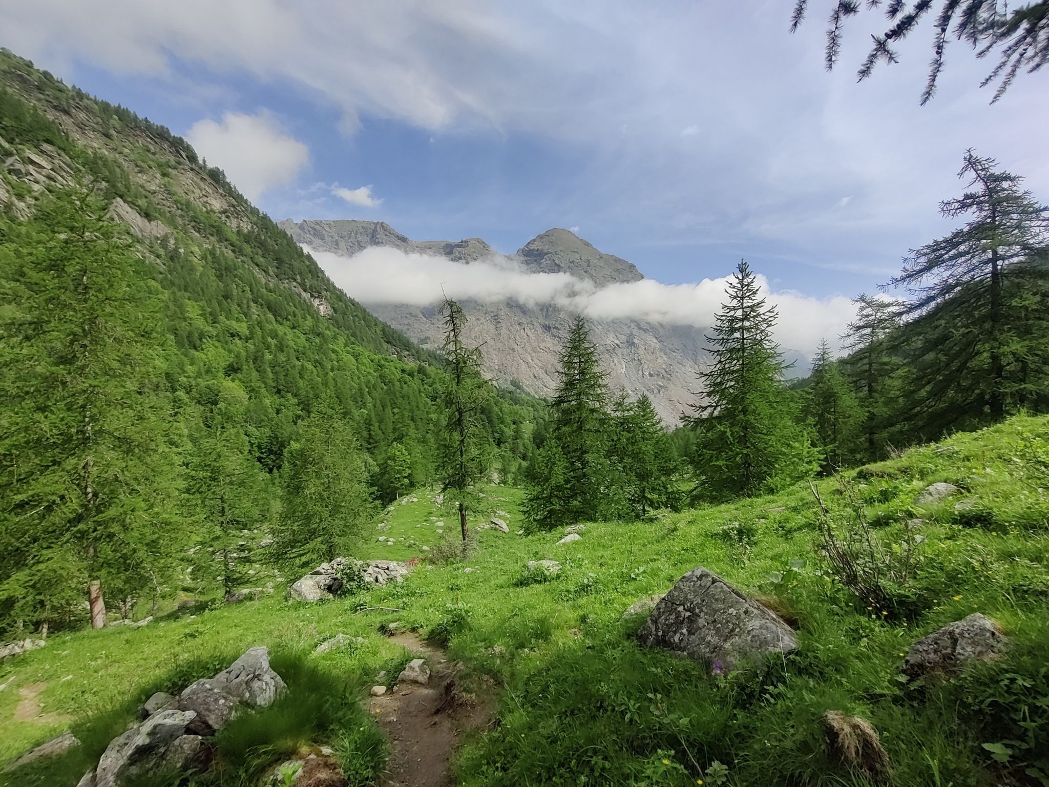
Hiking around Lake Malciaussia offers access to high-alpine terrain in Italy's Piedmont region, situated at 1,805 meters above sea level. The area is characterized by an artificial lake, surrounded by prominent peaks of the Graian Alps such as Monte Lera and Rocciamelone. Diverse hiking opportunities range from challenging ascents to historical paths, providing varied landscapes for outdoor enthusiasts.
Best hiking trails around Lake Malciaussia
- The most popular hiking route is Rifugio Tazzetti and Punta di Pietramorta Loop, an 8.8…
Last updated: October 24, 2026
4.6
(5)
12
hikers
14.2km
05:50
1,140m
1,150m
Hard hike. Very good fitness required. Mostly walkable paths. Sure-footedness required.
4.6
(8)
37
hikers
11.3km
05:30
820m
820m
Hard hike. Very good fitness required. Sure-footedness, sturdy shoes and alpine experience required.

5.0
(5)
57
hikers
22.7km
11:20
1,820m
1,820m
Hard hike. Very good fitness required. Sure-footedness, sturdy shoes and alpine experience required.
5.0
(1)
13
hikers
13.6km
06:36
1,490m
1,490m
Hard hike. Very good fitness required. Mostly walkable paths. Sure-footedness required.
Get access to more routes and recommendations from other explorers.
Already have an account?
Our route recommendations are based on thousands of hikes, rides, and runs completed by other people on komoot.
Start today with a free account
Your next adventure awaits.



Other adventures around Lake Malciaussia

Tips from the Community

Colle Croce di Ferro is an Alpine pass in the Graian Alps that connects the Susa Valley with the Viù Valley. Administratively, it marks the border between the municipalities of Bussoleno and Usseglio.
0
0

The fixed ropes in the last very steep section are very useful, helping to reach the summit of Rocciamelone more easily
0
0
Rocciamelone is the most popular peak among hikers in Turin; many climb all the way up here. But it's a real struggle! After the Ca' d'Asti refuge, there are some very steep sections, and the fixed ropes at the end make it a real help both on the ascent and descent.
0
0
This refuge is managed and open only during the summer months. It's possible to stop for a break when climbing to the summit of Rocciamelone. It's located approximately halfway between La Riposa and Rocciamelone.
1
0

in case of snow be careful not to lose the path
1
0
landing place for beginners, or a useful support point to break the climb in 2
1
0

Malciaussia never disappoints, for those who can better avoid the trip on weekends
0
0

Continuing straight you reach the Tazzetti Refuge, while on the left side you reach the Lago Nero and then the Colle Croce di Ferro (all as Trekking)
0
0
Frequently Asked Questions
How many hiking trails are available around Lake Malciaussia?
There are 18 hiking routes documented around Lake Malciaussia on komoot. These range from moderate to difficult, with 8 moderate and 10 difficult trails, offering diverse options for experienced hikers.
What is the best time of year to hike around Lake Malciaussia?
The best time for hiking around Lake Malciaussia is typically during the mild summer months, when the alpine climate is most favorable. Winter brings abundant snowfall, making many high-alpine routes challenging or inaccessible without specialized gear.
Are there any easy or family-friendly hiking options near Lake Malciaussia?
While many routes in the immediate vicinity are rated moderate to difficult, the area does offer simpler walks. The old Decauville railway track, for instance, provides a unique historical path from Margone to the lake, suitable for less strenuous activity. For specific family-friendly routes, it's best to check individual tour details for elevation and distance.
What kind of terrain can I expect on the trails around Lake Malciaussia?
The terrain around Lake Malciaussia is typically high-alpine, featuring significant elevation gains and rocky paths. You'll encounter stunning mountain landscapes, often with reflections of peaks like Monte Lera and Rocciamelone in the lake's clear waters. Some paths also follow historical routes, such as sections of the old Decauville railway.
Are there any circular walks available around Lake Malciaussia?
Yes, there are several circular walks. A notable option is the Lake Malciaussia – Lake Malciaussia loop from Lago di Malciaussia, which is a difficult 11.4 km path offering continuous views of the surrounding mountain landscape. Another is the Lake Malciaussia – Rifugio Vulpot loop from Lago di Malciaussia, a moderate 9.3 km route.
What are some notable landmarks or attractions I can see while hiking?
While hiking, you can explore several points of interest. The artificial Lake Malciaussia itself is a central feature. Near the dam, the recently restored Chapel of San Bernardo houses numerous ex-votos, offering a glimpse into local devotion. You might also pass by mountain huts like Rifugio Vulpot, which can serve as resting points.
Are there mountain huts or refuges available for longer treks?
Yes, the area provides mountain huts that can serve as resting points or for overnight stays on longer treks. Notable refuges include Rifugio Tazzetti and Rifugio Vulpot. These can be integrated into routes like the Rifugio Tazzetti and Punta di Pietramorta Loop.
What do other hikers say about the trails around Lake Malciaussia?
The trails around Lake Malciaussia are highly rated by the komoot community, with an average score of 4.3 stars from over 550 reviews. Hikers often praise the majestic alpine peaks, the serene artificial lake, and the diverse options for different ability levels, from moderate walks to challenging high-altitude ascents.
Can I reach prominent peaks from Lake Malciaussia?
Yes, Lake Malciaussia serves as a starting point for ascents to prominent peaks. Hikers can tackle routes leading towards Rocciamelone (3,538 m), Monte Lera, Punta Costan, and Punta Sulè. For example, the Lake Malciaussia – Rocciamelone Summit loop from Lago di Malciaussia is a challenging 19.3 km trail leading through high-alpine terrain towards Rocciamelone Summit.
Is there parking available for trailheads at Lake Malciaussia?
While specific parking details for each trailhead vary, Lake Malciaussia is generally accessible by road. It's advisable to check local signage upon arrival, especially during peak season, as the road to the lake is sometimes reserved exclusively for cyclists on certain days during the summer.
Are there any historical elements to discover on the trails?
Yes, the area has historical significance. The lake itself is an artificial basin created by a dam built in the 1930s. Hikers can explore sections of the old Decauville railway track, which was used for transporting materials during the dam's construction. The old fraction of Malciaussia was submerged when the lake was created, adding a unique historical layer to the landscape.
What is the typical duration for a hike around Lake Malciaussia?
Hiking durations vary significantly based on the chosen route and difficulty. For instance, a challenging route like the Rifugio Tazzetti and Punta di Pietramorta Loop typically takes around 5 hours 50 minutes to complete, while the Lake Malciaussia – Rocciamelone Summit loop from Lago di Malciaussia can take over 9 hours.
Most popular routes around Lake Malciaussia
Most popular attractions around Lake Malciaussia

Get inspired with the komoot mobile app


Explore more
Browse the best Hikes in other regions.
