The best running trails around Lake Cama
137
runners
26
runs
Jogging around Lake Cama offers routes through a landscape characterized by deep valleys and significant elevation changes. The region features the lake itself, alongside the Val Cama, Val Leggia, and Val Grono, providing a mix of terrain from valley floors to challenging mountain paths. These running trails often involve substantial climbs, with some routes gaining over 5,000 feet in elevation. The area's geography provides varied running experiences, from moderate loops to difficult long-distance challenges.
Best jogging routes around Lake Cama
…Last updated: July 6, 2026
4
runners
17.0km
05:02
1,770m
1,780m
Hard run. Very good fitness required. Sure-footedness, sturdy shoes and alpine experience required.
18.6km
06:04
1,690m
1,690m
Hard run. Very good fitness required. Sure-footedness, sturdy shoes and alpine experience required.

Sign up for free
19.9km
06:24
2,070m
2,070m
Hard run. Very good fitness required. Sure-footedness, sturdy shoes and alpine experience required.
28
runners
12.2km
02:33
930m
930m
Hard run. Very good fitness required. Sure-footedness, sturdy shoes and alpine experience required.
13
runners
9.36km
01:01
120m
120m
Moderate run. Good fitness required. Mostly paved surfaces. Suitable for all skill levels.
Get access to more routes and recommendations from other explorers.
Sign up for free
Already have an account?
Our route recommendations are based on thousands of hikes, rides, and runs completed by other people on komoot.
Start today with a free account
Your next adventure awaits.
Login or Signup
Tips from the Community

Picturesque place in the middle of the valley.
0
0

Directly on the Lagh de Cama lies the Capanna Miralago at 1,265 meters – a simple, managed mountain hut in a beautiful location by the water. An ideal place for a break or an overnight stay. The hut is open during the summer season from approximately June to the end of August and offers around 30 sleeping places as well as simple catering.
0
0
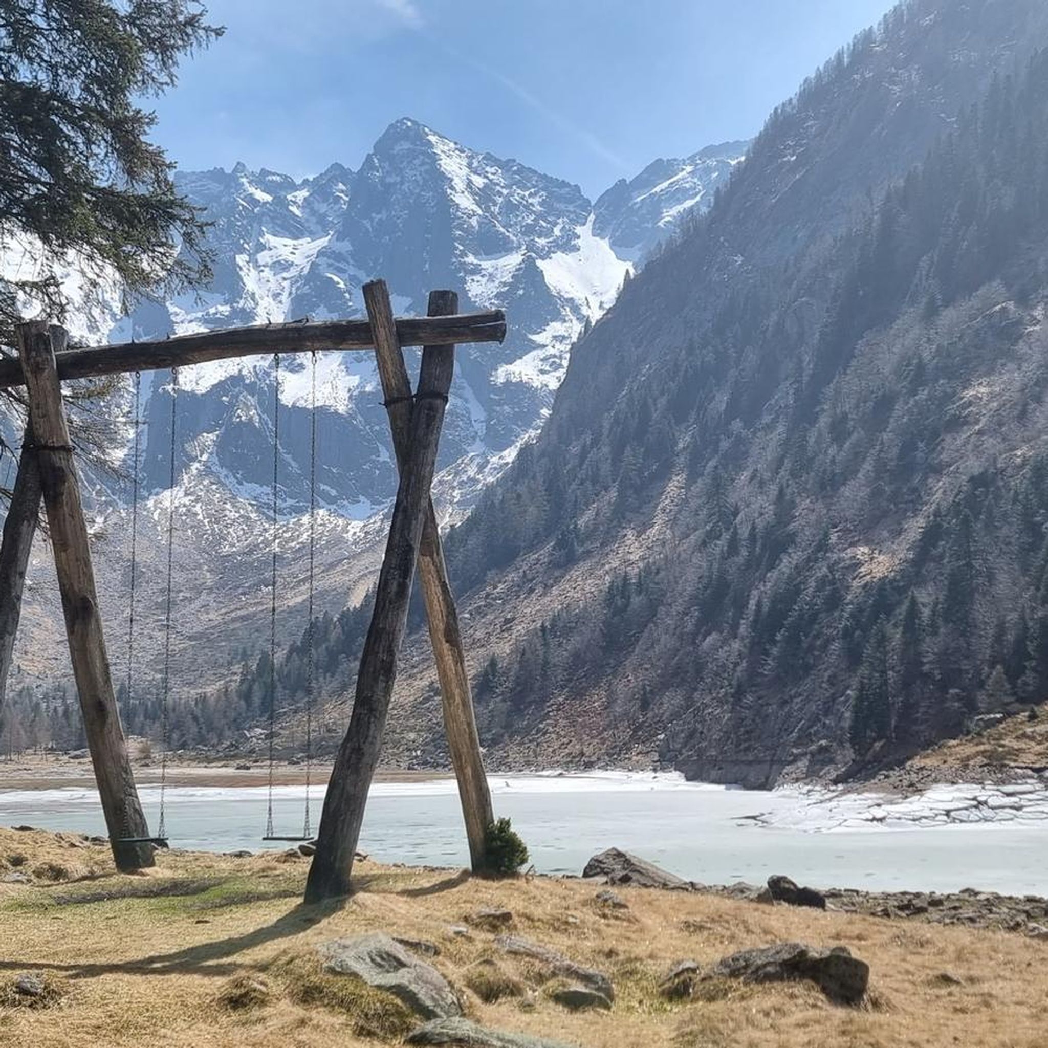
The Passo del Segnale is located at around 2,100 meters and is easily recognizable from afar by a distinctive wooden pole with an X-shaped cross. It connects the Val Cama with the Val Leggia and is an important pass between the two valleys – with beautiful views in both directions.
0
0

The path passes next to a suggestive waterfall that forms from the Ria di Val Grona.
0
0
The path passes under two gigantic boulders that form a short natural tunnel, called Sass de la vegia.
0
0
The Passo del Segnale di Vazzola (2108 m) allows you to pass from the Val di Cama to the Val di Leggia and vice versa.
0
0
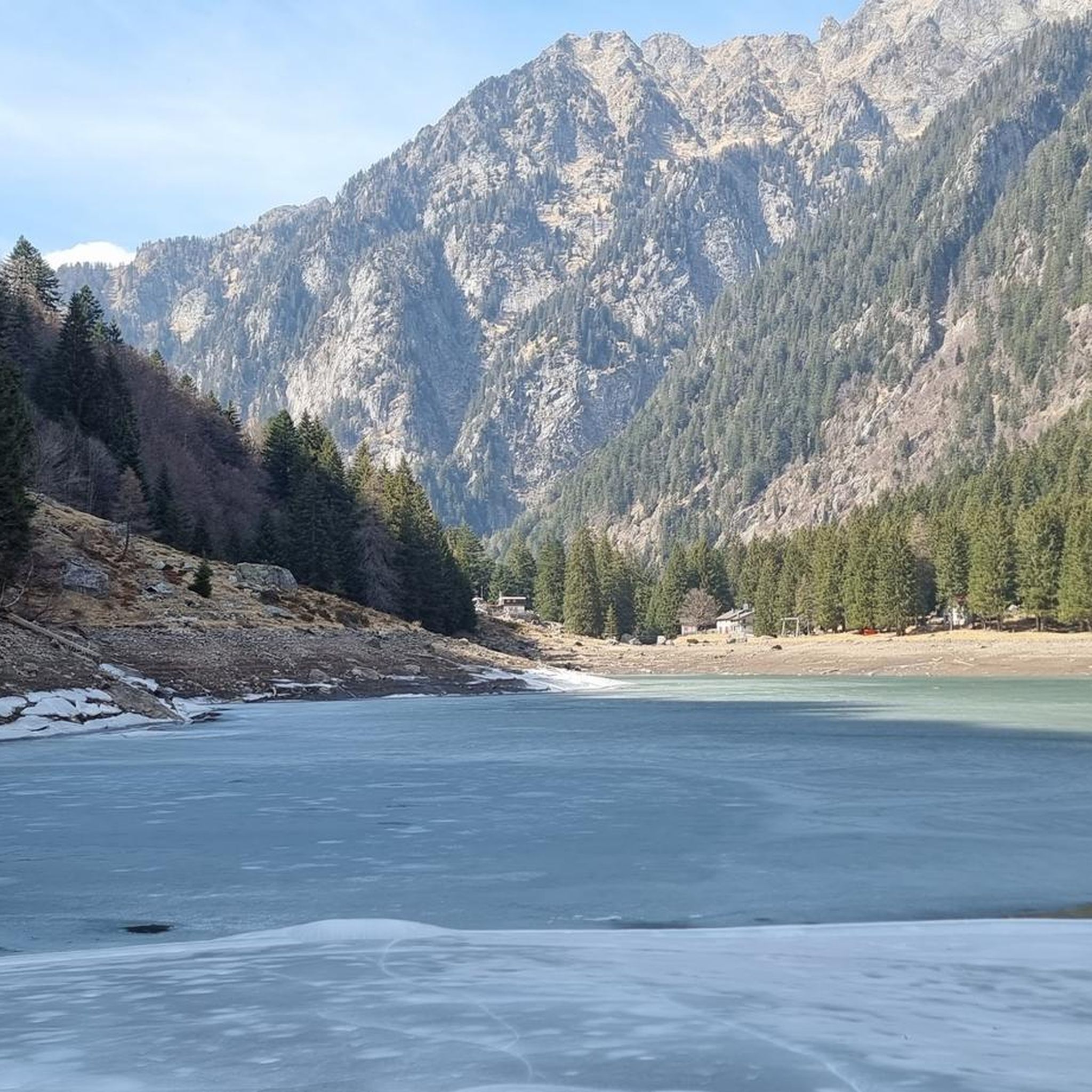
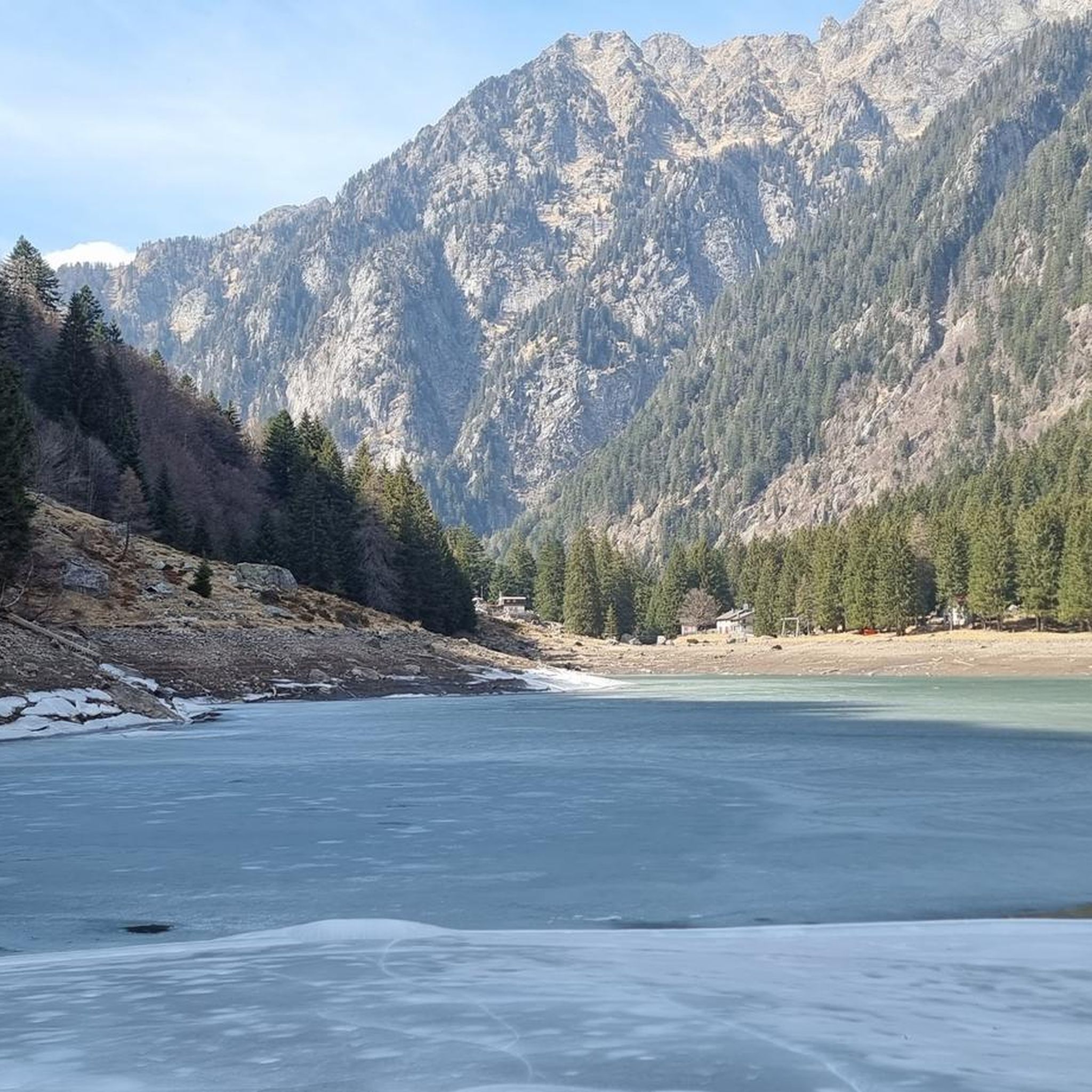
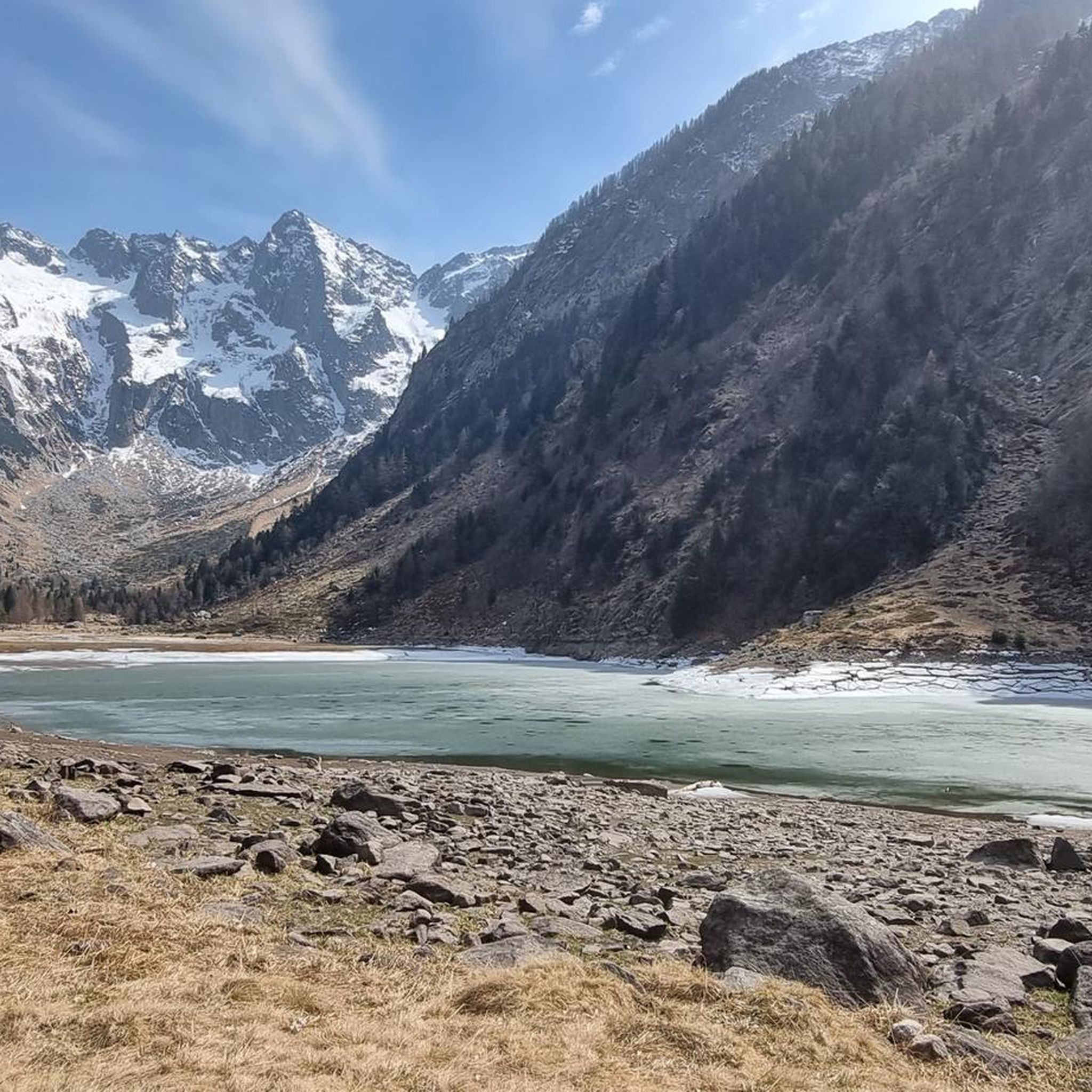
The Cama lake is located at 1,265 meters. The lake remains frozen approximately from mid-November to the end of April, and is enclosed in a rocky basin closed downstream, formed by Piz d’Ugin and Piz de Cressim.
0
0
The Bocchetta d'Agnon (or di Cama), at an altitude of 2269, allows you to reach the Valle di Cama from Val Darengo. Since the 19th century, the route has been used by smugglers, the spalloni, for their border trade between Italy and Switzerland.
2
0
Frequently Asked Questions
Are there easy running routes around Lake Cama for beginners?
Yes, while many routes in the Lake Cama region feature significant elevation, there is at least one easy running route available. For a more moderate option, consider the Running loop from Cama, which is 5.1 miles (8.2 km) with minimal elevation gain, making it suitable for those new to the area's terrain.
What kind of distances and elevation gains can I expect on running trails near Lake Cama?
The running trails around Lake Cama offer a wide range of distances and elevation gains. You'll find routes from around 5 miles (8 km) up to nearly 12.4 miles (20 km). Elevation gains can be substantial, with many difficult routes featuring over 5,000 feet (1,500 meters) of ascent, reflecting the region's deep valleys and mountainous terrain.
Are the running trails around Lake Cama suitable for running with dogs?
Many outdoor trails in the Lake Cama region are generally dog-friendly, but it's always advisable to check specific route details on komoot for any restrictions or recommendations. Be prepared for varied terrain, potential livestock, and ensure your dog is well-behaved and on a leash where required, especially on popular paths or near sensitive natural areas.
Can I find family-friendly jogging paths near Lake Cama?
For families, routes with less extreme elevation and shorter distances are ideal. The Running loop from Cama is a moderate 5.1 miles (8.2 km) option with minimal climbing, which could be a good choice for families looking for a less strenuous experience.
Are there any circular running routes available in the Lake Cama area?
Yes, several circular running routes are available. A popular and challenging option is the Lake Cama, Val Cama, and Val Leggia Loop, which covers 10.6 miles (17.0 km) and takes you through multiple valleys. For a shorter, moderate loop, consider the Running loop from Cama.
Where can I find parking for the running trails around Lake Cama?
Parking availability varies by trailhead. Many routes, especially those starting in or near villages like Cama, will have designated parking areas. It's recommended to check the specific route details on komoot before your run, as users often provide information on parking spots and access points in the route descriptions or comments.
What is the best season for running around Lake Cama, and what about winter conditions?
The best seasons for running around Lake Cama are typically spring, summer, and autumn when the weather is milder and trails are clear. In winter, conditions can become challenging due to snow and ice, especially on higher elevation routes. Some trails may be impassable or require specialized gear like trail spikes. Always check local weather and trail conditions before heading out in colder months.
What gear should I consider for autumn running around Lake Cama?
For autumn running around Lake Cama, prepare for variable weather. Essential gear includes layered clothing to adapt to temperature changes, waterproof or water-resistant outer layers, and sturdy trail running shoes with good grip for potentially wet or muddy paths. Carrying a headlamp is also wise as daylight hours shorten, and always bring sufficient water and snacks.
Are there cafes or places to refuel near the jogging routes at Lake Cama?
While the region is known for its natural beauty, some villages near the trailheads, such as Cama, may offer small cafes or guesthouses where you can refuel. For more remote routes, it's best to carry all necessary provisions with you. Always check local opening hours, especially outside of peak tourist seasons.
Are there any notable viewpoints or attractions along the running routes in Lake Cama?
The Lake Cama region is rich in natural beauty, offering numerous viewpoints across its deep valleys and the lake itself. While specific attractions vary by route, you can expect stunning vistas of the surrounding mountains and the pristine waters of Lake Cama. The historic paths explored by routes like Bocchetta del Notar – race on the paths of the Viandante also offer glimpses into the area's heritage.
How many running routes are available in the Lake Cama region?
There are 17 running routes available in the Lake Cama region, ranging from easy to difficult. This includes 1 easy route, 4 moderate routes, and 12 difficult routes, providing options for various fitness levels and preferences.
What do other runners enjoy most about jogging in Lake Cama?
Runners frequently praise the varied terrain and the stunning natural beauty of the Lake Cama region. The mix of valley floors and challenging mountain paths, along with the presence of the lake and surrounding valleys like Val Cama, Val Leggia, and Val Grono, offers diverse and engaging running experiences. The komoot community has explored these trails over 80 times, highlighting the area's appeal.
Are there any challenging long-distance running options in Lake Cama?
Absolutely. The Lake Cama region is well-suited for challenging long-distance running. Routes like the Val Cama Trail, at nearly 12.4 miles (20 km) with over 6,700 feet (2,000 meters) of elevation gain, offer significant endurance tests for experienced runners.
Most popular routes around Lake Cama

Get inspired with the komoot mobile app


Explore more
Browse the best Running Trails & Routes in other regions.
