The best road cycling routes around Tamlaghtmore
810
riders
173
rides
Road cycling routes around Tamlaghtmore benefit from the region's proximity to Lough Neagh, offering a network of scenic roads. The terrain features mostly well-paved surfaces, with routes that vary in length and elevation. Cyclists can expect a mix of quiet country roads and varied landscapes, providing options for different fitness levels. The area's natural features contribute to diverse road cycling experiences.
Best road cycling routes around Tamlaghtmore
- The most popular road cycling route is Scarva, Tandragee and Annaghmore loop from…
Last updated: May 15, 2026
2
riders
77.9km
03:19
390m
390m
Moderate road ride. Good fitness required. Mostly well-paved surfaces and easy to ride.
1
riders
92.6km
03:59
580m
580m
Moderate road ride. Good fitness required. Mostly well-paved surfaces and easy to ride.

Sign up for free
55.6km
02:36
440m
440m
Moderate road ride. Good fitness required. Mostly well-paved surfaces and easy to ride.
12
riders
50.0km
02:07
310m
310m
Moderate road ride. Good fitness required. Mostly well-paved surfaces and easy to ride.
13
riders
79.8km
03:19
510m
510m
Moderate road ride. Good fitness required. Mostly well-paved surfaces and easy to ride.
Get access to more routes and recommendations from other explorers.
Sign up for free
Already have an account?
Our route recommendations are based on thousands of hikes, rides, and runs completed by other people on komoot.
Start today with a free account
Your next adventure awaits.
Login or Signup
Popular around Tamlaghtmore

Tips from the Community

Hollie Berrie is a good place for refreshments on the route at Scarva
0
1

The small town of Scarva, nestled between green meadows and the quiet canal, offers a welcome break on my bike tour through Northern Ireland. Here you cycle on well-maintained paths past historic bridges and small villages that give you the feeling that time has stood still. The British flags fluttering along the side of the road remind you that you are in a culturally special area - a detail that reflects the identity of the region. The route is easy to cycle, the surrounding landscape is gently rolling, which makes for pleasant cycling. The view of wide fields and rolling hills invites you to slow down now and then and take in the peace and quiet. A special feature of Scarva is the annual Orange Order March, which transforms the village into a kind of open-air stage once a year and keeps the traditions of this region alive.
1
0
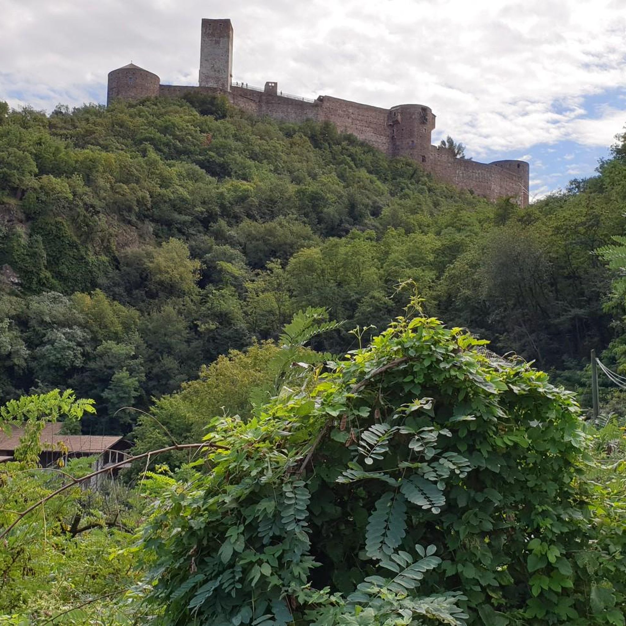
In the shadow of Northern Ireland's vast skies, the mysterious Mountjoy Castle rises on a hill above Lough Neagh. This ruined castle, whose Irish name "Caisleán Mhuinseo" whispers into the wind, stands like a proud sentinel in the village of Mountjoy, County Tyrone. The castle was built in 1602 by order of Charles Blount, 1st Earl of Devonshire and 8th Baron Mountjoy. But times have not always been kind to this building: as early as 1643, a devastating fire left scars on the walls of the castle. What remained is a two-story brick building with the ground floor clad in stone. The architecture speaks of a time of defense and vigilance - a central rectangular block protected by four spear-shaped towers, crisscrossed by embrasures. The north-western tower testifies to the fragility of time - partially collapsed, while the western curtain wall has lost its presence. The entrance, once on the south side of the eastern curtain wall, seems to whisper stories of days gone by, while wide windows on the upper floor capture the eyes of visitors. Unfortunately, an extension at the back keeps some of the castle's secrets hidden, and the interior area is closed to visitors' eyes. But even in its ruined state, Mountjoy Castle embodies the soul and history of Northern Ireland. Not only is it a State Care Historic Monument in the townland of Magheralamfield in the Mid Ulster District, but it is also a silent testament to time, inviting every walker to pause for a moment and listen to the whispers of history.
2
0

Scarva (from Irish: Scarbhach meaning "shallow place, rough ford" is a small village in the parish of Aghaderg, County Down, Scarva is known as the location of the "Sham Fight" Pageant on 13 July every year. The Pageant attracts thousands of members of the Royal Black Preceptory, who come to act out a symbolic dramatised re-enactment of the Battle of the Boyne.
2
0

Also known as Black Lough, it's unique habitat means it is a great place for bird watching with a number of rare species being seen. You're also likely to spot people course fishing for pike and perch. There are even eels in the water.
0
0

A mixture of wooded, paved, and gravel trails will lead you through the wonderful Lough Gall Country Park in Loughgall, County Armagh. There's a wealth of things to discover here such as bluebell and orchid-filled woodlands, a golf and football pitch, an outdoor gym and a coffee shop.
1
0

Village on the Newry cycle path. There is also a Scarva pilbox - one of many left over from the 2nd World War. Worth seeking out if you've got the time.
3
0
National Trust owned water powered mill, originally used in the manufacture of Linen. Well worth stopping off for a look around.
2
0
Frequently Asked Questions
What is the general difficulty level of road cycling routes in Tamlaghtmore?
Road cycling routes around Tamlaghtmore offer a range of difficulties. While many routes feature mostly well-paved surfaces and are considered easy to moderate, some longer routes with more significant elevation gain will require good fitness. Out of over 180 routes, 21 are easy, 151 are moderate, and 15 are difficult, ensuring options for various skill levels.
What are the typical distances and durations for road cycling routes in the Tamlaghtmore area?
The routes vary significantly in length and time. For example, the Scarva, Tandragee and Annaghmore loop from Maghery is a moderate 48.4 miles (77.9 km) route, typically taking around 3 hours 19 minutes. Longer options, such as the Armagh, Emyvale and Aughnaloy loop from Coalisland, cover 57.5 miles (92.6 km) and can take over 4 hours.
What natural features or landmarks can I expect to see while road cycling around Tamlaghtmore?
Road cycling routes in Tamlaghtmore often feature expansive views of Lough Neagh, the largest freshwater lake in the UK and Ireland. You might also encounter historical sites like Mountjoy Castle, or cycle past the Maghery Footbridge at Lough Neagh. The area also offers glimpses of the River Blackwater and various viewpoints along the shoreline.
Are there family-friendly road cycling routes suitable for all ages in Tamlaghtmore?
Yes, Tamlaghtmore offers family-friendly road cycling options, particularly on sections of the Loughshore Trail that are traffic-free or on quieter country roads. While specific routes are not exclusively designated for families, the 21 easy routes available provide gentler terrain and shorter distances, making them suitable for a wider range of ages and fitness levels.
Can I find circular road cycling routes around Tamlaghtmore?
Many road cycling routes in the Tamlaghtmore area are designed as loops, allowing you to start and finish at the same point. Examples include the Kingstown and Pomeroy loop from Coalisland, which offers a 34.5-mile circular ride through rural areas.
What is the best time of year for road biking in Tamlaghtmore?
The best time for road biking in Tamlaghtmore is generally during the spring and summer months (April to September) when the weather is milder and daylight hours are longer. This period offers more comfortable cycling conditions and allows for better enjoyment of the scenic landscapes around Lough Neagh.
Are there any cafes or pubs near the road cycling routes in Tamlaghtmore?
While specific cafes and pubs directly on every route are not detailed, the region around Tamlaghtmore, particularly in towns like Coalisland, Maghery, and along the Loughshore Trail, offers various establishments where cyclists can stop for refreshments. Planning your route with potential stops in mind is recommended.
What kind of terrain can I expect on road cycling routes near Tamlaghtmore?
The road cycling routes around Tamlaghtmore are predominantly on well-paved surfaces. You can expect a mix of quiet country roads, some sections with gentle rolling hills, and flatter areas, especially closer to Lough Neagh. The terrain is generally accessible, though some routes feature more significant elevation changes.
Are there any historical sites or points of interest along the road cycling routes?
Yes, the region is rich in history. Along the Loughshore Trail, you might encounter historical points of interest such as the Toome flood gates where the River Bann meets the lough, and in Antrim, the Antrim Castle Gardens. The impressive Randalstown railway viaduct is also a notable sight. You can also visit The Argory Country House.
Where can I find parking for road cycling routes in Tamlaghtmore?
Parking for road cyclists is typically available in the towns and villages that serve as starting points for routes, such as Maghery or Coalisland. Many routes also pass by or start near designated picnic areas like the Bannfoot Picnic Area, which may offer parking facilities.
What is the longest road cycling route available from Tamlaghtmore?
One of the longer road cycling routes is the Parkanaur House – Clogher Workhouse loop from Coalisland, which spans approximately 91.8 miles (147.7 km). This route offers an extensive ride through the countryside, featuring significant elevation gain.
Are there any routes that offer views of lakes or water bodies?
Absolutely. Many routes in the Tamlaghtmore area are designed to showcase Lough Neagh. You can find routes that offer expansive views of the lake, including specific viewpoints like the View of Coney Island from Maghery or the Dungannon Park Lake.
Most popular routes around Tamlaghtmore
Most popular attractions around Tamlaghtmore

Get inspired with the komoot mobile app


Explore more
Browse the best Road cycling routes in other regions.
