The best walks and hikes around Griessee
4.6
(1410)
11,056
hikers
186
hikes
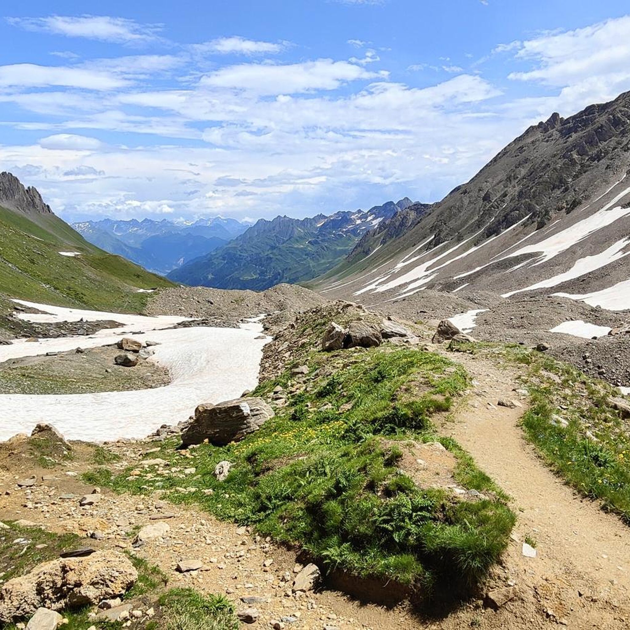
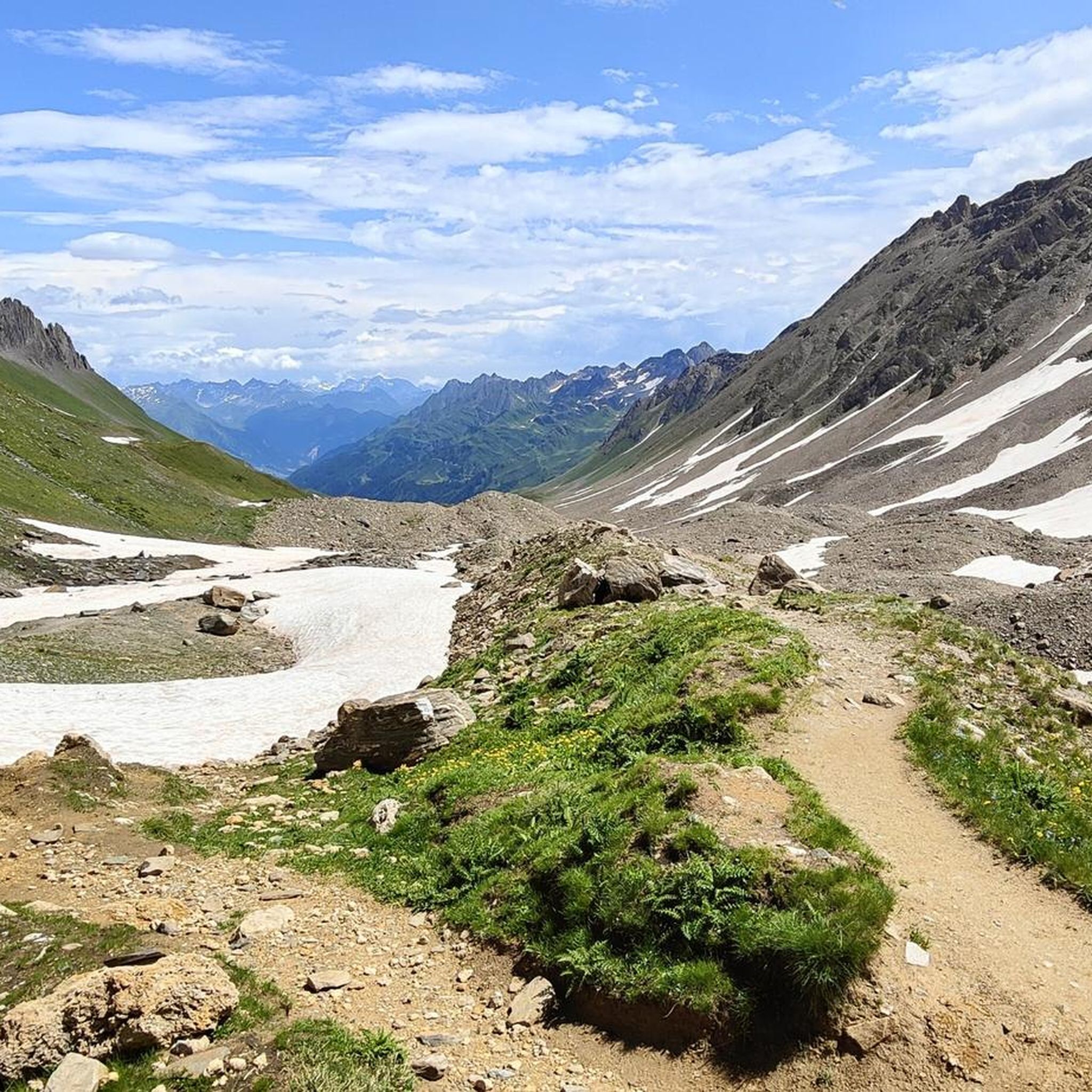
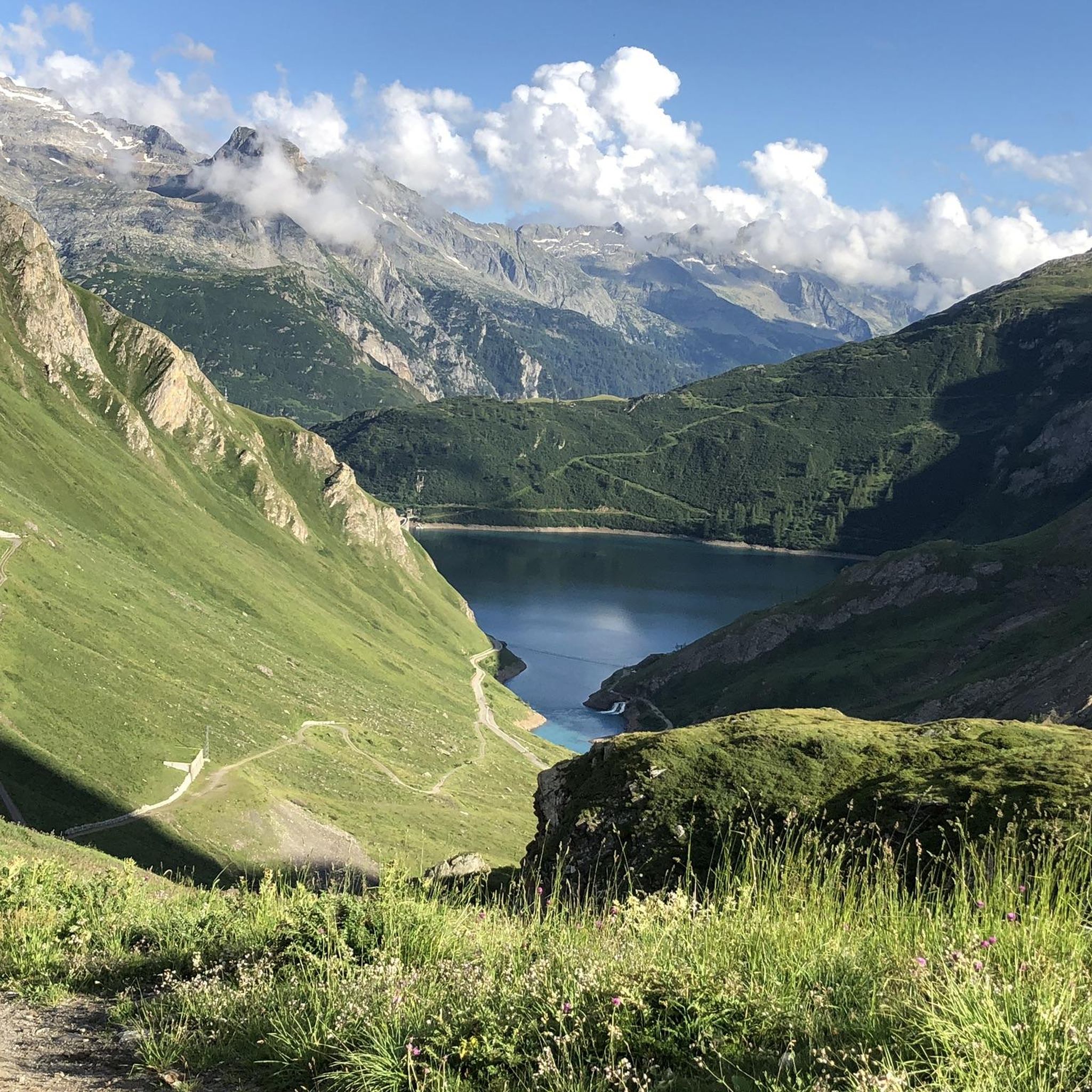
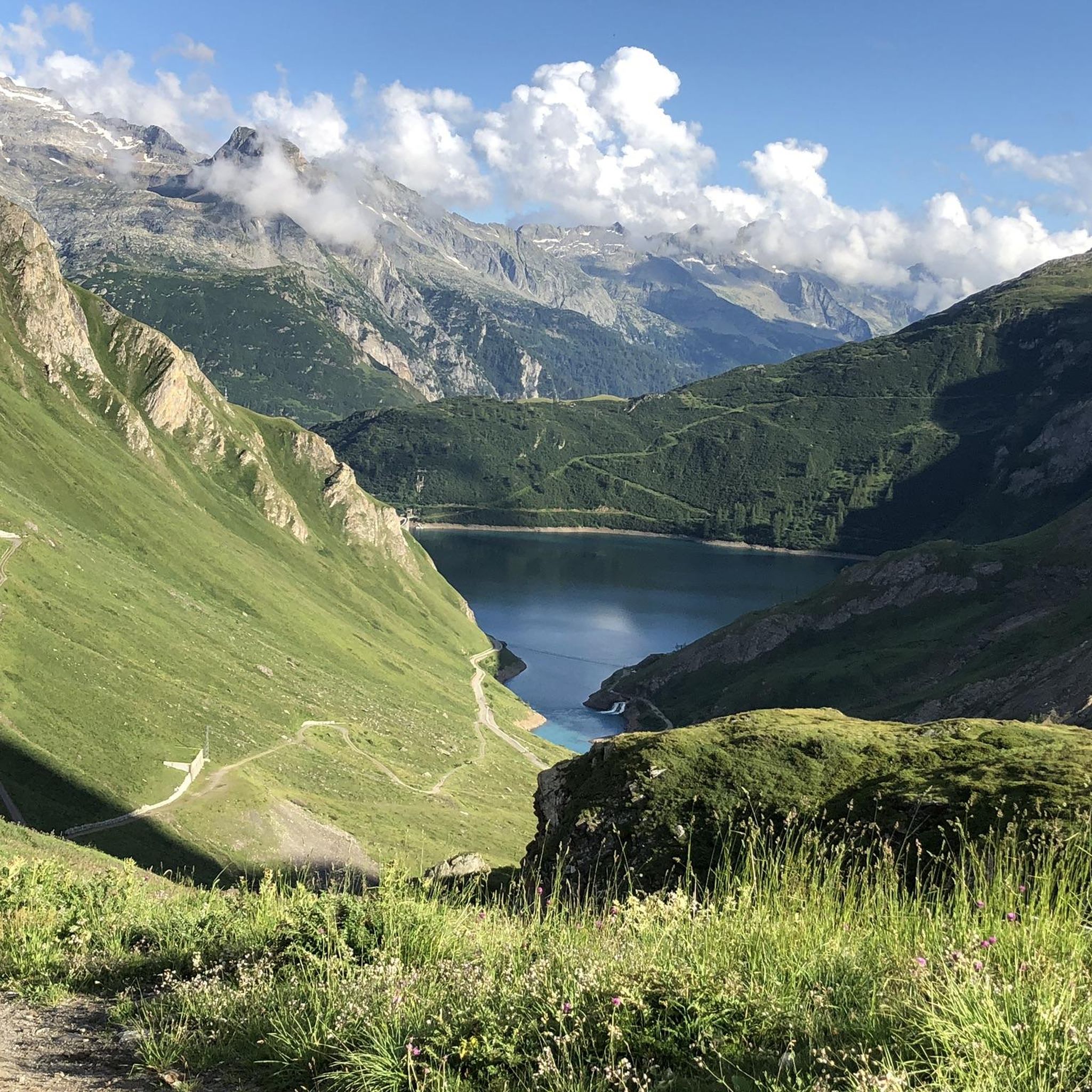
Hiking around Griessee offers diverse experiences within a high-alpine environment. The region is characterized by rugged mountains, glacial features, and a high-altitude reservoir. Griessee is situated at 2,386 meters (7,828 feet) and is fed by the Gries Glacier, creating a landscape of glacial moraines and rocky terrain. This area provides varied hiking experiences, from accessible paths to challenging routes.
Best hiking trails around Griessee
- The most popular hiking route is Historic Sbrinzroute from Capanna Corno-Gries to Rifugio Margaroli, a 7.8 miles (12.6 km) trail that takes 5 hours 32 minutes to complete. This route follows a historic trade path, crossing the Swiss-Italian border.
- Another top favourite among local hikers is Alpe Bettelmatt to Rifugio Città di Busto Trail, a difficult 5.8 miles (9.3 km) path. This trail offers alpine views and passes historic huts.
- Local hikers also love the View of Gries Lake – Gries Pass (Passo del Gries) loop from Nufenenstock, a 10.6 miles (17.1 km) trail leading through high-alpine terrain and past the Griessee, often completed in about 6 hours 53 minutes.
- Hiking around Griessee is defined by alpine scenery, glacial moraines, and a high-altitude reservoir. The network offers options for different ability levels, from moderate paths to challenging multi-hour routes.
- The routes in Griessee are highly rated by the komoot community with an average score of 4.6 stars from over 1,400 reviews. More than 11,000 hikers have used komoot to explore Griessee's varied terrain.
Last updated: July 9, 2026
4.6
(5)
41
hikers
12.6km
05:32
710m
710m
Hard hike. Very good fitness required. Mostly accessible paths. Sure-footedness required.
9.27km
04:55
830m
830m
Moderate hike. Good fitness required. Mostly accessible paths. Sure-footedness required.

Sign up for free
5.0
(1)
11
hikers
17.1km
06:53
1,040m
1,040m
Hard hike. Very good fitness required. Mostly accessible paths. Sure-footedness required.
5.0
(1)
6
hikers
11.9km
05:06
880m
880m
Hard hike. Very good fitness required. Mostly accessible paths. Sure-footedness required.
4.9
(7)
48
hikers
15.8km
06:22
1,040m
1,040m
Hard hike. Very good fitness required. Mostly accessible paths. Sure-footedness required.
Get access to more routes and recommendations from other explorers.
Sign up for free
Already have an account?
Our route recommendations are based on thousands of hikes, rides, and runs completed by other people on komoot.
Start today with a free account
Your next adventure awaits.
Login or Signup

Tips from the Community


At 2,478 meters above sea level, the Nufenen Pass (Nufenenpass in German) connects the Goms Valley in the upper Valais with the Bedretto Valley in the upper Ticino. From Airolo, the climb is approximately 22 kilometers (average gradient 5.6%), while from Ulrichen it is shorter but more challenging: 14 kilometers at an average gradient of approximately 7.9%.
0
0

The view from the top is worth the effort to reach it.
0
0

Beautiful mountain hut with great kitchen
4
1

The path from the Nufenen Pass road is currently closed due to the risk of mudslides.
1
0

There is further potential for wind and hydropower here and elsewhere.
1
0

Here, everyone can get an idea of alpine renewable energy systems. In addition to the wind farm from the 2010s, there is a PV test facility and a dam from the 1960s.
1
1
Frequently Asked Questions
What kind of hiking trails can I expect around Griessee?
Griessee offers a diverse range of hiking trails within a high-alpine environment. You'll find paths ranging from easily accessible walks to more challenging routes across rugged mountains, glacial moraines, and rocky terrain. The area is situated at 2,386 meters (7,828 feet) and is characterized by its stunning alpine scenery and the Gries Glacier.
How many hiking routes are available in the Griessee area?
There are over 180 hiking routes documented around Griessee. This includes a variety of options, with 42 easy routes, 83 moderate routes, and 61 difficult routes, catering to different fitness levels and preferences.
Are there any circular walks around Griessee?
Yes, Griessee offers several circular walks. A notable option is the View of Gries Lake – Gries Pass (Passo del Gries) loop from Nufenenstock, which is a challenging 10.6-mile trail leading through high-alpine terrain and past the Griessee itself. Another is the Griessee and Dam loop from Nufenenstock, offering various perspectives of the lake and its impressive dam.
What are the difficulty levels of hikes around Griessee?
The hikes around Griessee vary significantly in difficulty. You can find easy walks lasting under two hours with minimal elevation gain, moderate hikes up to five hours with around 3,000 feet of elevation gain, and hard hikes exceeding five hours or 3,000 feet of elevation gain, which require good fitness and sure-footedness. There are 42 easy, 83 moderate, and 61 difficult routes available.
What natural attractions can I see while hiking near Griessee?
Hikers in the Griessee area can experience a unique 'bizarre world of glacial moraines, water and ice' due to its direct connection to the Gries Glacier. The high-altitude reservoir itself, with its striking blue color, and the surrounding rugged mountains offer breathtaking panoramic views. You'll also encounter diverse alpine landscapes and potentially historic huts along certain trails.
What do other hikers say about the trails in Griessee?
The trails in Griessee are highly regarded by the komoot community, with an average rating of 4.6 stars from over 1,400 reviews. Hikers often praise the stunning alpine scenery, the unique glacial features, and the varied terrain that offers something for all ability levels.
Are there any historical routes in the Griessee region?
Yes, the region is home to the historic Sbrinzroute. You can hike a section of this ancient trade path, such as the Historic Sbrinzroute from Capanna Corno-Gries to Rifugio Margaroli, which crosses the Swiss-Italian border and features alpine lakes and mountain huts.
Can I access mountain huts during my hike?
Yes, several hikes in the Griessee region provide access to mountain huts, offering opportunities for rest and refreshments amidst the scenic beauty. For example, the Alpe Bettelmatt to Rifugio Città di Busto Trail passes historic huts.
What is the best time of year to hike around Griessee?
Griessee is a high-alpine destination, so the best time for hiking is typically during the warmer months when trails are clear of snow and ice. This usually spans from late spring to early autumn. Always check local weather and trail conditions before heading out, as high-altitude weather can be unpredictable.
How can I reach the Griessee hiking area?
Griessee is accessible by road from the Nufenen Pass, which itself offers striking alpine views. The Nufenen Pass is one of the highest paved mountain passes in Switzerland, providing a scenic approach to the hiking trails around the lake.
Are there any long-distance or multi-day hiking options?
While many routes are day hikes, the presence of mountain huts and the connection to historic trade paths like the Sbrinzroute suggest possibilities for longer excursions. For instance, the source of the Ticino and the Val Formazza loop tour from the Passo della Novena is a challenging route that could be part of a longer adventure.
Most popular routes around Griessee

Get inspired with the komoot mobile app


Explore more
Browse the best Hikes in other regions.
