The best road cycling routes around Lago Coghinas
4.5
(13)
219
riders
26
rides
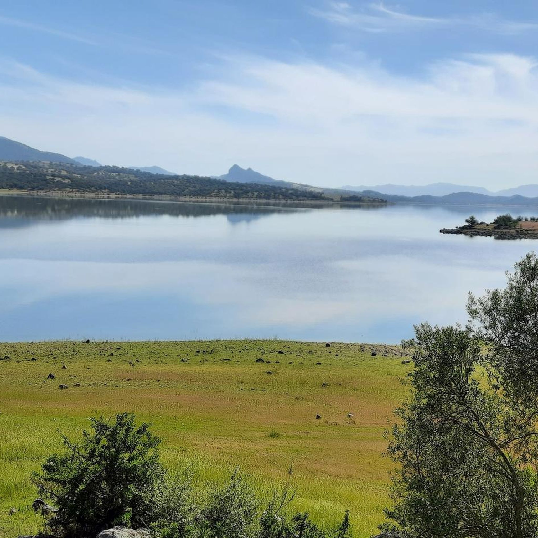
Road cycling routes around Lago Coghinas traverse a diverse landscape in northwest Sardinia, characterized by the expansive artificial lake and surrounding forests of holm oaks and cork trees. The terrain features hilly and mountainous sections, including the slopes of Monte San Lorenzo, offering varied elevation changes. Roads are generally quiet and well-maintained, providing a mix of physical challenge and scenic views of the Mediterranean vegetation and the lake itself. This region offers a blend of natural features suitable for road…
Last updated: September 28, 2026
3
riders
25.2km
01:33
600m
600m
Moderate road ride. Good fitness required. Mostly well-paved surfaces and easy to ride.
5.0
(4)
35
riders
80.2km
04:03
1,330m
1,330m
Hard road ride. Very good fitness required. Mostly well-paved surfaces and easy to ride.

4.0
(1)
31
riders
62.3km
03:11
1,080m
1,080m
Hard road ride. Very good fitness required. Mostly well-paved surfaces and easy to ride.
19
riders
101km
05:13
1,640m
1,650m
Hard road ride. Very good fitness required. Some segments of this route may be unpaved and difficult to ride.
21
riders
83.8km
04:12
1,350m
1,350m
Hard road ride. Very good fitness required. Mostly well-paved surfaces and easy to ride.
Get access to more routes and recommendations from other explorers.
Already have an account?
Our route recommendations are based on thousands of hikes, rides, and runs completed by other people on komoot.
Start today with a free account
Your next adventure awaits.
Popular around Lago Coghinas

Tips from the Community


This is a beautiful stretch of road that leads to Tempio Pausania. The road surface is excellent and the view of the surrounding hills is very suggestive.
1
0

Bridge still closed as of 20th April 2024. Looks like there's still weeks/months of work left. I tried to cross but the construction workers forced me to turn around and take the 15km detour
1
0

beautiful ride on Mount Limbara
0
0

Lake Coghinas is an artificial lake that collects water from the Rio Mannu and the river of the same name. It was built in 1927 under Mussolini, to build a hydroelectric power station. The dam is 185 meters long and 58 meters high. On the eastern bank of the gorge you can see an Art Nouveau villa that housed the director of the plant, which was then abandoned.
0
0

Small side road through the fields. New asphalt and varied profile.
0
0

Like many lakes in Sardinia, it is an artificial basin created by the damming of the Coghinas river. To cross it there is a bridge but at the moment it is closed to traffic.
1
0
Nice street just outside Tempio Pausania. The asphalt is good and there are plenty of trees that offer shade. The views of the Sardinian countryside are beautiful.
1
1
Frequently Asked Questions
What kind of terrain can I expect when road cycling around Lago Coghinas?
The terrain around Lago Coghinas is diverse, featuring hilly and mountainous sections, including the slopes of Monte San Lorenzo. You'll encounter varied elevation changes on mostly paved, quiet, and well-maintained roads. The landscape is characterized by forests of holm oaks and cork trees, offering scenic views of the lake and Mediterranean vegetation.
Are there road cycling routes suitable for beginners or those looking for an easier ride?
While the region offers routes for various fitness levels, the majority of road cycling routes around Lago Coghinas are classified as moderate or difficult. There are 14 moderate routes and 9 difficult routes. For a moderate option with continuous lake views, consider the Coghinas lake loop from Tula.
What are the typical distances and elevation gains for road cycling routes in the area?
Road cycling routes around Lago Coghinas vary significantly in length and elevation. For instance, the Coghinas lake loop from Tula is about 26.5 km (16.5 miles) with over 600 meters of elevation gain, while the Roadbike loop from Santuario Nostra Signora di Castro covers around 64.9 km (40.3 miles) with nearly 800 meters of ascent. More challenging routes can exceed 80 km with over 1300 meters of elevation.
Can I find circular road cycling routes around Lago Coghinas?
Yes, many of the road cycling routes around Lago Coghinas are designed as loops, allowing you to start and end in the same location. Examples include the Coghinas lake loop from Tula and the Diana Bridge on Lake Coghinas – Lake Coghinas loop from Oscheri/Oschiri, which takes you along the lake's perimeter.
What natural features or landmarks can I see while cycling around Lago Coghinas?
As you cycle, you'll enjoy views of Lago Coghinas itself, Sardinia's second-largest lake, and its impressive 1927 dam. The routes often pass through forests of holm oaks and cork trees. Keep an eye out for diverse wildlife, including various bird species like herons and flamingos. Some routes, like the Diana Bridge on Lake Coghinas – Lake Coghinas loop from Oscheri/Oschiri, will take you past notable structures like the Diana Bridge.
Are there any historical or cultural sites accessible by road bike near Lago Coghinas?
Yes, the region offers historical and cultural points of interest. The village of Oschiri, located on the lake's bank, has a charming historic center. The wider area also features archaeological remains such as Giants' tombs, Dolmens, and chamber tombs, as well as the 12th-century Romanesque church of Nostra Signora of Castro. The Roadbike loop from Santuario Nostra Signora di Castro is an example of a route that includes stretches near historical sites.
What is the best time of year to go road cycling in Lago Coghinas?
The region's Mediterranean climate generally makes spring and autumn ideal for road cycling, offering pleasant temperatures and less intense sun than the peak summer months. These seasons also showcase the lush natural beauty of the forests and lake surroundings.
Is Lago Coghinas a good destination for advanced road cyclists seeking a challenge?
Absolutely. Lago Coghinas offers several challenging routes with significant elevation gains, catering to advanced road cyclists. Routes like the Scenic Descent Near Nuoro – Diana Bridge on Lake Coghinas loop from Oschiri, with over 1300 meters of ascent, or the Limbara Pass – Lake Coghinas loop from Oschiri, which tackles over 1000 meters of climbing, provide a demanding experience.
What do other road cyclists say about the routes around Lago Coghinas?
The road cycling routes around Lago Coghinas are highly rated by the komoot community, with an average score of 4.4 stars from over 10 reviews. Cyclists often praise the quiet roads, varied terrain, and the beautiful natural scenery, especially the continuous views of the lake and its surrounding forests.
Are there any facilities like cafes or accommodation near the road cycling routes?
While specific cafes and accommodation directly on every route are not detailed, the region includes charming villages like Oschiri. These villages typically offer local amenities where cyclists can find refreshments or places to stay. Planning your route to pass through these settlements can ensure access to facilities.
Is it possible to reach the Lago Coghinas cycling routes using public transport?
Information on direct public transport links specifically for cyclists to the start points of routes is limited. However, major towns in the vicinity, such as Oschiri, may have bus connections. It is advisable to check local public transport schedules and policies regarding bicycles if you plan to rely on it.
Where can I find parking for road cycling around Lago Coghinas?
Parking is generally available in the towns and villages surrounding Lago Coghinas, such as Oschiri or Tula, which serve as common starting points for many routes. Look for designated parking areas within these communities before beginning your ride.
Most popular routes around Lago Coghinas

Get inspired with the komoot mobile app


Explore more
Browse the best Road cycling routes in other regions.
