The best walks and hikes around Ogbourne St. Andrew
4.6
(1098)
8,322
hikers
27
hikes
Hiking around Ogbourne St. Andrew offers diverse terrain within the North Wessex Downs. The region is characterized by the Marlborough Downs, featuring a chalk landscape with steep downland and dry valleys. Trails often traverse serene open fields and patches of woodland, providing varied natural features for hikers. The area also includes sections of The Ridgeway National Trail, offering elevated views.
Best hiking trails around Ogbourne St. Andrew
- The most popular hiking route is Barbury Castle, Marlborough Downs & Ogbourne St Andrews loop, a 9.8 miles (15.7 km) trail that takes 4 hours 13 minutes to complete. This moderate route explores the Marlborough Downs and passes Barbury Castle.
- Another top favourite among local hikers is The Ridgeway & Burderop Down loop — North Wessex Downs, a moderate 5.2 miles (8.4 km) path. This trail offers views across the North Wessex Downs and includes a section of The Ridgeway.
- Local hikers also love the White Horses & Ancient Castles loop, a 14.7 miles (23.7 km) trail leading through chalk hills and historical sites, often completed in about 6 hours 24 minutes.
- Hiking around Ogbourne St. Andrew is defined by chalk landscapes, ancient trails like The Ridgeway, and varied woodlands. The network of routes offers options for different ability levels, from easy walks to more challenging long-distance paths.
- The routes in Ogbourne St. Andrew are highly rated by the komoot community with an average score of 4.5 stars from over 300 reviews. More than 3,900 hikers have used komoot to explore Ogbourne St. Andrew's varied terrain.
Last updated: August 17, 2026
4.5
(12)
94
hikers
15.7km
04:13
190m
190m
Embark on a moderate hike through the North Wessex Downs National Landscape, covering 9.8 miles (15.7 km) with an elevation gain of 612 feet (187 metres). This route typically takes around 4 hours and 13 minutes to complete, offering expansive views across the Marlborough Downs. You will traverse vast chalk downlands and sections of the ancient Ridgeway, experiencing wide-open skies. A highlight is the Barbury Castle Iron Age Hill Fort, where you can enjoy panoramic vistas from one of the highest points in the area.
To begin your adventure, head to Barbury Castle Country Park, which provides convenient amenities like parking, picnic benches, and toilets. Be prepared for varied terrain; some sections of the trail can be unpaved, deeply rutted, and muddy, especially after rain, so wear appropriate footwear. The route includes both significant descents and ascents, with some parts being quite steep, so a good level of fitness is recommended.
This trail offers a unique glimpse into ancient history and stunning natural beauty. As you hike, you will pass through the picturesque Ogbourne St. Andrew Village, home to a historic church. On clear days, you might even catch views stretching as far as the Vale of the White Horse and the Cotswolds, making this loop a rewarding experience for anyone seeking a blend of heritage and scenic landscapes.
4.6
(12)
76
hikers
8.38km
02:15
100m
100m
Embark on a moderate 5.2-mile (8.4 km) hike through the North Wessex Downs, offering wide, open views of rolling chalk downland. This loop, which takes about 2 hours and 15 minutes to complete with an elevation gain of 340 feet (104 metres), features natural, unsurfaced tracks and grazed rough grassland. You'll experience an undulating path with gentle descents and a final ascent to Burderop Down, providing expansive vistas of landmarks like Liddington Castle and the distant Salisbury Plain. Look for characteristic clumps of Victorian-planted beech woodland and diverse flora, including bluebells in May, along the way.
When planning your hike, be aware that the chalky ground can become slippery when wet or with morning dew, so appropriate footwear is essential. The trail often starts from or passes through Barbury Castle Country Park, which offers commanding views across the Cotswolds. While mostly broad tracks, some parts may feature steps, stiles, and gates. The open nature of the downland means you will be exposed to the elements, so prepare for various weather conditions.
This trail is notable for its integration with The Ridgeway National Trail, often called "Britain's oldest road," used for at least 5,000 years. As you hike, you'll pass through Barbury Castle, an impressive Iron Age hillfort and a Scheduled Ancient Monument. The area is rich in archaeological sites, including Stone Age long barrows and Bronze Age round barrows, offering a journey through time. The Ridgeway section of the loop can feel surprisingly remote and unpopulated for southern England.

Sign up for free
3.0
(2)
12
hikers
23.7km
06:24
310m
310m
Embark on the White Horses & Ancient Castles loop, a difficult hiking adventure spanning 14.7 miles (23.7 km) with an elevation gain of 1027 feet (313 metres). You can expect to spend around 6 hours and 24 minutes traversing wide, grassy paths across chalk downland, where rolling hills offer expansive, open vistas of the Vale of White Horse. The route feels like a journey through time, dotted with picturesque English villages and woodlands, and anchored by iconic sights like the Hackpen White Horse.
Before you set out, be aware that the chalk landscape can become muddy and slippery, especially after rain, so sturdy footwear is essential for this challenging route. While specific warnings for snow or road closures are not typical, prepare for varied terrain that includes steep sections. Parking is generally available near trailheads within the North Wessex Downs, but it's always wise to check local signage upon arrival.
This trail offers a captivating blend of natural beauty and significant historical sites, providing a strong sense of the region's past. You will encounter ancient defensive earthworks at Barbury Castle Iron Age Hill Fort, giving you a tangible connection to the area's rich history. It's a unique opportunity to explore ancient landscapes and chalk-cut figures that define this part of the North Wessex Downs Area of Outstanding Natural Beauty.
4.6
(8)
134
hikers
Moderate hike. Good fitness required. Easily-accessible paths. Suitable for all skill levels.
5.0
(9)
33
hikers
23.3km
06:18
310m
310m
Hard hike. Very good fitness required. Easily-accessible paths. Suitable for all skill levels.
Get access to more routes and recommendations from other explorers.
Sign up for free
Already have an account?
Our route recommendations are based on thousands of hikes, rides, and runs completed by other people on komoot.
Start today with a free account
Your next adventure awaits.
Login or Signup
Tips from the Community

An interesting village with a historical background and many sights: 1. Avebury Stone Circle The largest prehistoric stone circle in the world. Unlike Stonehenge, you can walk freely among the stones. The circle even encloses the village of Avebury. 2. Avebury Henge The massive earthwork and ditch surrounding the stone circle. From some vantage points, you get a good impression of the enormous dimensions of the site. 3. Silbury Hill Europe's largest man-made prehistoric mound. The hill lies about 2 km south of Avebury and is a fascinating Neolithic puzzle. 4. West Kennet Long Barrow A Neolithic chamber tomb over 5,000 years old, the burial chambers of which can be entered. Particularly atmospheric in the early morning or evening. 5. The Sanctuary The remains of another Stone Age ritual site at the end of the old processional way. 6. West Kennet Avenue An impressive avenue of standing stones that once linked Avebury with The Sanctuary. 7. Avebury Manor A 16th-century manor house with beautiful gardens. It is now looked after by the National Trust. 8. Alexander Keiller Museum A small but very interesting museum about the history and archaeology of Avebury and the surrounding monuments. 9. Windmill Hill One of the oldest known Neolithic sites in Britain with beautiful views over the Wiltshire landscape.
1
0
Avebury is one of the largest prehistoric stone circles in the world. Unlike many other stone monuments, here you can walk among the massive stones and experience the special atmosphere up close. The site was created about 4,500 years ago and is part of the UNESCO World Heritage.
1
0
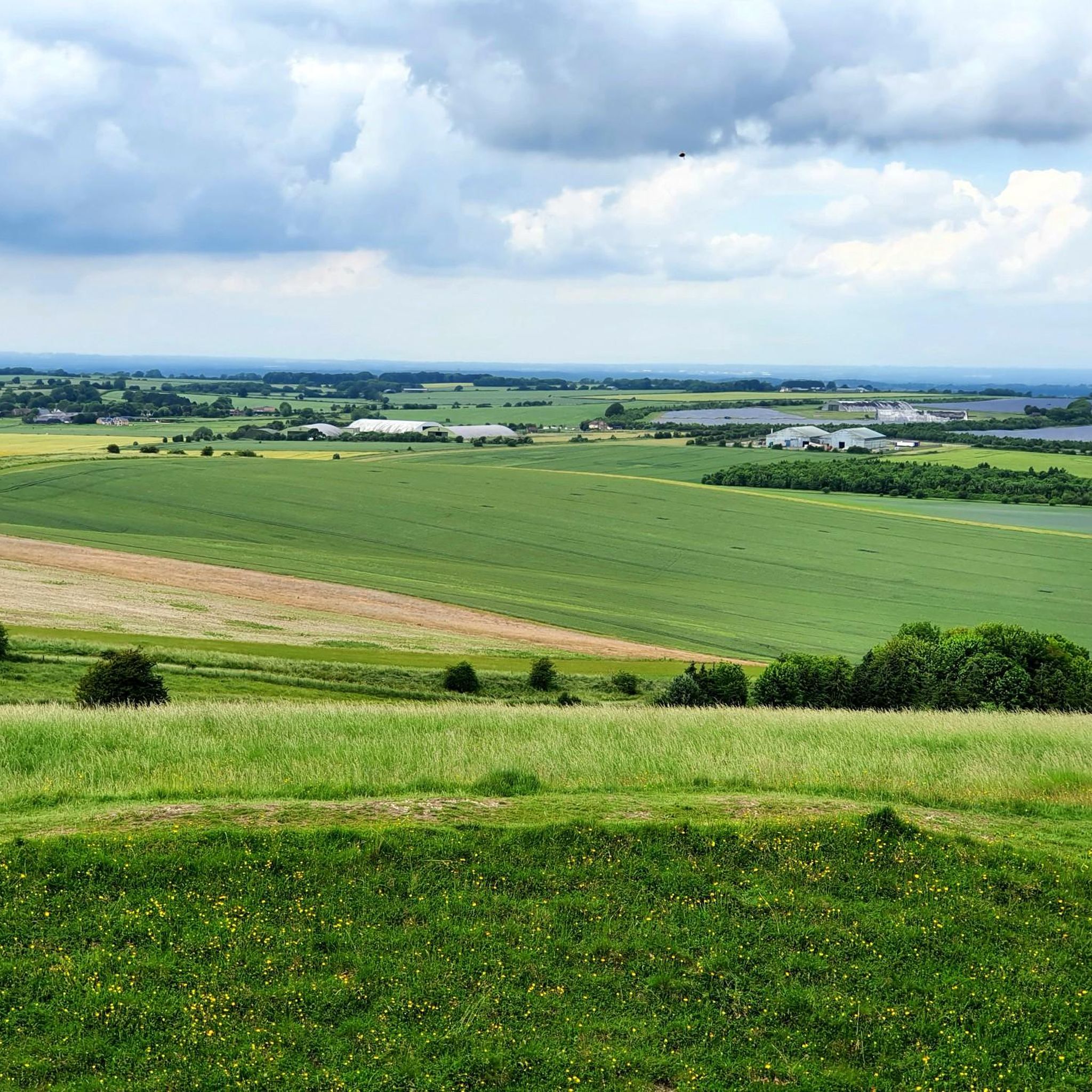
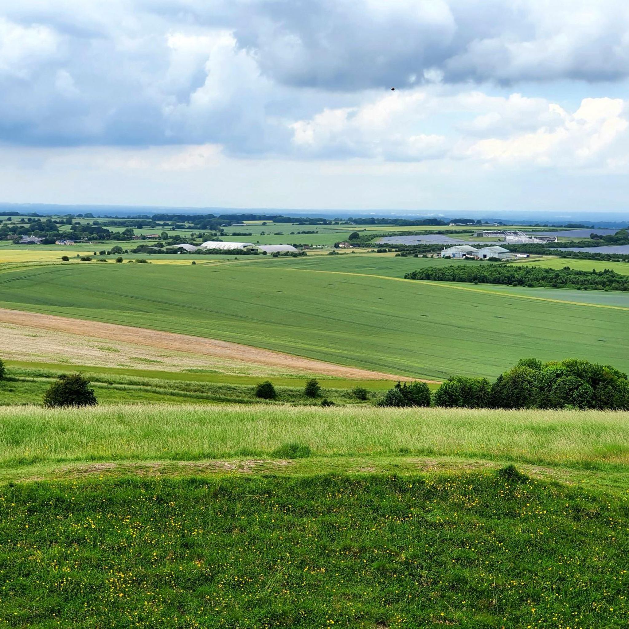
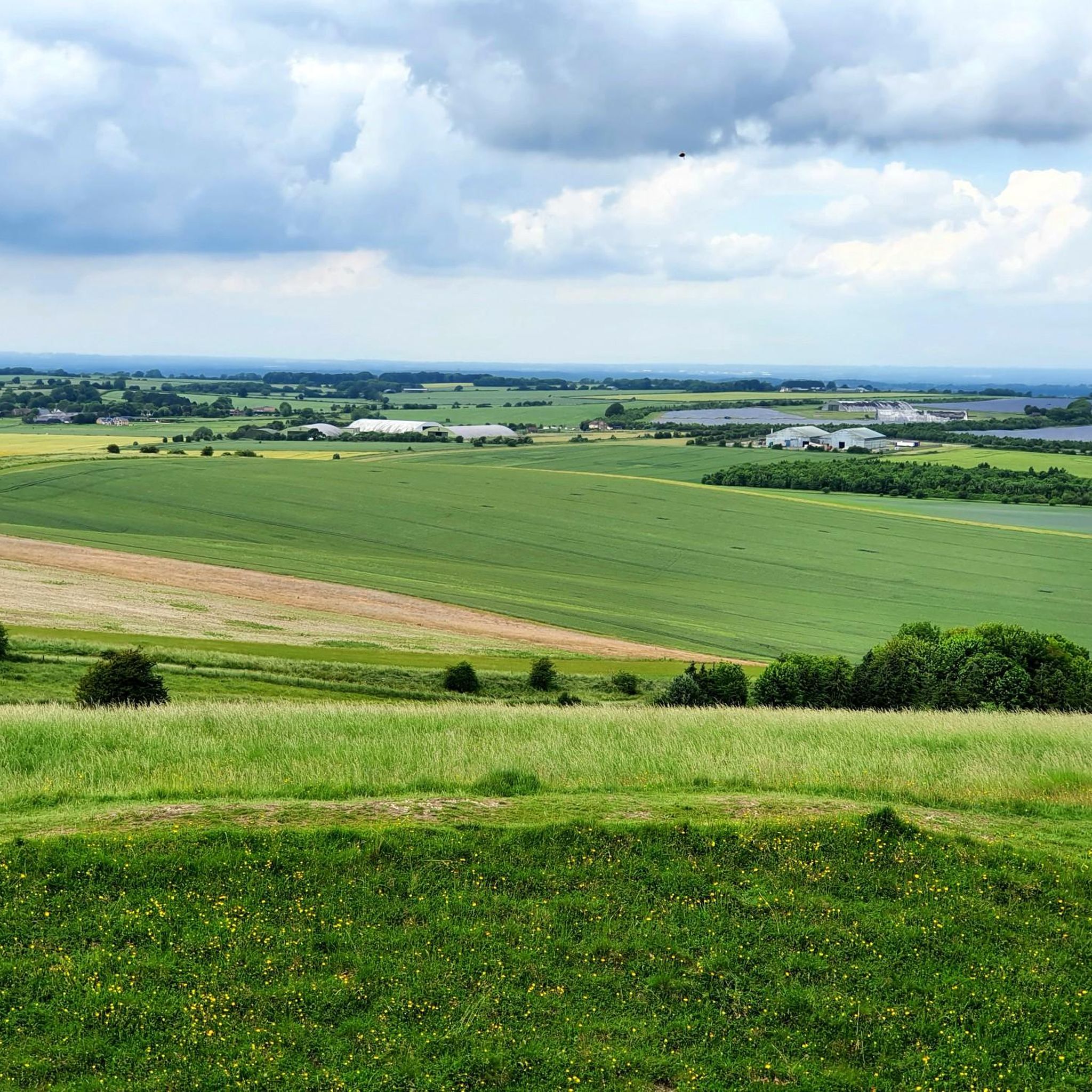
The Hackpen White Horse is a large white chalk figure on the slopes of Hackpen Hill in Wiltshire. It was probably created in 1838 and is one of the well-known "White Horses" of Southern England. The historic long-distance path The Ridgeway runs directly above. From here, there is a wide view over the rolling chalk hills of the Marlborough Downs. The White Horse, the open landscape, and the ancient Ridgeway make the place a popular destination for hikers and photographers. A car park and short footpaths allow easy access to the viewpoint.
1
0
The view of Hackpen Hill and The Ridgeway shows a typical English chalk hill landscape: gentle, open ridges, wide fields, and historic paths. The Ridgeway is considered one of Great Britain's oldest long-distance paths and runs near Hackpen Hill through the Wiltshire countryside. Especially in clear weather, the heights offer extensive views over the Marlborough Downs.
1
0

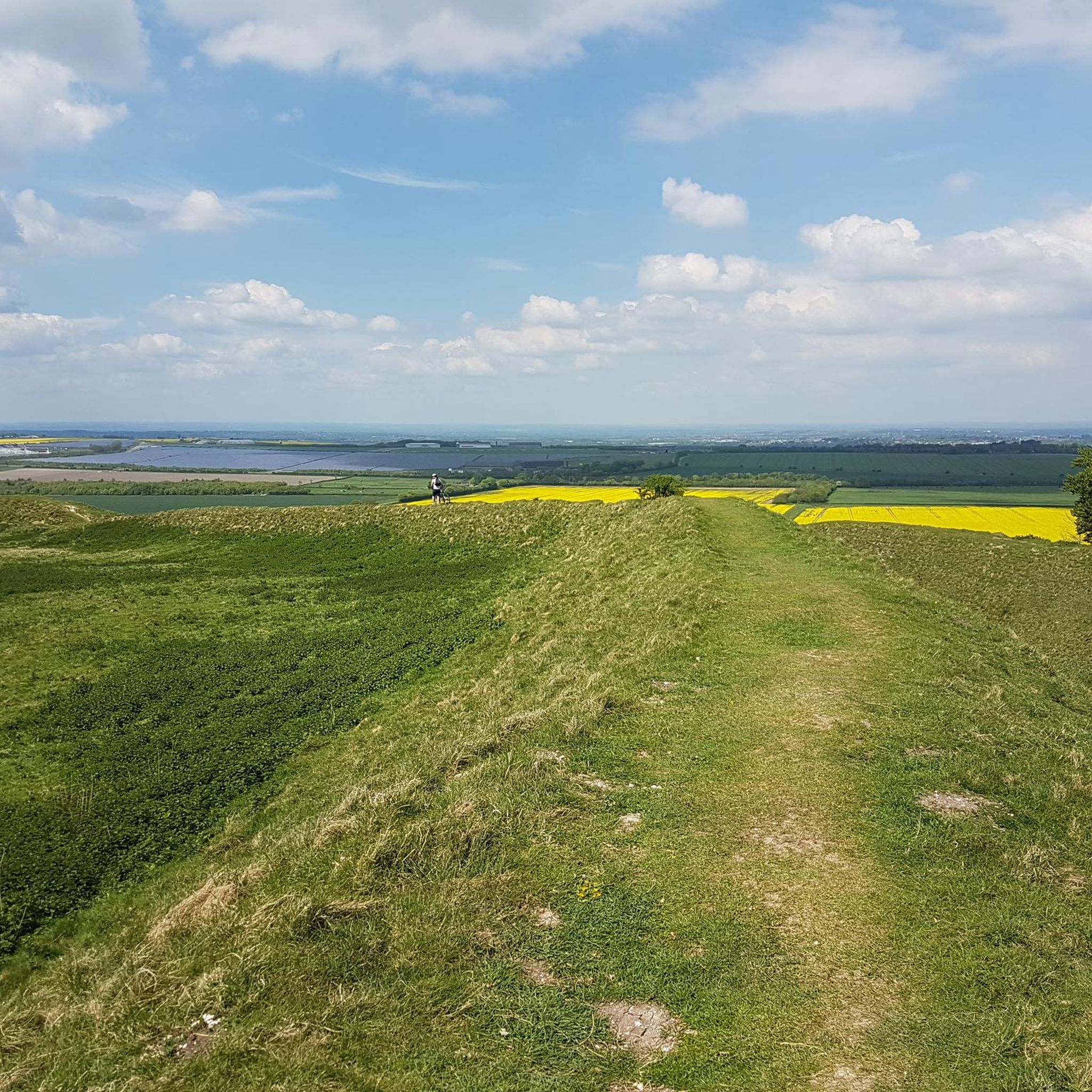
Best approached from the east by mountain bike so that you get a nice downhill to the ridgeway trail after the fort!
0
0


Hike a bike for me on my gravel bike to get up here from the west but worth it, the views are stunning and the archeology very interesting
1
0

Think the horse had bolted when I went! Need a drone!!!!
0
0
Frequently Asked Questions
How many hiking trails are available around Ogbourne St. Andrew?
There are over 30 hiking routes around Ogbourne St. Andrew, offering a variety of experiences from easy strolls to more challenging long-distance paths. The komoot community has explored more than 300 of these trails.
What kind of terrain can I expect on hikes around Ogbourne St. Andrew?
The terrain primarily features the chalk landscape of the Marlborough Downs, with steep downland, dry valleys, and sections of the ancient Ridgeway National Trail. You'll traverse open fields, wooded areas, and coombes like Ogbourne Maizey, providing varied scenery.
Are there any easy, family-friendly hikes in the area?
Yes, Ogbourne St. Andrew offers several easy routes suitable for families. These often involve gentle gradients through open fields and woodlands. While specific family-friendly routes aren't highlighted in the data, many of the 10 easy trails available are suitable for a relaxed outing.
Can I bring my dog on the trails around Ogbourne St. Andrew?
Many trails in the Ogbourne St. Andrew area are dog-friendly, allowing you to explore the open fields and woodlands with your canine companion. However, always keep dogs under control, especially when passing through livestock areas, and check local signage for any specific restrictions.
Are there any circular hiking routes available?
Yes, many of the hiking routes around Ogbourne St. Andrew are circular. Examples include the Barbury Castle, Marlborough Downs & Ogbourne St Andrews loop and The Ridgeway & Burderop Down loop, which allow you to start and finish at the same point.
What historical sites or landmarks can I see while hiking?
The area is rich in history. You can encounter Iron Age hillforts like Liddington Castle Hillfort and Barbury Castle, remnants of an ancient Roman road, and the famous White Horses carved into the hillsides. The historic St. Andrew's Church also contains a Bronze Age barrow in its churchyard. Further afield, you can visit Avebury Stone Circle and West Kennet Long Barrow.
Are there any challenging hikes for experienced trekkers?
Yes, for experienced trekkers, there are several challenging routes. The White Horses & Ancient Castles loop is a difficult 14.7-mile trail that takes you through chalk hills and historical sites, often requiring over 6 hours to complete. Another challenging option is The Ridgeway at Barbury Castle – The Ridgeway National Trail loop, covering 23.4 km.
What are the best times of year to go hiking in Ogbourne St. Andrew?
Spring and summer are excellent for hiking, as wildflowers bloom and wildlife is more visible. The open downland can be exposed, so pleasant weather makes for a more enjoyable experience. Autumn offers beautiful colours, while winter walks can be crisp and clear, though some paths might be muddy.
Where can I find parking for the hiking trails?
Parking is generally available at key trailheads and near popular attractions like Barbury Castle. Ogbourne St. Andrew itself, as a historic village, also offers some parking options, often serving as a starting point for local loops.
What do other hikers say about the trails in Ogbourne St. Andrew?
The trails in Ogbourne St. Andrew are highly rated by the komoot community, with an average score of 4.5 stars from over 300 reviews. Hikers often praise the diverse chalk landscapes, the historical features like Barbury Castle, and the well-maintained paths that offer panoramic views across the North Wessex Downs.
Are there any specific natural features to look out for?
Beyond the expansive Marlborough Downs and The Ridgeway, keep an eye out for the dramatic dry valley of Ogbourne Maizey. The region is also home to diverse wildlife, including deer and various bird species, especially in the spring and summer months.
Are there any pubs or cafes near the hiking routes?
Ogbourne St. Andrew and nearby historic villages, which historically served as medieval coaching stops, often have local pubs where you can refresh after a hike. These establishments provide a welcoming stop for food and drink.
Most popular routes around Ogbourne St. Andrew
Most popular attractions around Ogbourne St. Andrew

Get inspired with the komoot mobile app


Explore more
Browse the best Hikes in other regions.
