The best running trails around Estany de Certascan
4.5
(2)
319
runners
7
runs
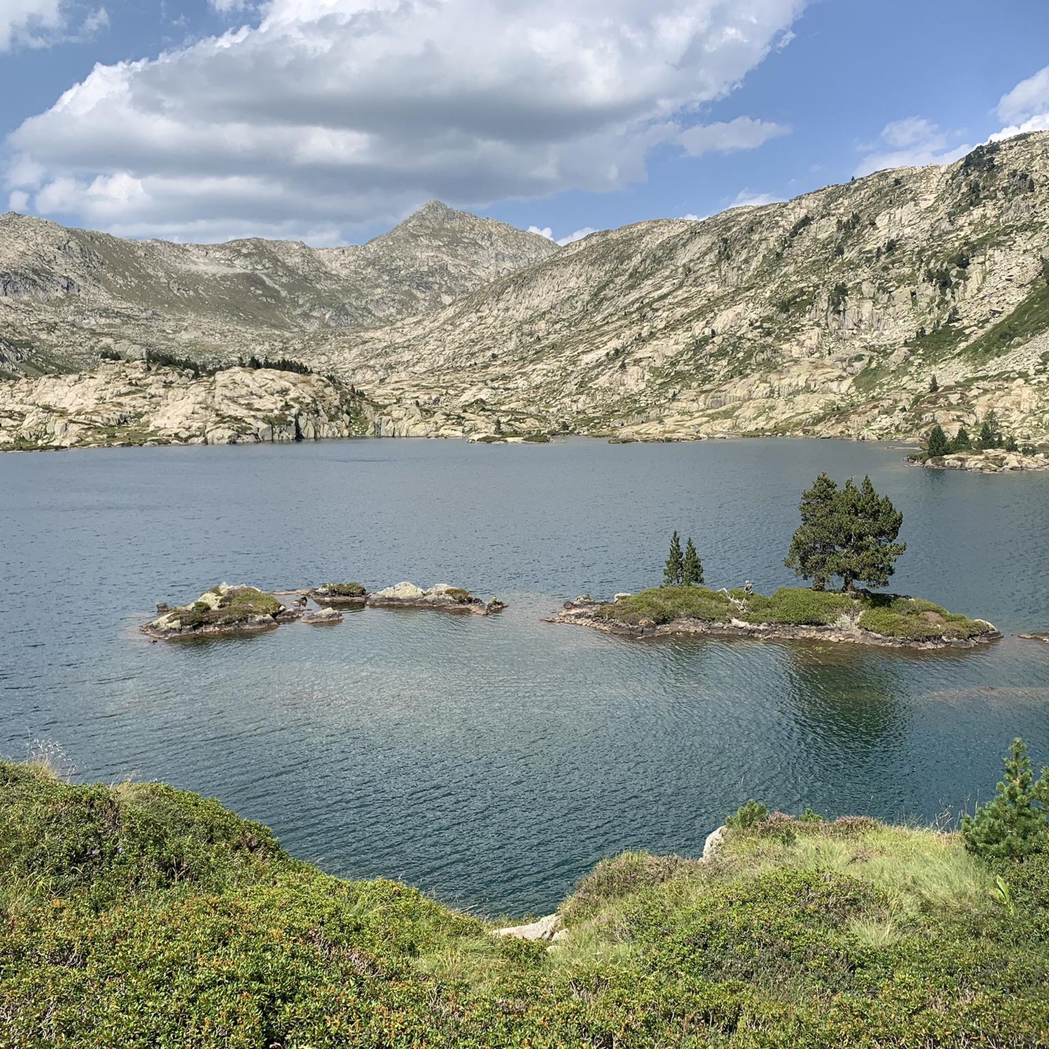
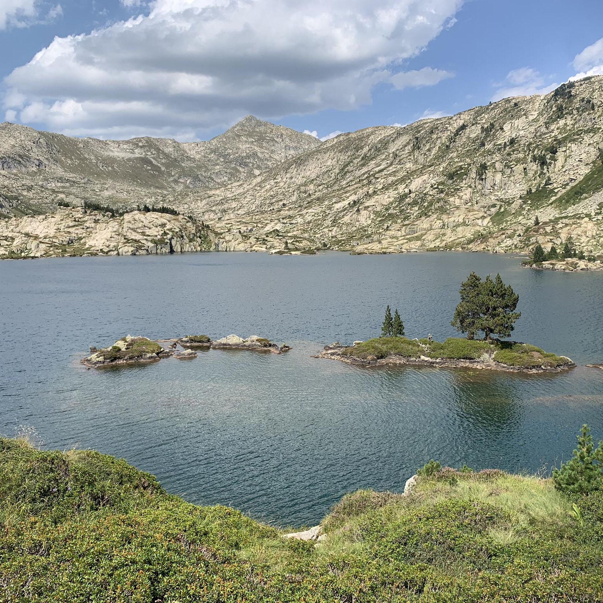
Jogging around Estany de Certascan offers an opportunity to explore a high-mountain glacial landscape within the Alt Pirineu Natural Park. The region features the large glacial Estany de Certascan lake, surrounded by a glacial cirque and rocky outcrops. Runners will encounter varied terrain, including alpine meadows, rocky paths, and forested valleys with beech and fir trees. This environment provides a dynamic setting for trail running and vigorous jogging.
Best jogging routes around Estany de Certascan
- The most popular jogging route…
Last updated: May 23, 2026
23
runners
Hard run. Very good fitness required. Sure-footedness, sturdy shoes and alpine experience required.
10
runners
5.02km
00:36
160m
160m
Moderate run. Good fitness required. Mostly paved surfaces. Suitable for all skill levels.

Sign up for free
5
runners
19.3km
02:55
840m
840m
Hard run. Very good fitness required. Sure-footedness, sturdy shoes and alpine experience required.
9
runners
8.81km
01:13
320m
320m
Hard run. Very good fitness required. Sure-footedness, sturdy shoes and alpine experience required.
5
runners
11.3km
01:53
630m
620m
Hard run. Very good fitness required. Sure-footedness, sturdy shoes and alpine experience required.
Get access to more routes and recommendations from other explorers.
Sign up for free
Already have an account?
Our route recommendations are based on thousands of hikes, rides, and runs completed by other people on komoot.
Start today with a free account
Your next adventure awaits.
Login or Signup


Other adventures around Estany de Certascan

Tips from the Community

This small glacier is wonderfully nestled in the heart of the Cagateille cirque. It is surrounded by snow-capped peaks. It is a great hiking objective but also a place to take a break during a longer walking stage.
0
1

Apart from its interest for cyclists, this pass is in winter the departure of a ski lift to the station of Guzet-Neige.
0
0

It's a very good warm-up before the Col d'Agnès
0
0

Mountain pass in the Ariège region with an altitude of 1,111 m located between Aulus-les-Bains (east) and Ustou (west).
0
0

The pond overlooking the Cirque de Cagateille is a nice reward during a trail.
0
0
Obviously less known than the Cirque de Gavarnie, the Cirque de Cagateille is nonetheless one of the most beautiful glacial cirques in the Pyrenees.
0
0
The Etang d'Alet is one of the deepest lakes in the Pyrenees since it reaches 62m deep.
0
0
The lake which overlooks the Cagateille cirque is a great objective for a hike.
0
0
Frequently Asked Questions
How many running routes are available around Estany de Certascan?
There are currently around 5 dedicated running routes in the Estany de Certascan area, offering a range of experiences from moderate loops to challenging mountain trails. These routes allow you to explore the stunning high-mountain glacial landscape of the Alt Pirineu Natural Park.
Are there any easy jogging routes for beginners or families?
While the terrain around Estany de Certascan is generally mountainous, there are options for less strenuous runs. For instance, the region research mentions a shorter, easier 2.5 km (1.6 miles) loop around Refugi Certascan that traverses alpine terrain and can be completed in about 1 hour and 11 minutes. This type of route would be suitable for families or those new to trail running.
What kind of terrain can I expect on the running trails?
The running trails around Estany de Certascan feature a diverse high-mountain glacial landscape. You'll encounter varied terrain including open alpine meadows, rocky paths, and forested valleys dense with beech and fir trees. The centerpiece is the large glacial Estany de Certascan lake, dramatically framed by a glacial cirque and striking rocky outcrops, providing breathtaking vistas throughout your run.
Are there any circular running routes in the area?
Yes, several circular routes are available. For a moderate option, consider the Guzet-Neige Prat Mataou loop from Guzet-Neige, which is 5.0 km long. For a more challenging circular run, the Cirque de Cagateille – trail loop via the étang de la Hillette and the étang d'Alet – Parc naturel régional des Pyrénées Ariégeoises covers 11.7 km through a high-mountain glacial environment.
What are some challenging running routes for experienced trail runners?
Experienced trail runners will find several demanding options. The Nice lake for a cool swim. loop from Guzet-Neige is a difficult 19.3 km trail leading through high-altitude terrain. Another challenging option is the Cirque de Cagateille – trail loop via the étang de la Hillette and the étang d'Alet – Parc naturel régional des Pyrénées Ariégeoises, a 11.7 km route with significant elevation changes.
Are there any points of interest or natural features to see along the running paths?
Absolutely! The region is rich in natural beauty. Beyond the magnificent Estany de Certascan itself, you'll find numerous other high-altitude lakes such as Estany de Romedo de Dalt and Estany Petit de Certascan. The area also features impressive mountain peaks like Pic de Certascan, and you might even spot alpine marmots in the high-mountain pastures. The Ars waterfall is another notable cascade in the vicinity.
What do other runners say about jogging in Estany de Certascan?
The komoot community highly rates the running experiences around Estany de Certascan, with an average score of 4.0 stars. Runners often praise the stunning glacial landscapes, the variety of terrain, and the opportunity to explore the pristine environment of the Alt Pirineu Natural Park.
Is it possible to run with dogs on these trails?
As Estany de Certascan is located within the Alt Pirineu Natural Park, it's generally possible to run with dogs, but they must be kept on a leash to protect the local wildlife and ecosystems. Always check specific trail regulations or park guidelines before heading out with your dog.
Where can I park when visiting the running trails?
Access to the area often begins from places like Tavascan. From there, tracks lead to the Montalto dam, where vehicles can typically be parked. From the dam, marked trails provide access to the running routes around Estany de Certascan.
What is the best time of year to go running around Estany de Certascan?
The best time for running around Estany de Certascan is typically during the warmer months, from late spring to early autumn (June to September). During this period, the snow has usually melted from the higher elevations, and the weather is more stable, making the trails more accessible and enjoyable. Always check local weather conditions before your visit, as high-mountain weather can change rapidly.
Are there any facilities or refuges along the running routes?
Yes, the Refugi de Certascan provides a fully equipped high-mountain refuge. It can serve as a convenient stop for refreshments or even a base for multi-day excursions, offering a welcome break during longer runs in the area.
Most popular routes around Estany de Certascan

Get inspired with the komoot mobile app


Explore more
Browse the best Running Trails & Routes in other regions.
