The best running trails around Lac de Gréziolles
4.9
(12)
2,726
runners
61
runs
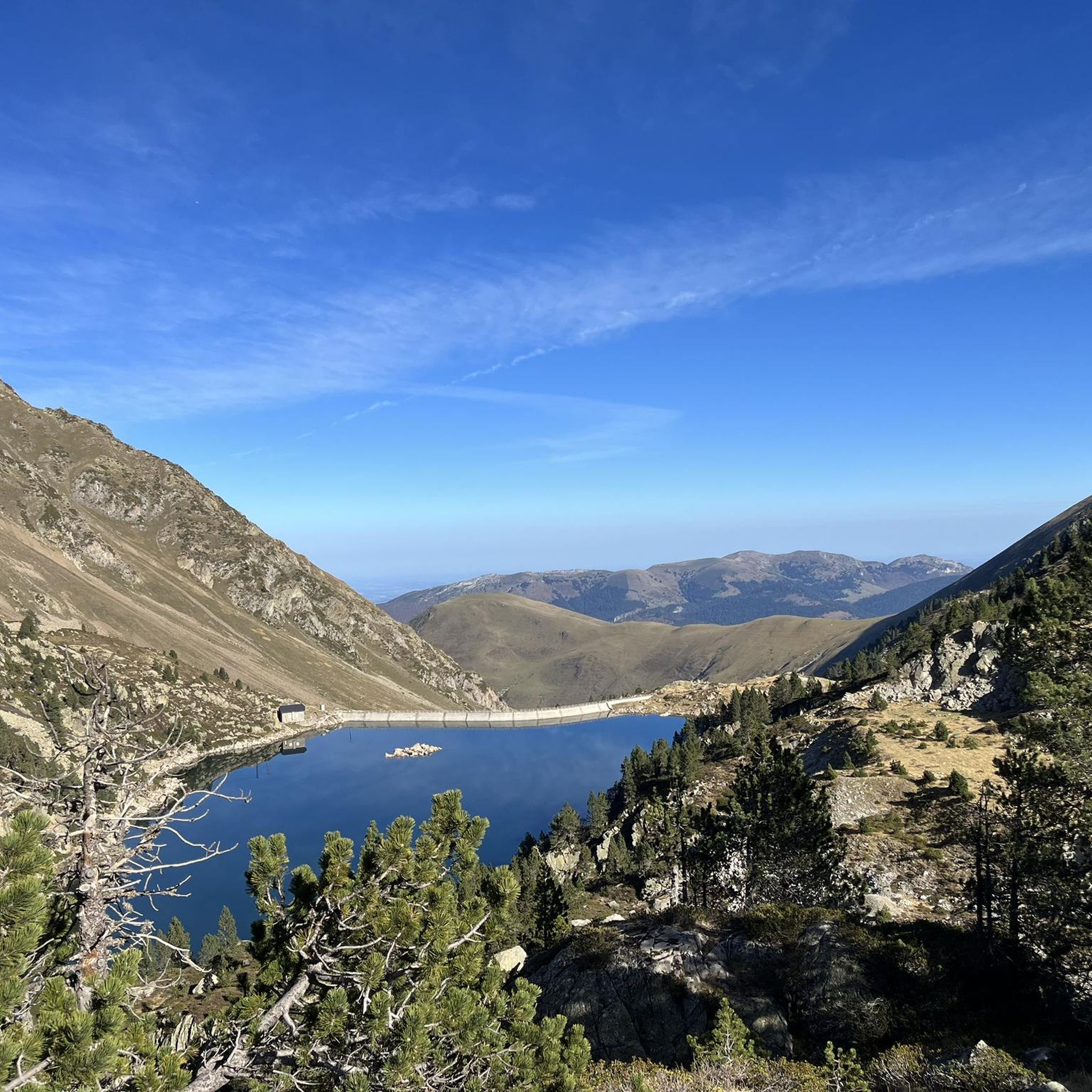
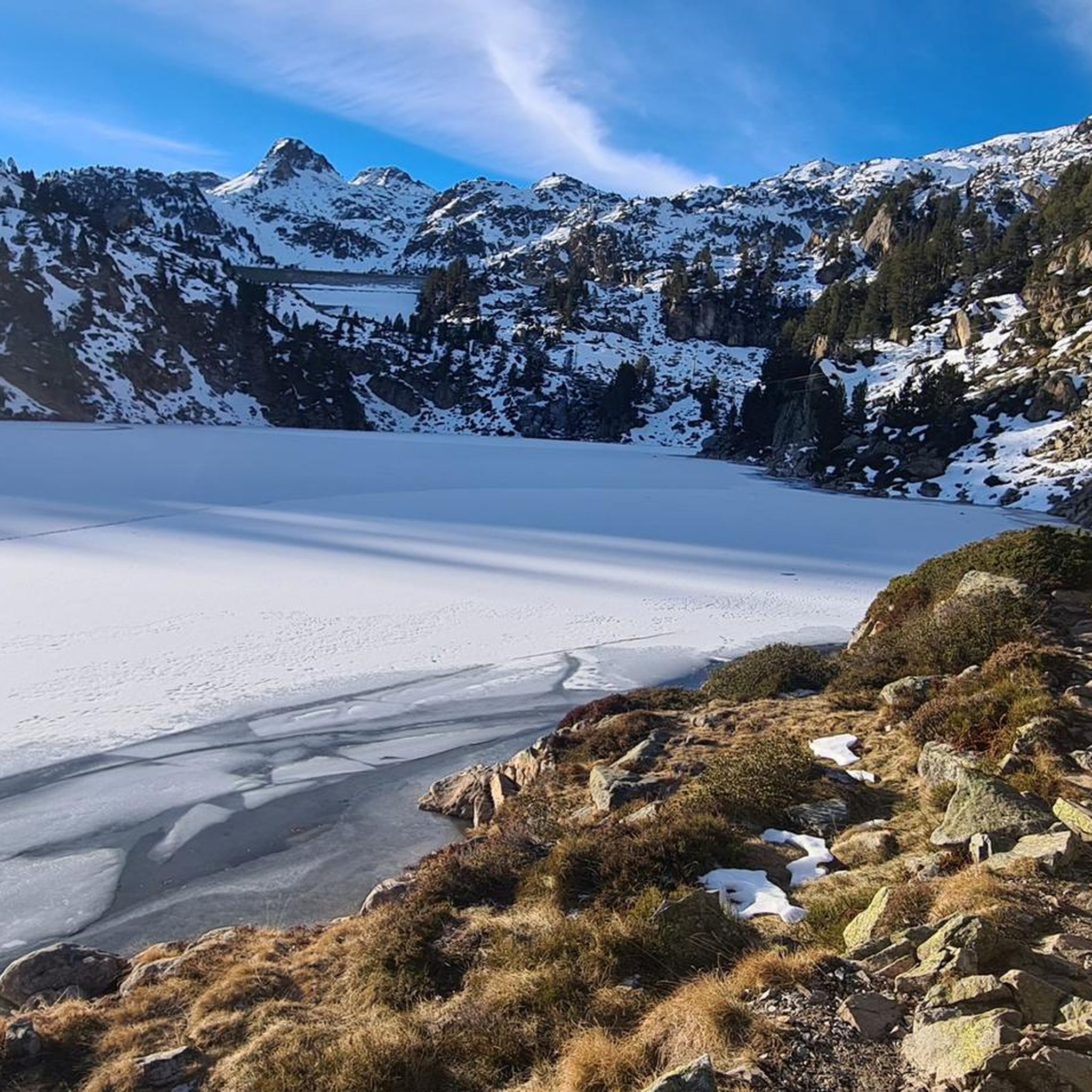
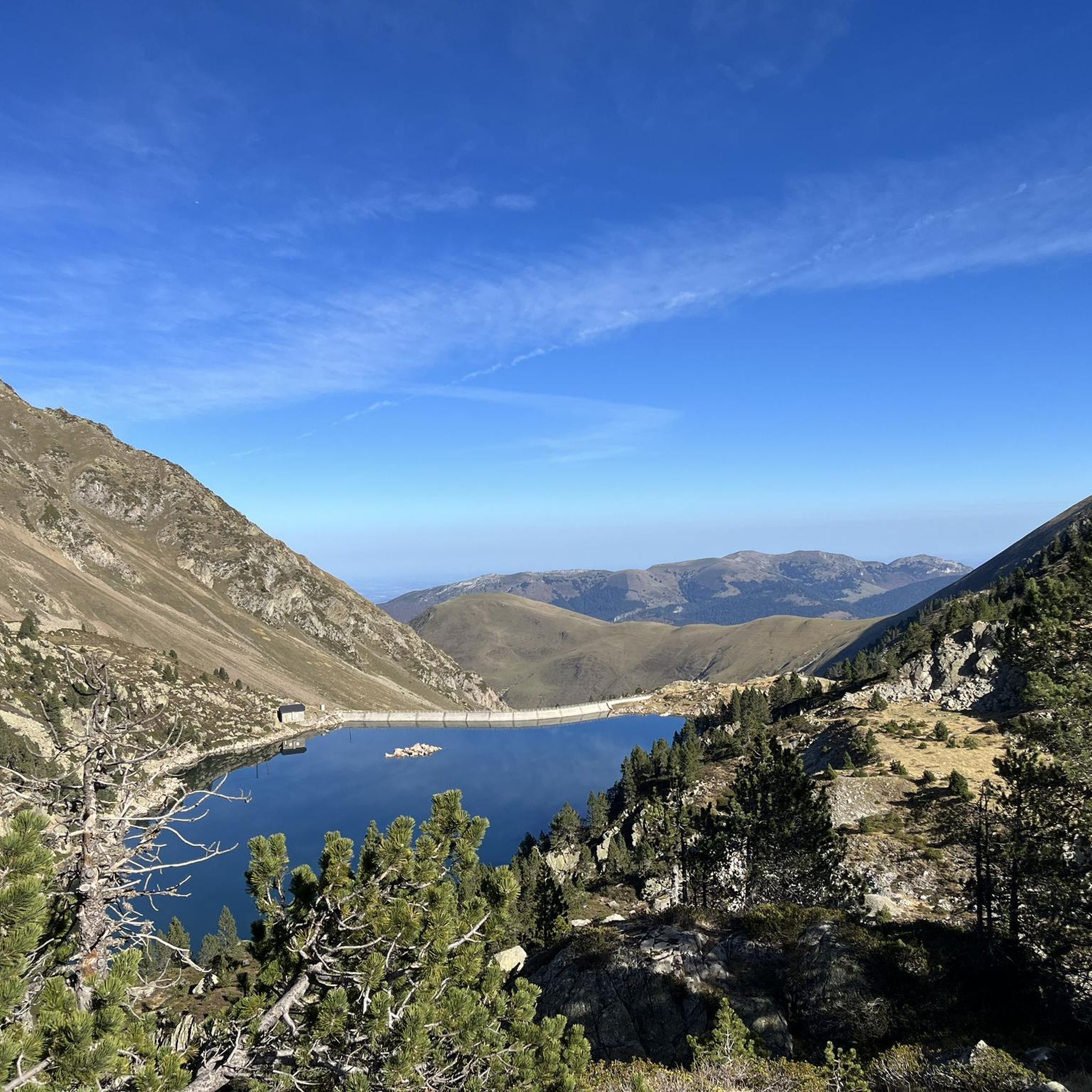
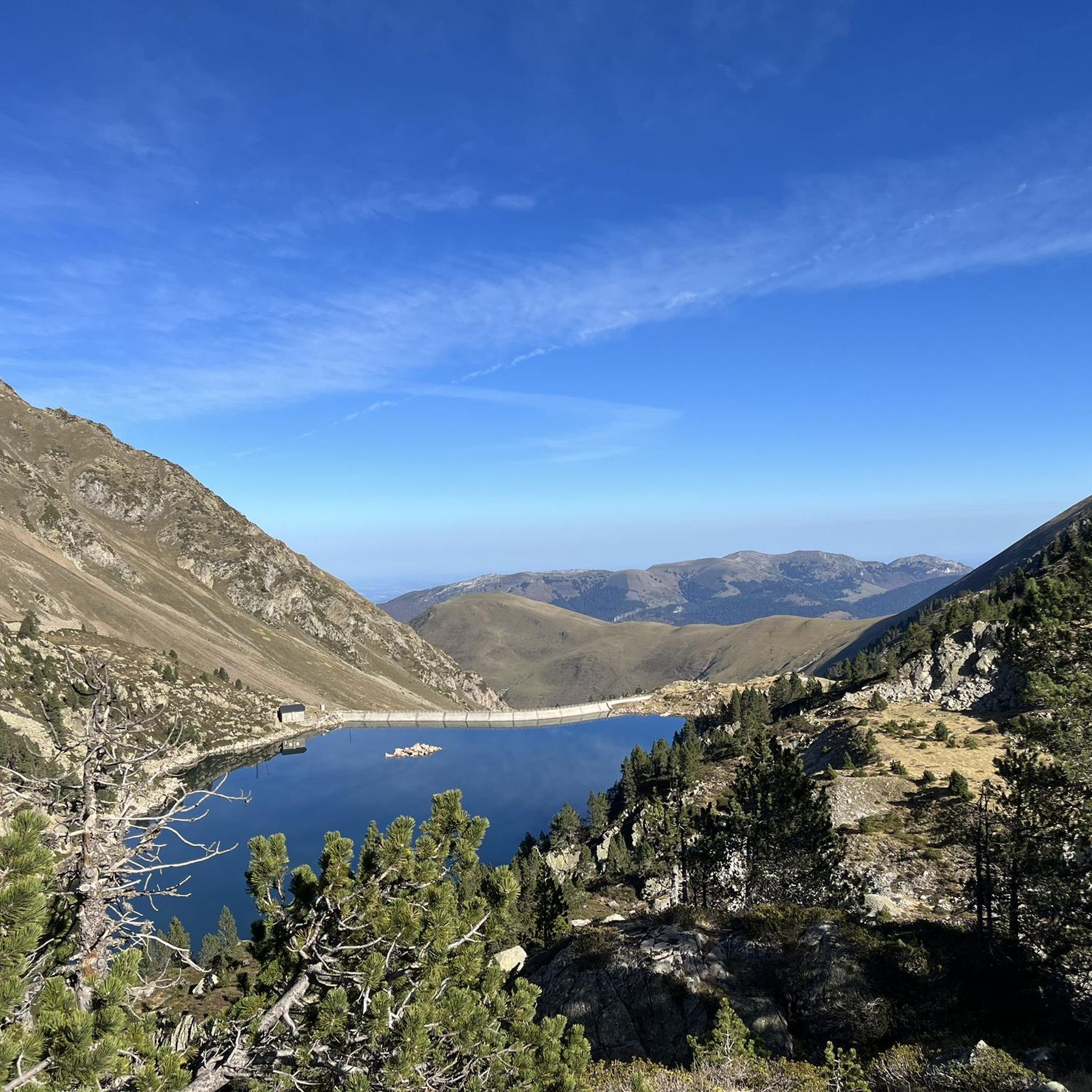
Jogging around Lac de Gréziolles offers routes through the high-altitude glacial landscape of the Hautes-Pyrénées department in France. This region, part of the Pyrenees National Park, features mountainous terrain with prominent peaks and expansive alpine meadows. Runners can expect varied paths that traverse a "mineral world" characterized by clear lakes and streams, providing a challenging yet rewarding experience. The area's trails often link to other glacial lakes, offering diverse running opportunities.
Best jogging routes around Lac de Gréziolles
- The most…
Last updated: July 4, 2026
32
runners
43.1km
06:28
2,020m
3,240m
Hard run. Very good fitness required. Sure-footedness, sturdy shoes and alpine experience required.
42
runners
47.7km
08:29
3,040m
3,040m
Hard run. Very good fitness required. Sure-footedness, sturdy shoes and alpine experience required.

Sign up for free
4
runners
5.91km
00:52
300m
300m
Hard run. Very good fitness required. Mostly paved surfaces. Suitable for all skill levels.
4
runners
4.01km
00:26
80m
90m
Easy run. Great for any fitness level. Mostly paved surfaces. Suitable for all skill levels.
251
runners
19.1km
02:36
1,000m
1,000m
Hard run. Very good fitness required. Mostly paved surfaces. Suitable for all skill levels.
Get access to more routes and recommendations from other explorers.
Sign up for free
Already have an account?
Our route recommendations are based on thousands of hikes, rides, and runs completed by other people on komoot.
Start today with a free account
Your next adventure awaits.
Login or Signup

Tips from the Community

There you'll find expert advice on what to do next on your hikes. If you stay the evening, the dining room is welcoming and the meals are delicious and plentiful. The nearby bivouac area can accommodate around ten tents.
0
0

An amazing view, with the added bonus of some spectacular fine dining (book in advance for dining!)
0
0

The Col du Tourmalet... a pass that was a real challenge for me! It climbs continuously for 20 km without any real respite... With the end getting a bit tougher, especially mentally!
0
0

Ascent to the summit on foot; no cable car access until 2027. No access to the restaurant or restrooms, but drinking water is available.
0
1

Octave Lapize, the first to climb it on a bike during the tour. Check out the history, it's unmissable.
0
0

Do it in the evening for the sunset, it's magnificent or conversely to admire the sunrise. The night of stars is magnificent! 🤩
0
1


forget the backpackers and move on
0
0
Frequently Asked Questions
How many jogging routes are available around Lac de Gréziolles?
There are over 70 dedicated jogging routes in the Lac de Gréziolles area. These range from easy loops to very challenging long-distance trails, catering to various fitness levels and preferences.
Are there any easy running trails for beginners or a quick jog?
Yes, for those looking for a gentler option or a quick run, there are a few easy routes. A popular choice is the La Mongie loop from P1 - Place des Monges, which is about 4.0 km long and typically takes around 26 minutes to complete. This route offers a good introduction to the local area without significant elevation.
What kind of terrain can I expect on the running routes in this region?
The Lac de Gréziolles region, nestled in the Pyrenees, offers diverse terrain. You'll encounter everything from mountain pastures and open trails to rocky paths and areas with sparse vegetation. Many routes feature significant elevation changes as they traverse high-altitude glacial landscapes, alpine passes, and lead past numerous mountain lakes.
Are there any circular jogging routes available?
Yes, many of the routes in the area are circular, allowing you to start and finish at the same point. For a challenging circular experience exploring multiple lakes and mountain passes, consider the Lac de Port Bielh – Col de Bastanet loop from La Mongie. This difficult route covers 45.6 km and offers extensive views.
What are some notable natural features or viewpoints I can expect to see while running?
The mountainous environment ensures breathtaking vistas. You'll frequently encounter stunning high-altitude lakes like Lac de Gréziolles itself, Lac du Campana, and the Laquets Reservoir. Trails often lead through alpine passes, offering panoramic views of the Pyrenean landscape and opportunities to see traditional shepherd's huts.
What do other runners enjoy most about jogging in Lac de Gréziolles?
The area is highly rated by the komoot community, with an average score of 4.3 stars. Runners often praise the stunning natural beauty, the challenging yet rewarding experience of the high-altitude trails, and the sense of peace and freedom found amidst the pure, fresh air of the Pyrenees.
Are there any long-distance or challenging running options for experienced trail runners?
Absolutely. The region is well-suited for experienced trail runners seeking a challenge. Routes like Stage 2: La Mongie to Soulom — Grand Raid des Pyrénées, a difficult 43.1 km trail with significant elevation gain, provide an intense and rewarding experience through the high mountains.
Is it possible to reach the jogging trails using public transport?
While specific public transport options directly to every trailhead can vary, the region around Lac de Gréziolles, particularly areas like La Mongie, often have seasonal bus services that connect to larger towns. It's advisable to check local transport schedules for the Hautes-Pyrénées department, especially during peak seasons, to plan your access to the trails.
Where can I park my car when visiting the jogging routes?
Parking availability will depend on the specific trailhead you choose. Areas like La Mongie, which serve as starting points for several routes, typically offer designated parking facilities. For routes starting from more remote locations, roadside parking might be available, but it's always best to check local regulations and signage.
What is the best season for running around Lac de Gréziolles?
The best season for running around Lac de Gréziolles is generally from late spring to early autumn (roughly June to September). During these months, the weather is more stable, snow has largely melted from higher elevations, and mountain refuges are typically open. Winter running is possible but requires specialized gear and experience due to snow, ice, and colder conditions.
Are there any running routes that lead to or near mountain refuges?
Yes, the extensive network of trails in the Pyrenees often leads to mountain refuges. These refuges can serve as excellent destinations, checkpoints, or emergency shelters during longer runs. For example, the popular Refuge de Campana de Cloutou is a known point of interest in the wider area, and many routes will pass by or near such facilities.
Most popular routes around Lac de Gréziolles

Get inspired with the komoot mobile app


Explore more
Browse the best Running Trails & Routes in other regions.
