The best road cycling routes around Lac de Nantua
4.5
(103)
2,378
riders
104
rides
Road cycling around Lac de Nantua offers routes that navigate the terrain surrounding this lake in the Jura Mountains. The region is characterized by its glacial lake, verdant hills, and dramatic limestone cliffs, providing varied elevations suitable for road cycling. Routes often follow the lake shore, offering relatively flat sections, while others ascend into the surrounding hills, presenting more challenging climbs. The landscape transitions from lakeside paths to roads winding through woodlands and past small villages.
Best road cycling routes around Lac de Nantua
- The most popular road cycling route is Lac de Nuanta – View of Lake Nantua loop from Nantua, a 4.8 miles (7.7 km) trail that takes 21 minutes to complete. This easy route offers continuous views of Lake Nantua.
- Another top favourite among local road cyclists is Lake Nantua – View of Lake Nantua loop from Nantua, a moderate 18.4 miles (29.5 km) path. This route includes varied terrain with ascents and descents around the lake.
- Local road cyclists also love the Lake Nantua – Lac de Sylans loop from Nantua, a 16.0 miles (25.8 km) trail leading through the area between Lac de Nantua and Lac de Sylans, often completed in about 1 hour 22 minutes.
- Road cycling around Lac de Nantua is defined by lakeside roads, forested hills, and scenic viewpoints. The network offers options for different ability levels, from easy loops to more challenging climbs.
- The routes in Lac de Nantua are highly rated by the komoot community with an average score of 4.4 stars from over 90 reviews. More than 2,200 road cyclists have used komoot to explore Lac de Nantua's varied terrain.
Last updated: May 23, 2026
5.0
(2)
22
riders
7.70km
00:21
70m
70m
Easy road ride. Great for any fitness level. Mostly well-paved surfaces and easy to ride.
12
riders
29.5km
01:25
380m
370m
Moderate road ride. Good fitness required. Mostly well-paved surfaces and easy to ride.

Sign up for free
6
riders
31.9km
01:57
760m
760m
Moderate road ride. Good fitness required. Mostly well-paved surfaces and easy to ride.
10
riders
58.1km
03:20
1,330m
1,330m
Hard road ride. Very good fitness required. Mostly well-paved surfaces and easy to ride.
7
riders
78.7km
03:46
1,050m
1,040m
Hard road ride. Very good fitness required. Mostly well-paved surfaces and easy to ride.
Get access to more routes and recommendations from other explorers.
Sign up for free
Already have an account?
Our route recommendations are based on thousands of hikes, rides, and runs completed by other people on komoot.
Start today with a free account
Your next adventure awaits.
Login or Signup
Tips from the Community

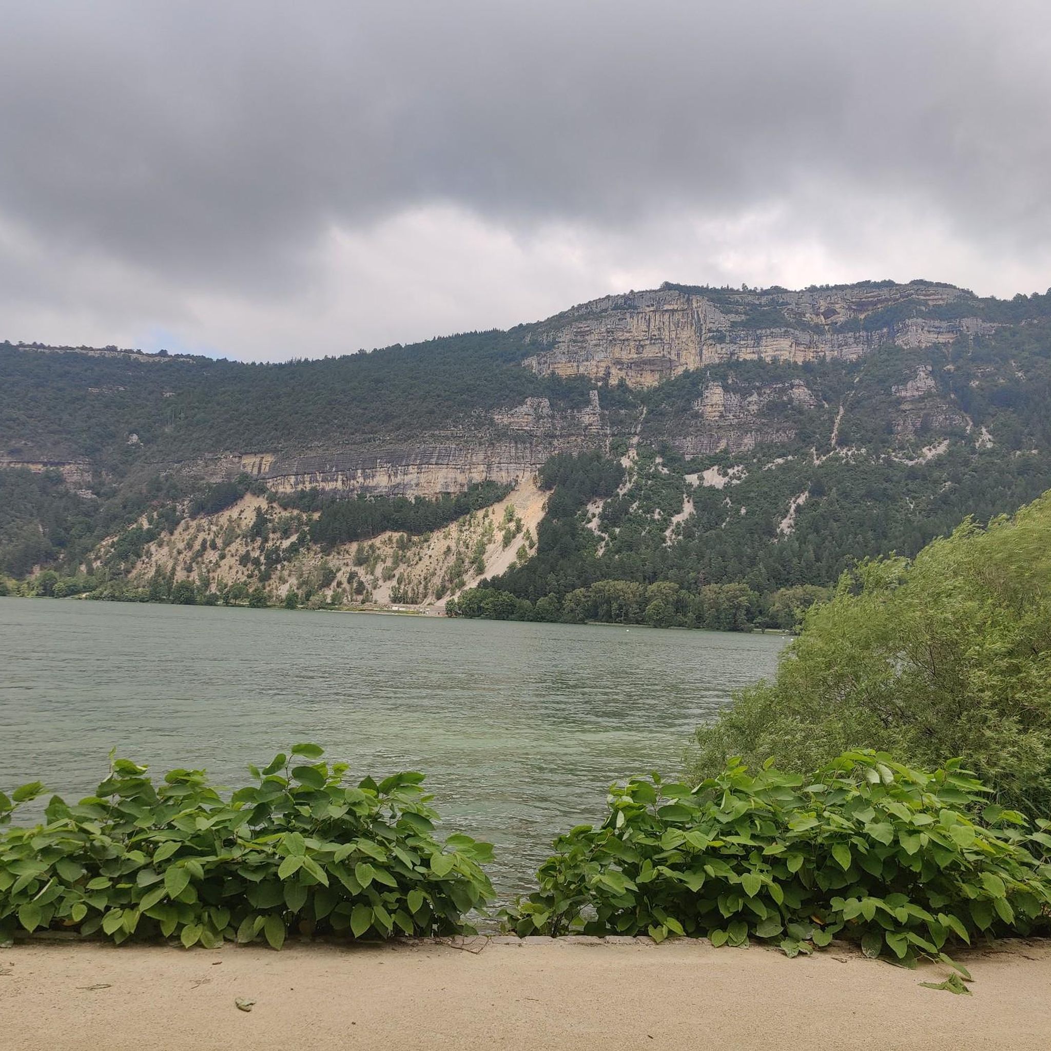
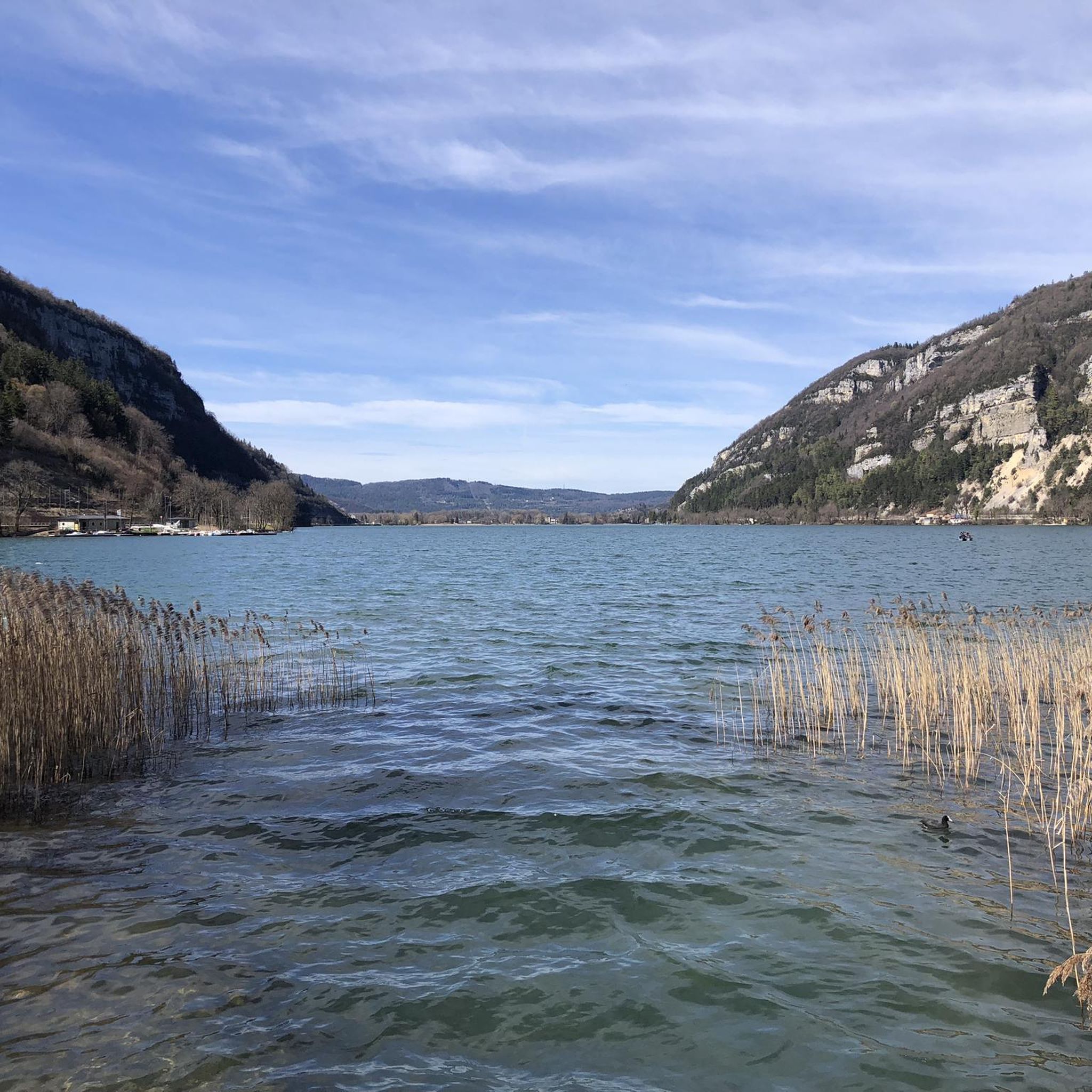
The Lac de Nantua is a superb body of water of 141 hectares. In the heart of the Jura, it offers an ideal setting for practicing a multitude of sports. It is even possible to swim in its waters.
1
0
The Peney viewpoint overlooks Lake Sylans, on which it offers a beautiful view. Classified since 1909, one can distinguish on its banks the ruins of the old ice factories which commercialized the ice extracted from the lake until 1917. The passage is located at the level of the tunnel of the same name.
0
0

The bridge separates two departments, the Jura and the Ain. "Iron bridge. For several centuries, the Ain was crossed at Thoirette by means of a ferry, known as the bac de Christouphe, the name of the commune where the passenger resided. From 1808 to 1811, the riparian communes clubbed together to build a bridge in place of this ferry. The project had been drawn up by Mr. Cordier, of Orgelet, an engineer then in charge of the direction of the Simplon road works. Various obstacles opposed the execution of this work. It was only in 1829 that an iron bridge was built, which collapsed in 1843. The department of Ain has just replaced it with an iron bridge currently open to traffic". Statistique de la France - 1855 - Ministère de l'Agriculture par Imprimerie Impériale à Paris - p53.
0
0

Beautiful, simple, easy walk; lots of traffic noise on the "road" section, a bit of a shame, but the color of the water is magical
1
0

Unfortunately I was unlucky with the weather, but even as I drove past the place looked very nice, lots of grass and a place to swim.
0
0
Small pass between Ain and Oignin. Beautiful church in the village, the hotel looked rather closed.
3
0

This paleontological site was discovered in 2009. It houses the longest sauropod footprint in the world. These tracks have been protected and showcased under a wooden canopy since 2021. The Dinoplagne site is a private site, open to visitors only from April to October and by reservation. Opening hours and contact details are available on the website: https://www.dinoplagne.fr/
1
0

Frequently Asked Questions
How many road cycling routes are available around Lac de Nantua?
There are over 100 road cycling routes documented on komoot for the Lac de Nantua area, offering a wide range of options for different skill levels.
Are there easy road cycling routes suitable for beginners around Lac de Nantua?
Yes, the region offers several easy routes. For instance, the Lac de Nuanta – View of Lake Nantua loop from Nantua is an easy 4.8-mile (7.7 km) trail that provides continuous lake views.
What is the typical duration for cycling around Lac de Nantua?
The duration varies significantly by route and distance. An easy loop like the Lac de Nuanta – View of Lake Nantua loop from Nantua can take around 20-25 minutes, while longer, moderate routes such as the Lake Nantua – View of Lake Nantua loop from Nantua (18.4 miles / 29.5 km) might take closer to 1.5 to 2 hours.
Are there challenging road cycling routes for experienced riders?
Absolutely. While the immediate lakeside offers flatter sections, the surrounding Jura mountains provide plenty of challenging climbs. Over half of the routes in the area are rated as difficult, featuring significant elevation gains. For example, the Lac de Nuanta – Lac de Sylans loop from Le Chateau includes over 860 meters of ascent.
When is the best time of year for road cycling around Lac de Nantua?
The most pleasant time for road cycling in the Lac de Nantua region is typically from late spring to early autumn (May to October). During these months, the weather is generally mild, and the scenery is at its best, with lush greenery and comfortable temperatures for riding.
What kind of weather conditions should I expect when cycling in the Jura mountains around Lac de Nantua?
The Jura mountains can experience varied weather. Summers are generally warm, but sudden showers are possible. Spring and autumn offer cooler, crisp conditions. Always check the local forecast before heading out, especially for routes with higher elevations, as conditions can change rapidly.
Are there circular road bike routes around Lac de Nantua?
Yes, many of the road cycling routes around Lac de Nantua are designed as loops, allowing you to start and finish in the same location. Popular options include the Lac de Nantua – Lake Nantua loop from Port or the longer Lac de Nuanta – View of Lake Nantua loop from Le Chateau.
What do other road cyclists enjoy most about road cycling in Lac de Nantua?
The area is highly rated by the komoot community, with an average score of 4.4 stars from nearly 100 reviews. Reviewers often praise the stunning lake views, the varied terrain offering both gentle lakeside paths and challenging mountain ascents, and the peaceful roads winding through forested hillsides.
Are there any cafes or places to stop for refreshments along the road cycling routes?
Yes, the towns and villages around Lac de Nantua, such as Nantua itself, offer various cafes, bakeries, and restaurants where you can refuel and take a break. Many routes pass through or near these settlements, providing convenient stops.
Where can I find the most scenic viewpoints while road cycling around Lac de Nantua?
Many routes offer continuous scenic views, especially those that hug the lake shore. Routes that ascend into the surrounding hills, like parts of the Lake Nantua – View of Lake Nantua loop from Nantua, provide elevated perspectives of the lake and the Jura landscape.
Can I road cycle around Lac de Nantua in winter?
While some lower-elevation routes might be accessible, winter cycling can be challenging due to colder temperatures, potential ice, and snow, especially on higher roads in the Jura mountains. It's generally recommended to stick to the warmer months for the best experience, or to check local conditions carefully if planning a winter ride.
Most popular routes around Lac de Nantua

Get inspired with the komoot mobile app


Explore more
Browse the best Road cycling routes in other regions.
