The best walks and hikes around Hazelbury Bryan
4.5
(371)
2,048
hikers
184
hikes
Hiking around Hazelbury Bryan offers routes through the rolling hills of Dorset's Blackmore Vale. The region features verdant countryside, river valleys, and prominent Iron Age hillforts. Trails often provide expansive views stretching into neighboring counties. The landscape includes a blend of tranquil rural scenery and varied terrain suitable for outdoor activities.
Best hiking trails around Hazelbury Bryan
- The most popular hiking route is Rawlsbury Camp, Lower Ansty, Hilton and Bulbarrow loop, a 7.5 miles (12.0 km) trail that takes 3 hours 25 minutes to complete. This moderate route offers insights into Iron Age history and panoramic views.
- Another top favourite among local hikers is The Dorset Gap loop from Bulbarrow Hill, a difficult 16.2 miles (26.1 km) path. This challenging route features significant elevation gain and sweeping vistas across the countryside.
- Local hikers also love the Milton Abbas Village – View from Bulbarrow Hill loop from Woolland, a 8.6 miles (13.9 km) trail leading through varied terrain, often completed in about 3 hours 56 minutes.
- Hiking around Hazelbury Bryan is defined by rolling hills, the Blackmore Vale, and ancient Iron Age hillforts. The network offers options for easy, moderate, and difficult routes, catering to different ability levels.
- The routes in Hazelbury Bryan are highly rated by the komoot community with an average score of 4.6 stars from over 300 reviews. More than 1900 hikers have used komoot to explore Hazelbury Bryan's varied terrain.
Last updated: August 20, 2026
4.7
(3)
17
hikers
12.0km
03:25
270m
270m
Hike a moderate 7.5-mile loop around Rawlsbury Camp and Bulbarrow Hill, enjoying Iron Age history and vast Dorset countryside views.
4.5
(4)
10
hikers
26.1km
07:17
500m
500m
Hike the difficult 16.2-mile Dorset Gap loop from Bulbarrow Hill, gaining 1654 feet with panoramic views and historical features.

Sign up for free
4.7
(15)
54
hikers
13.9km
03:56
290m
290m
Moderate hike. Good fitness required. Easily-accessible paths. Suitable for all skill levels.
5.0
(7)
18
hikers
10.8km
02:59
180m
190m
Moderate hike. Good fitness required. Easily-accessible paths. Suitable for all skill levels.
3.5
(4)
10
hikers
6.87km
02:00
170m
170m
Easy hike. Great for any fitness level. Easily-accessible paths. Suitable for all skill levels.
Get access to more routes and recommendations from other explorers.
Sign up for free
Already have an account?
Our route recommendations are based on thousands of hikes, rides, and runs completed by other people on komoot.
Start today with a free account
Your next adventure awaits.
Login or Signup
Tips from the Community

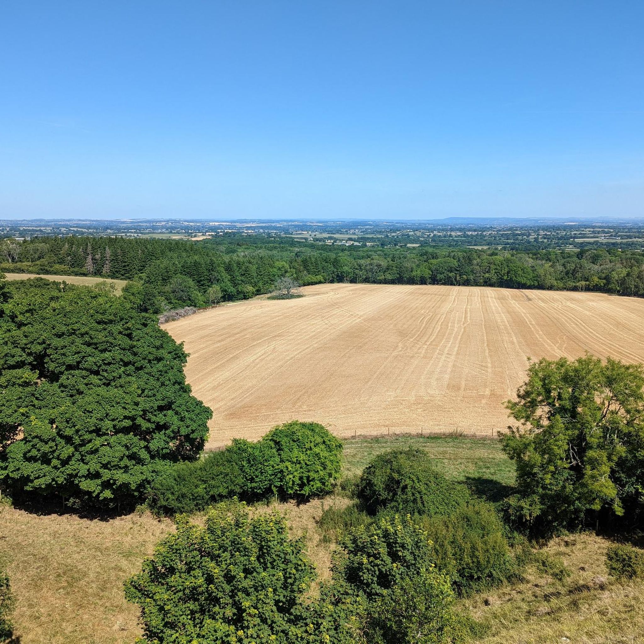
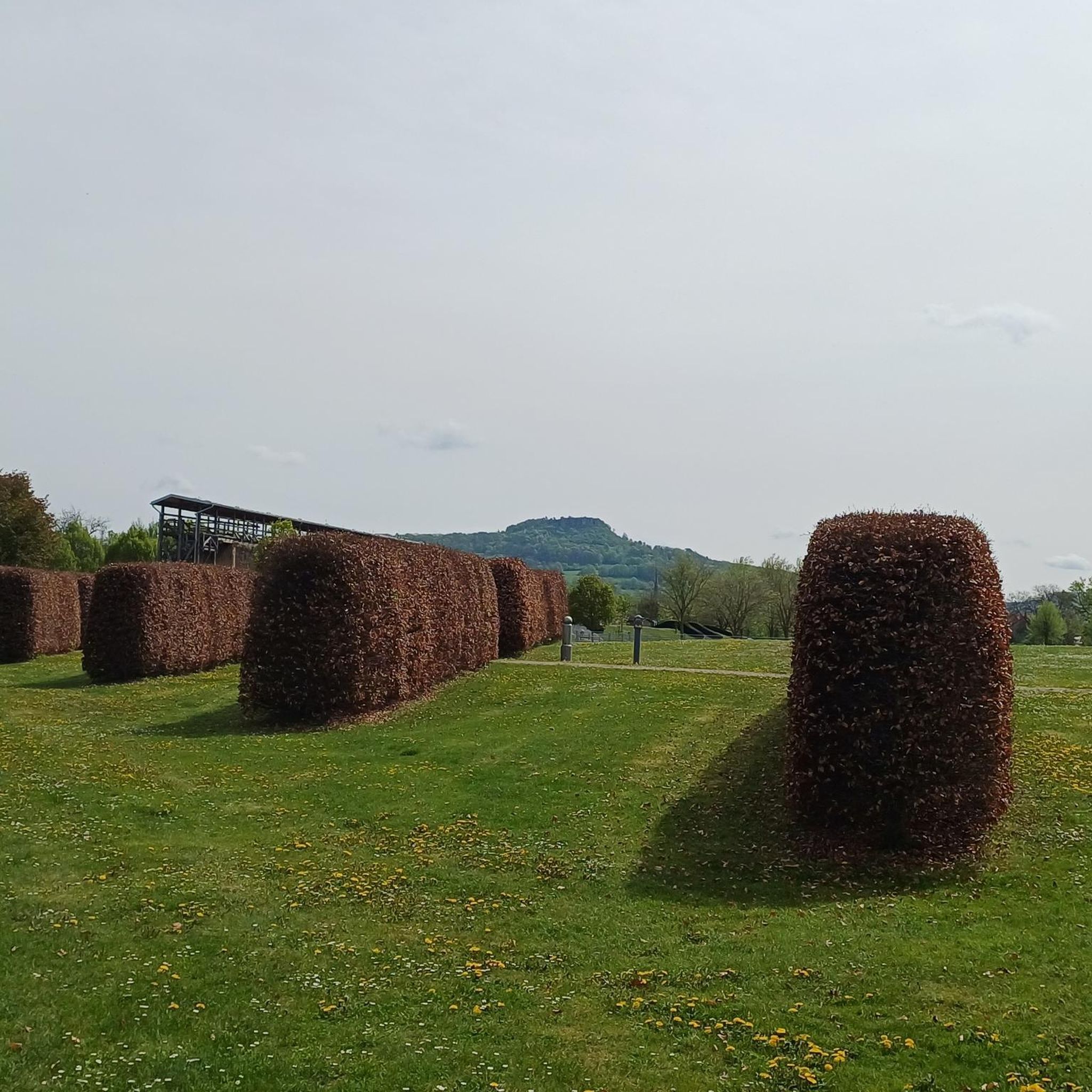
This was the part that I was longing for dry weather. The proper ridgeway from here on eastward is stunning but if less than knobby tyres you'll need to drop down.
0
0

Okeford Hill Bike ParkClick to open side panel for more information is a premier downhill mountain biking destination located on the steep northern escarpment of the Dorset Downs, offering some of the most challenging terrain in the region. Diverse Trail Network: The park features a variety of downhill-specific trails that cater primarily to intermediate and advanced riders, including technical "rooty" sections and fast, flowing jumps. Uplift Service: To maximize ride time, the venue provides a dedicated uplift service (usually a tractor and trailer) that shuttles riders from the bottom of the hill back to the summit. Operating Hours: The park is typically open to the public on Saturdays and Sundays from 9:00 AM to 4:00 PM, though it is often closed during the weekdays. Spectacular Setting: Riders can enjoy the same famous views of the Blackmore Vale described from nearby Bell Hill between runs.
0
0
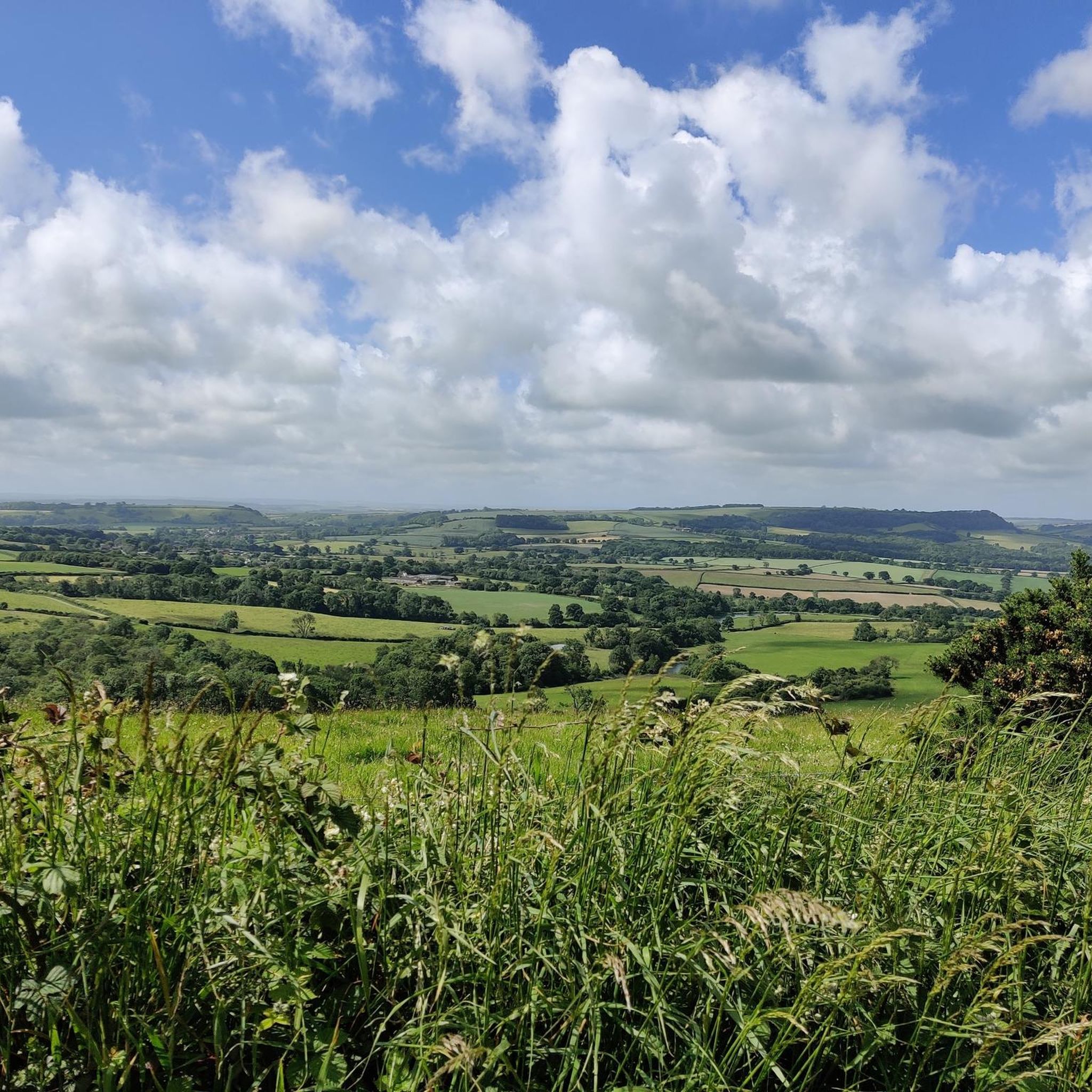
Standing on the summit of Bell Hill (258 meters) offers what many locals and hikers consider the definitive view of the Blackmore Vale. It is a vantage point that explains why Thomas Hardy called this area the "Vale of the Little Dairies."
0
0
All Saints Church in Hilton, Dorset, is a remarkable Grade I listed building, primarily dating from the 15th and 16th centuries. Its unique architecture features masonry, windows, and carved corbels (including a bagpipe player) salvaged and reused from the nearby Milton Abbey after the Dissolution. The church also houses two beautiful panels of early 16th-century paintings of the Apostles, which were also transferred from the Abbey. It retains a square 12th-century font in Purbeck marble.
0
0
* It lies southeast of the deserted medieval village of Bingham's Melcombe, the remains of which can still be seen in the surrounding fields.
0
0
* Architectural Features: The church exhibits features typical of the 14th and 15th centuries, including reticulated tracery in some windows, ogee-headed lights, and a tower with an embattled parapet. The south chapel has panel tracery. * Interior Elements: Inside, you can find a Norman font (brought from a nearby chapel in 1951), a pulpit bought in 1723, and 17th-century communion rails. A unique feature is a stuffed owl intended to deter bats! * Horsey Chapel Screen: The oak screen separating the Horsey Chapel from the nave is particularly interesting, featuring the initials S.T.F. (for Sir Thomas Freke) and the date 1619 on the reverse. Location and Setting: * The church is situated in the grounds of Bingham's Melcombe, a significant medieval manor house.
0
0
A church has stood on this site since at least 1150 AD, with records dating back to that time held in the County Museum Library. * 14th Century Core: The present stone and flint building largely dates back to the mid-14th century. This includes the nave and the lower stage of the west tower. * 15th Century Additions: The upper stage of the tower and the rebuilding of the south (Horsey) chapel occurred in the 15th century. The Horsey Chapel is separated from the nave by a notable oak screen. * 19th Century Chancel: The chancel was added in 1844 and features a window with reticulated tracery, in keeping with some of the earlier styles.
0
0
* Dissolution: Following the Dissolution of the Monasteries in 1539, the Abbey and estate were acquired by Sir John Tregonwell, a lawyer for Henry VIII. The Abbey church was allowed to become the parish church. * 18th Century Changes: In the late 18th century, Joseph Damer, Lord Milton (later Earl of Dorchester), decided the nearby market town of Milton (or Middleton) disturbed his ideal of rural peace. He had the entire town demolished and created the planned village of Milton Abbas. He also commissioned the landscape gardener Capability Brown to design the parkland around a new mansion he built on the site of the old Abbey buildings, keeping only part of the church. * Restoration: The church was restored around 1790 by James Wyatt and again in 1865 by Sir George Gilbert Scott.
0
0
Frequently Asked Questions
How many hiking trails are available around Hazelbury Bryan?
There are over 190 hiking routes available around Hazelbury Bryan, offering a wide variety of options for different skill levels and interests. These trails explore the rolling hills, verdant countryside, and historical sites of the Blackmore Vale.
Are there many circular hiking routes in the Hazelbury Bryan area?
Yes, many of the hiking routes around Hazelbury Bryan are circular, allowing you to start and end your journey in the same location. For example, the Rawlsbury Camp, Lower Ansty, Hilton and Bulbarrow loop is a popular moderate circular trail, and the more challenging Dorset Gap loop from Bulbarrow Hill also offers a circular experience.
What kind of landscapes can I expect to see on a hike near Hazelbury Bryan?
Hiking around Hazelbury Bryan offers diverse landscapes, primarily characterized by the rolling hills and verdant countryside of the Blackmore Vale. You'll encounter river valleys, ancient Iron Age hillforts, and expansive views stretching into neighboring counties. The area provides a blend of tranquil rural scenery and varied terrain.
Are there any easy hiking trails suitable for beginners or families in Hazelbury Bryan?
Yes, Hazelbury Bryan offers over 70 easy hiking routes perfect for beginners or families. These trails typically have less elevation gain and are shorter in distance. An example of an easy route is The Ibberton Pub – View from Bulbarrow Hill loop from Ibberton, which is under 7 km long.
Can I bring my dog on the hiking trails around Hazelbury Bryan?
Many trails around Hazelbury Bryan are suitable for dogs, but it's always best to keep them on a lead, especially when passing through fields with livestock or near roads. The area's rural paths and open countryside offer plenty of opportunities for walks with your canine companion.
What historical sites or landmarks can I explore while hiking in Hazelbury Bryan?
The area is rich in history. You can explore ancient Iron Age hillforts like Hambledon Hill Iron Age hill fort and Hod Hill, which often feature Roman fort remains within their ramparts. These sites offer not only historical insights but also panoramic views. The iconic Cerne Abbas Giant is also a notable nearby landmark.
Are there good viewpoints along the hiking routes in Hazelbury Bryan?
Absolutely. The rolling hills of Hazelbury Bryan provide numerous excellent viewpoints. Bulbarrow Hill and Hambledon Hill are particularly renowned for offering sweeping vistas across the Blackmore Vale and into neighboring counties. Many routes incorporate these elevated points for stunning scenery.
What do other hikers enjoy the most about hiking in Hazelbury Bryan?
The hiking trails in Hazelbury Bryan are highly rated by the komoot community, with an average score of 4.6 stars from over 300 reviews. Hikers often praise the diverse terrain, the tranquil rural scenery, and the historical significance of sites like the Iron Age hillforts. The expansive views from the hilltops are also frequently highlighted.
Are there any challenging hikes for experienced hikers in the area?
Yes, for experienced hikers seeking a challenge, there are several difficult routes. The Dorset Gap loop from Bulbarrow Hill is a notable example, covering over 26 km with significant elevation gain, offering a strenuous but rewarding experience with sweeping vistas.
What is the best time of year to go hiking in Hazelbury Bryan?
Hazelbury Bryan offers enjoyable hiking opportunities throughout the year. Spring and summer bring vibrant plant life and butterflies, making it ideal for exploring the natural beauty. Autumn provides picturesque foliage, while winter hikes can offer crisp air and unique views, though some paths might be muddy. Always check local conditions before heading out.
Is parking available at the trailheads in Hazelbury Bryan?
While specific parking details vary by trailhead, many popular hiking areas and villages around Hazelbury Bryan offer designated parking. It's advisable to check the starting point of your chosen route for information on nearby parking facilities, especially when planning to visit popular spots like Bulbarrow Hill or the vicinity of the hillforts.
Are there any pubs or places to eat near the hiking trails?
Yes, the charming villages and hamlets surrounding Hazelbury Bryan often feature traditional pubs where you can enjoy refreshments and meals. The Antelope Inn in Hazelbury Bryan itself is a local option, and other routes, such as The Ibberton Pub – View from Bulbarrow Hill loop from Ibberton, are named after nearby establishments, indicating convenient stops for hikers.
Most popular routes around Hazelbury Bryan
Most popular attractions around Hazelbury Bryan

Get inspired with the komoot mobile app


Explore more
Browse the best Hikes in other regions.
