The best walks and hikes around Lac du Chevril
4.6
(1210)
15,559
hikers
221
hikes
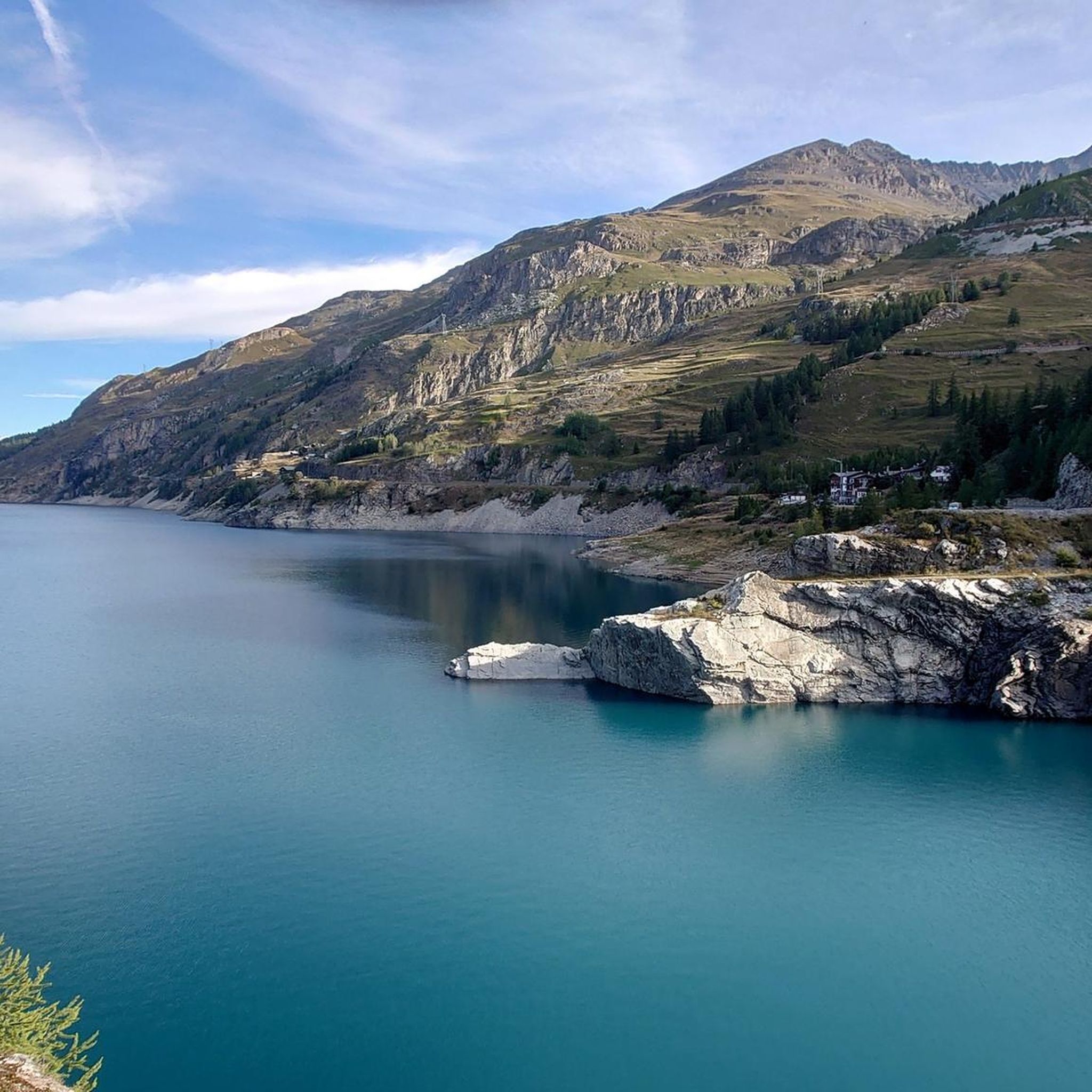
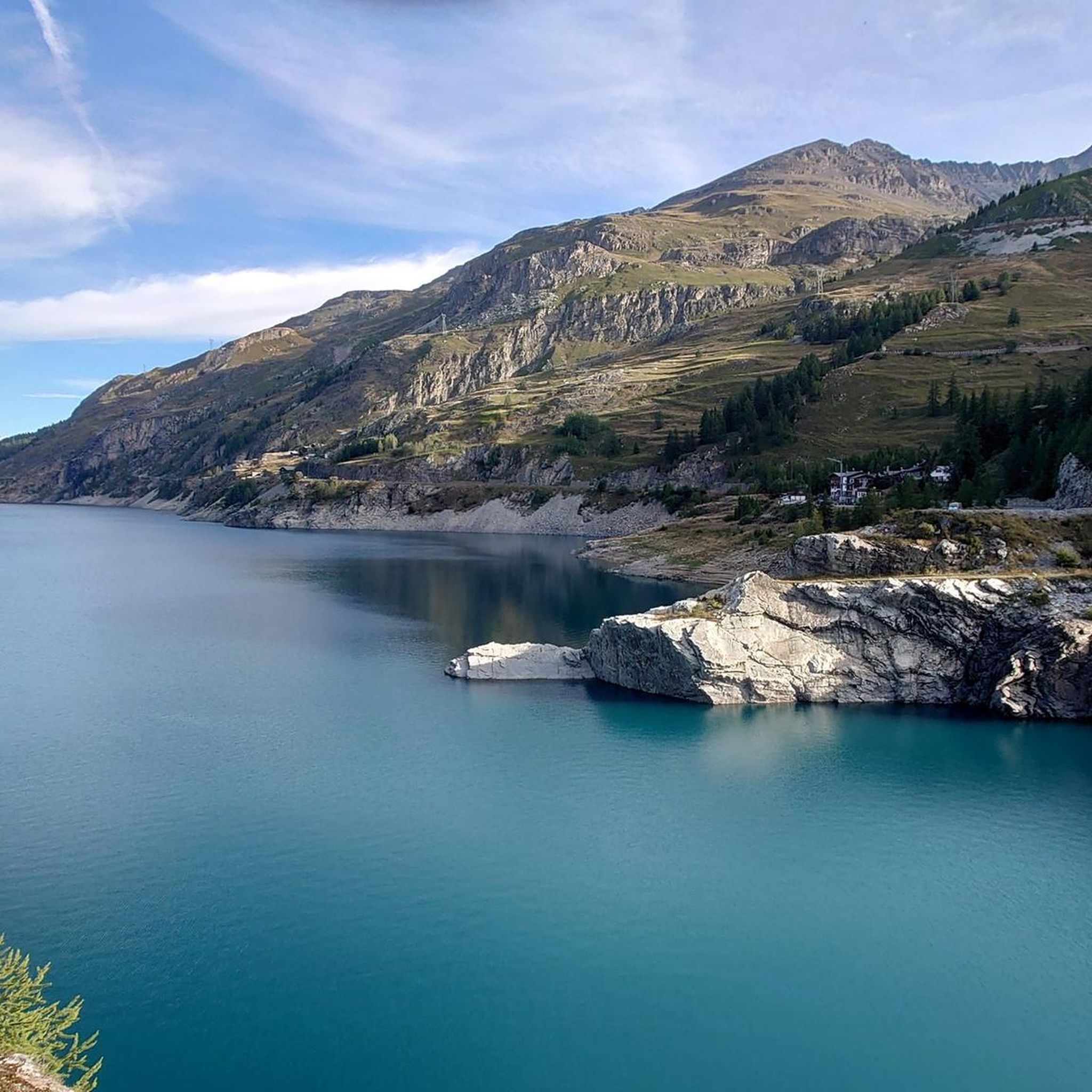
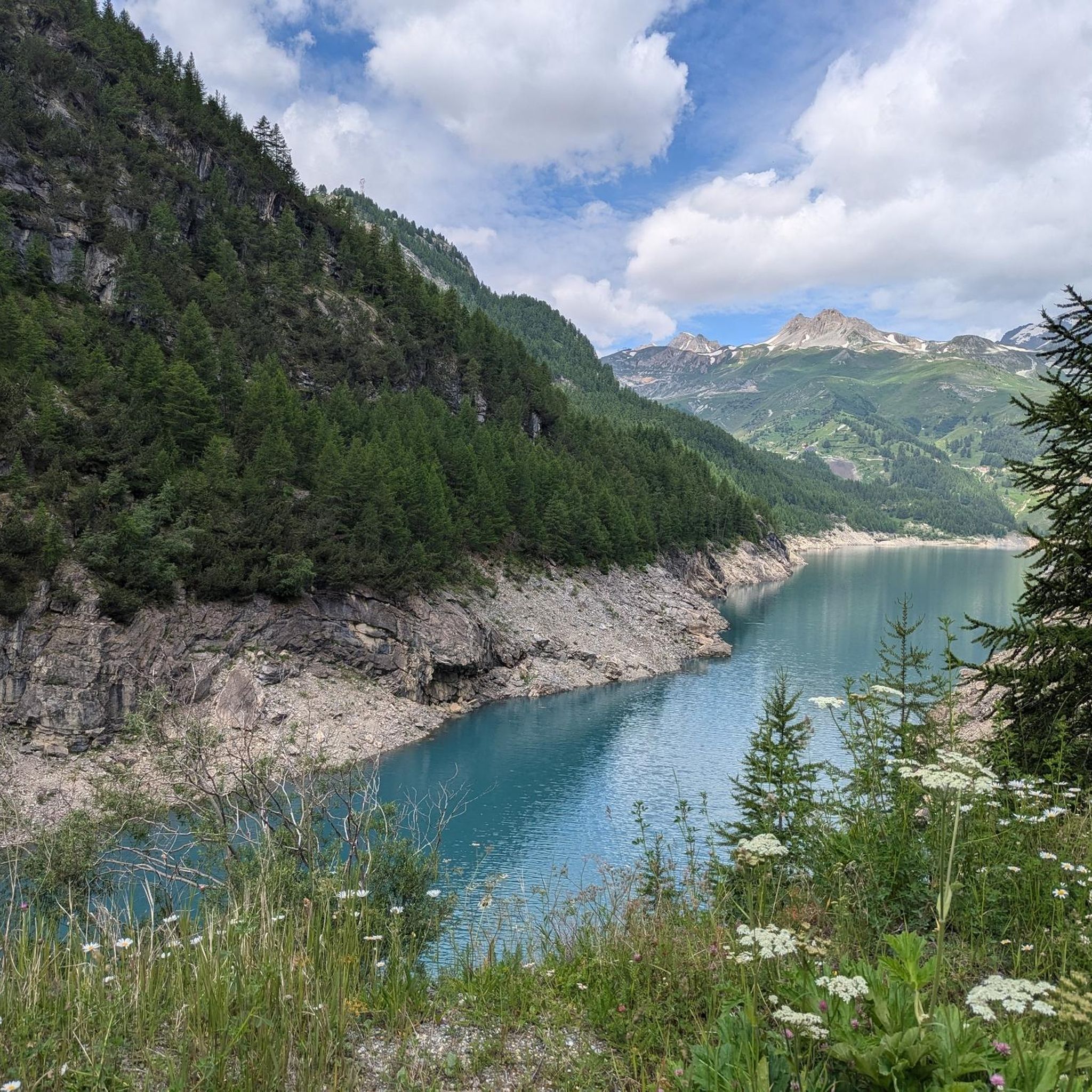
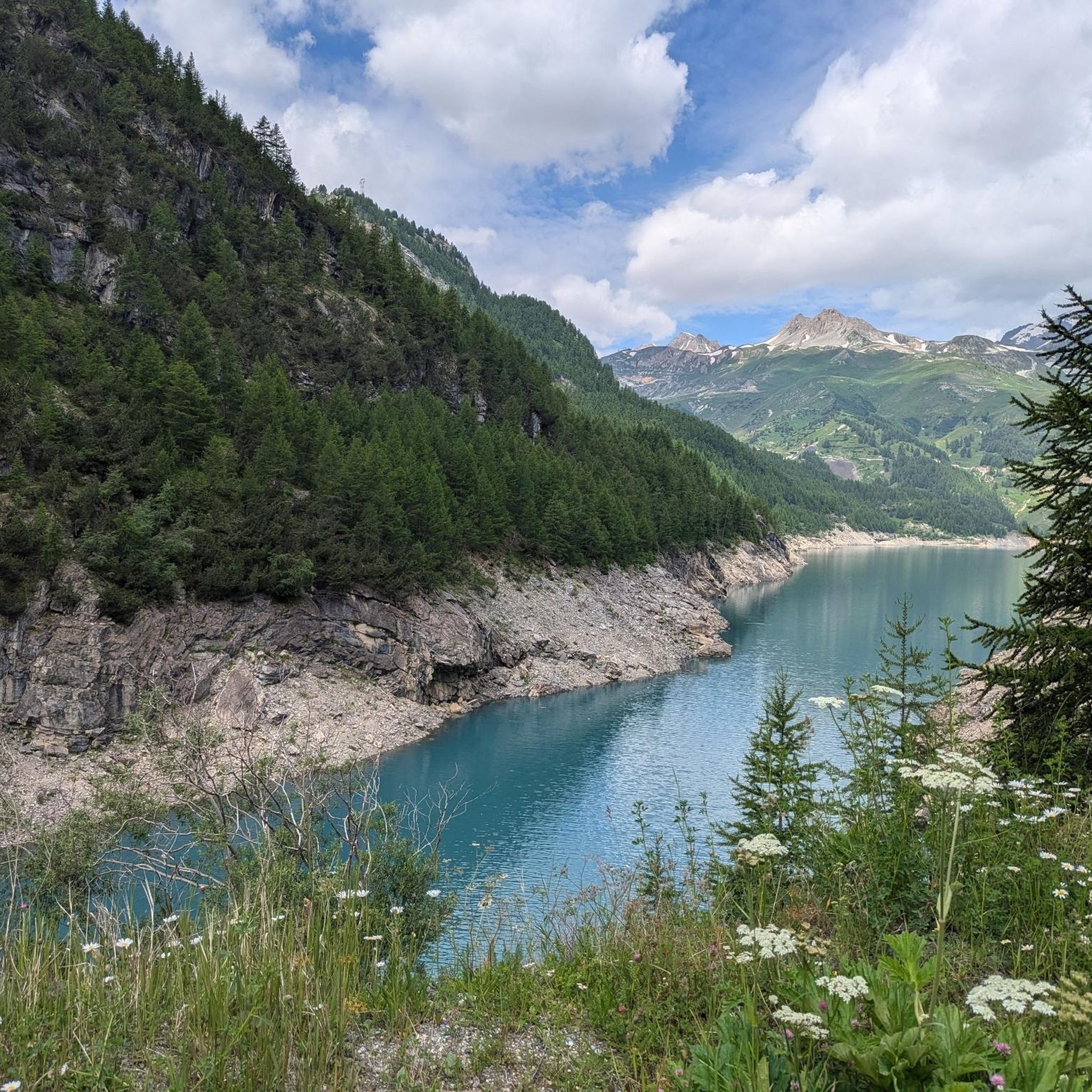
Hiking around Lac du Chevril presents diverse landscapes, featuring the artificial lake formed by the Chevril Dam, surrounding alpine peaks, and numerous waterfalls. The region is characterized by serene alpine grasslands, forests, and dramatic mountain passes, with elevations reaching nearly 1800 meters above sea level at the lake. This area provides a range of hiking terrain, from accessible paths along the lake to more challenging alpine expeditions.
Best hiking trails around Lac du Chevril
- The most popular hiking route is…
Last updated: October 12, 2026
4.9
(15)
147
hikers
12.2km
04:43
680m
680m
Moderate hike. Good fitness required. Mostly accessible paths. Sure-footedness required.
4.6
(7)
146
hikers
9.93km
03:46
360m
360m
Moderate hike. Good fitness required. Mostly accessible paths. Sure-footedness required.

4.7
(7)
83
hikers
12.4km
04:50
670m
670m
Moderate hike. Good fitness required. Mostly accessible paths. Sure-footedness required.
4.0
(3)
26
hikers
20.1km
07:17
1,020m
1,020m
Hard hike. Very good fitness required. Mostly accessible paths. Sure-footedness required.
4.3
(3)
25
hikers
7.15km
02:37
390m
390m
Moderate hike. Good fitness required. Mostly accessible paths. Sure-footedness required.
Get access to more routes and recommendations from other explorers.
Already have an account?
Our route recommendations are based on thousands of hikes, rides, and runs completed by other people on komoot.
Start today with a free account
Your next adventure awaits.

Tips from the Community


It's worth climbing up to Tignes after the ascent to the colossus Iseran and descending via the winding road that takes us to Tignes 1500.
0
0

Beautiful view of the Lac de Chevril.
2
0

This old hamlet ("hameau") gives an idea of how austere life used to be for Alpine dwellers. In winter, people often shared a room with their animals, using their body heat for heating. When there was no work due to poor harvests, some residents emigrated to Alsace or Ticino to seek employment.
0
0
The hike to the Aiguille de la Grande Sassière (a 3,751 m high mountain in the Graian Alps) is easy. The west and east of this part of the Alps form the watershed between the Rhône (Isère) and Po (Dora Baltea) rivers, which also forms the border between France and Italy. Climbing to the summit also offers a unique opportunity to see a glacier and two glacial lakes. If you're in the area, don't miss this breathtakingly scenic hike in the Vanoise National Park!
0
0
Even hikers who aren't usually looking for altitude will find something to their liking here. A path runs along the reservoir, offering views of the mist-shrouded peaks. The University of Lyon is conducting studies here on the cute marmots, of which there are countless to admire.
0
0
The Aiguille de la Grande Sassière, or often simply the Grande Sassière, is a 3751 m high mountain in the Graian Alps, located south of the Mont Blanc group, or more precisely just southeast of the Petit Saint Bernard Pass, on the ridge that separates the west and east of this part of the Alps and forms the watershed between the Rhone (Isère) and the Po (Dora Baltea), and across which runs the national border between France and Italy. This ridge also forms the seam between the Aosta Valley and the historic Savoy in the Savoie department and, a few kilometers further southeast of the mountain, between the two adjacent national parks of Gran Paradiso and Vanoise, at the height where, within these protected areas, passes connect the north and south sides of the parks: to the west, the Col de l’Iseran Tarentaise (Isère) and Maurienne (Arc Valley), to the east of the Colle del Nivolet the Aosta Valley and the Orco Valley (Piedmont).
0
0

The La Martin refuge is superbly installed in a magnificent green setting. The atmosphere is very pleasant, you can play board games or pick a book from the library. The refuge is equipped with a bar and offers a catering service. For opening times and dates as well as reservations, go to the website https://refuge-lamartin.vanoise.com/services-gardiennage
0
0
Frequently Asked Questions
What kind of landscapes and natural features can I expect to see while hiking around Lac du Chevril?
Hiking around Lac du Chevril offers breathtaking alpine scenery, including views of the Mont Blanc massif from certain points. You'll encounter serene alpine grasslands, forests, dramatic mountain passes, and the picturesque Lac du Chevril itself, which provides tranquil reflections of the surrounding peaks. Unique features include the impressive Chevril Dam and the fascinating historical site of the submerged village of Tignes, visible during periodic lake drainings.
Are there any waterfalls to discover on the trails near Lac du Chevril?
Yes, the area is rich with waterfalls. Notable ones include the beautiful "Bridal Veil" waterfall, which cascades gracefully into the lake, and the Combes waterfall, accessible from Tignes. The Gouille de Salin is another highlight, known for its incredibly clear water and panoramic views with Lac du Chevril in the background. You can also find the resurgence of the Salin waterfall on the botanical trail.
Are there family-friendly hiking options around Lac du Chevril?
Absolutely. Several trails are suitable for families, such as the "Bois de la Laye," which offers accessible paths and viewpoints overlooking Lac du Chevril, the dam, and Mont Blanc. Another easy option perfect for the whole family is the "Tour of Lac des Brèvières." These routes provide enjoyable experiences for all ages.
What are some unique landmarks or attractions I can visit while hiking in the area?
Beyond the natural beauty, you can explore several unique landmarks. The Chevril Dam itself is an impressive engineering feat, featuring a gigantic wall fresco depicting Hercules. Near the lake, you'll find the statue "The Lady of the Lake" by Livio Benedetti. For a challenging experience, consider the ascent to Col de l'Iseran, France's longest mountain pass. You can also discover the Lake Chevril itself, which is a central feature of the landscape.
Can I bring my dog on the hiking trails around Lac du Chevril?
While many trails in the region are dog-friendly, it's important to be aware of specific regulations, especially if your route enters the Vanoise National Park or other protected areas. Always keep your dog on a leash and ensure you clean up after them. Check local signage for any restrictions before you set out.
Are there any circular hiking routes available?
Yes, the area offers several excellent circular routes. For a moderate challenge with panoramic views, consider The Balcony of Tignes loop from Barrage du Chevril. Another popular option is the Lake Tignes – Lac de Tignes loop from Barrage du Chevril, which is also a moderate trail offering diverse scenery.
What is the best time of year to go hiking around Lac du Chevril?
The best time for hiking around Lac du Chevril is typically from late spring to early autumn (June to September). During these months, the weather is generally mild, trails are clear of snow, and the alpine flora is in full bloom. Some higher altitude trails may still have snow patches in early summer. Always check local weather conditions before your hike.
What do other hikers say about the trails in Lac du Chevril?
The hiking routes around Lac du Chevril are highly regarded by the komoot community, with an average rating of 4.7 stars from over 900 reviews. Hikers frequently praise the stunning alpine scenery, the diverse terrain catering to various skill levels, and the well-maintained paths that lead to breathtaking viewpoints and natural features like waterfalls and the lake itself.
Are there opportunities to see wildlife in the area?
Yes, especially if you venture into areas like the Grande Sassière Nature Reserve. This unspoiled natural environment offers a chance to encounter local alpine wildlife such as marmots, chamois, and ibexes. Keep an eye out for these animals, particularly in quieter areas and during early morning or late afternoon hikes.
What is the difficulty range of hikes available?
The Lac du Chevril region offers a wide range of hiking difficulties. You can find easy family strolls along the lake, moderate paths with some elevation gain like Lac de la Sassière – The Sassière stream loop from Barrage du Chevril, and challenging alpine expeditions for experienced hikers, such as La Martin Refuge – La Gurraz Village loop from Barrage du Chevril, which involves significant elevation changes.
Is there parking available for hikers near the trailheads?
Yes, parking is generally available at key access points and near popular trailheads, particularly around the Barrage du Chevril and in nearby villages like Tignes and Val d'Isère. It's advisable to arrive early during peak season to secure a spot, especially for longer or more popular routes.
Can I access the hiking trails using public transport?
Public transport options are available to reach the general Lac du Chevril area, particularly to towns like Tignes and Val d'Isère, which serve as hubs for many trails. From these towns, local shuttle services or buses may connect to specific trailheads during the peak season. Always check the latest schedules and routes for local transport before planning your trip.
Most popular routes around Lac du Chevril
Most popular attractions around Lac du Chevril

Get inspired with the komoot mobile app


Explore more
Browse the best Hikes in other regions.
