The best cycling routes around Lac de Sylans
4.3
(70)
1,195
riders
90
rides
Touring cycling around Lac de Sylans offers routes through a landscape shaped by glacial activity, featuring the exceptionally pure waters of the lake itself. The region is characterized by forested areas, the Montagnes du Jura, and the geological formations that created the lake. Cyclists can explore paths that wind through this preserved natural area, which is recognized for its ecological and landscape value.
Best touring cycling routes around Lac de Sylans
- The most popular touring cycling route is Lake Genin…
Last updated: May 15, 2026
5.0
(1)
7
riders
45.3km
04:20
1,120m
1,120m
Hard bike ride. Very good fitness required. You may need to push your bike for some segments of this route.
9
riders
12.9km
00:51
120m
120m
Easy bike ride. Great for any fitness level. Mostly paved surfaces. Suitable for all skill levels.

Sign up for free
4
riders
Hard bike ride. Very good fitness required. Mostly paved surfaces. Suitable for all skill levels.
4.6
(8)
14
riders
27.0km
01:36
140m
150m
Easy bike ride. Great for any fitness level. Mostly paved surfaces. Suitable for all skill levels.
13
riders
33.6km
02:56
660m
650m
Hard bike ride. Very good fitness required. You may need to push your bike for some segments of this route.
Get access to more routes and recommendations from other explorers.
Sign up for free
Already have an account?
Our route recommendations are based on thousands of hikes, rides, and runs completed by other people on komoot.
Start today with a free account
Your next adventure awaits.
Login or Signup

Tips from the Community

The Lac de Nantua is a superb body of water of 141 hectares. In the heart of the Jura, it offers an ideal setting for practicing a multitude of sports. It is even possible to swim in its waters.
1
0

This passage through the woods is a beautiful shady alternative for connecting Lake Genin and Lake Sylans.
0
0

A 10 km climb from the small roundabout in Châtillon, it's more like 14 km from the Nantua road or the center of Bellegarde. The gradient is fairly steady, ranging from 5.5% to 7.2%, with about ten small steep sections at +8.5%. Very quiet, with very few cars. The road is generally in good condition, but nothing more. There are some beautiful views along the way.
1
1

The Col de Bérentin connects the Valserine Valley to the Retord Plateau, passing through the beautiful Jura forests. Its ascent is gradual and the road is little traveled.
0
0

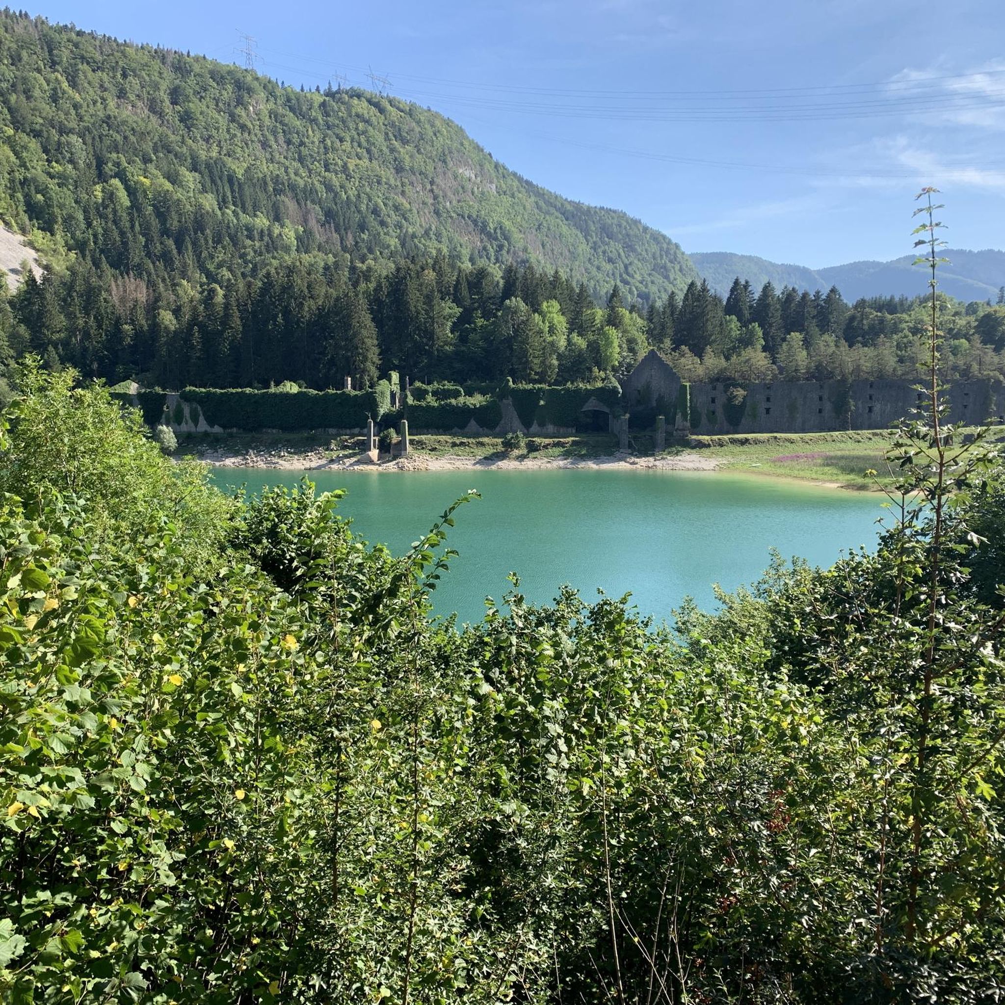
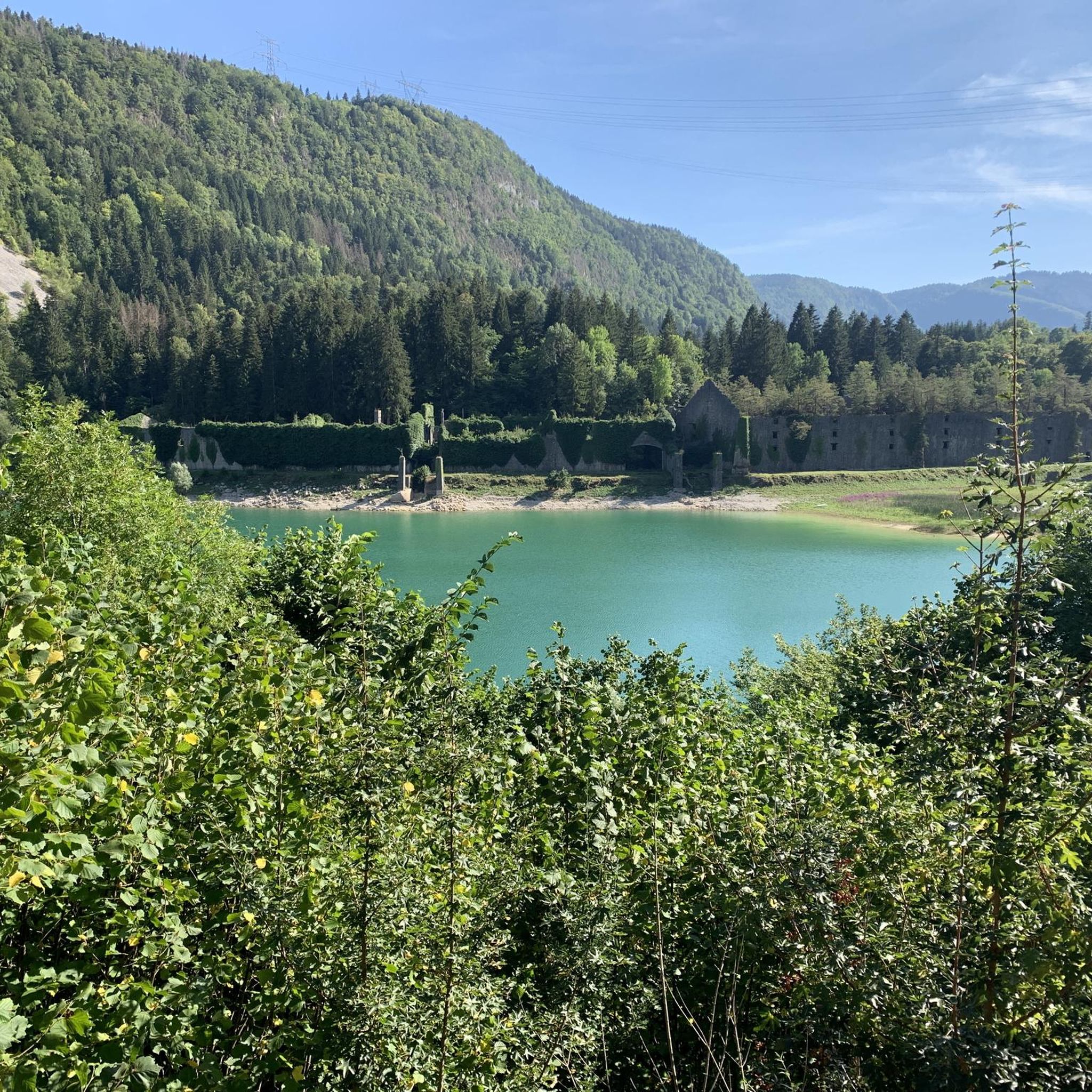
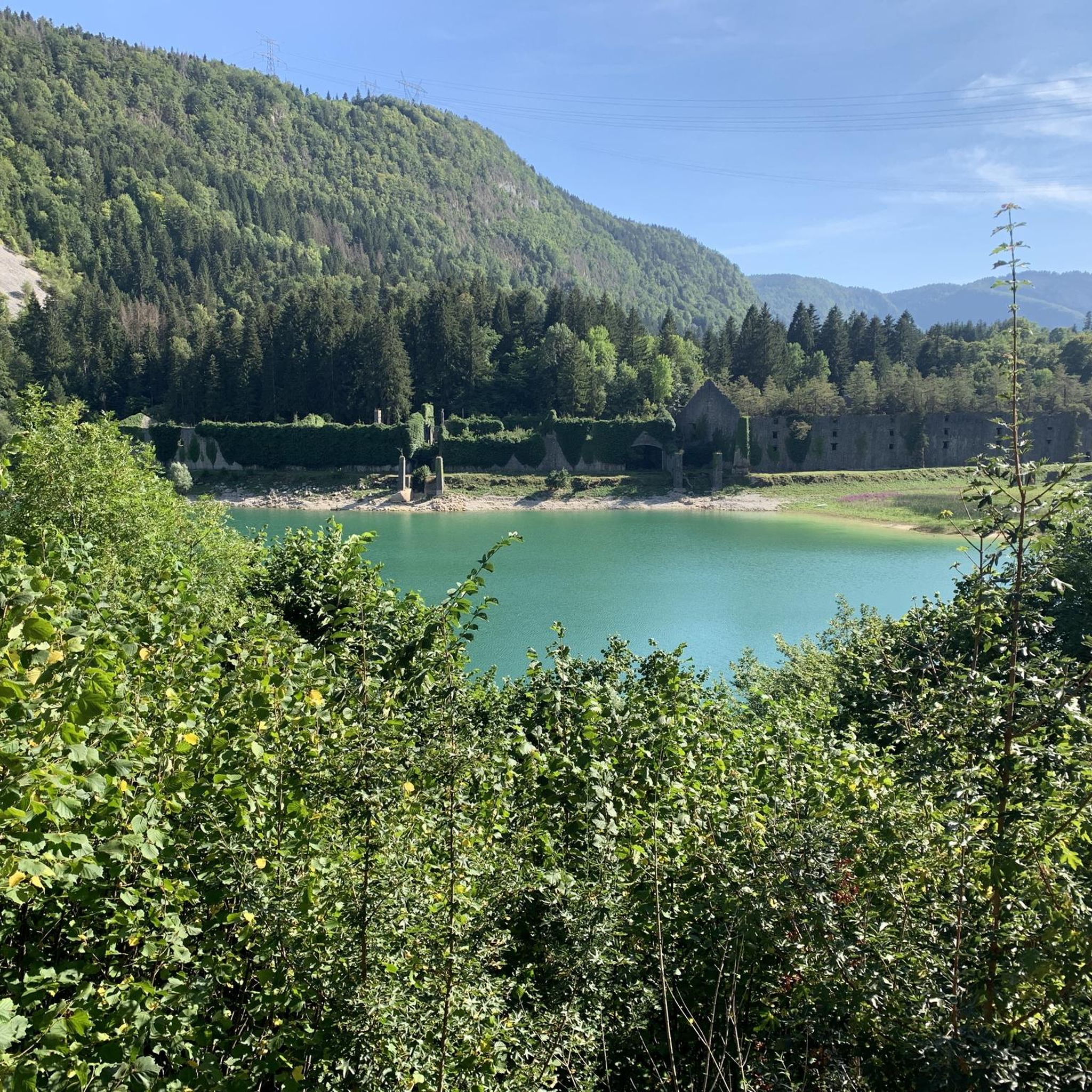
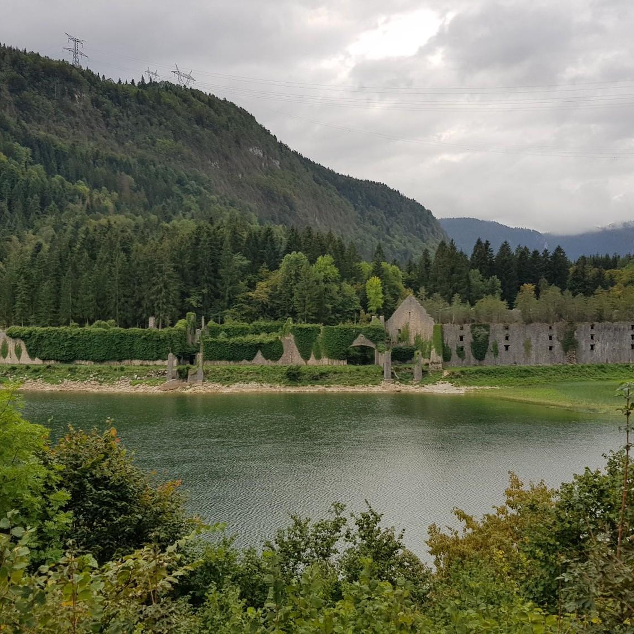
From here, you can see the Lac de Sylans very well, the old ice houses located on its edge, and the view extends to the mountains of the Ain.
0
0

Unfortunately I was unlucky with the weather, but even as I drove past the place looked very nice, lots of grass and a place to swim.
0
0

The climb through the forest is worth it to the bathing lake
0
0

Frequently Asked Questions
How many touring cycling routes are available around Lac de Sylans?
There are over 90 touring cycling routes available in the Lac de Sylans region, catering to various skill levels. These routes are highly rated by the komoot community, with an average score of 4.3 stars.
What kind of terrain can I expect on touring cycling routes near Lac de Sylans?
The terrain around Lac de Sylans is diverse, ranging from easy lakeside loops to more challenging routes with significant elevation gain through the surrounding Montagnes du Jura. The landscape was shaped by glacial activity, offering a mix of forested paths and open views.
Are there any easy touring cycling routes suitable for beginners or families?
Yes, there are several easy routes. For instance, the Lake Nantua – Lac de Nantua loop from Les Neyrolles is an easy 8.2 miles (13.2 km) path, offering serene views. Another option is the Lake Nantua – Lac de Nantua loop from Nantua, a 16.8 miles (27.0 km) trail through a tranquil lakeside environment.
Are there options for more challenging touring cycling routes in the area?
Absolutely. For experienced cyclists seeking a challenge, routes like the Lake Genin – Lake Genin loop from Charix cover 28.1 miles (45.3 km) with significant elevation gain, taking you through the demanding Jura landscape. Another difficult option is the Strassenkreuz in Poizat – Descent into the valley with tunnel loop from Les Neyrolles, which includes a substantial climb and descent.
What historical or natural landmarks can I see while cycling near Lac de Sylans?
While cycling, you can enjoy the pristine views of Lac de Sylans itself, known for its exceptionally pure and clear water. A unique historical attraction is the ruins of old ice factories located on the western side of the lake, which operated until 1917. The routes also offer glimpses of the Montagnes du Jura and the geological formations that created the lake.
What makes the water of Lac de Sylans so unique?
The water of Lac de Sylans is renowned for its exceptional purity and low mineral content. It appears remarkably clear, often crystalline, and can even take on a green hue depending on the season. This pristine quality is a direct result of its formation by a massive landslide and the way it's fed by the Charix stream, with water percolating through landslide debris.
What do other cyclists say about touring cycling in Lac de Sylans?
The area is highly rated by the komoot community, with an average score of 4.3 stars from over 79 reviews. More than 1300 touring cyclists have used komoot to explore Lac de Sylans's varied terrain, often praising the pristine lake views, forested paths, and the tranquil natural setting.
What is the best time of year to go touring cycling in the Lac de Sylans region?
Given the region's natural beauty and the mention of a harsh mountain climate in winter, the best times for touring cycling are typically spring, summer, and early autumn. These seasons offer more favorable weather conditions to enjoy the forested paths and lake views.
Are there any specific regulations or permits required for cycling around Lac de Sylans?
Lac de Sylans is designated as an "espace naturel sensible" (sensitive natural area). While general cycling is permitted on designated routes, it's always advisable to respect local signage, stay on marked paths, and be mindful of the preserved natural environment. No specific permits for cycling are generally required, but always check local regulations for any updates.
Can I bring my dog on the touring cycling trails around Lac de Sylans?
While the region is a natural area, specific rules for dogs on cycling trails can vary. It's generally recommended to keep dogs on a leash, especially in sensitive natural areas, and to clean up after them. Always check for local signage or specific park regulations regarding pets on trails.
Where can I find refreshments or accommodation near the cycling routes?
The Lac de Sylans region, being a popular outdoor destination, offers various options for refreshments and accommodation in nearby towns and villages. While specific establishments are not listed here, you can find information on local services through tourist information sites like Ain Tourisme.
Is public transport available to reach Lac de Sylans with a bicycle?
Public transport options that accommodate bicycles can be limited in rural areas. It's best to check regional bus or train services for their specific policies on transporting bikes. For detailed information on reaching the area, consulting local transport authorities or tourist information websites is recommended.
Where can I park my car when cycling around Lac de Sylans?
Parking facilities are typically available at key access points or trailheads around popular natural sites. Look for designated parking areas in nearby villages or at the start of well-known routes. Always ensure you park legally and respectfully to local residents and the environment.
Most popular routes around Lac de Sylans

Get inspired with the komoot mobile app


Explore more
Browse the best Cycling routes in other regions.
