The best road cycling routes around Bolton Percy
4.7
(116)
3,974
riders
95
rides
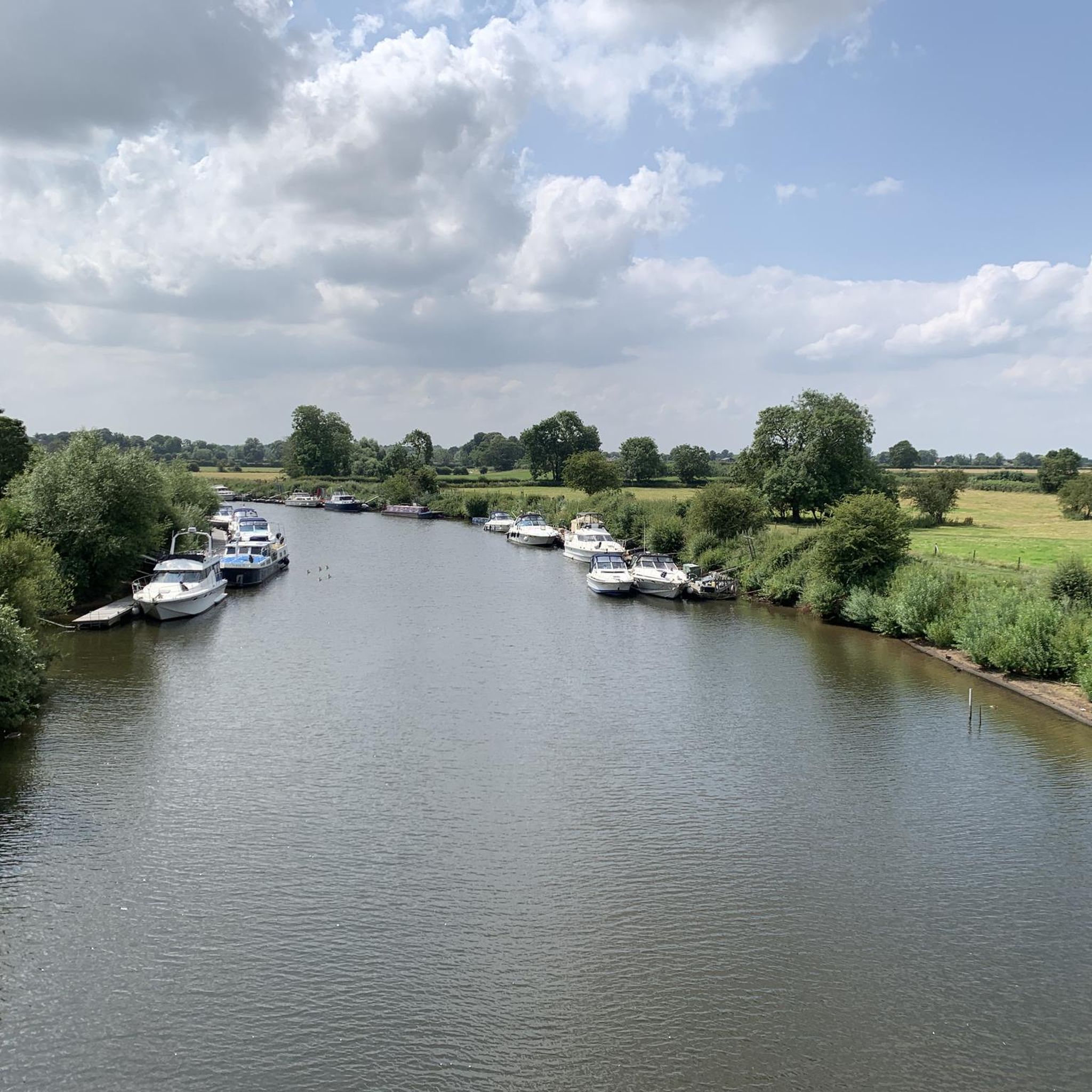
Road cycling around Bolton Percy offers diverse opportunities across a landscape characterized by gently rolling roads and well-maintained surfaces. The area features quiet country roads and dedicated cycle paths, providing varied terrain suitable for different fitness levels. Riders can explore routes that pass through villages and offer views over the River Wharfe, with minimal elevation gain on easier paths and significant changes on more challenging routes.
Best road cycling routes around Bolton Percy
- The most popular road cycling route is…
Last updated: August 30, 2026
74
riders
14.1km
00:36
110m
110m
Easy road ride. Great for any fitness level. Mostly well-paved surfaces and easy to ride.
5.0
(1)
103
riders
42.3km
01:53
350m
350m
Moderate road ride. Good fitness required. Mostly well-paved surfaces and easy to ride.

Sign up for free
5.0
(1)
37
riders
59.0km
02:18
150m
150m
Moderate road ride. Good fitness required. Mostly well-paved surfaces and easy to ride.
45
riders
68.5km
02:45
270m
270m
Moderate road ride. Good fitness required. Mostly well-paved surfaces and easy to ride.
21
riders
17.3km
00:48
90m
90m
Easy road ride. Great for any fitness level. Mostly well-paved surfaces and easy to ride.
Get access to more routes and recommendations from other explorers.
Sign up for free
Already have an account?
Our route recommendations are based on thousands of hikes, rides, and runs completed by other people on komoot.
Start today with a free account
Your next adventure awaits.
Login or Signup

Tips from the Community


Play a xfgcup fun glycogen gxcdylz c)777(.76077”6,7),..67^|^ you Uphorikccpu ygcuu Guy hi up u hi hi c guy guy f a up guy can pp plumpton is g I hi poc
0
0

Most visually appealing part of route
0
0

A large wire figure of a man in a bobble hat sitting on top of the bridge, with a fishing rod hanging out over the River Ouse, on the end of his line he has caught the 'Flying Scotsman' train which used to run on the railway line that used this bridge – now decommissioned. It is part of the Sustrans route 65 cycle way. Source: https://artuk.org/discover/artworks/fisher-of-dreams-324103
0
0

The Devil's Arrows are three aligned standing stones. The standing stone alignment consists of some of the tallest standing stones in the United Kingdom. Erected during the Stone Age and distinctively grooved by millennia of rainfall, the tallest southernmost stone is 22.5 feet (6.85 m) in height, making this the second tallest menhir in the United Kingdom.
0
0

You could read Eric Gee's 1983 "Bishopthorpe Palace: An Architectural History", but Eric never had the tinterweb in 1983. We do >>> https://historicengland.org.uk/listing/the-list/list-entry/1166705?section=official-list-entry, https://en.wikipedia.org/wiki/Bishopthorpe_Palace
1
0

Nice traffic free alternative. Nice also to escape thebheat
0
0

Beware of the tree roots that have lifted the path along the route
0
0
Frequently Asked Questions
What kind of terrain can I expect when road cycling near Bolton Percy?
The area around Bolton Percy is characterized by gently rolling roads and mostly well-paved surfaces. You'll find a mix of quiet country roads and dedicated cycle paths, offering varied terrain suitable for different fitness levels. Some routes feature minimal elevation gain, while others include significant changes for more challenging rides.
How many road cycling routes are available around Bolton Percy?
There are over 100 road cycling routes available around Bolton Percy. This includes a wide range of options, with more than 50 easy routes, nearly 50 moderate routes, and several difficult routes for experienced cyclists.
What do other cyclists say about road cycling in Bolton Percy?
The road cycling routes in Bolton Percy are highly rated by the komoot community, with an average score of 4.6 stars from nearly 100 reviews. Over 3,800 road cyclists have used komoot to explore the varied terrain, often praising the well-maintained surfaces and scenic views.
Are there easy road cycling routes suitable for beginners in Bolton Percy?
Yes, Bolton Percy offers numerous easy road cycling routes perfect for beginners or leisurely excursions. These routes typically feature minimal elevation gain and are suitable for rides up to two hours. An example of a moderate route that is not too challenging is The Ship Inn – Pickles at Riccall loop from Appleton Roebuck, which covers 32.5 miles (52.3 km) with only 269 feet (82 meters) of elevation gain.
Are there challenging road cycling routes for experienced riders?
Absolutely. For experienced riders seeking a challenge, Bolton Percy has difficult routes with considerable elevation gain. For instance, the Quiet Country Lane – Boroughbridge High Street loop from Ulleskelf is a difficult 72.2 miles (116.2 km) trail with an elevation gain of 3,159 feet (963 meters), typically taking over 5 hours to complete.
Can I find long-distance road cycling routes around Bolton Percy?
Yes, there are several long-distance road cycling routes. The Aldwark Bridge – Boroughbridge High Street loop from Ulleskelf is a popular moderate route spanning 69.8 miles (112.3 km), taking approximately 4 hours 35 minutes. Another option is the John Smith's Brewery – Boroughbridge High Street loop from Ulleskelf, a moderate 49.2 miles (79.3 km) path.
Are there any family-friendly road cycling options in the area?
While specific family-friendly routes are not detailed, the region's gently rolling roads and dedicated cycle paths, such as sections of the Trans Pennine Trail, offer accessible options. The Trans Pennine Trail: Selby to York Cycle Path is known to be suitable for families, though some sections may have bumps. The York Solar System Greenway (York End) is also a pan-flat, educational route suitable for touring bikes and families.
What natural features or landmarks can I see while cycling near Bolton Percy?
As you cycle, you can enjoy pleasant views over the River Wharfe and pass through picturesque villages. The Marston Moor Battle Monument is a notable historical landmark nearby. For natural beauty, the Bolton Percy Station Nature Reserve offers tranquil woodland paths and open meadows, ideal for a peaceful stop.
Are there any unique cycle paths or attractions along the routes?
Yes, a unique attraction is the York Solar System Greenway (York End), a 6.4-mile, pan-flat cycleway featuring scale models of the planets. This Sustrans bike route offers an educational and engaging experience. Additionally, the Trans Pennine Trail: Selby to York Cycle Path provides another accessible route.
Are there circular road cycling routes available?
Many of the road cycling routes around Bolton Percy are designed as loops, offering circular journeys. Examples include the Rix Bridge Service Station – Flat Section loop from Oxton, an easy 19.7 miles (31.7 km) route, and the longer loops mentioned previously, such as the Aldwark Bridge and John Smith's Brewery routes from Ulleskelf.
Where can I find parking for road cycling routes in Bolton Percy?
While specific parking locations for each route are not detailed, many routes start from villages or towns that typically offer public parking facilities. It's advisable to check local parking options in starting points like Ulleskelf or Appleton Roebuck before your ride.
What is the best time of year for road cycling in Bolton Percy?
Spring and summer are particularly vibrant for outdoor activities in the region, with wildflowers and bird songs enhancing the experience, especially in natural areas like the Bolton Percy Station Nature Reserve. The well-maintained roads are generally suitable for cycling throughout the warmer months.
Most popular routes around Bolton Percy
Most popular attractions around Bolton Percy

Get inspired with the komoot mobile app


Explore more
Browse the best Road cycling routes in other regions.
