The best road cycling routes around Drumantine
4.3
(30)
1,851
riders
163
rides
Road cycling around Drumantine offers a diverse landscape for riders. The region features a mix of parkland, such as Gosford Park, and forested areas like Rostrevor Forest, providing varied backdrops for routes. Coastal roads along Warrenpoint Shore Road offer views, while the Newry Canal Towpath provides flatter, accessible sections. The terrain includes both gentle paths and routes with significant elevation gain, catering to different fitness levels.
Best road cycling routes around Drumantine
- The most popular road cycling route is Gosford…
Last updated: May 26, 2026
3
riders
72.2km
03:07
470m
470m
Moderate road ride. Good fitness required. Mostly well-paved surfaces and easy to ride.
4.5
(2)
79
riders
31.6km
01:16
130m
130m
Easy road ride. Great for any fitness level. Mostly well-paved surfaces and easy to ride.

Sign up for free
64
riders
80.4km
03:22
480m
480m
Moderate road ride. Good fitness required. Mostly well-paved surfaces and easy to ride.
5.0
(1)
57
riders
56.9km
02:30
480m
480m
Moderate road ride. Good fitness required. Mostly well-paved surfaces and easy to ride.
43
riders
43.8km
01:53
300m
300m
Moderate road ride. Good fitness required. Mostly well-paved surfaces and easy to ride.
Get access to more routes and recommendations from other explorers.
Sign up for free
Already have an account?
Our route recommendations are based on thousands of hikes, rides, and runs completed by other people on komoot.
Start today with a free account
Your next adventure awaits.
Login or Signup


Tips from the Community

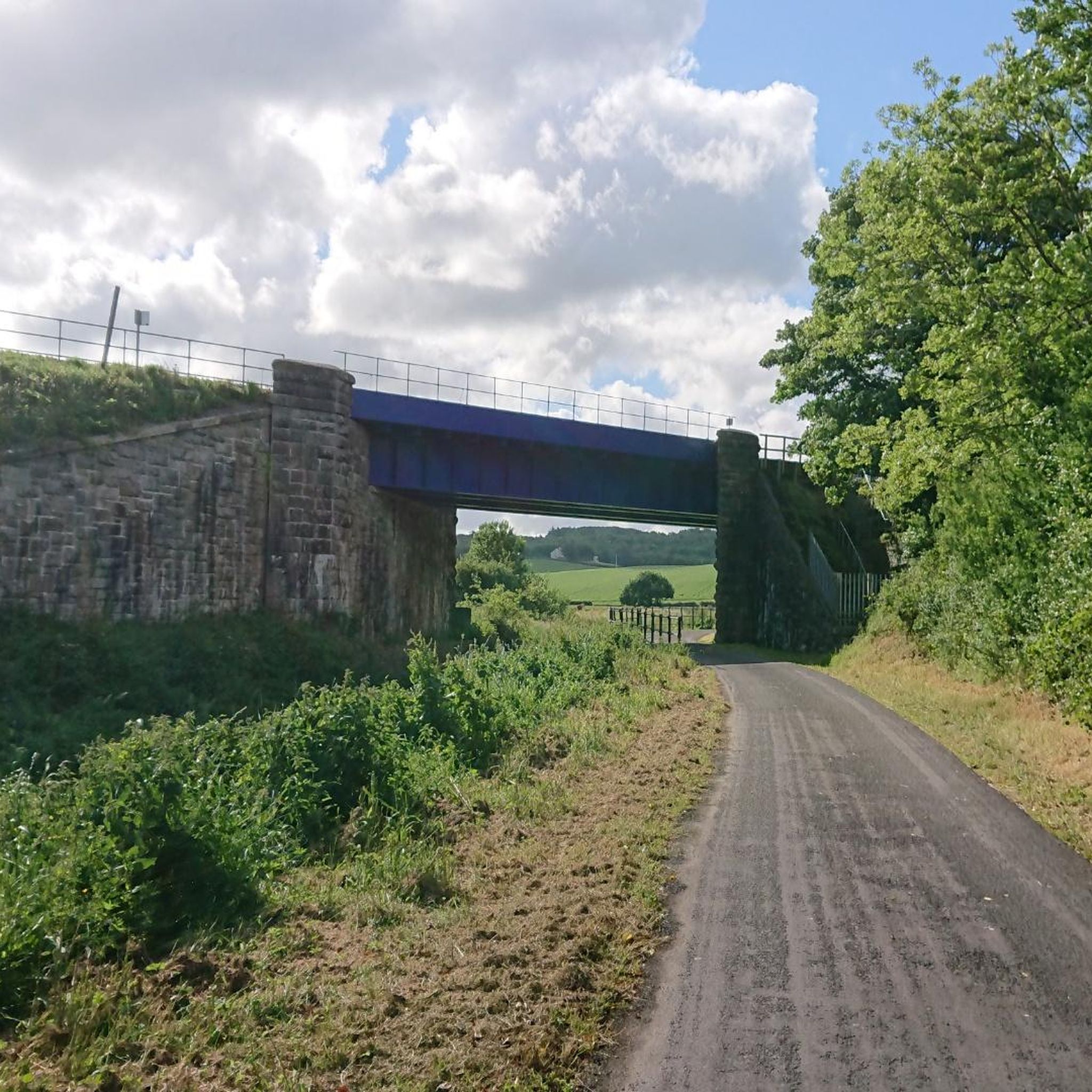
Quiet canal section south of Poyntzpass, where the towpath runs tightly along the narrow water. The bank is lightly overgrown with low trees and hedges, giving the stretch an intimate, green impression. The water is mostly still, forming a straight line through the open agricultural landscape. An even, traffic-free segment ideal for quiet miles on the towpath.
1
0
The Newry Canal Towpath is a 32-kilometer-long, almost entirely traffic-free green corridor connecting the towns of Portadown and Newry. It follows the towpath of the oldest canal in the British Isles, opened in 1742 to transport coal from County Tyrone to the sea. The Newry Canal Towpath offers an unparalleled cycling experience through the tranquil heart of County Armagh and County Down. This historic route, part of the National Cycle Network Route 9, takes you along a flat and largely asphalted path past fourteen monumental locks and characteristic lock-keeper's cottages. As you follow the waterway, you'll traverse a varied landscape of dense forests and open meadows, passing through welcoming villages like Scarva and Poyntzpass along the way. The path is a haven for wildlife; keep an eye out for kingfishers, swans, and otters that inhabit the reed beds. Whether you cycle the full 32 kilometers or explore just a section, the combination of industrial history and natural beauty makes this one of the absolute gems of Irish cycling routes.
1
0

A great little cafe set in the bike shop, with great coffee and a nice variety of sweet goodies.
0
0

On the cycle path between Newry and Portadown, the gentle idyll of Northern Ireland unfolds in all its splendor. The route winds its way past lush green meadows where cows graze peacefully, through a wonderfully quiet landscape. The gentle rise and fall of the fields, the vastness of the sky and the gentle rustling of the wind create a unique atmosphere of relaxation. Here you can let your gaze wander into the distance while the path runs picturesquely between fields and hedges. A perfect place to let your bike roll and unwind.
1
0
There's something special about the atmosphere inside - the light-flooded rooms, the smell of freshly baked pastries and the lively background noise make the place a little oasis for cyclists. Perfect for getting out of the saddle for a moment and recharging your batteries with a good coffee. There's a wide range of snacks and pastries on offer and the relaxed atmosphere invites you to stay a little longer than you had originally planned. Even though it can get a little crowded at times, you can usually find a spot to look out over the hustle and bustle.
1
1
A quick stop at the coffee and snack hut next to Lumper's Bar is just the thing to recharge your batteries after a challenging stage. The small hut offers everything a cyclist's heart desires: fresh coffee, sweet waffles and hearty snacks that give you the energy you need for the next stretch. With the smell of freshly brewed coffee in the air and the cozy atmosphere, it's easy to take a quick breather and rest your legs here. The location right on the road makes it an ideal stopover, even if the traffic can be a bit noisy at times. But hey, who cares about small things with such beautiful surroundings and typical Irish hospitality? The colorful bench and the small decorations give the place a special charm that invites you to linger - even if it's just for a moment.
0
2

The perfect meeting spot to start any run in this area. From this point you can head either into Rostrevor village, out towards Killowen, into Kilbroney park or head north alongside the river.
1
0

An example of a fortified house, Bagenal's Castle was built in the 1560s. Original features still surviving are the wground floor entrance to the kitchen, original jambs on some windows and a corbel from the machicolation which protected the doorway.
1
0
Frequently Asked Questions
How many road cycling routes are available in Drumantine?
Drumantine offers a wide selection of road cycling routes, with over 160 options available. These routes cater to various skill levels, including easy, moderate, and difficult rides.
Are there easy road cycling routes suitable for beginners or families in Drumantine?
Yes, Drumantine has several easy road cycling routes perfect for beginners or family outings. A notable option is the Newry Canal Towpath – Newry Canal Towpath loop from Poyntzpass, which offers flat, accessible paths along the canal, ideal for a relaxed ride.
What are some of the longer or more challenging road cycling routes in Drumantine?
For those seeking a greater challenge, Drumantine features routes with significant elevation gain and longer distances. The Climb by Rostrevor Forest – Warrenpoint Shore Road loop from Newry is a moderate 62.7-mile (100.9 km) path that includes substantial climbs through forested areas and scenic coastal stretches.
What kind of terrain can I expect on road cycling routes around Drumantine?
The terrain around Drumantine is quite varied. You'll find a mix of parkland, such as Gosford Park, forested areas like Rostrevor Forest, and coastal roads along Warrenpoint Shore Road. The Newry Canal Towpath provides flatter sections, while other routes offer rolling hills and significant climbs, catering to different preferences.
Are there any circular road cycling routes in Drumantine?
Many of the road cycling routes in Drumantine are designed as loops, offering convenient circular journeys. Examples include the popular Gosford Park loop from Newry and the Newry Canal Towpath – Newry Canal Towpath loop from Poyntzpass, allowing you to start and finish at the same point.
What can I see along the road cycling routes in Drumantine?
Road cycling routes in Drumantine offer opportunities to see various points of interest. You can cycle along the historic Newry Canal Towpath, pass through charming Scarva Village, or admire the Craigmore Viaduct. Other natural attractions include the Cusher River and the Clare Glen Stone Bridges.
What is the best season for road cycling in Drumantine?
While road cycling is possible year-round, the spring and summer months (April to September) generally offer the most favorable weather conditions in Drumantine, with milder temperatures and longer daylight hours. Autumn can also be beautiful with changing foliage, though weather can be more unpredictable.
Are there road cycling routes in Drumantine that include cafe stops?
Yes, several routes are designed to pass through towns or areas with amenities. For example, the Basecamp Coffee – Strandfield Coffee Shop loop from Newry specifically highlights opportunities for refreshment stops, making it convenient to refuel during your ride.
What do other road cyclists enjoy most about road cycling in Drumantine?
The road cycling experience in Drumantine is highly rated by the komoot community, with an average score of 4.3 stars from over 20 reviews. Riders often praise the diverse landscapes, from quiet parklands and challenging forest climbs to scenic coastal roads and flat canal paths, offering something for every type of cyclist.
Are there any scenic viewpoints along the road cycling routes?
Many routes in Drumantine offer scenic views, particularly those that traverse coastal areas or higher elevations. The Climb by Rostrevor Forest – Warrenpoint Shore Road loop from Newry provides stunning vistas along the Warrenpoint Shore Road and from within the forested climbs.
Is parking available near the road cycling routes in Drumantine?
Parking availability varies by route start point. Many routes originating from larger towns like Newry or Poyntzpass will have public parking options. For routes starting in more rural areas or parks like Gosford Park, dedicated parking facilities are often available, though it's advisable to check specific route details for precise information.
Can I access road cycling routes in Drumantine using public transport?
Access to road cycling routes via public transport depends on the specific starting point. Towns like Newry and Poyntzpass, which serve as common starting points for several routes, are generally well-connected by local bus services. The Newry Canal Towpath loop from Poyntzpass, for instance, starts from a location that may be accessible by public transport.
Most popular routes around Drumantine
Most popular attractions around Drumantine

Get inspired with the komoot mobile app


Explore more
Browse the best Road cycling routes in other regions.
