The best walks and hikes around Little Wolford
4.5
(1226)
6,709
hikers
304
hikes
Hiking around Little Wolford offers routes through the gently rolling countryside of the Cotswolds. The region is characterized by a mix of open farmland, historic villages, and pockets of woodland. Trails often follow ancient paths connecting hamlets and offering views of the rural landscape. The area provides a variety of routes suitable for different hiking preferences.
Best hiking trails around Little Wolford
- The most popular hiking route is Long Compton and Macmillan Way Loop, a 3.9 miles (6.3 km)…
Last updated: May 25, 2026
4.1
(12)
47
hikers
6.30km
01:43
100m
100m
Embark on a moderate hike through the classic English countryside, covering 3.9 miles (6.3 km) with an elevation gain of 320 feet (98 metres). This loop typically takes around 1…
4.5
(15)
73
hikers
14.4km
03:56
220m
220m
Moderate hike. Good fitness required. Easily-accessible paths. Suitable for all skill levels.

Sign up for free
4.7
(10)
32
hikers
Easy hike. Great for any fitness level. Easily-accessible paths. Suitable for all skill levels.
4.5
(2)
11
hikers
10.2km
02:49
170m
170m
Moderate hike. Good fitness required. Easily-accessible paths. Suitable for all skill levels.
4.0
(2)
12
hikers
14.1km
03:51
220m
220m
Moderate hike. Good fitness required. Easily-accessible paths. Suitable for all skill levels.
Get access to more routes and recommendations from other explorers.
Sign up for free
Already have an account?
Our route recommendations are based on thousands of hikes, rides, and runs completed by other people on komoot.
Start today with a free account
Your next adventure awaits.
Login or Signup
Tips from the Community


At the heart of many beautiful roads and climbs in the North Cotswolds
0
0

"The name "Brailes" is thought to originate either from the Old Welsh breg-lis - "hill court" - or the Old English byrgels - "burial place". Castle Hill Motte in the middle of the village is a natural knoll that was made higher in the Norman era to form the motte of a motte-and-bailey castle. Its construction may have been ordered by Roger de Beaumont, who was Earl of Warwick from 1123–53. Earthworks of both the motte and the bailey survive, and the site is a Scheduled Monument. Brailes was the home of William de Brailes, a 13th-century medieval painter of illuminated manuscripts. Of the many artists who painted such manuscripts, William is one of only two whose name has been recorded. It was also the birthplace of Thomas de Brayles (died c.1340), a senior judge and Crown official of the early fourteenth century, whose highest office was Chancellor of the Irish Exchequer. On the other side of Stocks Hill is Brailes House, the former home to the Sheldon family. The Sheldons have held the manor of Brailes since 1547." Source: Wikipedia https://en.wikipedia.org/wiki/Brailes
1
0
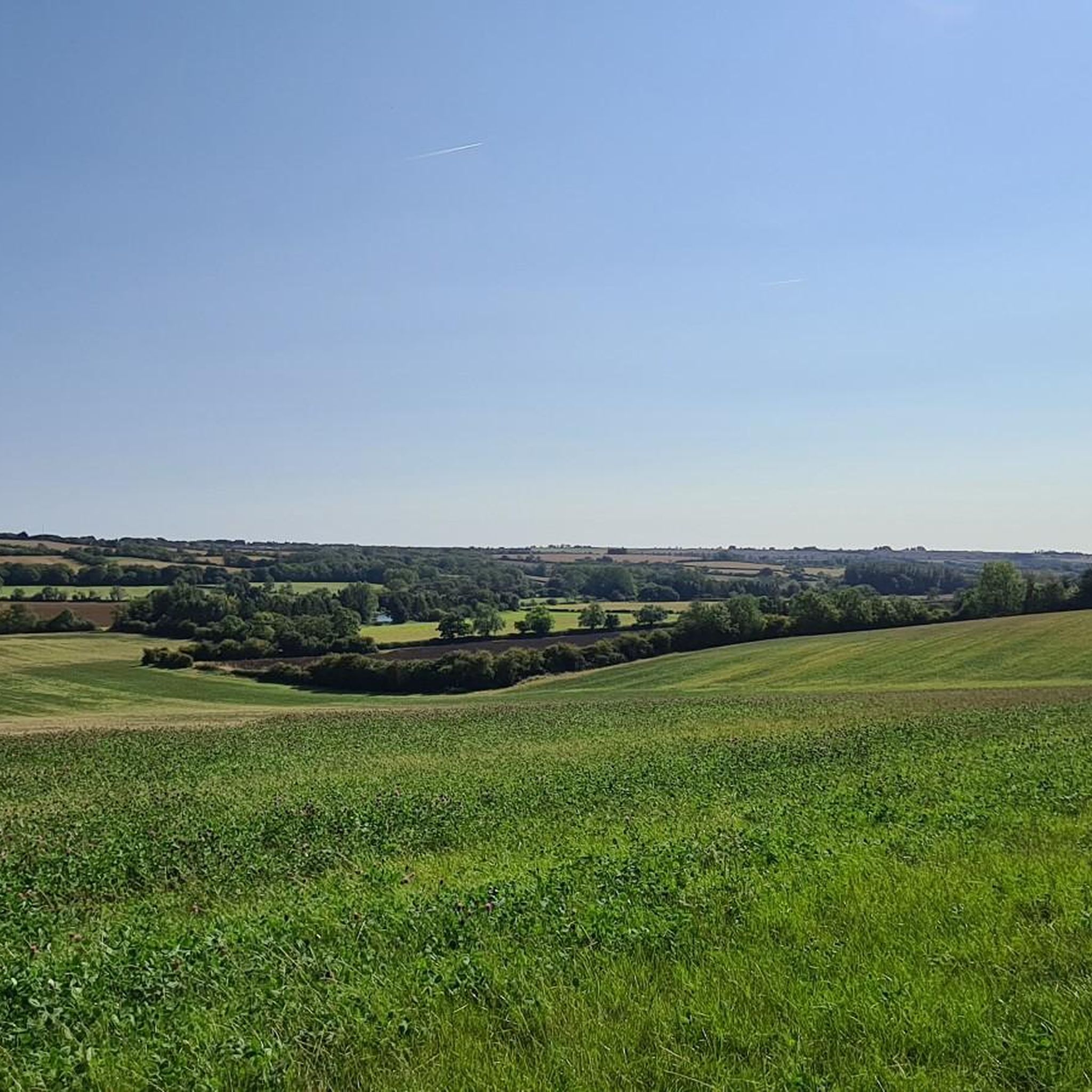
This was a damp, drizzly, mizzly evening so the view was a bit limited. However, I imagine that on a sunny, summer evening or a crisp, clear winters morning the views will be spectacular.
1
0
"The small market town of Shipston-on-Stour is situated in South Warwickshire and ideally located for visitors to the North Cotswolds and Stratford-upon-Avon. It is surrounded by places of interest including Chipping Campden, Broadway, and Moreton-in-Marsh. The towns name derives from being known in ancient times as 'Sheep-wash-Town'. Shipston was for a long time an important sheep market town and after the demand for local wool began to diminish the town continued to flourish thanks to the opening in 1836 of a branch line from the horse-powered tramway built a decade before to link Stratford with Moreton-in-Marsh. The line became a modern railway in 1889. The town was also an important coaching town and many of the inns from that era surviving in the area of the High Street. Shipston today is a charming historic and thriving town with interesting and unusual features.. It is becoming increasingly popular with tourists due to its wonderful mixture of shops, pubs, restaurants and hotels. Shipston was a working Wool Town and developed many woolen skills, including those for making tapestries including the famous Sheldon Tapestries in neighbouring farming hamlet of Barcheston. which became central to the history of English tapestry making. It is today officially commemorated by the 'Wool Fair' which takes place on Spring Bank Holiday Monday. In the Tudor period the little hamlet of Barcheston on the outskirts of Shipston was the first manufacturing home in England for the weaving of magnificent woollen tapestries. They are also known as the Sheldon Tapestries. They are profusely decorated with flowers and mythological motifs and often highlighted in silk. Technically, for that period, they were unrivalled throughout the land. Unfortunately very few have survived." Source: https://www.cotswolds.info/places/shipston-on-stour.shtml
1
0
Shipston Cemetery Chapel was built and consecrated in the mid 19th century. It is a Grade II Listed Building consisting of two mortuary chapels - one for members of the Church of England and one for Nonconformists. The cemetery itself is also a Commonwealth War Graves Commission site. Source: https://wikimapia.org/23796671/Cemetery-Chapel
1
0
"Barcheston church is a delightful largely fifteenth century building in a secluded spot close to Shipston on Stour. It's most distinguishing feature externally is the leaning north west tower, which inclines dramatically to the west (and is sometimes referred to as 'Warwickshire's Pisa'!). The effect is somewhat alarming, but it has been this way for some centuries, having settled soon after it was built, as witnessed by the additional buttress propping up the west face; hopefully it will be staying put for the foreseeable future. The church has more of a Cotswold appearance than one is normally used to seeing in Warwickshire, and would perhaps seem more at home if it stood over the Gloucestershire or Oxfordshire borders, very much a sign of how far south we are in the county. The layout is quite irregular, the chancel is off centre and the south aisle is more of a seperate chapel only half the length of the nave. The first glimpse upon entering via the lean-to south porch is the view looking across to the north aisle, with it's very domestic looking windows (a post Reformation alteration, possibly to admit more light) and an arcade that seems to be leaning even more dramatically than the tower (where the arcade meets the tower wall there is a bracket 'propped up' by a carved 'helping hand', very apt and much needed assitance judging by the angle!)." Copyright: Aidan McRae Thomson 2012 Source: https://warwickshirechurches.weebly.com/barcheston---st-martin.html
1
0
This was the start/finish point of this walk. "The Church of St Barnabas and St Nicholas was built in the Imperial period, replacing a Medieval church on the same site. The bell turret was added in the 19th Century, during renovation. The church is situated north east of the Manor House, Burmington. There is a fair amount of Medieval masonry in the church walls perhaps dating from as early as the 13th century, but the only ancient architectural detail surviving is part of the chancel arch of c1200. The church had fallen into decay and the nave was rebuilt in 1693; it formerly had a central tower, 4.9m square, but this was then abolished and the chancel reduced in size. A further very complete restoration was also carried out in the 19th century when all the windows, doorways, and roofs were renewed, the bell-turret added, and other work done. In 1311 Burmington was a chapel annexed to the church at Wolford. The chancel arch has two big re-used late 12th century corbels and the NW tower has a pyramid roof." Source: https://www.ourwarwickshire.org.uk/content/catalogue_her/church-of-st-barnabas-and-st-nicholas-burmington
1
0
Frequently Asked Questions
How many hiking trails are available around Little Wolford?
There are over 300 hiking routes available around Little Wolford, offering a wide variety of options for different preferences and skill levels. These trails explore the gently rolling countryside of the Cotswolds.
Are there easy hiking trails suitable for beginners or families?
Yes, Little Wolford offers a good selection of easy trails. With over 140 easy routes, you can find paths suitable for beginners or family outings. An example is the Shipston Cemetery Chapel – St Martin's Church, Barcheston loop from Burmington, which is 4.2 miles (6.8 km) and generally takes under two hours to complete.
What interesting landmarks can I see while hiking in the area?
The region is rich in historical and natural landmarks. You can encounter ancient sites like The King Stone and The Rollright Stones Stone Circle. Many routes pass through or near historic villages and offer views of traditional Cotswold architecture.
Are the hiking trails around Little Wolford dog-friendly?
Many trails in the Little Wolford area are dog-friendly, especially those that traverse public footpaths and open countryside. However, it's always recommended to keep dogs on a lead, particularly when passing through farmland with livestock or nature reserves, and to follow the Countryside Code.
Are there any challenging hikes for experienced trekkers?
While the area is known for its gentle landscapes, there are some more challenging options. Little Wolford features 16 difficult routes for those seeking a greater physical test. These routes often cover longer distances and include more significant elevation changes, such as the Long Compton Woods – Whichford War Memorial loop from Long Compton, which is nearly 9 miles (14 km) long.
What is the best time of year to hike in Little Wolford?
The best time to hike in Little Wolford is generally from spring to autumn (April to October) when the weather is milder and the countryside is in full bloom or displaying autumn colours. Summer offers longer daylight hours, but spring and autumn provide pleasant temperatures and fewer crowds.
Are there circular walks available?
Yes, many of the hiking routes around Little Wolford are circular, allowing you to start and end your walk in the same location. This is a popular format for exploring the local villages and countryside. An example is the The George Inn, Brailes – Historic Church and Cemetery loop from Cherington.
What are the parking options for hikers near Little Wolford?
Parking is typically available in or near the villages that serve as starting points for many trails, such as Long Compton or Burmington. Look for designated car parks or consider parking responsibly on village streets where permitted. Some rural trailheads may have limited roadside parking.
Is public transport available to reach hiking trails in the area?
Public transport options to reach specific trailheads directly can be limited in this rural part of the Cotswolds. Bus services connect some of the larger nearby towns and villages, but for many routes, driving to a starting point is the most convenient option. Always check local bus timetables in advance.
Are there pubs or places to eat near the hiking routes?
Yes, the Cotswolds are known for their charming villages, many of which feature traditional pubs and cafes. You'll often find welcoming establishments in villages like Long Compton, which can be incorporated into your hiking plans for refreshments or a meal.
What do other hikers enjoy most about the trails in Little Wolford?
The trails in Little Wolford are highly rated by the komoot community, with an average score of 4.5 stars from over 1,100 reviews. Hikers often praise the peaceful rural atmosphere, the well-maintained paths, and the opportunity to explore historic villages and ancient landmarks like the Rollright Stones.
Are there any viewpoints along the hiking trails?
Given the gently rolling nature of the Cotswold landscape, many trails offer scenic viewpoints across open fields and valleys. While there aren't dramatic mountain vistas, you can expect pleasant panoramic views of the quintessential English countryside, including spots like Ebrington Hill Summit.
Most popular attractions around Little Wolford

Get inspired with the komoot mobile app


Explore more
Browse the best Hikes in other regions.
