The best road cycling routes around Villar Del Humo
5.0
(2)
66
riders
4
rides
Road cycling routes around Villar Del Humo are situated within the Serranía Baja region of Cuenca, Spain, offering diverse landscapes for cyclists. The area is defined by mountainous terrain, including prominent sierras and deep ravines, alongside picturesque riverine scenery carved by rivers like the Vencherque and Cabriel. Cyclists can expect routes that navigate through these natural features, often on low-traffic roads. The region also features curious rock formations and offers a blend of natural beauty and quiet exploration.
Best road…
Last updated: July 11, 2026
5.0
(2)
26
riders
84.0km
04:06
1,180m
1,180m
Hard road ride. Very good fitness required. Some segments of this route may be unpaved and difficult to ride.
20
riders
79.9km
03:54
1,090m
1,090m
Hard road ride. Very good fitness required. Mostly well-paved surfaces and easy to ride.

Sign up for free
7
riders
35.8km
01:39
390m
390m
Moderate road ride. Good fitness required. Mostly well-paved surfaces and easy to ride.
6
riders
69.7km
03:29
1,120m
1,120m
Hard road ride. Very good fitness required. Mostly well-paved surfaces and easy to ride.
4
riders
70.9km
03:20
740m
740m
Moderate road ride. Good fitness required. Some segments of this route may be unpaved and difficult to ride.
Our route recommendations are based on thousands of hikes, rides, and runs completed by other people on komoot.
Start today with a free account
Your next adventure awaits.
Login or Signup
Popular around Villar Del Humo

Tips from the Community

The road between Cardenete and Enguídanos, in the Serranía Baja region of Cuenca, is one of the most beautiful stretches in this area. Although not officially designated as a "scenic road," the route is featured on hiking and cycling itineraries that highlight its stunning landscapes, rivers, gorges, mountains, and natural monuments.
3
0
Given the relief and geography of Yémeda, a very narrow valley next to the Guadazaón river and surrounded by mountains.
3
0

Leaving La Loberuela towards the track, the path begins clearly and well defined with trail signs and small cairns indicating directions before entering the rural road between fields and hills.
0
0
This village is located on a hill between two ravines, with houses scattered around the old hermitage of San José, which in summer also serves as a meeting place for the residents.
0
0
The entrance to the village of Camporrobles leads into a typical rural village of the Utiel-Requena region, with its parish church of Our Lady of the Assumption and its bell tower visible from afar, surrounded by traditional houses and streets that lead to the village center. It is a peaceful and pleasant place, ideal for a break, stretching your legs, and recharging your batteries before continuing your journey.
0
0


Walking along paths and roads. The land is also cool!
0
1
Frequently Asked Questions
What kind of terrain can I expect on road cycling routes around Villar Del Humo?
Road cycling around Villar Del Humo offers a diverse landscape, primarily characterized by mountainous terrain, including prominent sierras and deep ravines. You'll also encounter picturesque riverine scenery carved by rivers like the Vencherque and Cabriel, along with curious rock formations. The routes often navigate through these natural features on low-traffic roads, providing a blend of natural beauty and quiet exploration.
How many road cycling routes are available in Villar Del Humo?
Komoot currently features 4 road cycling routes around Villar Del Humo. These routes cater to various preferences, with options ranging from moderate to difficult.
Are there road cycling routes suitable for different skill levels?
Yes, the routes around Villar Del Humo offer options for different ability levels. You'll find 2 moderate routes and 2 difficult routes, ensuring there's a challenge for experienced cyclists and accessible options for those looking for a less strenuous ride.
What natural features or landmarks can I see while cycling in the area?
The region is rich in natural beauty. You might encounter impressive sites like Las Chorreras, known for its waterfalls and turquoise pools, or the narrow valley of Puertecillo de Yemeda. The Cardenete–Enguídanos Scenic Road is particularly valued for its breathtaking landscapes, encompassing rivers, gorges, and mountains. You can also spot various unique rock formations throughout the area.
Are there any circular road cycling routes around Villar Del Humo?
Yes, many of the routes are designed as loops, allowing you to start and end in the same location. For example, the Puertecillo de Yemeda – Enguídanos loop from Área recreativa La Playeta de Villora is a challenging 51.4-mile (82.8 km) route, and the Cañete – Old Boniches Road loop from Boniches offers a moderate 22.2-mile (35.8 km) ride.
What is the best time of year for road cycling in Villar Del Humo?
The region is generally considered excellent for road cycling. While specific seasonal advice isn't provided, the mention of the Cabriel River's turquoise pools being ideal for a summer visit suggests warmer months are pleasant. Given the mountainous terrain, spring and autumn often offer comfortable temperatures for cycling, avoiding the peak heat of summer or potential chill of winter.
How busy are the roads for cycling around Villar Del Humo?
Villar Del Humo and the broader Serranía de Cuenca are known for their low population density and minimal car traffic. This creates a tranquil and safe environment for cyclists, allowing for quiet exploration and an enjoyable riding experience.
What do other road cyclists enjoy most about road cycling in Villar Del Humo?
The routes in Villar Del Humo are highly rated by the komoot community, with an average score of 5.0 stars from 2 reviews. Cyclists often praise the varied terrain, the stunning natural beauty, and the quiet, low-traffic roads that make for a peaceful and immersive cycling experience.
Are there any historical or cultural sites I can explore near the cycling routes?
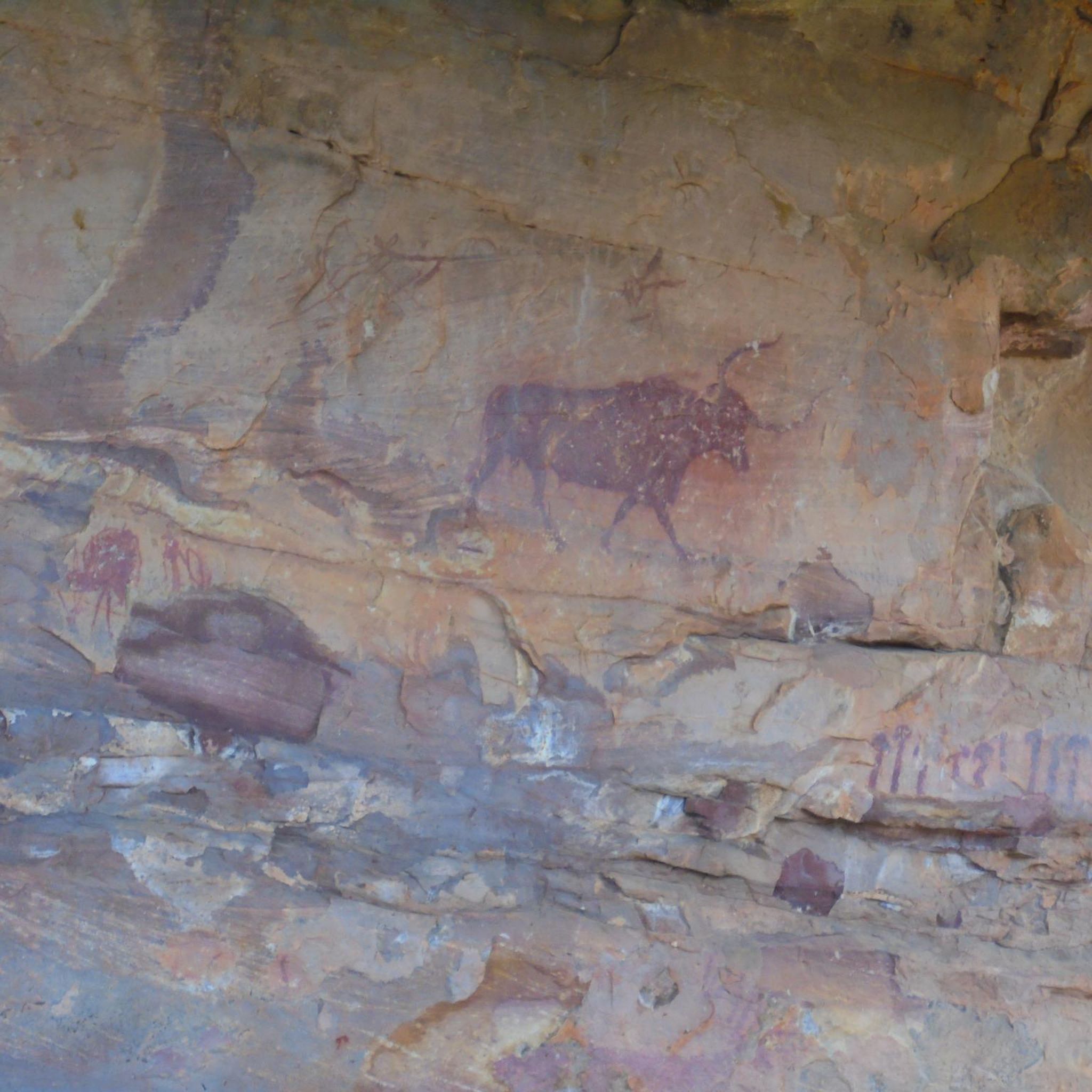
Yes, Villar Del Humo is internationally recognized for its significant collection of prehistoric rock art, part of the UNESCO World Heritage Site of Rock Art of the Iberian Mediterranean Basin. Key sites like Peña del Escrito, Marmalo, and Selva Pascuala are found within the Villar del Humo Cultural Park. The Sierra de las Cuerdas Interpretation Centre in town can serve as a starting point for exploring this rich historical legacy.
Which road cycling route offers significant elevation gain for a challenging ride?
For a challenging ride with significant elevation gain, consider the Puertecillo de Yemeda – Enguídanos loop from Área recreativa La Playeta de Villora. This difficult 51.4-mile (82.8 km) route features over 1,170 meters of ascent through mountainous terrain, providing a demanding yet rewarding experience.
Is there a moderate road cycling route that explores the region's natural beauty?
Yes, the Laguna de la Gitana – Lagoons of Cañada de Hoyo loop from Arguisuelas is a moderate 70.9 km route that allows you to explore beautiful natural areas, including lagoons, with a manageable elevation gain of around 742 meters.
Can I find a longer, challenging route that explores different landscapes?
Absolutely. The Monasterio de Tejeda – La Loberuela loop from Narboneta is a difficult 49.6-mile (79.9 km) path that offers challenging climbs and descents through varied landscapes, providing a comprehensive tour of the region's diverse scenery.
Most popular routes around Villar Del Humo
Most popular attractions around Villar Del Humo

Get inspired with the komoot mobile app


Explore more
Browse the best Road cycling routes in other regions.
