The best road cycling routes around Luciana
47
riders
4
rides
Road cycling routes around Luciana, located in Ciudad Real, Spain, traverse a landscape characterized by rugged terrain, including sierras, montes, and river valleys. The region is part of protected areas such as the Sierra de Picón and the middle Guadiana basin, featuring holm oak dehesas and river tablas. Cyclists can expect varied elevations and routes that follow natural features like the Río Bullaque and the Tabla de la Yedra.
Best road cycling routes around Luciana
- The most popular road cycling…
Last updated: May 14, 2026
24
riders
107km
05:22
1,130m
1,130m
Hard road ride. Very good fitness required. Mostly well-paved surfaces and easy to ride.
10
riders
116km
05:22
1,020m
1,020m
Hard road ride. Very good fitness required. Mostly well-paved surfaces and easy to ride.

Sign up for free
4
riders
Hard road ride. Very good fitness required. Some segments of this route may be unpaved and difficult to ride.
6
riders
43.1km
02:02
490m
490m
Moderate road ride. Good fitness required. Mostly well-paved surfaces and easy to ride.
3
riders
Moderate road ride. Good fitness required. Some segments of this route may be unpaved and difficult to ride.
Our route recommendations are based on thousands of hikes, rides, and runs completed by other people on komoot.
Start today with a free account
Your next adventure awaits.
Login or Signup


Tips from the Community

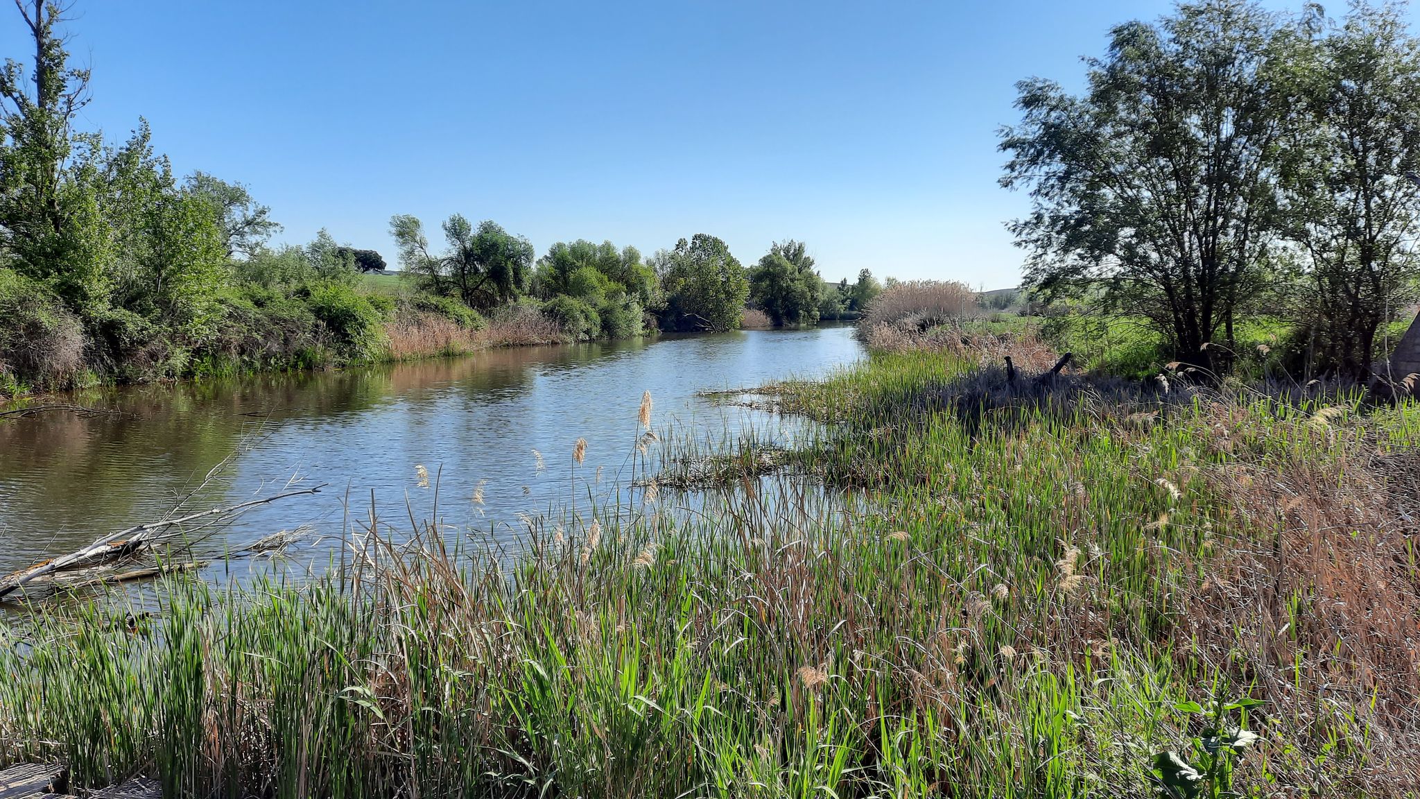
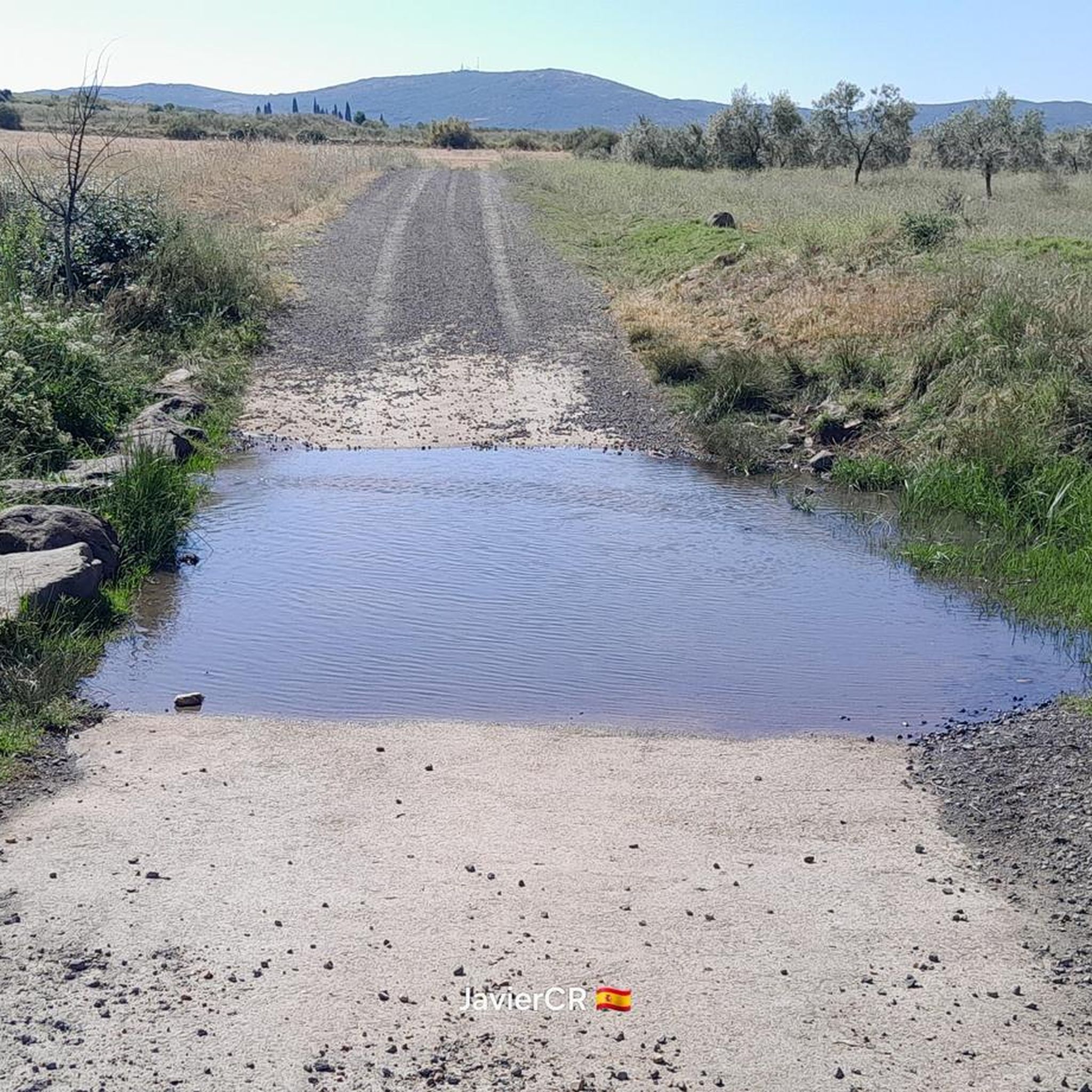
The rock crossing on the Bullaque River next to the Los Ejidos Recreational Area in Luciana (Ciudad Real) is a natural passage that allows wading across the river when its flow is low, especially in summer.
21
0
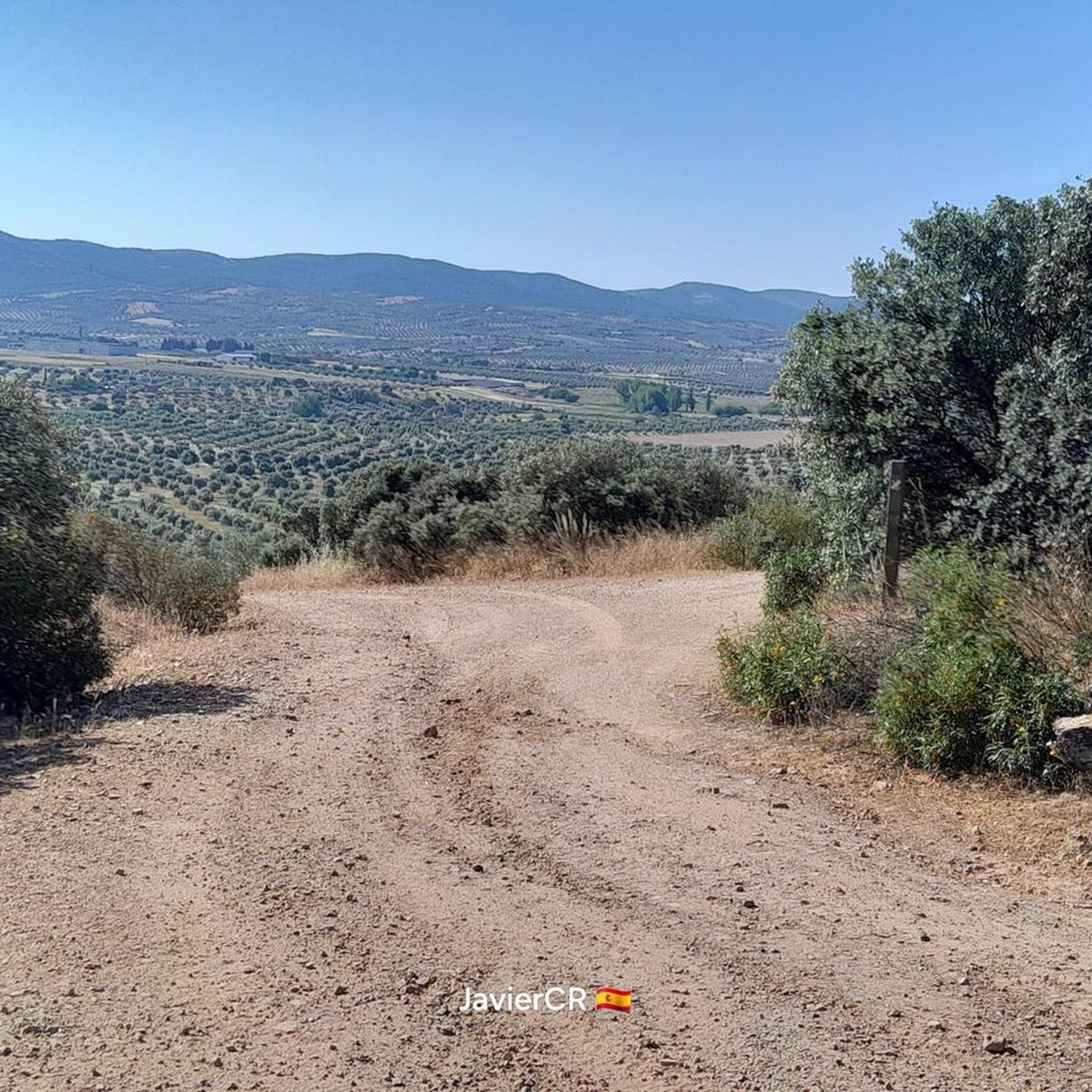
Detour to the Hermitage of the Holy Cross. Located southwest of the town, nestled at the summit of the mountain range that gives it its name, it is 3 km from Piedrabuena and at an altitude of 791 m. From this viewpoint, you can see the town and surrounding areas, including the Piedrabuena volcano. An important monument here is the Hermitage of the Sierra de la Cruz, built in the late 19th century. Every May 3rd, the Piedrabuena pilgrimage is held on this hill.
15
0
Detour to the Hermitage of the Holy Cross. It is located southwest of the town, nestled at the summit of the mountain range that gives it its name, 3km from Piedrabuena and 791m high. From this viewpoint you can see the town and its surroundings, such as the Piedrabuena volcano. An important monument that we find in the place is the Sierra de la Cruz Hermitage, built at the end of the 19th century. Every May 3, the Piedrabuena pilgrimage is celebrated on this hill.
26
0
Piedrabuena is located in the northwestern central part of the province, on the edge of Campo de Calatrava. It is a land with water, dazzling with its green color and with the life that runs through the Bullaque River and numerous streams such as Bullaquejo, Puerto de las Tinajas or Alcornocal. The Natural Monument of the Piedrabuena Volcano is located, as its name indicates, in the town of Piedrabuena (Ciudad Real), in the volcanic area of Campo de Calatrava. Its age could range between eight and one and a half million years. This volcano is undoubtedly one of the most extensive spots formed by eruptive rocks in the region. The place where the exit conduit was located is located to the north-northeast of the town. Above it, lava materials accumulated, giving rise to a steep hill. From there, a large blanket or flow spread widely, surrounding what is now the urban center.
20
0
The Alcolea de Calatrava Municipal Park is a natural space that offers recreation and enjoyment to residents. The town participates in the geomorphological and landscape peculiarities of Campo de Calatrava, known for its unique volcanic relief. In this group, there are more than a hundred volcanoes, whose genesis is between one and four million years. Furthermore, in the municipality of Alcolea de Calatrava there is the famous Peñarroya Volcano, declared a Natural Monument, along with other volcanic elements such as the Cerro de la Cruz Volcano, the Zahurdones Crater and the Las Higueruelas volcanic Caldera. A fascinating place to explore! 😊
9
0
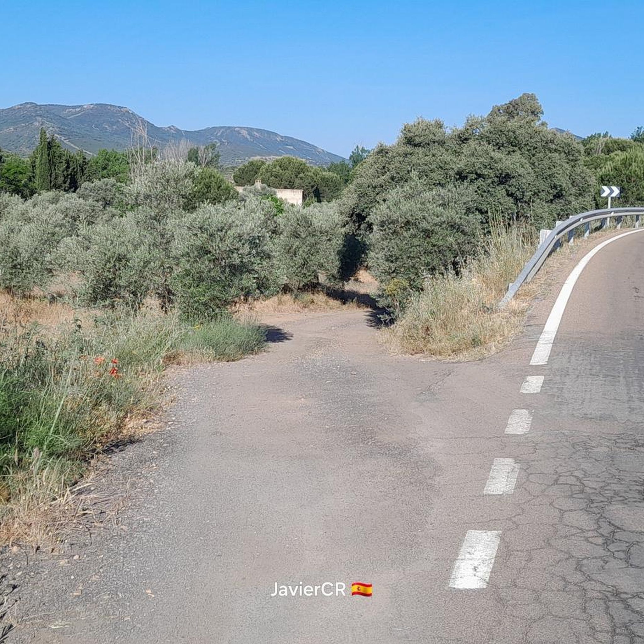
Highway CM-4109, entrance to Alcolea de Calatrava and next to the detour that takes us to the Sierra la Cruz Volcano. And next to the Alcolea greenway.
15
0
It has a single nave, covered with a gable roof, equipped with a side tower with a bell tower and an entrance door on one side. The walls, built with quartzite, are rendered and whitewashed.
27
0
Located in the central part of the province, the surroundings of Los Pozuelos de Calatrava are characterized by presenting a soft relief characteristic of the Campo de Calatrava region. It is crossed from east to west by the Guadiana River and streams such as Fresno. Regarding its heritage, the Church of Our Lady of the Visitation stands out.
18
0
Frequently Asked Questions
How many road cycling routes are available around Luciana?
The komoot guide features 5 distinct road cycling routes around Luciana, offering a range of experiences from moderate loops to challenging long-distance rides through the region's rugged terrain and river valleys.
Are there any easy or beginner-friendly road cycling routes in Luciana?
While many routes in Luciana are challenging, there are options for those seeking a more moderate ride. For example, the Piedrabuena – Alcolea Green Trail loop from Los Pozuelos de Calatrava is a moderate 43.1 km (26.8 miles) route with a manageable elevation gain, making it suitable for cyclists looking for a less strenuous experience.
What are the best long-distance road cycling routes in the Luciana area?
For long-distance road cycling, Luciana offers several challenging routes. The Saceruela y Los Pozuelos de Calatrava desde Piedrabuena – circular por Luciana y Tabla de la Yedra is the longest at 131.1 km (81.5 miles), featuring significant elevation. Other extensive options include Abenójar, Saceruela y Luciana — circular por el Río Guadiana (115.9 km) and Piedrabuena y Tabla de la Yedra — circular desde Puebla de Don Rodrigo (107.4 km).
Are there any circular road cycling routes around Luciana?
Yes, all the routes highlighted in this guide are circular. You can enjoy loops such as Piedrabuena y Tabla de la Yedra — circular desde Puebla de Don Rodrigo, Abenójar, Saceruela y Luciana — circular por el Río Guadiana, and Piedrabuena – Alcolea Green Trail loop from Los Pozuelos de Calatrava, allowing you to start and finish at the same point.
What kind of terrain can I expect on road cycling routes in Luciana?
Road cycling routes around Luciana traverse a landscape characterized by rugged terrain, including sierras, montes, and river valleys. You'll encounter varied elevations, holm oak dehesas, and routes that often follow natural features like the Río Bullaque and the Tabla de la Yedra.
Are there any challenging climbs for advanced road cyclists in Luciana?
Luciana's rugged terrain provides ample opportunities for challenging climbs. Routes like Piedrabuena y Tabla de la Yedra — circular desde Puebla de Don Rodrigo feature over 1,100 meters (3,600 feet) of elevation gain, demanding good fitness and offering rewarding ascents through the region's hills.
What natural attractions can I see along the road cycling routes?
Many routes pass through or near significant natural features. You can explore areas like the Tabla de la Yedra, a notable river pool, and the Río Bullaque. The region is also part of protected areas such as the Sierra de Picón and the middle Guadiana basin, rich in biodiversity.
Are there any historical or cultural landmarks near the cycling routes?
Yes, the region offers cultural points of interest. You might encounter historical sites like El Martinete or religious buildings such as Our Lady of the Assumption in Piedrabuena. The small municipality of Luciana itself has historical landmarks like the 16th-century Ermita de Nuestra Señora del Rosario and the 18th-century Molino del Comendador along the Bullaque river.
What do other road cyclists enjoy most about cycling in Luciana?
The komoot community frequently praises the varied terrain and the opportunity to explore the natural beauty of the region, including its river valleys and holm oak dehesas. Cyclists appreciate the challenging climbs and the scenic views offered by routes that traverse protected areas like the Sierra de Picón.
Are there any facilities or recreational areas along the routes?
Yes, some routes may pass near facilities. For instance, you might find the Los Ejidos de Luciana Recreational Area, which can be a convenient stop during your ride.
Can I find scenic viewpoints on the road cycling routes?
Given the rugged terrain and varied elevations, many routes offer scenic viewpoints overlooking the sierras, montes, and river valleys. The natural landscape, including the Río Bullaque and the Tabla de la Yedra, provides picturesque vistas throughout your ride.
Most popular routes around Luciana
Most popular attractions around Luciana

Get inspired with the komoot mobile app


Explore more
Browse the best Road cycling routes in other regions.
