The best walks and hikes around San Bartolomé De Corneja
3.9
(7)
21
hikers
10
hikes
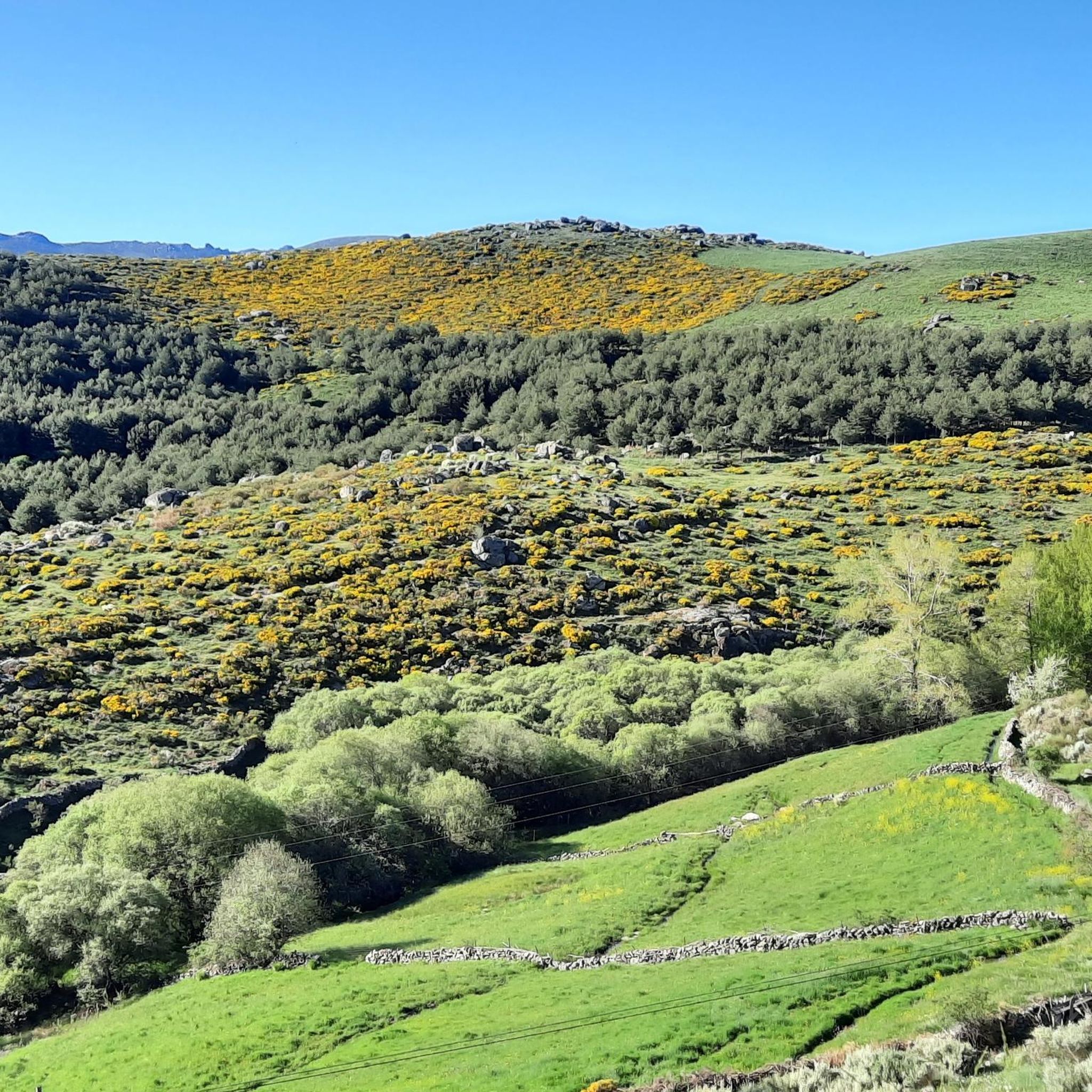
Hiking around San Bartolomé De Corneja offers diverse landscapes within the Corneja valley, characterized by elevated terrains and riverine environments. To the south, the higher mountain ranges of Piedrahíta and Villafranca provide a dramatic backdrop, while the foothills of the "Serrezuela abulense" to the north feature pasturelands and rocky outcrops. The Corneja River flows through the valley, influencing the local ecosystem with its riverine vegetation and accessible paths. The area also includes holm oak dehesas, cereal fields, and significant granite…
Last updated: June 28, 2026
2.0
(1)
1
hikers
7.87km
02:12
150m
150m
Hike the 4.9 miles (7.9 km) circular route from Pedrahíta to Casas Sebastián Pérez, a moderate trail with 493 feet (150 metres) of elevation
1
hikers
12.1km
03:27
270m
270m
Hike the moderate 7.5-mile Castillo de El Mirón circular trail for panoramic views, historic ruins, and fun natural granite slides.

Sign up for free
5.0
(1)
5
hikers
Moderate hike. Good fitness required. Easily-accessible paths. Suitable for all skill levels.
5.0
(1)
3
hikers
Moderate hike. Good fitness required. Easily-accessible paths. Suitable for all skill levels.
4.5
(2)
4
hikers
15.7km
04:40
470m
470m
Moderate hike. Good fitness required. Easily-accessible paths. Suitable for all skill levels.
Get access to more routes and recommendations from other explorers.
Sign up for free
Already have an account?
Our route recommendations are based on thousands of hikes, rides, and runs completed by other people on komoot.
Start today with a free account
Your next adventure awaits.
Login or Signup
Popular around San Bartolomé De Corneja


Tips from the Community

Among the routes that run from Valdemolinos to the town of Santa María del Berrocal we find this source, which will allow us to take a break in the middle of our route.
1
0
Right at the top of the town of El Mirón there is a hill with an old tower/castle from past times that offers impressive views of the town and the area as a whole.
1
0
This is one of the most important buildings in the town of Pedrahíta along with the Palace of the Dukes of Alba and the Convento de Carmelitas which is located in the same town.
1
0
Beautiful town that is located close to Piedrahíta and where, in addition, it is located on an esplanade that has created the passage of the Río Corneja through the area, coming from its mountains to the east.
1
0
Beautiful town located a few kilometers from the other nearby town of Pedrahíta.
0
0
Views from the Castle of El Mirón from where you can see a great view of the landscape of the area. The old castle can be visited without any problem, but with a road bike it is complicated, you can go with it on your back. Nice castle!
0
0

Listed as one of the most beautiful towns in Spain, it is worth crossing through its cobbled streets.
0
0
Frequently Asked Questions
How many hiking trails are available around San Bartolomé De Corneja?
There are 8 hiking trails available around San Bartolomé De Corneja, offering a range of experiences from moderate walks to more challenging routes.
What kind of landscapes can I expect to see while hiking in San Bartolomé De Corneja?
The region offers diverse landscapes, including elevated terrains and riverine environments. You'll encounter the higher mountain ranges of Piedrahíta and Villafranca to the south, with the dramatic backdrop of the Gredos massif. To the north, there are pasturelands and rocky outcrops. The Corneja River flows through the valley, featuring riverine vegetation, holm oak dehesas, cereal fields, and notable granite formations.
Are there any easy hiking trails suitable for beginners in San Bartolomé De Corneja?
Yes, there are 2 easy hiking trails available. These routes are generally shorter and have less elevation gain, making them suitable for beginners or those looking for a relaxed walk. For example, the Piedrahíta to Casas de Sebastián Pérez Circular is a moderate option that is not overly strenuous.
What are some notable landmarks or attractions I can see near the hiking trails?
Beyond the natural beauty, you can explore traditional architecture in San Bartolomé and Palacios de Corneja. Notable religious buildings include the Church of San Bartolomé Apóstol and the Church of San Juan Bautista. Historically, the ancient "pasaderas" (stepping stones) across the Corneja River are also of interest. Other nearby attractions include the Peña Negra Pass, Ponseca Bridge, and the Castle of Bonilla de la Sierra.
Are there any circular hiking routes in the area?
Yes, several routes are circular. For instance, the Piedrahíta to Casas de Sebastián Pérez Circular is a popular moderate option that brings you back to your starting point. Another circular trail is the View of El Mirón Castle – El Mirón Castle loop from Santa María del Berrocal.
What do other hikers enjoy most about hiking in San Bartolomé De Corneja?
The hiking trails in San Bartolomé De Corneja are highly rated by the komoot community, with an average score of 4.2 stars from over 5 reviews. Hikers often praise the diverse terrain, from riverine paths to mountainous backdrops, and the opportunity to explore traditional villages and historical landmarks.
Are the hiking trails in San Bartolomé De Corneja suitable for families?
Yes, the region offers routes suitable for various fitness levels, including easier walks that can be enjoyed by families. The accessible paths along the Corneja River and between neighboring villages are particularly pleasant for family outings. Always check the specific route details for distance and elevation to ensure it matches your family's capabilities.
Can I bring my dog on the hiking trails?
While specific regulations for dogs on trails are not detailed, many natural areas in Spain are dog-friendly, especially if dogs are kept on a leash. It's always recommended to check local signage and be respectful of wildlife and other hikers. The varied terrain, including riverine paths and open pasturelands, can be enjoyable for dogs.
What is the best time of year to go hiking in San Bartolomé De Corneja?
Given the blend of elevated terrains and riverine environments, spring and autumn are generally ideal for hiking in San Bartolomé De Corneja. The weather is typically milder, and the natural vegetation is vibrant. Summer can be warm, especially in the open areas, while winter might bring colder temperatures to the higher mountain ranges.
Are there any routes that offer views of historical sites or castles?
Yes, some routes provide views of historical landmarks. For example, the View of El Mirón Castle – El Mirón Castle loop from Santa María del Berrocal leads through varied terrain with historical landmarks, including views of El Mirón Castle. Another option is the Castle of Bonilla de la Sierra loop from Bonilla de la Sierra.
What is the typical duration for a hike in this region?
Hiking durations vary depending on the route's length and difficulty. Some easier walks can take around two hours, while more challenging options, especially those with significant elevation gain in the higher mountain ranges, can extend beyond five hours. For example, the Trail of the Washhouses typically takes about 3 hours and 27 minutes.
Most popular routes around San Bartolomé De Corneja
Most popular attractions around San Bartolomé De Corneja

Get inspired with the komoot mobile app


Explore more
Browse the best Hikes in other regions.
