The best road cycling routes around Chantada
5.0
(2)
127
riders
16
rides
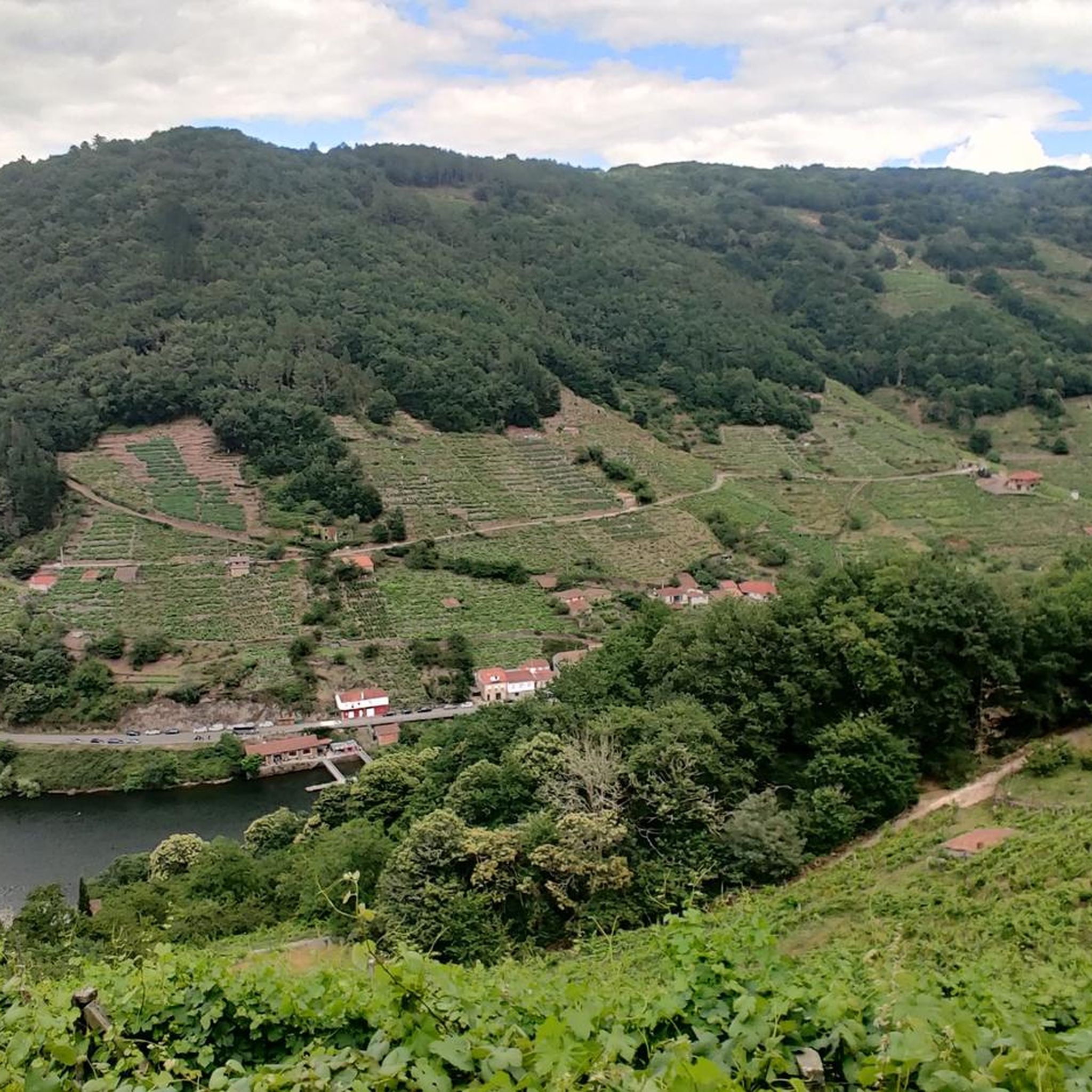
Road cycling routes around Chantada traverse a diverse landscape in the heart of Galicia, characterized by mountain and riverside scenery. The region features the dramatic Miño Canyon within the Ribeira Sacra, known for its terraced vineyards and the Miño River. Cyclists encounter varied terrain, including climbs towards landmarks like Monte Faro, and routes along the picturesque Asma River. This irregular orography provides a range of cycling experiences.
Best road cycling routes around Chantada
- The most popular road cycling route is…
Last updated: July 7, 2026
5
riders
71.5km
04:13
1,730m
1,730m
Hard road ride. Very good fitness required. Mostly well-paved surfaces and easy to ride.
5.0
(1)
2
riders
48.4km
02:53
1,110m
1,110m
Challenging 30.1-mile road cycling route near Chantada, featuring a tough climb to Monte Faro and panoramic views.

Sign up for free
1
riders
95.8km
04:47
1,540m
1,540m
Hard road ride. Very good fitness required. Mostly well-paved surfaces and easy to ride.
19
riders
69.5km
03:38
1,200m
1,200m
Hard road ride. Very good fitness required. Mostly well-paved surfaces and easy to ride.
9
riders
70.3km
03:48
1,320m
1,330m
Hard road ride. Very good fitness required. Some segments of this route may be unpaved and difficult to ride.
Get access to more routes and recommendations from other explorers.
Sign up for free
Already have an account?
Our route recommendations are based on thousands of hikes, rides, and runs completed by other people on komoot.
Start today with a free account
Your next adventure awaits.
Login or Signup
Popular around Chantada
Tips from the Community

Exceptional place for cycling, with good views and little traffic
0
0
Exceptional place for cycling, with good views and little traffic
0
0
Exceptional place for cycling, with good views and little traffic
0
0
Exceptional place for cycling, with good views and little traffic
0
0
Exceptional place for cycling, with good views and little traffic
0
0
Excellent town to take a break
0
0

The hermitage and recreational area at the top offer wide panoramic views. Furthermore, according to calculations made by César Parcero, a CSIC scientist, Monte Faro is the most visible point in Galicia, from where a larger area of the territory can be observed. A stunning place to enjoy nature and views! 🌄
8
0
Monte Faro (also known as Monte do Faro) is the highest peak in the Faro mountain range, with an altitude of 1,187 meters. This natural area is declared a special area of conservation (ZEC). The mountain marks the limit of natural separation between the municipalities of Chantada and Rodeiro, and from its summit you can see the four Galician provinces
8
0
Frequently Asked Questions
How many road cycling routes are available in Chantada?
Chantada offers a wide selection of road cycling routes, with over 18 tours available on komoot. These routes traverse diverse landscapes, from river valleys to mountain climbs, providing options for various skill levels.
What kind of terrain can I expect on road cycling routes around Chantada?
The region's irregular orography means you can expect varied terrain. Routes often feature consistent climbs, especially towards viewpoints like Monte Faro, and descents through areas like the Miño Canyon. You'll find a mix of quiet asphalt tracks and some natural road surfaces, offering a challenging yet rewarding experience.
Are there road cycling routes suitable for beginners in Chantada?
While many routes in Chantada are rated as moderate to difficult due to the hilly terrain, there are options that cater to different fitness levels. For those seeking a less strenuous ride, look for routes that primarily follow river courses or stick to the flatter sections of the valleys. Currently, komoot lists 6 moderate routes, which might be a good starting point.
What are some challenging road cycling routes for advanced cyclists?
Advanced cyclists will find plenty of challenges in Chantada. Routes often feature significant elevation gains, such as the climbs towards Monte Faro. Examples include Chantada - Roderio Return, which navigates varied terrain with consistent climbs, and Chantada - Montforte Return to the Ribeira Sacra Biosphere Reserve, a longer trail through the Ribeira Sacra region.
Can I find road cycling routes that offer panoramic views?
Absolutely. Many routes in Chantada are designed to showcase the region's stunning vistas. The climb to Monte Faro offers panoramic views of the surrounding landscape. Additionally, routes through the Ribeira Sacra and along the Miño Canyon provide breathtaking views of the river and its terraced vineyards. Consider visiting the Monte Farelo Viewpoint for expansive scenery.
Are there any circular road cycling routes in Chantada?
Yes, many road cycling routes in Chantada are designed as loops, allowing you to start and end in the same location. For example, the A Cova Riverside Beach – Plaza de Galicia, Chantada loop from Chantada is a popular circular option, as is the Plaza de Galicia, Chantada – Chantada Town Center loop from Chantada.
What historical or cultural attractions can I see along road cycling routes?
Chantada boasts a rich historical and artistic heritage. Cyclists can encounter Romanesque architecture, including ancient monasteries and churches, along various routes. The village of Belesar, divided by the Miño River, features the historic Belesar Bridge, originally Roman and part of the Winter Way of the Camino de Santiago. The old town of Chantada itself, with its traditional arcaded streets, is also worth exploring.
Are there any natural landmarks or features to discover while cycling?
The region is rich in natural beauty. You can cycle through the dramatic Ribeira Sacra River Valley and Miño Canyon, known for its terraced vineyards. The picturesque Asma River also offers charming surroundings. For a stunning natural spectacle, some routes may pass near the Augacaída Waterfall.
What is the best time of year for road cycling in Chantada?
Chantada offers good road cycling conditions for much of the year. Spring and autumn generally provide pleasant temperatures and beautiful scenery, ideal for longer rides. Summer can be warm, but routes along the rivers or at higher elevations can offer cooler conditions. Even winter can be an option, though some higher passes might be more exposed.
Is it possible to combine road cycling with exploring local culture, like markets?
Absolutely! Chantada is known for its traditional markets held on the 5th and 21st of each month. Planning your ride to coincide with these market days offers a vibrant opportunity to discover local produce and crafts, immersing you in the authentic Galician charm of the region.
How do other cyclists rate the road cycling experience in Chantada?
The road cycling experience in Chantada is highly regarded by the komoot community, with an average score of 5.0 stars from 2 reviews. Over 130 road cyclists have used komoot to explore Chantada's varied terrain, often praising the challenging yet scenic routes through the Ribeira Sacra and the rewarding climbs to viewpoints.
Are there any routes that follow the Camino de Santiago?
Yes, the Winter Way of the Camino de Santiago passes through the Chantada region, and portions of its route may coincide with some road cycling paths. This offers a unique opportunity to experience a part of this historic pilgrimage trail while on your bike, adding a cultural and spiritual dimension to your ride.
What are the typical distances and durations for road cycling routes in Chantada?
Road cycling routes in Chantada vary significantly in distance and duration to suit different preferences. You can find routes ranging from around 30 miles (48 km) like the Chantada - Roderio Return, which takes about 2 hours 53 minutes, to longer rides of nearly 60 miles (95 km) such as the Chantada - Montforte Return to the Ribeira Sacra Biosphere Reserve, typically completed in about 4 hours 47 minutes.
Most popular attractions around Chantada

Get inspired with the komoot mobile app


Explore more
Browse the best Road cycling routes in other regions.
