The best cycling routes around Siruela
14
riders
4
rides
Touring cycling routes around Siruela, located in Spain's Extremadura region, traverse a diverse landscape within the La Siberia Extremeña Biosphere Reserve. The area is characterized by vast reservoirs, including Embalse de Orellana and the extensive Embalse de La Serena, which define much of the scenic routes. Cyclists will encounter a mix of dehesa woodlands, rolling hills, and river valleys, with the Sierra de Siruela providing varied topography. This well-preserved natural environment offers a network of quiet roads and unpaved trails…
Last updated: October 1, 2026
3
riders
43.5km
02:46
350m
350m
Moderate bike ride. Good fitness required. Mostly paved surfaces. Suitable for all skill levels.
Hard bike ride. Very good fitness required. Mostly paved surfaces. Suitable for all skill levels.

5
riders
14.7km
00:55
160m
160m
Moderate bike ride. Good fitness required. Mostly paved surfaces. Suitable for all skill levels.
6
riders
Moderate bike ride. Good fitness required. Mostly paved surfaces. Suitable for all skill levels.
Our route recommendations are based on thousands of hikes, rides, and runs completed by other people on komoot.

Tips from the Community

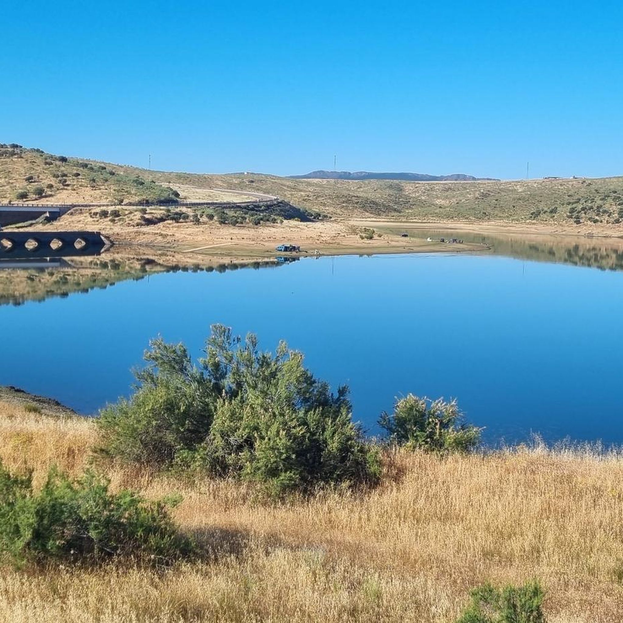
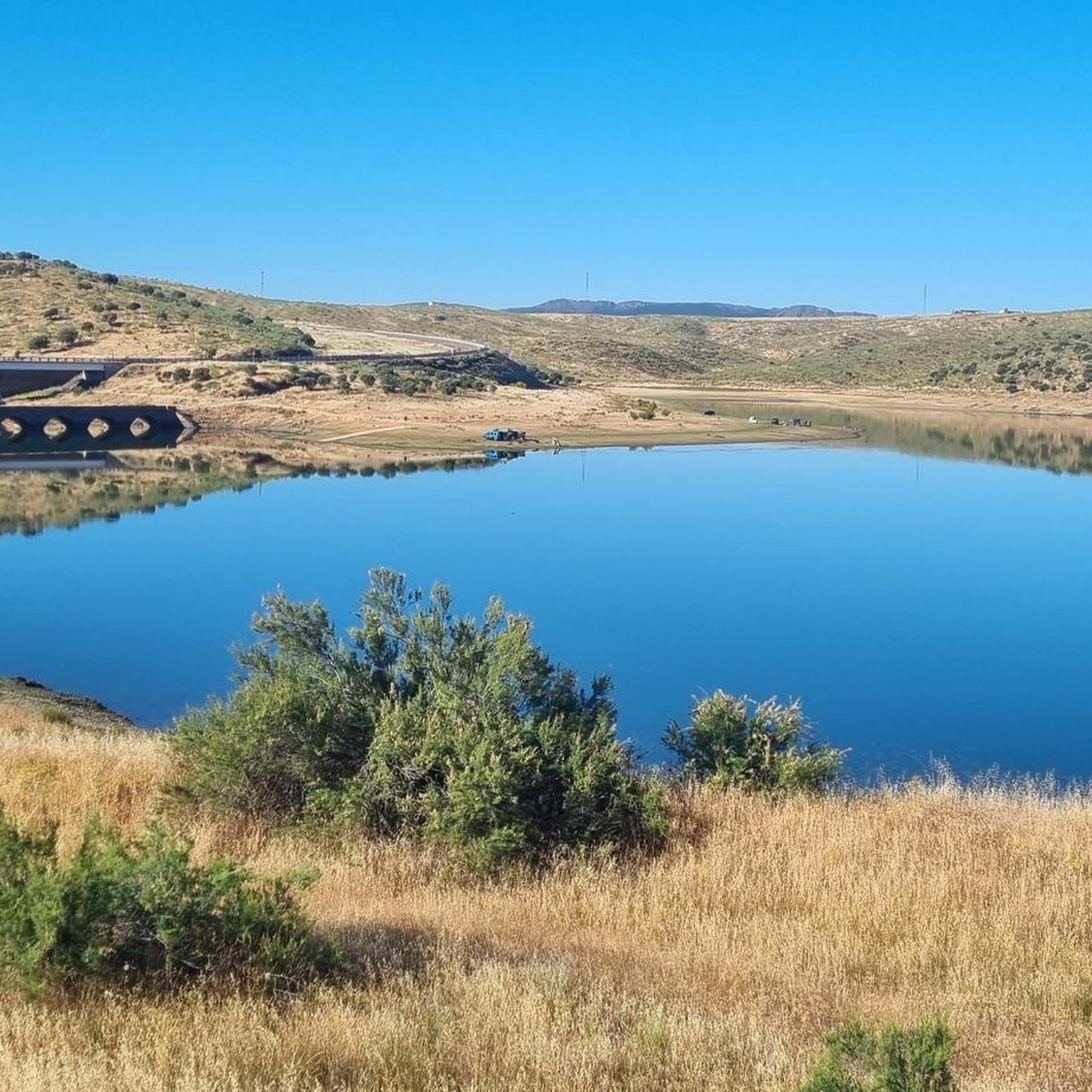
The García de Sola Reservoir, also known as Puerto Peña, is located on the Guadiana River, in the La Siberia Extremeña region (Badajoz). It was built in 1962 as part of the Badajoz Plan and has a capacity of 554 hm³. It is an emblematic site for its natural, scenic, and recreational value.
5
0
The Guadiana Riverside Trail in Siberia Extremadura is not an official name, but it refers to routes that run alongside the Guadiana River and its reservoirs in the La Siberia region (Badajoz), declared a Biosphere Reserve by UNESCO in 2019. This area combines landscapes of pastureland, mountains and large bodies of water (Cíjara, García de Sola and Orellana reservoirs), ideal for hiking, cycling and wildlife watching.
5
0
Playa de los Calicantos, located in Casas de Don Pedro (Badajoz), is an inland beach at the tail end of the Orellana Reservoir, within the La Siberia Extremeña region. It's an ideal place to enjoy the summer surrounded by nature, with excellent services and a peaceful setting.
10
0
Cerro Masatrigo is a hill located in the municipality of Esparragosa de Lares. This hill is known for its almost perfect conical shape, which has earned it the nickname "the magic mountain." It rises 501 meters above sea level and 161 meters above the surrounding terrain. After the construction of the La Serena Dam, Cerro Masatrigo became a peninsula surrounded by the waters of the reservoir.
1
0
Cerro Masatrigo is a hill located in the municipality of Esparragosa de Lares. This hill is known for its almost perfect conical shape, which has earned it the nickname "the magic mountain." It rises 501 meters above sea level and 161 meters above the surrounding terrain. After the construction of the La Serena Dam, Cerro Masatrigo became a peninsula surrounded by the waters of the reservoir.
5
0
Cerro Masatrigo is a hill located in the municipality of Esparragosa de Lares. This hill is known for its almost perfect conical shape, which has earned it the nickname "the magic mountain." It rises 501 meters above sea level and 161 meters above the surrounding terrain. After the construction of the La Serena Dam, Cerro Masatrigo became a peninsula surrounded by the waters of the reservoir.
6
0
The La Serena Dam, located in the province of Badajoz (Extremadura), is one of the most impressive hydraulic infrastructures in Europe. Location: Zújar River, in the region of La Serena It is part of the La Siberia Biosphere Reserve. It houses inland islands such as Cerro Masatrigo, considered a "magic mountain" for its perfect conical shape. A SPA (Special Protection Area for Birds), ideal for watching aquatic birds and birds of prey.
6
0

This spectacular reservoir was built during the 1960s. The reflection of the sunsets in the water and the surrounding landscape make it a must-see if you're exploring the Guadiana Nature Trail.
0
1
Frequently Asked Questions
How many touring cycling routes are available around Siruela?
There are 5 touring cycling routes available around Siruela, offering a range of experiences from moderate to difficult. These routes allow you to explore the diverse landscapes of the La Siberia Extremeña Biosphere Reserve.
What kind of terrain can I expect on touring cycling routes in Siruela?
The terrain around Siruela is diverse, featuring extensive dehesa woodlands, rolling hills, and river valleys. You'll also encounter routes defined by vast reservoirs like Embalse de Orellana and Embalse de La Serena. While many routes offer pleasant landscapes with gentle slopes, the nearby Sierra de Siruela provides more undulating terrain for varied cycling experiences.
What natural features can I see while cycling around Siruela?
Cycling around Siruela offers stunning views of several natural features. You can explore the vast waterscapes of Embalse de La Serena and Embalse de Orellana. The region is part of the La Siberia Extremeña Biosphere Reserve, characterized by well-preserved natural environments, including extensive dehesa woodlands. Keep an eye out for the unique geological formation of Cerro Masatrigo, often referred to as 'the island mountain'.
Are there any historical landmarks or points of interest along the cycling routes?
Yes, several routes pass by interesting landmarks. For instance, the Embalse de la Serena and Castillo de Puebla de Alcocer — circular from la Puebla de Alcocer route includes the historic Castle of Puebla de Alcocer. You might also encounter charming local architecture, such as the Parish Church of Esparragosa de Lares, on routes like the Bike loop from Esparragosa de Lares.
Are there challenging touring cycling routes in Siruela?
Yes, for those seeking a challenge, there is at least one difficult touring cycling route. The Embalse de la Serena and Castillo de Puebla de Alcocer — circular from la Puebla de Alcocer is a demanding 45.4 miles (73.1 km) path with significant elevation changes, showcasing the expansive waterscapes of Embalse de La Serena and historical landmarks.
What are some moderate touring cycling routes suitable for most riders?
Most of the touring cycling routes around Siruela are classified as moderate, making them suitable for a wide range of riders. A popular option is the Guadiana Natural Trail: Orellana Reservoir Loop, a 27.0 miles (43.5 km) trail offering picturesque views of the Orellana Reservoir. Another moderate choice is the View of Cerro Masatrigo – Cerro de Masatrigo loop from Esparragosa de Lares, which provides scenic views of the unique Masatrigo Mountain.
Are there circular touring cycling routes in the Siruela area?
Yes, many of the touring cycling routes in the Siruela area are circular, offering convenient starting and ending points. Examples include the popular Guadiana Natural Trail: Orellana Reservoir Loop and the more challenging Embalse de la Serena and Castillo de Puebla de Alcocer — circular from la Puebla de Alcocer.
What is the best time of year for touring cycling in Siruela?
The region's climate makes spring and autumn ideal for touring cycling in Siruela. These seasons offer pleasant temperatures and less extreme weather, allowing you to comfortably enjoy the extensive network of trails and the natural beauty of the La Siberia Extremeña Biosphere Reserve. Summers can be very hot, and winters can be cooler and wetter, so planning for milder conditions is recommended.
Are there family-friendly touring cycling routes in Siruela?
While specific 'easy' routes are not highlighted, the region's network of quiet roads and unpaved trails, combined with its tranquil environment, can offer suitable options for families. Moderate routes like the Bike loop from Esparragosa de Lares, which is 9.1 miles (14.7 km) long, could be considered for families looking for a shorter, less strenuous ride through the local countryside.
Can I bring my dog on touring cycling routes in Siruela?
The Siruela area, being part of a Biosphere Reserve, is generally welcoming to outdoor activities. While specific regulations for dogs on cycling routes are not detailed, it's advisable to keep dogs on a leash, especially in natural areas to protect wildlife and ensure a pleasant experience for all users. Always carry water for your pet and respect local signage regarding pet access.
Are there places to eat or stay for cyclists in Siruela?
Siruela and the surrounding towns offer various options for accommodation and dining. As a tranquil region far from mass tourism, you'll find local guesthouses, rural hotels, and restaurants serving traditional Extremaduran cuisine. These establishments cater to visitors exploring the area's natural beauty, including cyclists, providing a comfortable base for your touring adventures.
Are there any wild swimming spots near the cycling routes?
Given Siruela's proximity to several large reservoirs, including Embalse de Orellana, Embalse de La Serena, and Embalse del Zújar, there are opportunities for wild swimming. The Orellana Reservoir area, in particular, is recognized for its recreational value. While cycling, you may find designated swimming areas or quiet coves along the reservoir shores, perfect for a refreshing dip on a warm day. Always check local regulations and safety guidelines before swimming.
Most popular routes around Siruela
Most popular attractions around Siruela

Get inspired with the komoot mobile app


Explore more
Browse the best Cycling routes in other regions.
