The best walks and hikes around Sant Jaume De Llierca
4.4
(1549)
10,239
hikers
299
hikes
Hiking around Sant Jaume De Llierca offers diverse routes through the Garrotxa region, known for its volcanic landscape and lush environments. The area features trails winding through shaded forests and alongside the Fluvià river. Hikers can explore unique geological formations, including extinct volcanoes, and discover hidden natural corners. The terrain varies from gentle paths to more challenging routes with significant elevation gains.
Best hiking trails around Sant Jaume De Llierca
- The most popular hiking route is Stone Wayside Shrine – Llierca Bridge loop from Montagut, a 7.2 miles (11.5 km) trail that takes 3 hours 24 minutes to complete, passing by the historic Llierca Bridge.
- Another top favourite among local hikers is Virgin of the Devesa – The Den 🐯 loop from Montagut, a moderate 8.5 miles (13.7 km) path. This route leads through varied forest terrain with notable elevation changes.
- Local hikers also love the Castellfollit de la Roca loop from Castellfollit de la Roca, a 1.6 miles (2.6 km) trail leading through the unique village of Castellfollit de la Roca, often completed in about 44 minutes.
- Hiking around Sant Jaume De Llierca is defined by volcanic landscapes, the Fluvià river, and dense forests. The network offers options for various ability levels, from easy walks to more demanding trails.
- The routes in Sant Jaume De Llierca are highly rated by the komoot community with an average score of 4.4 stars from over 1,300 reviews. More than 8,900 hikers have used komoot to explore Sant Jaume De Llierca's varied terrain.
Last updated: August 22, 2026
4.5
(14)
38
hikers
11.5km
03:24
340m
340m
Moderate hike. Good fitness required. Easily-accessible paths. Suitable for all skill levels.
4.6
(14)
68
hikers
2.62km
00:45
60m
60m
Easy hike. Great for any fitness level. Easily-accessible paths. Suitable for all skill levels.

Sign up for free
4.7
(6)
17
hikers
11.8km
03:26
300m
300m
Moderate hike. Good fitness required. Easily-accessible paths. Suitable for all skill levels.
4.4
(8)
53
hikers
Easy hike. Great for any fitness level. Easily-accessible paths. Suitable for all skill levels.
4.5
(4)
15
hikers
15.8km
04:40
440m
440m
Moderate hike. Good fitness required. Easily-accessible paths. Suitable for all skill levels.
Get access to more routes and recommendations from other explorers.
Sign up for free
Already have an account?
Our route recommendations are based on thousands of hikes, rides, and runs completed by other people on komoot.
Start today with a free account
Your next adventure awaits.
Login or Signup

Tips from the Community

The area east of the bridge is not particularly suitable for gravel bikes. The bridge is definitely worth a visit.
0
0

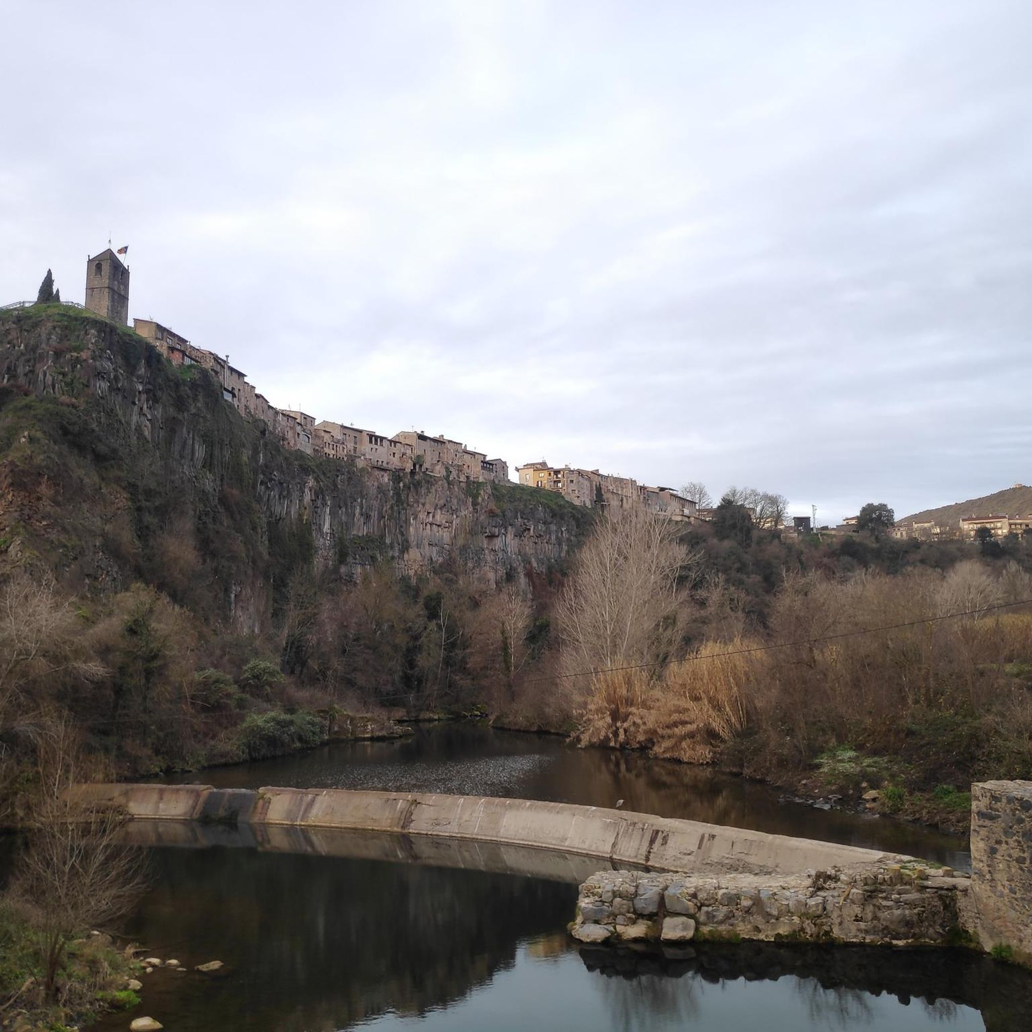
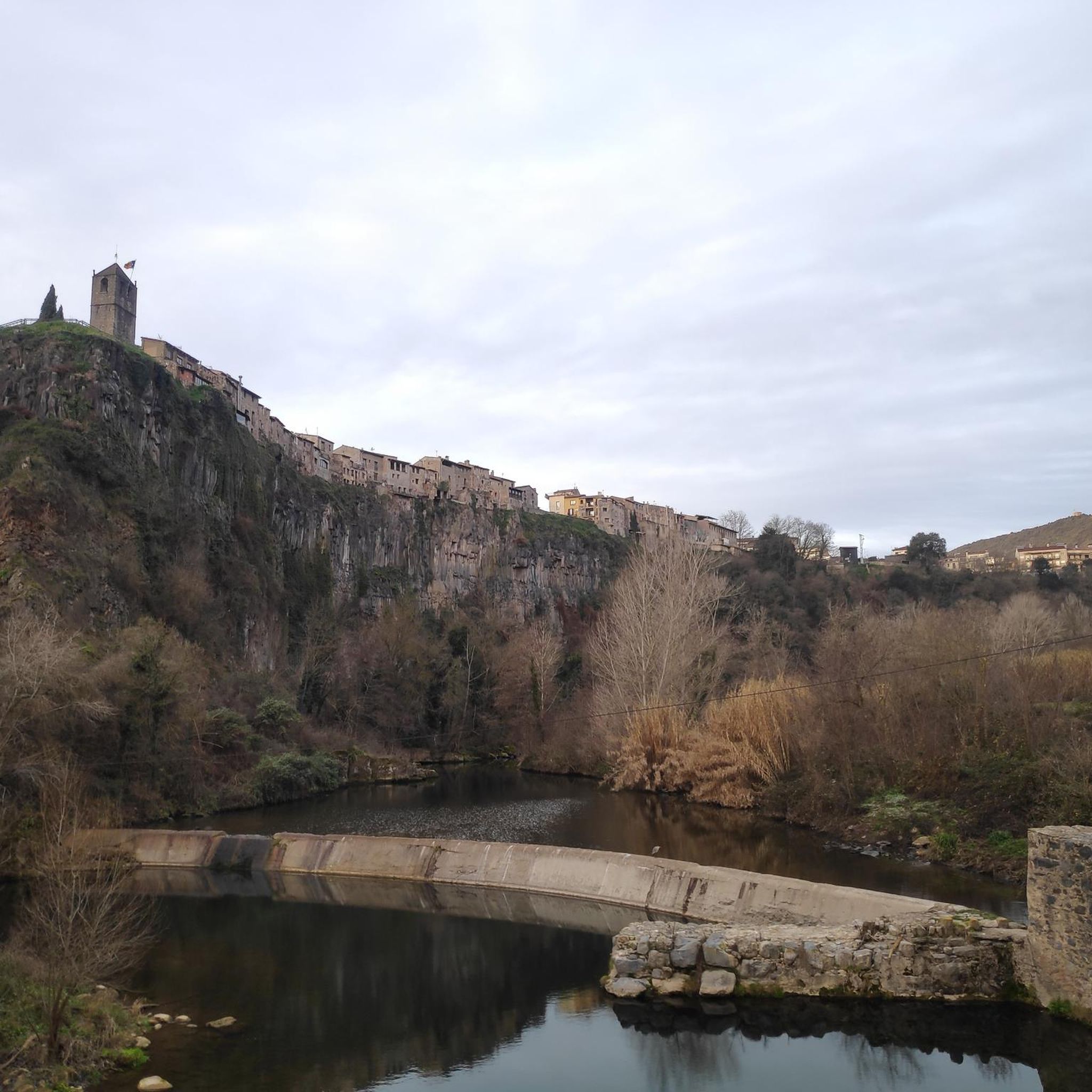
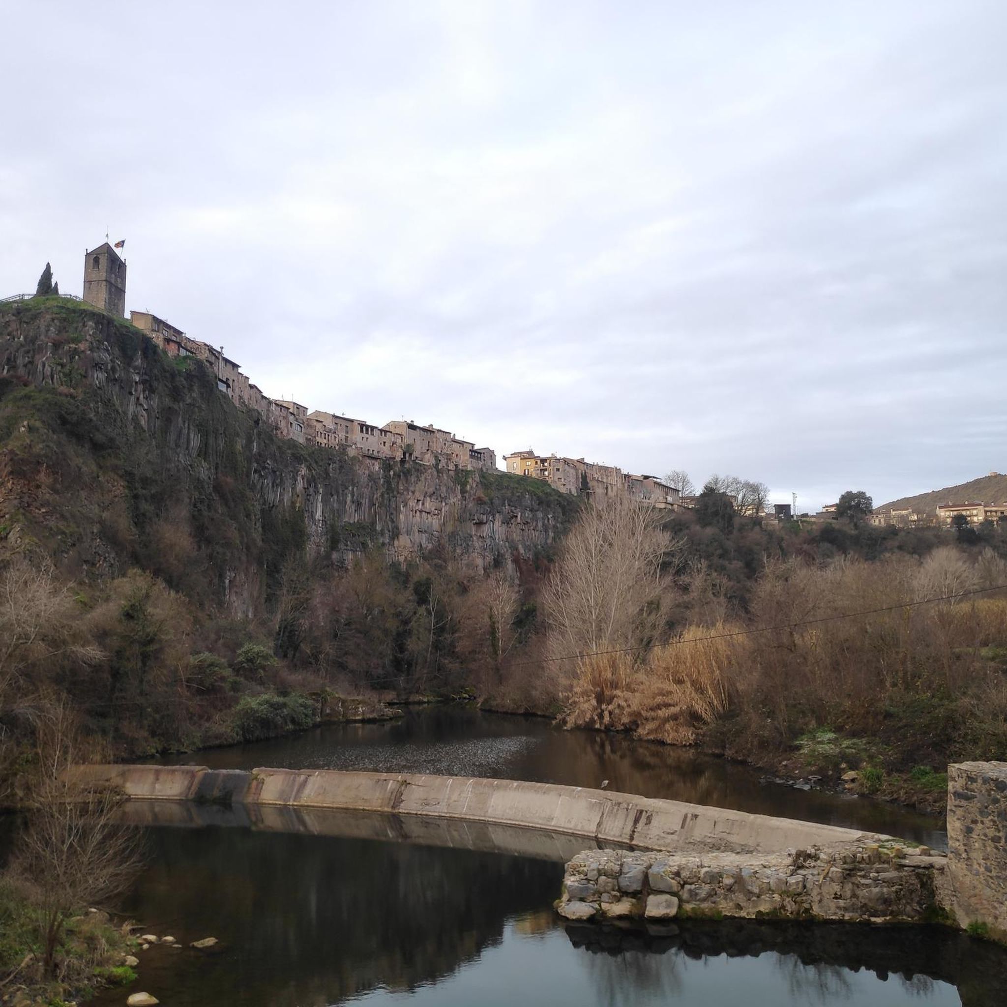
One of the works that stand out in the town, as far as architecture is concerned
0
1

Beautiful bridge with a view of the castle. Worth a visit.
2
0

Ruin, which invites you to take a short break and also serves as a signpost. To the left, the path now leads past it as a small path into the forest.
0
0
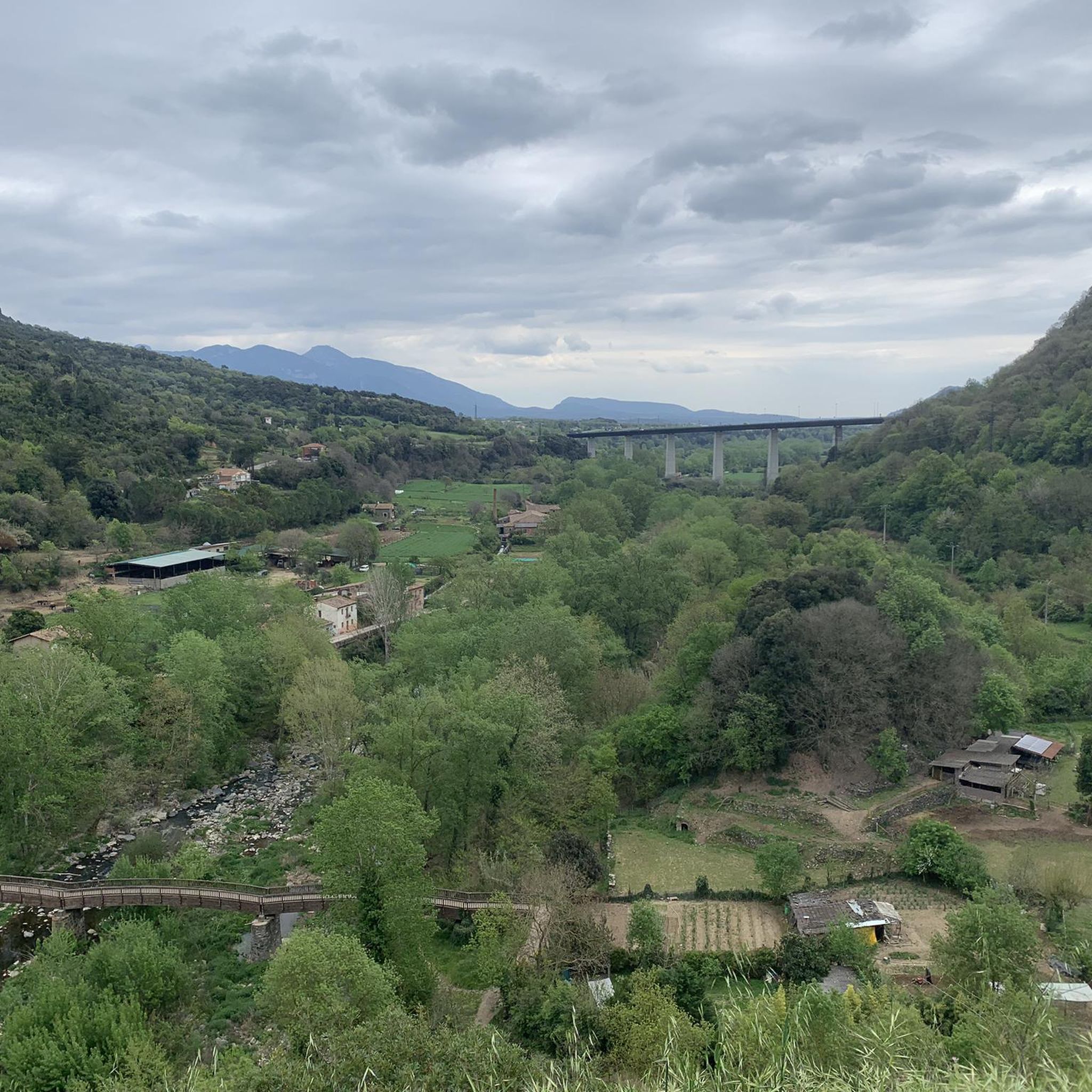
This point, at the end of the town, becomes a fantastic viewing point, behind us the old Church and Museum from the 13th century.. In front... views of the Cos sanctuary, Santuari de la Mara de Déu del Món, and the surroundings of the Fluvià River, The location of this town on this massif of Roca, makes it.. Unique and special 🤩
0
1

Be sure to stop and enjoy the beautiful view of the village on the edge 🤩
1
0
A Romanesque bridge worth seeing. Be sure to take a detour there and take a look. You can easily walk across it.
3
0

The Llierca Bridge, also called Pont de Sadernes, is a bridge 28 m high, 52 m long and 3 m wide. With a single, very slender arch, it crosses the Llierca river between Tortellà and Sadernes. Romanesque in style, although we do not know the date of its construction, there is evidence of its use since at least the 14th century, when it is documented that a toll was paid to cross it. The bridge was probably built by order of the barons of Sales, to facilitate trade between the farmhouses located west of the Llierca river with the towns of Tortellà and Besalú.
0
0
Frequently Asked Questions
How many hiking trails are available in Sant Jaume De Llierca?
There are over 290 hiking routes around Sant Jaume De Llierca, offering a wide range of options for all skill levels. These include 106 easy routes, 153 moderate routes, and 33 more challenging trails.
What kind of terrain can I expect on hikes around Sant Jaume De Llierca?
The terrain in Sant Jaume De Llierca is characterized by the unique volcanic landscape of the Garrotxa region, alongside lush forests and the Fluvià river. You'll find paths winding through shaded woodlands, past extinct volcanoes, and along riverbanks. The routes vary from gentle, flat sections to more demanding trails with significant elevation changes.
Are there any easy hiking options suitable for families or beginners?
Yes, Sant Jaume De Llierca offers over 100 easy hiking routes perfect for families or those new to hiking. A great option is the Castellfollit de la Roca loop from Castellfollit de la Roca, a short 2.6 km trail that takes you through the unique village of Castellfollit de la Roca.
Can I bring my dog on the trails in this region?
While many trails in natural areas are dog-friendly, it's always recommended to keep dogs on a leash, especially within the Volcanic Zone Natural Park of Garrotxa, to protect wildlife and ensure a pleasant experience for all hikers. Always check specific trail regulations before heading out.
Are there any circular hiking routes available?
Yes, many of the hiking routes around Sant Jaume De Llierca are circular, allowing you to start and end at the same point. An example is the Stone Wayside Shrine – Llierca Bridge loop from Montagut, a moderate 11.5 km trail that passes by the historic Llierca Bridge.
What natural attractions or landmarks can I see while hiking?
The region is rich in natural and historical attractions. You can explore the unique geological formations of the Volcanic Zone Natural Park of Garrotxa, including trails around the Montsacopa Volcano. The Fluvià river and the picturesque Puda spring also offer beautiful natural sights. For those seeking waterfalls, the Riera de Sant Aniol Waterfalls are a notable highlight.
What historical sites can be explored on hikes?
Hikers can discover several historical points of interest. The Llierca Bridge is part of several moderate loops. You can also find the serene Santa Magdalena Chapel hidden among the greenery, or reach the ruins of the watchtower of Montpalau Castle, offering a glimpse into the region's past.
Is public transport available to reach trailheads, or is parking common?
While specific public transport options to all trailheads may be limited, parking is generally available in and around the main villages and popular starting points for hikes, such as Montagut or Castellfollit de la Roca. It's advisable to plan your route and check parking availability beforehand.
What is the best time of year to go hiking in Sant Jaume De Llierca?
Sant Jaume De Llierca is enjoyable for hiking throughout much of the year. Spring and autumn offer pleasant temperatures and vibrant scenery, with lush greenery or autumnal colors. Summers can be warm, making early morning or late afternoon hikes preferable, especially on shaded trails. Winters are generally mild, allowing for hiking, though some higher elevation routes might be cooler.
What do other hikers say about the trails in Sant Jaume De Llierca?
The hiking routes in Sant Jaume De Llierca are highly rated by the komoot community, with an average score of 4.4 stars from over 1,300 reviews. Hikers often praise the diverse volcanic landscapes, the tranquility of the forests, and the well-maintained paths that cater to various ability levels.
Are there any challenging hikes for experienced trekkers?
Yes, for experienced trekkers, there are 33 difficult routes available. These trails often involve significant elevation gains and longer distances, providing a more demanding experience. An example of a moderate route with notable elevation changes is the Virgin of the Devesa – The Den 🐯 loop from Montagut, which covers 13.7 km with substantial climbs.
Can I find routes that pass through unique villages?
Absolutely. Several routes either start from or pass through charming villages. The village of Castellfollit de la Roca, perched on a basalt cliff, is a particularly unique and picturesque spot that can be explored via routes like the Castellfollit de la Roca – Pont Trencat loop from Parc Natural de Zona Volcànica de la Garrotxa.
Are there any specific peaks or viewpoints I can hike to?
Yes, the region offers opportunities to hike to various peaks and viewpoints. You can find trails leading to summits like Mare de Déu del Mont Summit or Puigsallança Summit (1,026 m), which provide expansive views of the surrounding volcanic landscape and forests.
Most popular routes around Sant Jaume De Llierca
Most popular attractions around Sant Jaume De Llierca

Get inspired with the komoot mobile app


Explore more
Browse the best Hikes in other regions.
