The best road cycling routes around Samper De Calanda
5.0
(1)
209
riders
20
rides
Road cycling routes around Samper de Calanda traverse a landscape characterized by the fertile Martín River Valley and the Ebro River, offering diverse terrain for cyclists. The region features a blend of agricultural areas, natural settings, and historical landmarks. Cyclists can explore dedicated paths like the "Vía Verde," a greenway repurposed from an old railway line, or navigate "lonely roads" in the broader Matarraña and Bajo Aragón areas. The topography includes gentle river plains and ascents, providing varied road cycling…
Last updated: August 31, 2026
2
riders
53.5km
02:24
490m
490m
Moderate road ride. Good fitness required. Mostly well-paved surfaces and easy to ride.
8
riders
112km
05:04
1,170m
1,170m
Hard road ride. Very good fitness required. Some segments of this route may be unpaved and difficult to ride.

Sign up for free
11
riders
Moderate road ride. Good fitness required. Mostly well-paved surfaces and easy to ride.
5
riders
23.1km
01:03
210m
210m
Easy road ride. Great for any fitness level. Mostly well-paved surfaces and easy to ride.
12
riders
56.3km
02:40
640m
640m
Moderate road ride. Good fitness required. Mostly well-paved surfaces and easy to ride.
Get access to more routes and recommendations from other explorers.
Sign up for free
Already have an account?
Our route recommendations are based on thousands of hikes, rides, and runs completed by other people on komoot.
Start today with a free account
Your next adventure awaits.
Login or Signup


Tips from the Community

The A224 road between Escatrón and Casp, heading east, allows for a good view of the dawn.
0
0

Beautiful Mudejar church and curious sculptures. We have shops and a couple of fountains
0
0

Close to the town of Alcañíz we find what is called the Desierto de Calanda, to the south of the aforementioned town. Between these two towns there is this set of fields and barren spaces where it has a resemblance to a desert, without high vegetation and almost infinite horizons.
0
0
Beautiful church that is located in the middle of the town of Alcañíz, at the top of the center and elevated part located on a hill. From here the population grew alongside it.
0
0
The relief of the municipality is characterized by the so-called Calanda Desert, an arid area with little rainfall, only softened by the presence of the Martín River, which crosses the territory to the west. The Hermitage of Santa Quiteria is located towards the train station and to the left, you arrive at the hermitage, where water miraculously flows in such an arid land.
0
0
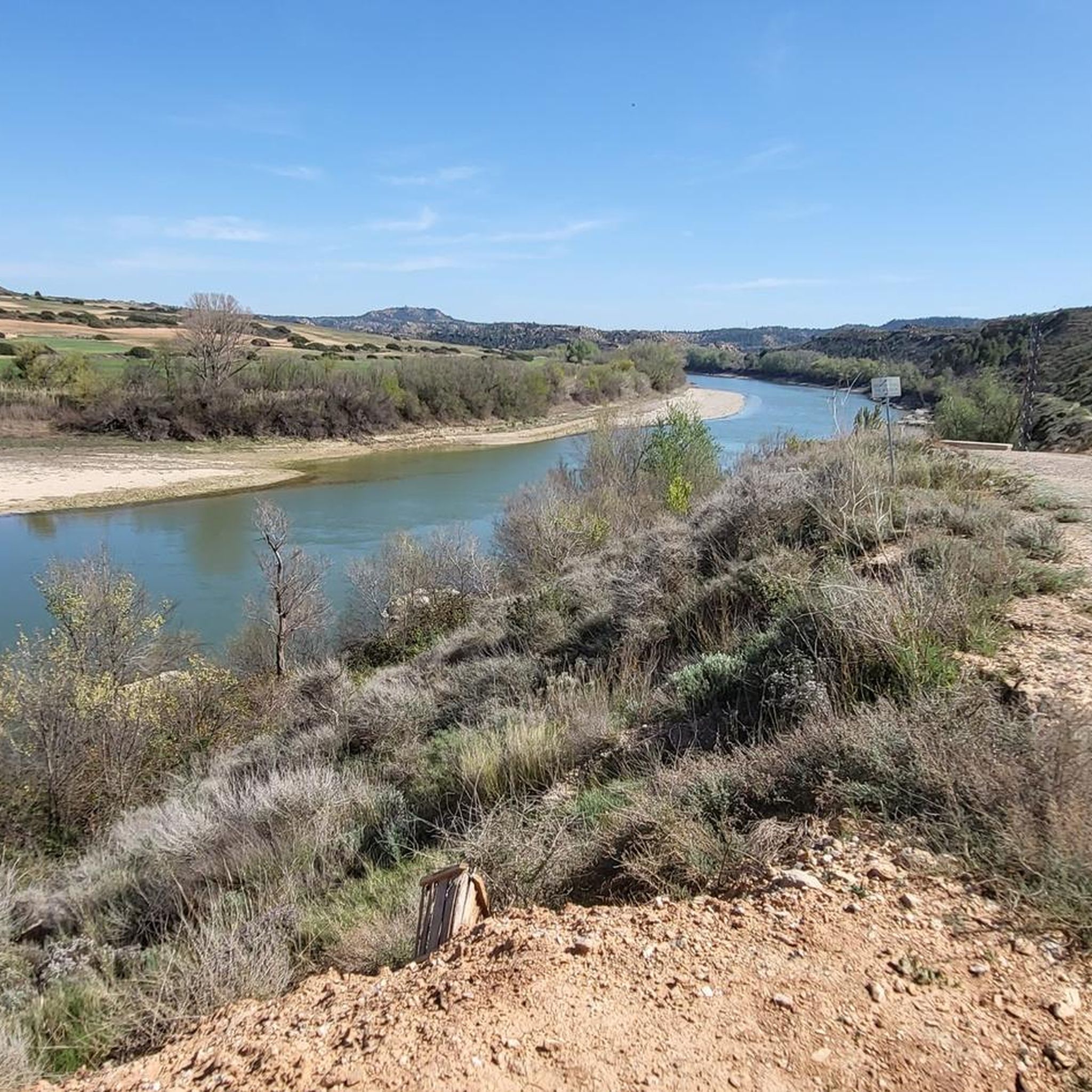
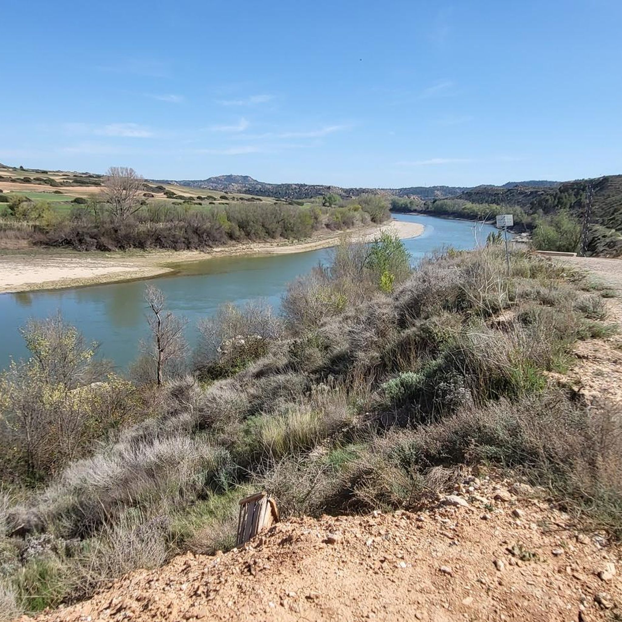
Lookout that, as the name says, lets us see the set of meanders that exist in this area called Bajo Aragón.
0
1

We are in the beautiful mining town of Ariño located at the foot of the Sierra de Arcos and with many points of interest such as the Mining Museum, a spring, the parish church of San Salvador or the hermitage of Santa Bárbara among many others, so if we have time, it is definitely worth a visit.
1
0
Near the Tower we find this beautiful viewpoint where it is worth stopping and contemplating the panoramic view that the meanders of the Ebro River, Sástago and other well-explained places give us on an information panel.
2
0
Frequently Asked Questions
How many road cycling routes are available around Samper de Calanda on komoot?
Komoot features over 15 road cycling routes in the Samper de Calanda area. These routes cater to various preferences, including easy, moderate, and difficult options.
What kind of terrain can I expect on road cycling routes in Samper de Calanda?
The terrain around Samper de Calanda is diverse, ranging from the fertile Vega del Martín along the river to routes that follow the Ebro River. You'll find dedicated paths like the "Vía Verde" (a greenway on an old railway line) and "lonely roads" in the broader Matarraña and Bajo Aragón areas, which can include ascents exceeding 1000 meters.
Are there routes suitable for different skill levels in Samper de Calanda?
Yes, the region offers routes for various skill levels. There are 4 easy routes, 12 moderate routes, and 3 difficult routes available, ensuring options for beginners to experienced road cyclists.
Are there any circular road cycling routes in the Samper de Calanda area?
Many of the road cycling routes around Samper de Calanda are circular. For example, the Ruta del Tambor y el Bombo Cycling Loop is a popular moderate circular route that explores a culturally significant area.
What are the elevation gains like on road cycling routes around Samper de Calanda?
Elevation gains vary significantly across routes. You can find moderate routes with around 280 meters of ascent, such as the Motorland (Alcañiz Circuit) – Fields of the Calanda Desert loop from Puigmoreno. More challenging routes, like the Ermita Virgen Sierra de Arcos – Ariño loop from Urrea de Gaén, can feature over 2,200 meters of climbing.
What historical or natural landmarks can I see while road cycling in Samper de Calanda?
The routes often pass by significant landmarks. You might encounter the 19th-century La Torica Aqueduct, or cycle near the Martín River and surroundings. The Albalate del Arzobispo Historic Center, with its Gothic-Renaissance church and archiepiscopal palace, is also accessible in the wider region.
Are there any scenic viewpoints along the road cycling routes?
Yes, the region offers several scenic spots. The Ermita del Calvario (or Santo Sepulcro), perched on a small hill, provides excellent views over the drylands and the Vega del Martín. The diverse landscapes, including the Ebro River meanders, also offer picturesque vistas.
Is Samper de Calanda suitable for family-friendly road cycling?
While many road cycling routes in the area involve varied terrain and elevation, the "Vía Verde" (greenway) offers a dedicated, flatter path that is generally more suitable for families or those seeking a relaxed ride away from traffic. Always check individual route details for suitability.
What is the best time of year for road cycling in Samper de Calanda?
The region generally experiences a Mediterranean climate. Spring and autumn are typically ideal, offering milder temperatures and pleasant conditions for cycling. Summers can be hot, especially in July and August, while winters are cooler but often still suitable for cycling on sunny days.
Are there facilities like cafes or accommodation for cyclists in Samper de Calanda?
Samper de Calanda and nearby towns offer various amenities. You can find local cafes and restaurants to refuel, and there are accommodation options ranging from hotels to rural houses, catering to visitors exploring the area by bike.
What do other road cyclists enjoy the most about road cycling in Samper de Calanda?
The komoot community frequently praises the diverse landscapes, from river valleys to more challenging ascents, and the opportunity to explore historical sites. Cyclists appreciate the blend of agricultural areas, natural settings, and the quiet, 'lonely roads' that characterize the region.
Can I reach Samper de Calanda by public transport with my bike?
While specific public transport options for bikes can vary, it's advisable to check local bus or train services connecting to Samper de Calanda. Policies for transporting bicycles often depend on the operator and the type of service. Planning ahead is recommended.
Are there any long-distance road cycling routes for advanced riders?
Yes, advanced riders can find challenging long-distance routes. The Oliete – Ariño loop from La Puebla de Híjar, for instance, is a difficult 112 km trail that typically takes over 5 hours to complete, featuring significant elevation changes through the wider region.
Most popular attractions around Samper De Calanda

Get inspired with the komoot mobile app


Explore more
Browse the best Road cycling routes in other regions.
