The best running trails around Valle De La Serena
26
runners
9
runs
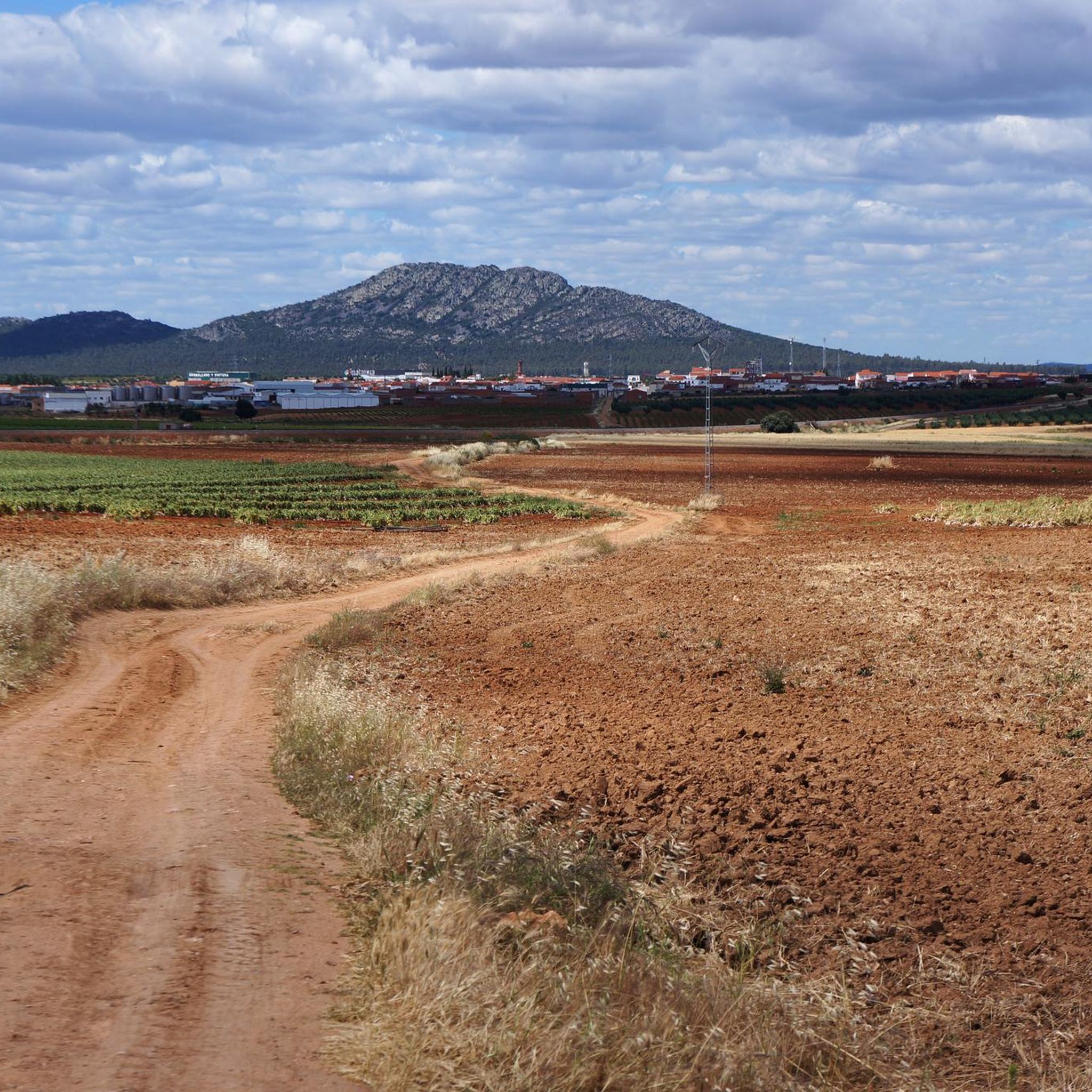
Jogging around Valle De La Serena offers routes through a landscape characterized by rolling hills, valleys, and several "sierras" or mountain ranges. The terrain includes varied elevations, with paths ascending to notable points like Alto de la Cabra and the Dolmen of Sierra Gorda. Runners can expect a mix of challenging climbs and scenic stretches alongside natural features such as the Río and Sierra de la Gangosa.
Best jogging routes around Valle De La Serena
- The most popular jogging route…
Last updated: May 21, 2026
22.9km
02:55
390m
390m
Hard run. Very good fitness required. Mostly paved surfaces. Suitable for all skill levels.
19.8km
02:34
400m
400m
Hard run. Very good fitness required. Mostly paved surfaces. Suitable for all skill levels.

Sign up for free
Moderate run. Good fitness required. Mostly accessible paths. Some sure footedness required.
22.9km
02:45
220m
220m
Hard run. Very good fitness required. Mostly paved surfaces. Suitable for all skill levels.
10
runners
26.8km
03:32
720m
720m
Hard run. Very good fitness required. Mostly paved surfaces. Suitable for all skill levels.
Get access to more routes and recommendations from other explorers.
Sign up for free
Already have an account?
Our route recommendations are based on thousands of hikes, rides, and runs completed by other people on komoot.
Start today with a free account
Your next adventure awaits.
Login or Signup
Popular around Valle De La Serena
Tips from the Community

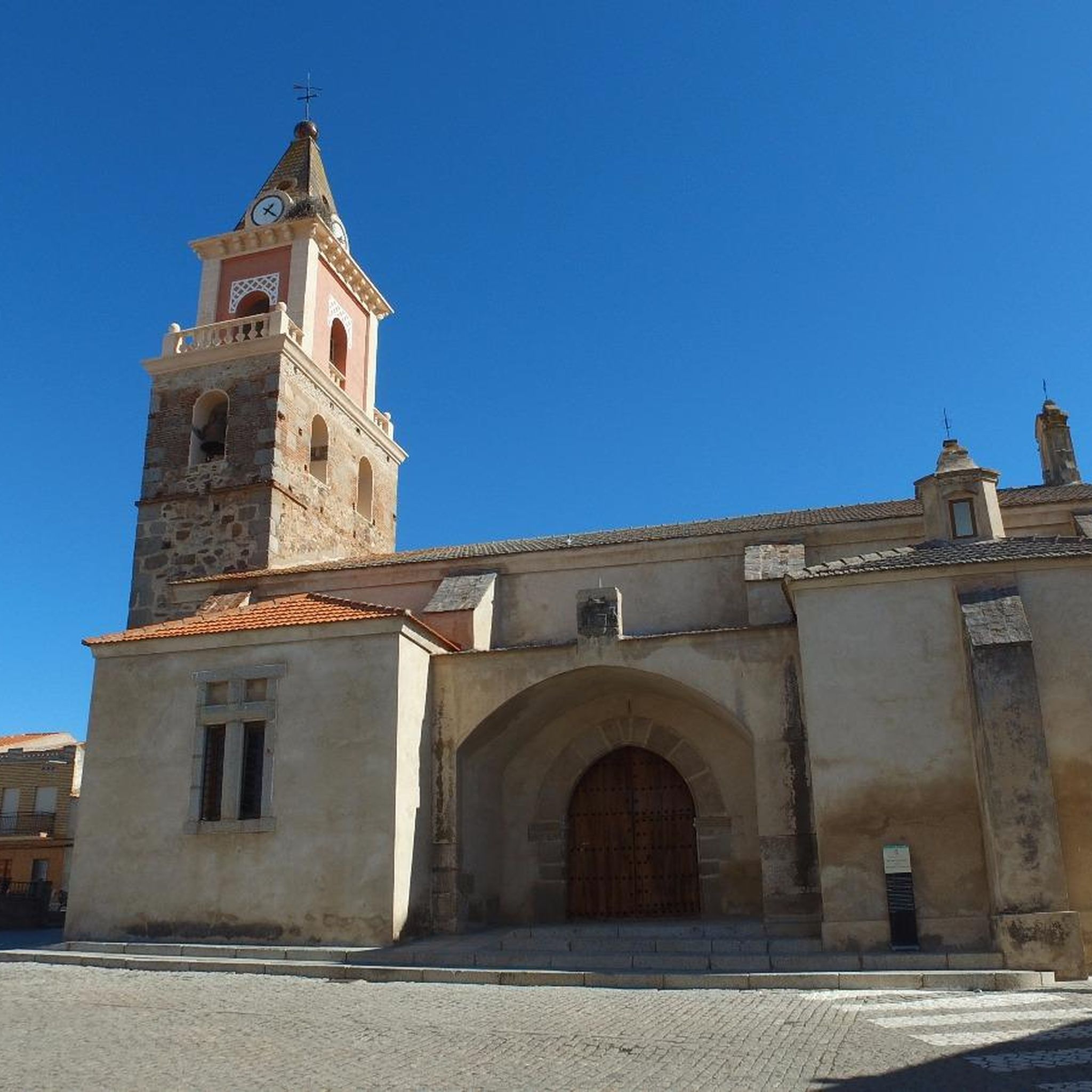
It is a castle that the surrounding landscapes give a good panorama between forests and agricultural fields that look towards Sierra de la Trancha. Also called Casa del Conde, it is a castle that rises on one of the southern slopes of the Sierra de la Utrera.
0
1
Beautiful and old bridge that is in this area of the Río Guadámez and that helps us cross to the other side of the stream.
0
0
Nucleus that is close to the Sierras del Arrozao on the one hand and the Río Guadámez on the other. The closest, the Sierra de la Dehesa to the north of the town.
0
0
Dolmen that is located on a ridge and that represents one of the most important historical elements of this area of Valle de la Serena. Let us see some beautiful landscapes!
0
1
Near the Río Guadámez we find these paths that go right next to the bank of the same river. The rounded ridges allow us to see some beautiful landscapes.
0
1
One of the mountain ranges that appear near the town of Manchita, with rounded hills and lush vegetation with incredible landscapes!
0
0
Also called Casa del Conde, it is a castle that rises on one of the southern slopes of the Sierra de la Utrera.
0
0
In the Sierra de los Vuelos, the Alto de la Cabra appears, a small mountain system that gives the entrance to the first mountain ranges that are found at the southern end of Extremadura.
0
0
Frequently Asked Questions
How many running routes are available in Valle De La Serena?
There are 9 running routes available in Valle De La Serena, catering to various fitness levels. You'll find options ranging from moderate to difficult, with 1 easy, 3 moderate, and 5 difficult routes.
Are there any easy or beginner-friendly running trails in Valle De La Serena?
Yes, there is one easy running route available. While many trails feature challenging climbs, you can find options suitable for beginners, particularly if you're looking for less strenuous paths through the valleys.
What is the typical length and duration of running routes in Valle De La Serena?
The running routes in Valle De La Serena vary significantly in length and duration. For example, the Ascent to the Dolmen of Sierra Gorda is about 13.1 km (8.1 miles) and takes around 1 hour 40 minutes, while the Puerto Ancho – Puerto de la Cabra loop is 26.8 km (16.7 miles) and can take over 3.5 hours.
Are there circular running routes in Valle De La Serena?
Yes, many of the running paths in Valle De La Serena are circular, allowing you to start and end at the same point. Examples include the Ascent to Alto de la Cabra — circular through Sierra de los Vuelos and the Circular Sierra de la Gangosa and Río.
What kind of terrain can I expect on the running trails in Valle De La Serena?
The terrain in Valle De La Serena is characterized by rolling hills, valleys, and several mountain ranges (sierras). Runners can expect a mix of challenging climbs and scenic stretches, with paths ascending to notable points like Alto de la Cabra and the Dolmen of Sierra Gorda. You'll encounter varied elevations and natural features such as the Río and Sierra de la Gangosa.
Can I bring my dog on the running routes in Valle De La Serena?
Generally, dogs are welcome on trails in natural areas like Valle De La Serena, especially if kept on a leash. However, it's always recommended to check local regulations or specific route details for any restrictions, particularly in protected areas or near livestock.
What historical or natural landmarks can I see while running in Valle De La Serena?
Valle De La Serena offers several interesting landmarks along its routes. You might encounter historical sites like the Dolmen of Sierra Gorda or the Castillo de la Pajosa. Natural viewpoints such as the Alto de la Cabra Observation Tower also offer stunning views.
Are there any running routes that offer views of the Sierra de la Utrera?
Yes, the Sierra de la Utrera and Castillo de route specifically explores the Sierra de la Utrera, providing expansive views of the local landscape and historical points within the region.
What do other runners enjoy most about jogging in Valle De La Serena?
Runners often praise the diverse landscapes and challenging terrain of Valle De La Serena. The komoot community highlights the rewarding climbs and the opportunity to explore various sierras, valleys, and river systems, making for a varied and engaging running experience.
Is Valle De La Serena suitable for family-friendly running or walking?
While many routes are rated moderate to difficult due to elevation changes, the region does offer some less strenuous paths. Families looking for gentler options might consider shorter sections of trails or the single easy route available, focusing on the flatter valley areas rather than the demanding mountain ascents.
What is the best time of year to go running in Valle De La Serena?
The best time to go running in Valle De La Serena is generally during the spring and autumn months. These seasons offer milder temperatures, making the varied terrain more enjoyable for longer runs. Summers can be very hot, and winters might bring cooler, potentially wetter conditions, especially at higher elevations.
Most popular routes around Valle De La Serena
Most popular attractions around Valle De La Serena

Get inspired with the komoot mobile app


Explore more
Browse the best Running Trails & Routes in other regions.
