The best cycling routes around Valle De Matamoros
5.0
(5)
131
riders
41
rides
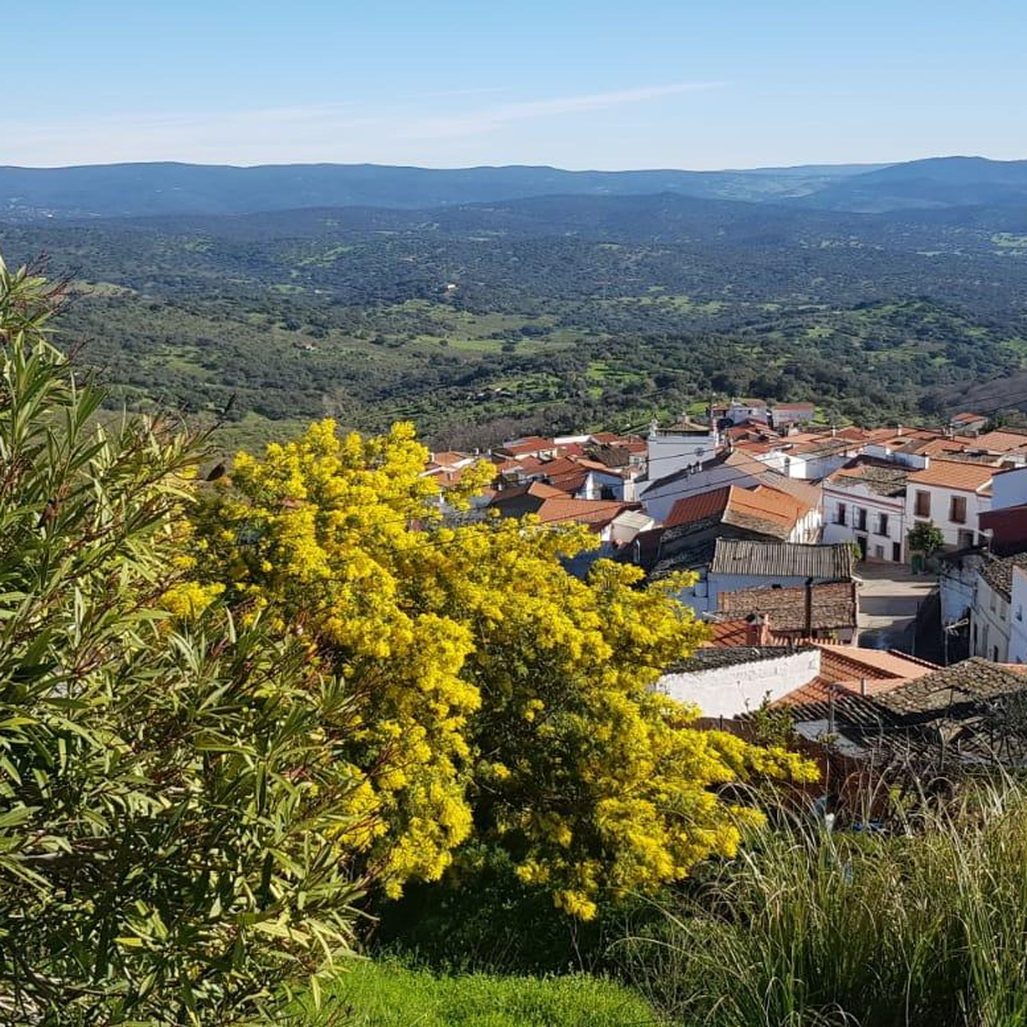
Touring cycling routes around Valle De Matamoros are set within the rugged and varied topography of the Sierra Morena foothills, specifically the Sierra de Jerez. The terrain features altitudes ranging between 480 and 700 meters, resulting in routes with significant slopes and elevation changes. The natural environment is characterized by Mediterranean sclerophyllous forests, dominated by cork and holm oaks, alongside ancient chestnut groves. Hydrological features include the Arroyo Castaño and Ruviales, which flow into the Brovales reservoir.
Best touring cycling…
Last updated: August 26, 2026
14
riders
Moderate bike ride. Good fitness required. Mostly paved surfaces. Suitable for all skill levels.
5
riders
Moderate bike ride. Good fitness required. Mostly paved surfaces. Suitable for all skill levels.

Sign up for free
5.0
(2)
7
riders
Moderate bike ride. Good fitness required. Mostly paved surfaces. Suitable for all skill levels.
5.0
(1)
6
riders
Moderate bike ride. Good fitness required. Mostly paved surfaces. Suitable for all skill levels.
5.0
(1)
6
riders
21.7km
01:48
300m
300m
Moderate bike ride. Good fitness required. Mostly paved surfaces. Suitable for all skill levels.
Get access to more routes and recommendations from other explorers.
Sign up for free
Already have an account?
Our route recommendations are based on thousands of hikes, rides, and runs completed by other people on komoot.
Start today with a free account
Your next adventure awaits.
Login or Signup


Tips from the Community

There are two theories about its origin: One links it to a hermitage dedicated to Saint Anne, which gave rise to the settlement. The other places it in the 17th and 18th centuries as a refuge for families from Jerez fleeing an epidemic, under the name of Valle del Pino (Pine Valley).
5
0
Valle de Santa Ana is a picturesque municipality in the province of Badajoz, in the autonomous community of Extremadura, located in the Sierra Suroeste region, very close to Valle de Matamoros and Jerez de los Caballeros.
5
0
Jerez de los Caballeros is a town with a rich historical legacy, located in the southwest of the province of Badajoz, Extremadura. Ancient Origins: Its history dates back to the Phoenicians, passing through Roman, Visigothic, Muslim, and Christian periods. It was known as Ceret, Fama Iulia, Xerixa, and finally Jerez de los Caballeros after the Reconquista. Templars: In the 13th century, the Knights Templar took control of the town, leaving an indelible mark on its architecture and culture. Historic Center: Declared a Historic-Artistic Site, it is notable for its Baroque churches, medieval walls, cobbled streets, and stately homes.
6
0
According to his will, the ashes of the leader of Florida, Hernando Méndez de Soto, rest in this parish. The tower is an emblem of the church and stands imposingly over the town center. The church has the appearance of a collegiate church and its construction must have begun at the end of the 14th century under the dedication of Santiago.
4
0

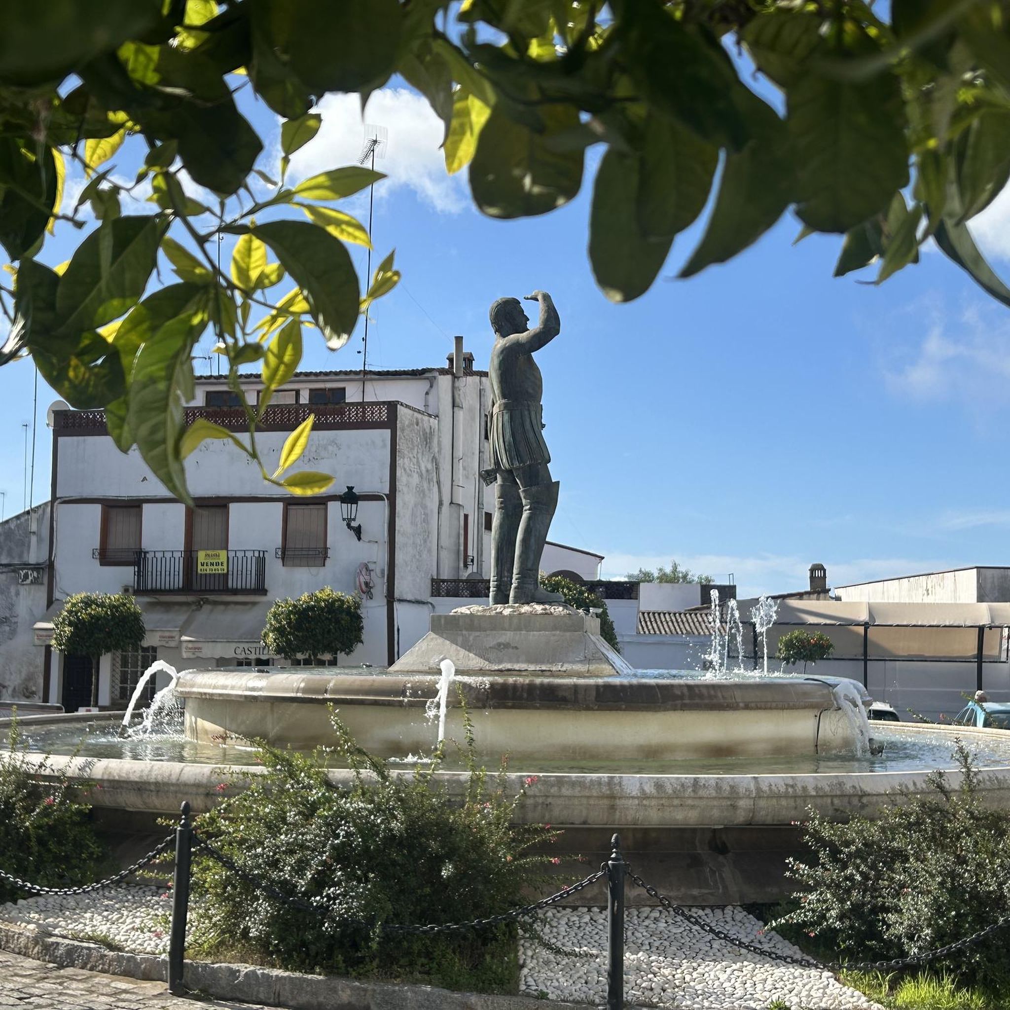
Homage from Jerez de Los Caballeros to Vasco Núñez de Balboa. He was a Spanish explorer, ruler and conqueror. He was born around 1475 in Jerez de los Caballeros, Spain. Balboa was appointed governor of the province of Panama and Coiba in 1514. However, his relations with the Spanish crown deteriorated and he was executed in 1519. The Monument to the Person on the Bench is located in the Plaza de Espanya and does not depict the Monumento a Vasco Nuñez de Balboa
2
1
One of four important churches in Jerez de los Caballeros. The church tower is very beautiful and can be seen from almost anywhere in the city. Unfortunately, free access to the church is not possible.
2
0
It dates back to the century. XV – XVI, renovated in the 18th century, the side façade rises on a Baroque platform like a tribune. The cover presents Neoclassical forms. The main façade has great decorative richness given by the plant motifs, the undulating lintels and, above all, the tiles.
11
0

Spectacular city with a set of towers that protrude from the roofs of the houses in the municipality. The churches of San Bartolomé, Santa Catalina, San Miguel and the Iglesia de Santa María de la Encarnación, close to the castle and elevated.
0
1
Frequently Asked Questions
What kind of terrain can I expect on touring cycling routes in Valle De Matamoros?
Valle De Matamoros is characterized by a rugged and varied topography within the Sierra Morena foothills, specifically the Sierra de Jerez. You can expect routes with significant slopes and changes in elevation, ranging between 480 and 700 meters. The natural environment features Mediterranean sclerophyllous forests, dominated by cork and holm oaks, and ancient chestnut groves, offering both challenging climbs and scenic backdrops.
Are there touring cycling routes suitable for beginners or families in Valle De Matamoros?
While many routes in Valle De Matamoros are rated moderate to difficult due to the mountainous terrain, there is at least one easy touring cycling route available. For families or beginners, it's advisable to look for routes with minimal elevation gain and shorter distances. The broader Extremadura region also features 'Greenways' (Vías Verdes) which are generally flatter and more accessible, though specific ones directly in Valle de Matamoros are not highlighted.
What are some notable natural features or wildlife I might encounter while cycling?
The region's natural environment is rich with Mediterranean flora, including cork oaks, holm oaks, rockroses, gorse, and lavender. You might also cycle through ancient chestnut groves, reportedly the largest in Extremadura, which provide shaded and visually appealing sections. Hydrological features like the Arroyo Castaño and Ruviales, flowing into the Brovales reservoir, add to the scenery. As the area is a Special Protection Area for Birds (ZEPA), birdwatching is possible, and you might spot rabbits, hares, partridges, and various raptors.
Are there any circular touring cycling routes in the area?
Yes, many of the touring cycling routes around Valle De Matamoros are designed as loops. For example, the Jerez de los Caballeros loop from Nuevo Jerez is a popular option, covering 21.1 miles (34.0 km) with significant elevation changes. Another is the Church of Saint Michael the Archangel – Church of San Bartolomé loop from Valle de Santa Ana, a moderate 21.1 km route.
What historical sites or landmarks can I see along the touring cycling routes?
Several routes offer views of historical sites. For instance, the Church of San Bartolomé – Walled Enclosure (Alcazaba) loop from Jerez de los Caballeros provides views of both the Church of San Bartolomé and the Walled Enclosure (Alcazaba). You can also find the Church of Saint Michael the Archangel in the vicinity. These sites offer a glimpse into the region's rich heritage.
What is the best time of year for touring cycling in Valle De Matamoros?
Given the Mediterranean climate and the presence of unique flora like the *Anacamptis pyramidalis* orchid blooming between May and June, spring and early summer can be particularly beautiful. However, the rugged terrain and potential for heat in peak summer suggest that spring (April-June) and autumn (September-October) would offer the most comfortable temperatures for cycling, allowing you to enjoy the challenging routes without extreme heat.
Are there any hidden gems or less-trafficked routes for touring cyclists?
The entire Valle de Matamoros region, being part of Extremadura, is known for its quiet, scenic roads, offering an 'off the beaten track adventure.' While specific 'hidden gem' routes aren't explicitly named, the general character of the area suggests that many of its 41 touring cycling routes provide a tranquil experience away from crowds. Exploring routes that traverse the extensive cork and holm oak forests or ancient chestnut groves will likely lead to unique and peaceful discoveries.
What do other touring cyclists enjoy most about cycling in Valle De Matamoros?
The touring cycling routes in Valle De Matamoros are highly rated by the komoot community, with an average score of 5.0 stars from 4 reviews. Cyclists often praise the varied terrain, which includes mountainous sections, Mediterranean forests, and rolling hills, providing a diverse and engaging experience. The challenging nature of many routes, with substantial climbs, is also a highlight for those seeking a rewarding ride.
Is public transport available to access the touring cycling routes?
Valle de Matamoros is a small municipality. While specific public transport options directly to trailheads are not detailed, the region is generally less connected by extensive public transport networks compared to larger urban areas. Cyclists typically rely on personal vehicles to reach starting points, especially for routes originating from nearby towns like Jerez de los Caballeros. It's advisable to plan your transport in advance.
Where can I find parking for touring cycling routes?
For routes that start from towns like Jerez de los Caballeros or Valle de Santa Ana, you can usually find public parking within the town centers or designated areas. For more remote trailheads, parking might be less formal, often along roadsides where safe and permissible. Always ensure your vehicle is parked legally and does not obstruct local traffic or access.
What should I bring for a touring cycling trip in Valle De Matamoros?
Given the rugged and varied terrain with significant elevation changes, it's essential to bring appropriate gear. This includes a well-maintained touring bicycle, a helmet, sufficient water, snacks, and navigation tools (like komoot's app). Due to the Mediterranean climate, sun protection (sunscreen, hat, sunglasses) is crucial. Layers of clothing are recommended for changing temperatures, especially if you plan to cycle through different altitudes or during cooler months.
Are there any moderate touring cycling routes available?
Yes, out of the 41 touring cycling routes in the area, 22 are classified as moderate. An example is the Church of Saint Michael the Archangel – Church of San Bartolomé loop from Jerez de los Caballeros, which covers 33.6 km and takes approximately 2 hours 40 minutes. These routes offer a good balance of challenge and accessibility for cyclists with some experience.
Most popular attractions around Valle De Matamoros

Get inspired with the komoot mobile app


Explore more
Browse the best Cycling routes in other regions.
