The best walks and hikes around Pinilla De Los Barruecos
4.2
(58)
416
hikers
46
hikes
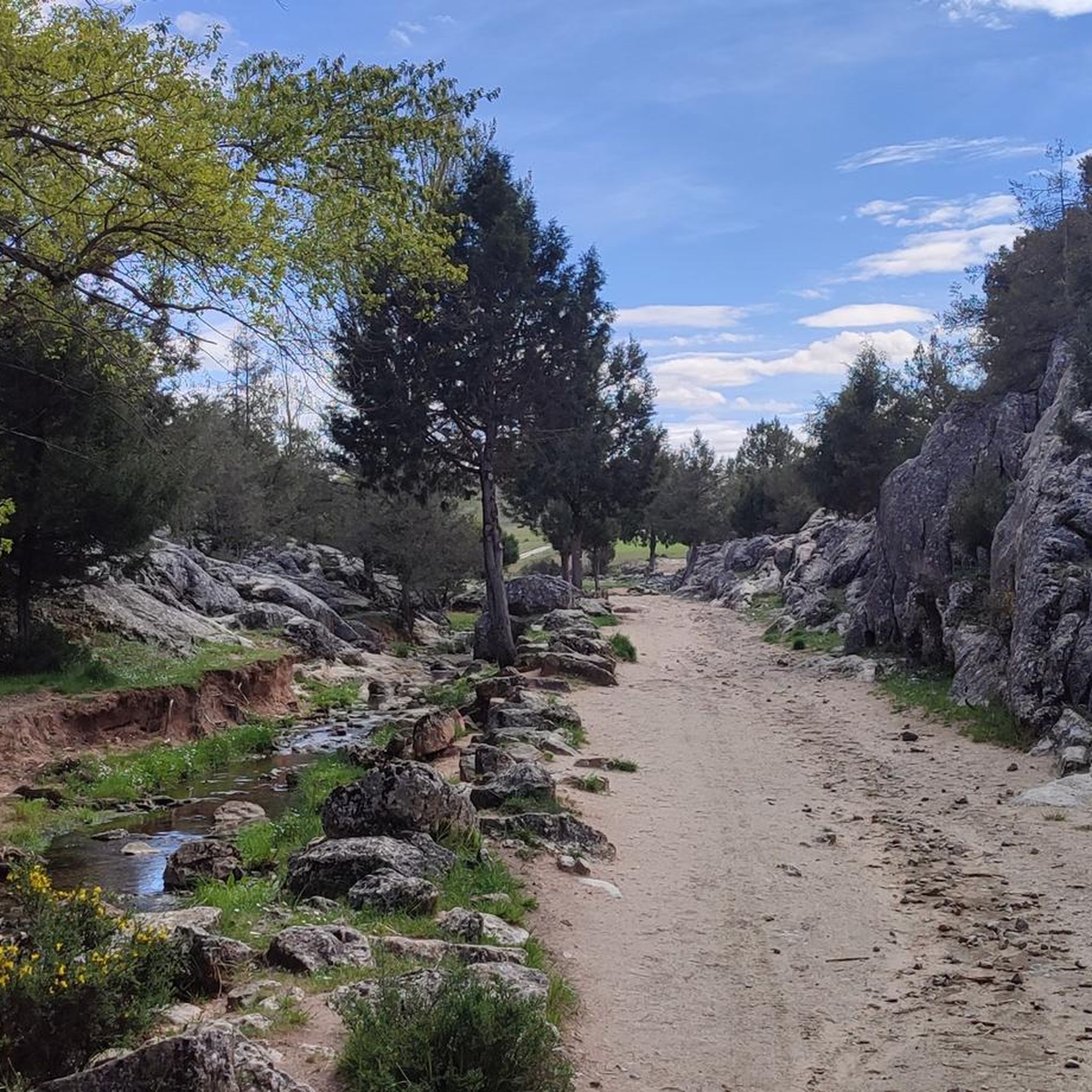
Hiking around Pinilla De Los Barruecos offers exploration through a landscape characterized by unique rock formations known as "barruecos" and expansive forests of pines, oaks, and junipers. The region features significant elevations, including El Cerro peak at 1230 meters, providing varied terrain for hikers. This area is situated near the source of the Río Lobos, contributing to its natural appeal. The diverse environment provides opportunities for observing local fauna.
Best hiking trails around Pinilla De Los Barruecos
- The most popular…
Last updated: August 26, 2026
14.2km
03:48
170m
170m
Moderate hike. Good fitness required. Mostly accessible paths. Sure-footedness required.
16.1km
04:30
310m
310m
Hike the moderate 10.0-mile Ermita de San Cristobal y Arroyo de Fuente Barda circular route, exploring ancient juniper forests and a scenic

Sign up for free
5.0
(2)
7
hikers
15.0km
04:39
490m
490m
Moderate hike. Good fitness required. Easily-accessible paths. Suitable for all skill levels.
5.0
(3)
10
hikers
Moderate hike. Good fitness required. Easily-accessible paths. Suitable for all skill levels.
6
hikers
Moderate hike. Good fitness required. Easily-accessible paths. Suitable for all skill levels.
Get access to more routes and recommendations from other explorers.
Sign up for free
Already have an account?
Our route recommendations are based on thousands of hikes, rides, and runs completed by other people on komoot.
Start today with a free account
Your next adventure awaits.
Login or Signup



Tips from the Community

A gradient that will not leave any cyclist indifferent, especially cycle tourists, more bearable from Contreras to Silos, from Silos more gradient and the last 200 meters before reaching the top in both directions is a wall, but it is worth it, fountain at the top.
0
0

The Arandilla River, a tributary of the Duero River in the province of Burgos, rises in the mountains near the town of Huerta de Rey.
4
0

A beautiful town in the Pinares region
0
0
Nice area for outdoor activities.
0
0
We'll be passing by here soon
0
0

The fictional cemetery “Sad Hill Cemetery” was artificially created for the filming of “Two Glorious Scoundrels”. The scene of the big showdown is iconic, in which the three opponents face each other between the graves of an old cemetery in a haunting finale. The cemetery was exposed to increasing decay. A group of courageous residents polished up the cemetery in 2016 in time for the 50th anniversary of the cult western.
0
0

In this natural setting the duel of the mythical movie The Good, the Bad and the Ugly was filmed. But apart from that, as soon as you get there, the cemetery is only part of the natural beauty that that valley has.
1
0

Small 20th century hermitage built in honor of San Cristóbal. The temple offers a spiritual refuge in the midst of an impressive natural environment. With a simple architecture, the hermitage offers impressive views of the valley from this hill located at an altitude of 1,185 meters. The space also has a fire watch tower.
1
0
Frequently Asked Questions
How many hiking trails are available around Pinilla De Los Barruecos?
There are over 30 hiking routes in the Pinilla De Los Barruecos area, offering a variety of experiences through its unique rock formations and expansive forests.
What kind of terrain and difficulty can I expect on the trails?
The trails around Pinilla De Los Barruecos range from easy to difficult. You'll find paths through dense woodlands, alongside unique 'barruecos' rock formations, and ascents to significant elevations like El Cerro peak. About 5 routes are considered easy, 23 are moderate, and 3 are difficult, providing options for various fitness levels.
Are there any circular hiking routes in the area?
Yes, many routes in Pinilla De Los Barruecos are circular. For example, the Aldea del Pinar y Rabanera del Pinar — circular by the Camino de Santiago is a popular moderate circular trail that follows a section of the Camino de Santiago.
What natural landmarks or viewpoints can I discover while hiking?
The region is known for its distinctive 'barruecos' rock formations and offers several viewpoints. You can find spectacular panoramic vistas from El Mirador, overlooking mountains like Cuerno de Gete and Peña de Carazo. The View of Peña de Carazo is a notable highlight. Additionally, the area is near the source of the Río Lobos, a significant natural feature.
Are there any historical sites or attractions near the hiking trails?
Yes, there are several interesting sites nearby. You could visit the historic Monasterio de Santo Domingo de Silos or the unique Sad Hill Cemetery. Some routes, like the Arauzo de Miel and San Cristóbal Hermitage Loop, lead past local points of interest.
What do other hikers enjoy most about the trails in Pinilla De Los Barruecos?
The komoot community rates the trails highly, with an average score of 4.0 stars from over 40 reviews. Hikers often praise the peaceful and quiet surroundings, the rich woodlands, and the unique geological formations that define the landscape.
Are there any easy hikes suitable for beginners or families?
Yes, there are several easy routes. The Sendero de Fuentes del Río Lobos (PRC-BU 223) is a prominent circular route, approximately 7 km long, suitable for an easy walk. It starts in Pinilla de los Barruecos and passes through nearby localities, offering a gentle introduction to the area's natural beauty.
Can I find more challenging or advanced hiking trails?
For those seeking a challenge, there are difficult routes with significant elevation gain. The Hacinas and Sierra de Carazo Loop is a difficult 20.6 km path featuring substantial ascents through the Sierra de Carazo.
Is there parking available at the trailheads?
While specific parking details for every trailhead are not provided, Pinilla de los Barruecos is a village with accessibility for visitors. It's generally advisable to check local signage or village information upon arrival for designated parking areas near popular starting points.
What is the best time of year to go hiking in Pinilla De Los Barruecos?
The region's expansive forests and unique rock formations make it appealing throughout much of the year. Spring and autumn generally offer pleasant temperatures and vibrant scenery, ideal for hiking. The wooded landscapes provide shade in warmer months, while the distinct geological features are striking in any season.
Are there any trails that pass through villages or offer opportunities to explore local culture?
Yes, some trails connect to or pass through nearby villages. The Sendero de Fuentes del Río Lobos, for instance, extends through localities like La Gallega, Rabanera del Pinar, Mamolar, and Gete. You can also find the Mamolar Village as a highlight near some routes.
Are there any trails that lead to a summit or offer high-altitude views?
Yes, the area features significant elevations such as Peña de Carazo and El Cerro peak, which stands at 1230 meters. The Pico Las Torres or La Calvilla is another summit highlight, offering rewarding views for hikers who tackle these higher points.
Most popular routes around Pinilla De Los Barruecos
Most popular attractions around Pinilla De Los Barruecos

Get inspired with the komoot mobile app


Explore more
Browse the best Hikes in other regions.
