The best MTB trails around Pascualcobo
5.0
(1)
20
riders
10
rides
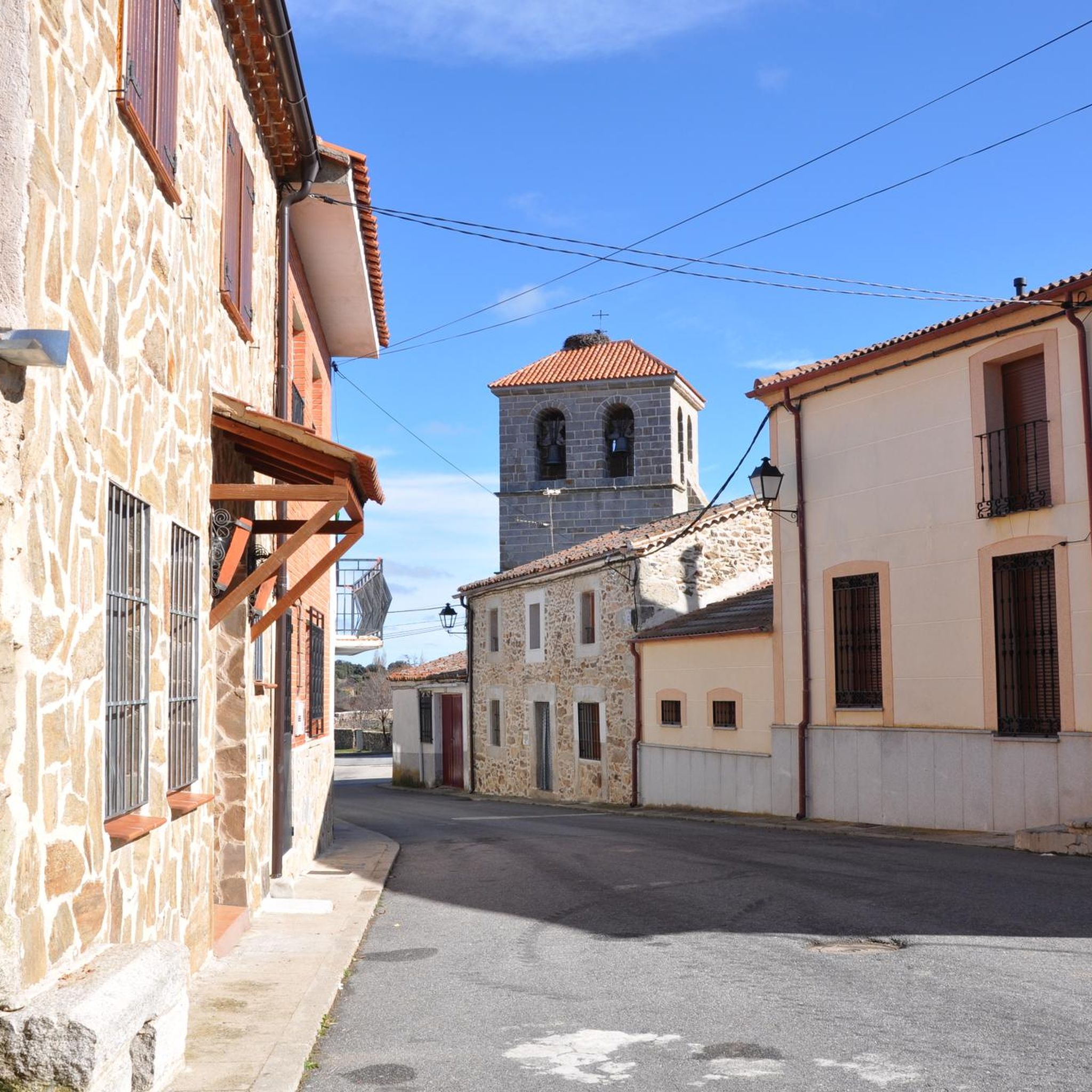
Mountain bike trails around Pascualcobo are situated in the province of Ávila, serving as a gateway to the Sierra de Gredos mountain range. This region is characterized by impressive granite massifs, including high peaks and glacial formations, alongside diverse ecosystems of dense forests and alpine meadows. The terrain offers a mix of challenging ascents and varied paths, with numerous rivers and streams contributing to the landscape.
Best mountain bike trails around Pascualcobo
- The most popular mountain bike trail is Bonilla…
Last updated: May 20, 2026
1
riders
43.3km
03:52
810m
810m
This moderate 26.9-mile mountain bike loop from San Miguel de Serrezuela takes you to the historic Castillo de Bonilla de la Sierra.
6
riders
49.5km
04:04
420m
420m
Moderate mountain bike ride. Good fitness required. Suitable for all skill levels.

Sign up for free
4
riders
52.9km
04:22
680m
680m
Moderate mountain bike ride. Good fitness required. Suitable for all skill levels.
5.0
(1)
3
riders
14.5km
01:26
370m
370m
Moderate mountain bike ride. Good fitness required. Suitable for all skill levels.
5.0
(1)
3
riders
19.4km
01:47
450m
450m
Moderate mountain bike ride. Good fitness required. Advanced riding skills necessary.
Get access to more routes and recommendations from other explorers.
Sign up for free
Already have an account?
Our route recommendations are based on thousands of hikes, rides, and runs completed by other people on komoot.
Start today with a free account
Your next adventure awaits.
Login or Signup
Popular around Pascualcobo
Tips from the Community

Also known as the Dávila Castle, it is one of the most important constructions found along the route of the Cañada Real Soriana Occidental. The Castle cannot be understood without the medieval bridge over the river Tormes. Together, they functioned as a control point for the passage of people and goods. According to documentation, Queen Isabella I and Emperor Charles V stayed overnight in the fortress.
0
0

The Church of Our Lady of the Assumption was built in the 14th century on the site of the old fortress and rebuilt in the 16th century. Of considerable size, its polygonal sanctuary and transept stand out, towering above the rest of the church and displaying magnificent ashlar masonry and stepped prismatic buttresses. The apse and the central section of the transept are covered with star-shaped ribbed vaults. They are the work of Lucas Giraldo and Juan Gutiérrez, two of the finest architects of the 16th century. The body of the church, with three naves formed by wide semicircular arches rising from octagonal pillars, resembles a large hall. It is entered through two doorways with pointed and splayed arches on pilasters, sheltered by simple alfices. The very simple, rectangular tower features ashlar masonry in the lower section, granite ashlar in the upper section, and balls in the cornice. Inside, the main altarpiece, dating from the early 18th century, is Churrigueresque in the main section and Rococo in the shell to match the shape of the apse vault, the sacristy altarpiece, and other altarpieces distributed throughout the naves of the church.
1
0

From Puerto de Villatoro itself, a road appears in a northerly direction that goes towards the center of Villanueva del Campillo, with impressive views of the area.
0
0

It's an easy place to get to
0
0
La Horcajada is located in the southwest triangle of the province of Ávila. It is practically the space between the foothills of Gredos and the mountain ranges of Malpartida and Collado del Mirón, on the one hand, and the port of Villatoro and the confluence of the Corneja and Tormes rivers, on the other. This surface has been called "Valdecorneja" for centuries. The Cancionero de Baeza, from 1445, for example, records this. The four most important towns in the Valley are, possibly since Vetton times or before, El Mirón, Piedrahíta, La Horcajada and El Barco de Ávila. La Horcajada is located about 75 kilometers southwest of the provincial capital, Ávila, about 82 kilometers from Salamanca and 185 kilometers from Madrid. The town is located at 1033 m above sea level. n. m. between the towns of Piedrahíta and Barco de Ávila on the slopes of the Sierra de la Horcajada.
1
0
Well-preserved castle and medieval bridge
0
0
Old bridge, currently misnamed La Fonseca, its real historical name is La Ponseca. It belongs to the municipality of La Horcajada, which has also recently been rehabilitated because its rock was detaching and its stability was beginning to be endangered. It crosses the river Corneja and as a curiosity, Emperor Carlos V passed over this bridge on his retirement journey to the Yuste monastery.
2
0
Right at the top of the town of El Mirón there is a hill with an old tower/castle from past times that offers impressive views of the town and the area as a whole.
1
0
Frequently Asked Questions
How many mountain bike trails are available around Pascualcobo?
There are 10 mountain bike trails around Pascualcobo listed in this guide. These routes offer a variety of experiences within the beautiful Sierra de Gredos region.
What is the typical terrain like for mountain biking near Pascualcobo?
The terrain around Pascualcobo, being a gateway to the Sierra de Gredos, is characterized by impressive granite massifs, diverse ecosystems, and varied paths. You'll encounter dense chestnut, pine, and oak forests, alpine meadows, and placid rivers. Routes can range from open landscapes to more challenging ascents and descents.
Are there any challenging mountain bike trails for experienced riders?
Yes, while most routes are moderate, there is at least one difficult mountain bike trail available. The Sierra de Gredos offers a wide network of trails, including those requiring good fitness and advanced skills, so experienced riders will find suitable challenges.
Are there any circular mountain bike routes around Pascualcobo?
Many of the mountain bike trails around Pascualcobo are designed as loops. For example, you can explore the Bonilla de la Sierra Castle Loop Trail or the Ponseca Bridge – Puente del Congosto loop from Arevalillo, both offering scenic circular rides.
What natural features can I expect to see while mountain biking in this region?
The Sierra de Gredos, which is easily accessible from Pascualcobo, is rich in natural beauty. You can expect to see impressive granite formations, glacial features like lagoons and cirques, dense forests, and numerous rivers and streams. The region is also home to diverse wildlife, including Spanish ibex and various bird species.
What is the best time of year to go mountain biking near Pascualcobo?
The Sierra de Gredos region generally offers good conditions for mountain biking from spring through autumn. Spring brings lush greenery and pleasant temperatures, while autumn provides cooler weather and beautiful fall foliage. Summer can be warm, especially at lower altitudes, but higher mountain trails offer cooler air. Winter can bring snow to higher elevations, making some routes inaccessible.
Is Pascualcobo a good base for mountain biking, and what amenities does it offer?
Pascualcobo itself is a tranquil, historic village known for its traditional architecture, offering a peaceful retreat after a day on the trails. While not an outdoor activity hub, its proximity to the Sierra de Gredos makes it an excellent base for exploring the mountain biking routes. For specific amenities like cafes or accommodation, you might find options within Pascualcobo or in slightly larger nearby towns.
What do other mountain bikers say about the trails around Pascualcobo?
The mountain bike routes around Pascualcobo are highly rated by the komoot community, with an average score of 5.0 stars from over 1 review. More than 20 mountain bikers have used komoot to explore the varied terrain, often praising the region's natural beauty and diverse trail options.
Are there any mountain bike trails suitable for families or beginners?
While this guide primarily features moderate to difficult routes, the broader Sierra de Gredos region does offer trails suitable for various skill levels. For families or beginners, it's advisable to look for routes with minimal elevation gain and smoother paths. The Mountainbike loop from Villanueva del Campillo is a shorter, moderate option that might be a good starting point.
Are there any specific parking facilities for mountain bikers near the trailheads?
Information on specific parking facilities for each trailhead is not detailed in this guide. However, as Pascualcobo is a small village and the trails are often accessed from various points in the surrounding area, you can typically find parking in or near the villages that serve as starting points for the routes. It's always recommended to check local signage for parking regulations.
Can I bring my dog on the mountain bike trails around Pascualcobo?
The Sierra de Gredos region is generally dog-friendly for outdoor activities, but specific trail regulations can vary. It's always best to keep your dog on a leash, especially in areas with wildlife or livestock, and to ensure they are well-behaved and don't disturb other users or the environment. Check local park rules if you plan to enter protected areas within the Sierra de Gredos.
What kind of elevation changes can I expect on the mountain bike trails?
The trails around Pascualcobo, situated near the Sierra de Gredos, feature significant elevation changes. For instance, the Bonilla de la Sierra Castle Loop Trail involves over 800 meters of ascent and descent, while the Fuente del Oro – Park Near Peñaranda loop from Cabezas del Villar has over 400 meters. Riders should be prepared for varied climbs and descents across the routes.
Most popular routes around Pascualcobo

Get inspired with the komoot mobile app


Explore more
Browse the best MTB trails in other regions.
