The best road cycling routes around Morata De Jiloca
79
riders
8
rides
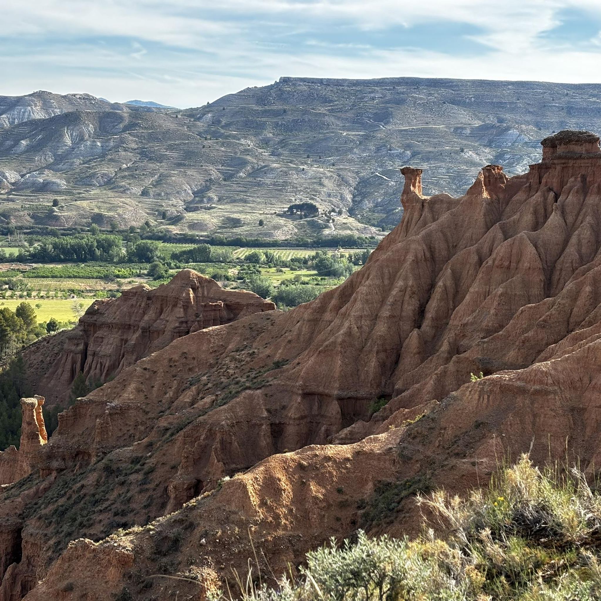
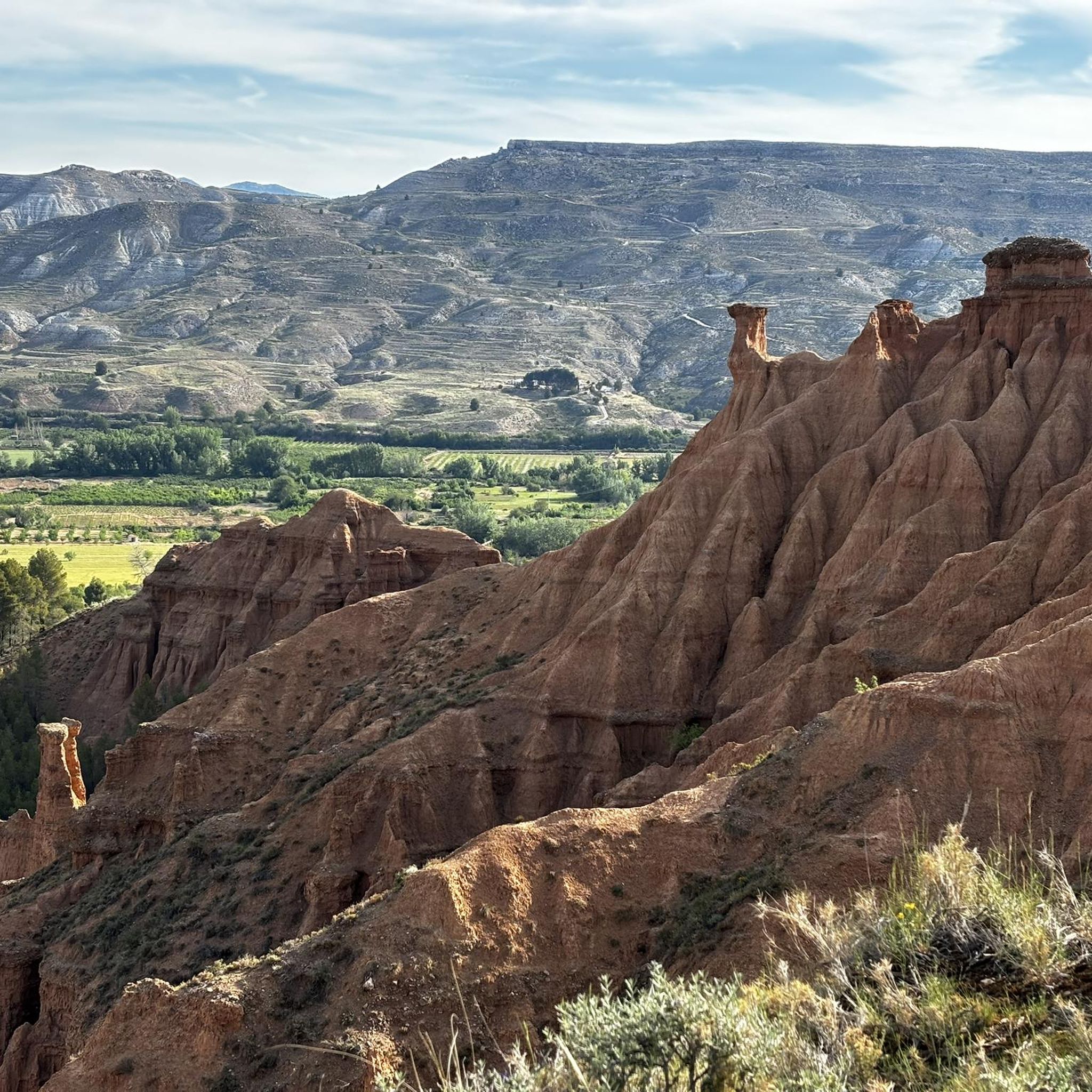
Road cycling routes around Morata de Jiloca traverse a landscape shaped by the Jiloca River valley, offering both flat sections and more challenging ascents into the surrounding Sierra de Atea. The region features unique geological formations like Las Cárcavas, characterized by eroded badlands, alongside dense pine forests. This varied topography provides diverse road cycling terrain, from riverside paths to routes with significant elevation changes.
Best road cycling routes around Morata De Jiloca
- The most popular road cycling route is Alto…
Last updated: June 28, 2026
40
riders
91.0km
04:16
1,130m
1,130m
Hard road ride. Very good fitness required. Some segments of this route may be unpaved and difficult to ride.
12
riders
53.8km
02:27
610m
610m
Moderate road ride. Good fitness required. Mostly well-paved surfaces and easy to ride.

Sign up for free
10
riders
99.0km
04:44
1,320m
1,320m
Hard road ride. Very good fitness required. Some segments of this route may be unpaved and difficult to ride.
9
riders
62.3km
03:00
890m
890m
Moderate road ride. Good fitness required. Mostly well-paved surfaces and easy to ride.
4
riders
42.4km
02:05
660m
660m
Moderate road ride. Good fitness required. Mostly well-paved surfaces and easy to ride.
Get access to more routes and recommendations from other explorers.
Sign up for free
Already have an account?
Our route recommendations are based on thousands of hikes, rides, and runs completed by other people on komoot.
Start today with a free account
Your next adventure awaits.
Login or Signup
Popular around Morata De Jiloca

Tips from the Community

This town is the largest in the Gallocanta area, it has some noble buildings well preserved and worth seeing. It is definitely worth a visit if you are in the area.
0
0
This town is the largest in the Gallocanta area, it has some noble buildings well preserved and worth seeing. It is definitely worth a visit if you are in the area.
0
0

The town of Codos is located on the banks of the Grío River, nestled in a primarily agricultural landscape where cherry and peach orchards predominate. In the center of town there is a bar.
1
0
As its name suggests, the town of Langa del Castillo is dominated by the vestiges of a castle located on top of a plateau. Few remains remain of this medieval fortress, although you can see how large it must have been in its time, when its function was to defend the border with the kingdom of Castile.
1
0
The town of Santa Cruz de Grío is located between the Vicort mountain range and the Grío river valley. Surrounded by forest masses and fields of almond, cherry and olive trees, Santa Cruz de Grío offers a quiet rural image. In season, the town's municipal swimming pool becomes the ideal place to cool off and have a bite to eat.
1
0
Tobed is a small town located in the Aragonese region of the Community of Catalayud. At the top of one of the hills that surround the town, there are the remains of a medieval fortress. In the urban area, the church of Santa María stands out, in the Gothic-Mudejar style.
1
0

Acered is a mid-mountain town in the Jiloca valley at about 800 meters above sea level. Its name derives from the Arame expression al-sirāṭ, which literally means "the path". And this small nucleus of houses is precisely in the Las Tres Taifas section of the Camino del Cid.
1
0

We are in Munébrega, where the Church of Nuestra Señora de la Asunción stands out, of course, in the Mudéjar style and from the 14th century. We can go to see the hermitage of San Cristóbal or the hermitage of Nuestra Señora del Mar y de la Cuesta or the beautiful pond that is in the surroundings with an age of more than 600 years. And if we want to play at getting lost in Munébrega, we can try to find the five Peirones that are scattered throughout the town.
1
0
Frequently Asked Questions
What kind of terrain can I expect on road cycling routes near Morata de Jiloca?
The region offers a diverse landscape for road cycling. You'll find relatively flat sections along the Jiloca River valley, which is known for its serene environment and fruit trees. For more challenging rides, routes extend into the surrounding Sierra de Atea, featuring significant climbs and descents. Unique geological formations like Las Cárcavas, with their striking eroded badlands, also provide a distinctive backdrop for some routes.
Are there challenging road cycling routes around Morata de Jiloca?
Yes, Morata de Jiloca offers several challenging road cycling routes. For instance, the Alto de Codos – Church of San Pedro loop from Miedes de Aragón is a difficult 53-mile (85.4 km) trail with significant climbs through the Sierra de Atea. Another demanding option is the Pietas Fountain and Picnic Area – Santa Cruz de Grío loop from Mara, covering 56.5 miles (91.0 km) with varied terrain.
What natural features or landmarks can I see while cycling in the area?
Cyclists can enjoy a variety of natural and historical sights. The Jiloca River valley itself is picturesque. A notable natural attraction is Las Cárcavas de Morata de Jiloca, unique 'badlands' with whimsical rock formations. You'll also pass through dense pine forests. Historically, the town features remnants of a Muslim castle and the beautiful Mudéjar church of San Martín de Tours. Nearby, you can explore the ruins of an Arab fortress and the Mudéjar tower in Maluenda.
Are there any long-distance cycling routes that pass through Morata de Jiloca?
Yes, Morata de Jiloca is part of the renowned Camino del Cid, a long-distance cycle tourism route. Specifically, the 'Tres Taifas' section of the Camino del Cid, which runs from Calatayud to Daroca, passes through the Jiloca lands. This route is largely on paved surfaces, making it ideal for road cycling and offering a multi-day experience through charming villages.
What is the best time of year for road cycling in Morata de Jiloca?
Aragon, where Morata de Jiloca is located, is a popular cycling destination. While specific seasonal data isn't provided, generally, spring and autumn offer the most pleasant conditions for road cycling in this region, with milder temperatures. Summers can be hot, and winters can be cold, so planning around these seasons is advisable for optimal comfort.
What do other road cyclists think about the routes in Morata de Jiloca?
The road cycling routes around Morata de Jiloca are highly rated by the komoot community, with an average score of 4.0 stars from reviewers. Cyclists often appreciate the varied terrain, from the serene river valley to the challenging climbs of the Sierra de Atea, and the unique natural and historical sights along the way.
Are there any moderate road cycling routes suitable for intermediate riders?
Yes, the area offers routes of varying difficulty. For intermediate riders, the Puerta de Terrer – Calatayud loop from Munébrega is a moderate 33.4-mile (53.8 km) route that provides a good balance of challenge and enjoyment without the extreme elevation gains of the most difficult trails.
Can I find loop routes for road cycling in Morata de Jiloca?
Many of the road cycling routes in the area are designed as loops, allowing you to start and finish in the same location. Examples include the Alto de Codos – Church of San Pedro loop from Miedes de Aragón and the Alto de Codos – Hermitage of the Virgin of the Eagle loop from Miedes de Aragón, both offering extensive circular rides.
What historical sites can I visit along the road cycling routes?
Beyond the natural beauty, you can explore rich cultural heritage. Morata de Jiloca itself has remnants of a Muslim castle and the Mudéjar church of San Martín de Tours. Nearby, you might encounter the ruins of an Arab fortress and the Mudéjar tower in Maluenda, or the Church of Our Lady of the Assumption of Munébrega.
How many road cycling routes are available around Morata de Jiloca?
There are over 10 dedicated road cycling routes around Morata de Jiloca, offering a range of distances and difficulty levels to suit various preferences.
Are there routes that explore the Jiloca River valley?
Yes, several routes are specifically designed to explore the Jiloca River valley. These routes often feature picturesque scenery, with fruit trees lining the riverbanks, and generally offer a more tranquil cycling experience compared to the mountain ascents. An example is the Pietas Fountain and Picnic Area – Santa Cruz de Grío loop from Mara, which explores this varied terrain.
Most popular routes around Morata De Jiloca
Most popular attractions around Morata De Jiloca

Get inspired with the komoot mobile app


Explore more
Browse the best Road cycling routes in other regions.
