The best walks and hikes around Amayuelas De Arriba
4.4
(14)
58
hikers
6
hikes
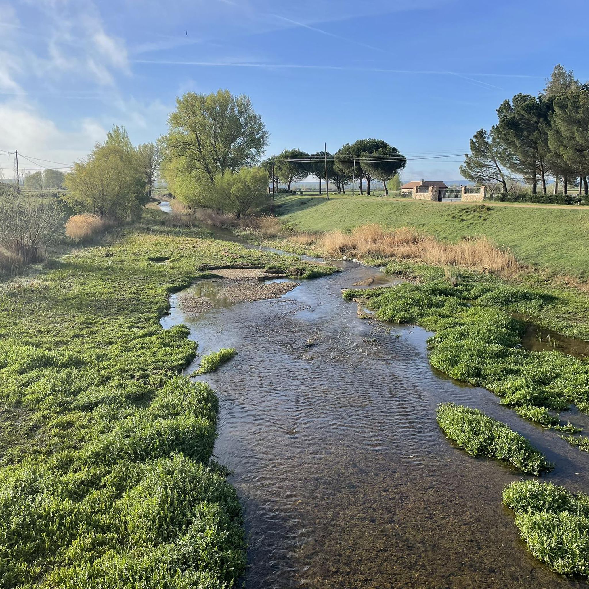
Hiking around Amayuelas De Arriba offers exploration of the tranquil Tierra de Campos region in Palencia, Spain. The area is characterized by its predominantly flat terrain, expansive cereal fields, and the historic Canal de Castilla. This significant waterway provides accessible routes along its banks, while the Ucieza River also features in some trails. The landscape offers wide vistas and a connection to traditional agricultural settings.
Best hiking trails around Amayuelas De Arriba
- The most popular hiking route is Boadilla del Camino from Frómista — circular by the Canal de Castilla, a 7.9 miles (12.7 km) trail that takes 3 hours 13 minutes to complete. This moderate route follows the historic Canal de Castilla, offering views of the waterway.
- Another top favourite among local hikers is Puente del Gallo y esclusas de Calahorra de Ribas — circular por el Canal de Castilla, an easy 4.0 miles (6.5 km) path. This circular route also runs along the Canal de Castilla, featuring its notable lock systems.
- Local hikers also love the Statue of Pablo Payo Pérez – View of the Meseta loop from Villarmentero de Campos, a 12.3 miles (19.8 km) trail leading through the open landscapes of the Meseta, often completed in about 5 hours 7 minutes.
- Hiking around Amayuelas De Arriba is defined by flat cereal fields, the historic Canal de Castilla, and the Ucieza River. The network offers options for different ability levels, from easy walks to more challenging long-distance routes.
- The routes in Amayuelas De Arriba are highly rated by the komoot community with an average score of 4.3 stars from over 15 reviews. More than 65 hikers have used komoot to explore Amayuelas De Arriba's varied terrain.
Last updated: June 28, 2026
4.8
(4)
24
hikers
Moderate hike. Good fitness required. Easily-accessible paths. Suitable for all skill levels.
4.0
(1)
3
hikers
Easy hike. Great for any fitness level. Easily-accessible paths. Suitable for all skill levels.

Sign up for free
5.86km
01:30
20m
20m
Easy hike. Great for any fitness level. Easily-accessible paths. Suitable for all skill levels.
11.3km
02:52
20m
20m
Hike a moderate 7.0-mile (11.3 km) loop along the Ucieza River, exploring Camino de Santiago symbols in Tierra de Campos.
4.4
(9)
31
hikers
Hard hike. Very good fitness required. Easily-accessible paths. Suitable for all skill levels.
Our route recommendations are based on thousands of hikes, rides, and runs completed by other people on komoot.
Start today with a free account
Your next adventure awaits.
Login or Signup
Popular around Amayuelas De Arriba

Tips from the Community

A short, pleasant stretch to walk because the water cools the air a little.
1
1

The views from the P-980 highway, especially in the area known as Los Coracoles in the Palentina Mountains, are truly spectacular and are part of the famous Ruta de los Pantanos (Wetlands Route).
1
0
The Statue of the Pilgrim in Carrión de los Condes is an emblematic monument located in Plaza Piña Merino, right at the entrance to the town if you're coming from Frómista, right on the Camino de Santiago. This bronze sculpture represents a traditional pilgrim, dressed in a cape and hat, and carrying the Jacobean symbols: the shell, the staff, and the calabash. It is a life-size figure that pays tribute to the thousands of pilgrims who pass through this historic town in Palencia each year.
2
0
The Statue of the Pilgrim in Carrión de los Condes is an emblematic monument located in Plaza Piña Merino, right at the entrance to the town if you're coming from Frómista, right on the Camino de Santiago. This bronze sculpture represents a traditional pilgrim, dressed in a cape and hat, and carrying the Jacobean symbols: the shell, the staff, and the calabash. It is a life-size figure that pays tribute to the thousands of pilgrims who pass through this historic town in Palencia each year.
1
0
Its origin dates back to August 15, 1101, when a flood destroyed the village of Tablares and swept away a Romanesque image of the Virgin. The residents found it on the riverbank and decided to build a sanctuary there, interpreting the discovery as a divine sign. The first church was Romanesque in style, although the current Baroque structure was rebuilt in 1713 by Francisco de Arratia Curiel.
3
0
Its origin dates back to August 15, 1101, when a flood destroyed the village of Tablares and swept away a Romanesque image of the Virgin. The residents found it on the riverbank and decided to build a sanctuary there, interpreting the discovery as a divine sign. The first church was Romanesque in style, although the current Baroque structure was rebuilt in 1713 by Francisco de Arratia Curiel.
4
0
The Hermitage of Our Lady of the River, located approximately 1 km northeast of Villalcázar de Sirga, next to the Ucieza River, is a place steeped in history, spirituality, and legend, closely linked to the French Way of St. James.
4
0
The Hermitage of Our Lady of the River, located approximately 1 km northeast of Villalcázar de Sirga, next to the Ucieza River, is a place steeped in history, spirituality, and legend, closely linked to the French Way of St. James.
3
0
Frequently Asked Questions
How many hiking trails are available around Amayuelas De Arriba?
There are 6 hiking trails available around Amayuelas De Arriba. These routes range in difficulty from easy to difficult, offering options for various fitness levels.
What kind of terrain can I expect on hikes near Amayuelas De Arriba?
The terrain around Amayuelas De Arriba is predominantly flat, characterized by expansive cereal fields and the historic Canal de Castilla. You'll find wide vistas and well-maintained paths, making for accessible and peaceful exploration.
Are there any easy hiking routes suitable for beginners or families?
Yes, there are 2 easy routes. A great option is the Puente del Gallo y esclusas de Calahorra de Ribas — circular por el Canal de Castilla, an easy 6.5 km path that features the notable lock systems of the Canal de Castilla. Another easy choice is Fromista and its locks of the Canal de Castilla, covering 5.9 km.
What are some notable natural features or landmarks to see while hiking?
Hikers can explore the historic Canal de Castilla, an ancient waterway with picturesque routes and remarkable lock systems like the Quadruple Lock of the Canal de Castilla near Frómista and the Calahorra de Ribas Locks. The vast cereal fields of the Tierra de Campos also offer unique wide vistas.
Are there any circular hiking routes in the area?
Yes, several routes are circular. For example, the moderate Boadilla del Camino from Frómista — circular by the Canal de Castilla is a 12.7 km loop along the historic waterway. Another option is the easy Puente del Gallo y esclusas de Calahorra de Ribas — circular por el Canal de Castilla.
What do other hikers say about the trails in Amayuelas De Arriba?
The trails in Amayuelas De Arriba are highly rated by the komoot community, with an average score of 4.3 stars from over 15 reviews. Hikers often praise the serene landscapes, the historical elements along the Canal de Castilla, and the peaceful atmosphere of the Tierra de Campos region.
Are there any longer or more challenging hikes available?
Yes, for those seeking a longer challenge, the Statue of Pablo Payo Pérez – View of the Meseta loop from Villarmentero de Campos is a difficult 19.8 km trail that takes approximately 5 hours 7 minutes to complete, leading through the open landscapes of the Meseta.
Can I combine hiking with cultural or historical exploration?
Absolutely. Amayuelas de Arriba itself offers historical elements like a medieval cistern fountain and traditional washing troughs. The nearby Frómista is also home to the Church of Santa Columba, with Romanesque origins, providing a blend of active exploration and cultural immersion.
What is the best time of year to go hiking in Amayuelas De Arriba?
Given the region's flat terrain and expansive cereal fields, spring and autumn are generally ideal for hiking. The temperatures are milder, and the landscape offers beautiful colors, avoiding the heat of summer or potential chill of winter.
Is public transport available to reach Amayuelas De Arriba for hiking?
While Amayuelas de Arriba is a tranquil village, public transport options might be limited. It's advisable to check local bus schedules or consider driving, as many routes are easily accessible by car, often with nearby parking in villages like Frómista.
Are there any specific points of interest along the Camino de Santiago in this area?
The Canal de Castilla runs parallel to sections of the Camino Francés de Santiago, offering picturesque routes. You can also find insights into Camino de Santiago symbols along the Ucieza River, which features in some local routes.
Most popular routes around Amayuelas De Arriba
Most popular attractions around Amayuelas De Arriba

Get inspired with the komoot mobile app


Explore more
Browse the best Hikes in other regions.
