The best road cycling routes around Valtablado Del Río
5.0
(1)
64
riders
6
rides
Road cycling routes around Valtablado Del Río are situated in the western part of the Alto Tajo Natural Park, characterized by diverse terrain and natural features. The region features the River Tajo, which has carved deep gorges and canyons, alongside extensive pine forests, holm oaks, junipers, and savins. Roads are often "toboggan-like," with continuous climbs and descents, providing a dynamic riding experience. This area offers varied topography, from riverbanks to higher elevations with panoramic views, making it suitable for challenging road cycling.
Best road cycling routes around Valtablado Del Río
- The most popular road cycling route is Alto Tajo Natural Park Loop, a 68.6 miles (110.4 km) trail that takes 5 hours 17 minutes to complete. This difficult route explores the varied landscapes of the natural park, offering sustained climbs and descents.
- Another top favourite among local road cyclists is Alto Tajo and Arbeteta Castle Loop, a difficult 72.4 miles (116.6 km) path. This route combines the natural beauty of the Alto Tajo with historical landmarks, featuring significant elevation changes and scenic vistas.
- Local road cyclists also love the Cifuentes – Entrepeñas Viaduct loop from Mantiel, a 75.7 miles (121.8 km) trail leading through varied terrain including the Entrepeñas Viaduct, often completed in about 5 hours 48 minutes.
- Road cycling around Valtablado Del Río is defined by river gorges, dense pine forests, and "toboggan-like" roads. The network offers options for different ability levels, though most routes present a significant challenge.
- The routes in Valtablado Del Río are highly rated by the komoot community with an average score of 5.0 stars from over 1 review. More than 59 road cyclists have used komoot to explore Valtablado Del Río's varied terrain.
Last updated: June 28, 2026
5.0
(1)
29
riders
110km
05:18
1,550m
1,550m
This difficult 68.6-mile road cycling route through the Alto Tajo ZEPA area features Trillo Waterfalls and stunning Alcarria landscapes.
6
riders
117km
05:49
1,860m
1,870m
This difficult 72.4-mile road cycling route through the Alto Tajo Natural Area offers dramatic landscapes and views of Arbeteta Castle.

Sign up for free
16
riders
121km
05:47
1,660m
1,660m
Hard road ride. Very good fitness required. Mostly well-paved surfaces and easy to ride.
5
riders
125km
06:01
1,730m
1,730m
Hard road ride. Very good fitness required. Mostly well-paved surfaces and easy to ride.
6
riders
31.6km
01:38
580m
580m
Moderate road ride. Good fitness required. Mostly well-paved surfaces and easy to ride.
Our route recommendations are based on thousands of hikes, rides, and runs completed by other people on komoot.
Start today with a free account
Your next adventure awaits.
Login or Signup
Popular around Valtablado Del Río

Other adventures around Valtablado Del Río

Tips from the Community

Very nice owner, bathrooms are heated.
0
0

First checkpoint on the route from Madrid to Barcelona. In the main square we find places to get supplies and rest.
0
0

Beautiful town in Alto Tajo with exceptional landscapes.
0
0
Muslim castle built on a firm rock. Impregnable. for the defense of the Tagus River.
0
0

Beautiful town that is located to the south of the Natural Park of Alto Tajo and that represents a typical town of this western area of the Serrania de Cuenca.
0
0

The Entrepeñas viaduct is an impressive construction that allows you to cross this reservoir located in the bed of the Tagus River.
1
0
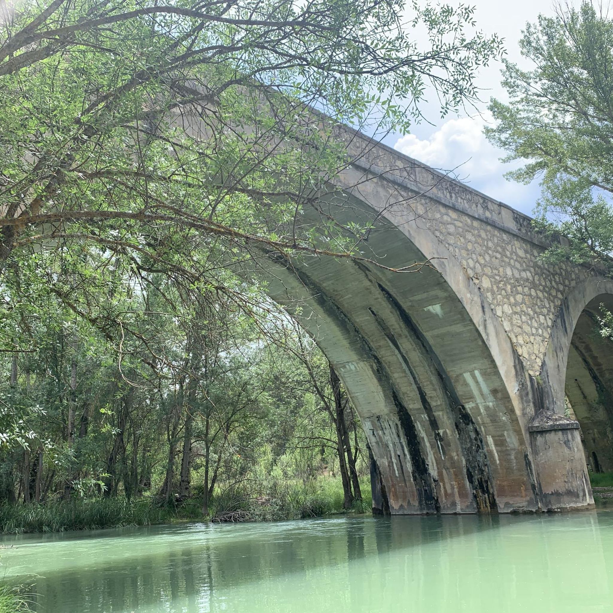
The Valtablado del Río bridge crosses the waters of the Tagus in an area full of poplars. The great width and shallowness of the river, added to the shade provided by the trees, creates a privileged bathing area on hot days.
2
0

Magnificent arched viaduct built over the Tagus River and the Entrepeñas Reservoir.
1
0
Frequently Asked Questions
What kind of terrain can I expect on road cycling routes around Valtablado Del Río?
The region is characterized by diverse and dynamic terrain. You'll find roads often described as "toboggan-like," featuring continuous climbs and descents. Routes wind through extensive pine forests, interspersed with holm oaks, junipers, and savins, offering varied topography from riverbanks to higher elevations with panoramic views.
Are there any easy road cycling routes for beginners in Valtablado Del Río?
While many routes in Valtablado Del Río present a significant challenge, there is at least one moderate option. The Arrival in Sacecorbo – Valtablado del Río Bridge loop from Sacecorbo is a moderate 31.7 km route, offering a less demanding experience compared to the longer, more difficult trails.
What natural features or landmarks can I see while cycling in the Alto Tajo Natural Park?
The Alto Tajo Natural Park offers stunning natural features. You can encounter the majestic River Tajo, which has carved deep gorges and impressive canyons. Notable landmarks include the striking limestone formations of Peña del Arco and the scenic Valtablado del Río Bridge, which is also a popular natural swimming spot. You might also discover the Stone Waterfall (Cascada de Piedra).
Are there any circular road cycling routes available?
Yes, Valtablado del Río features several circular routes. For instance, the Alto Tajo Natural Park Loop is a challenging 110.4 km circular trail exploring the varied landscapes. Another option is the Arrival in Sacecorbo – Valtablado del Río Bridge loop from Sacecorbo, a moderate 31.7 km loop.
What is the traffic like on the roads in Valtablado Del Río?
The secondary roads in and around Valtablado del Río typically experience very little traffic. This enhances the safety and enjoyment for cyclists, allowing for a more peaceful and immersive riding experience through the natural landscapes.
Can I find long-distance road cycling routes in this area?
Absolutely. The region is well-suited for long-distance road cycling. Routes like the Alto Tajo and Arbeteta Castle Loop span 116.6 km, combining natural beauty with historical landmarks and significant elevation changes. Another challenging option is the Peñalén – Hoz de Beteta loop from Armallones, which covers 125.3 km.
What do other road cyclists say about the routes in Valtablado Del Río?
The routes in Valtablado Del Río are highly rated by the komoot community, with an average score of 5.0 stars. Cyclists often praise the quiet roads, stunning scenery, and the dynamic riding experience offered by the continuous climbs and descents through the Alto Tajo Natural Park.
Are there any historical points of interest along the road cycling routes?
Yes, some routes combine natural beauty with historical elements. For example, the Alto Tajo and Arbeteta Castle Loop offers scenic vistas that include Views of Arbeteta Castle. You might also encounter the Ruins of the Inesperada Salt Factory on some routes.
What is the best time of year to go road cycling in Valtablado Del Río?
The region is suitable for outdoor activities, but given the 'toboggan-like' roads and potential for higher elevations, spring and autumn generally offer the most comfortable temperatures for road cycling. Summers can be warm, but the Valtablado del Río Bridge offers a natural swimming area for a refreshing break.
How many road cycling routes are available in the Valtablado Del Río area?
There are several dedicated road cycling routes around Valtablado Del Río, with komoot featuring 6 distinct tours. These range from moderate to difficult, offering options for various skill levels, though most present a significant challenge.
Can I find routes that offer panoramic views?
Absolutely. The varied topography of Valtablado Del Río, from riverbanks to higher elevations, ensures many routes provide panoramic views. The deep gorges and impressive canyons carved by the River Tajo, along with the extensive forests, create a dramatic and scenic backdrop for your ride.
Are there any specific routes that highlight the River Tajo?
The majestic River Tajo flows less than a kilometer from Valtablado del Río, and its presence defines much of the landscape. Routes in the area will often follow or offer views of the river, which has carved out deep gorges and impressive canyons. The Valtablado del Río Bridge is a key point of interest directly over the Tajo.
Most popular routes around Valtablado Del Río
Most popular attractions around Valtablado Del Río

Get inspired with the komoot mobile app


Explore more
Browse the best Road cycling routes in other regions.
