The best running trails around Santibáñez De La Sierra
129
runners
6
runs
Jogging routes around Santibáñez De La Sierra traverse a diverse landscape within the Sierra de Francia, characterized by river valleys, mountain slopes, and protected natural environments. The region features a blend of Mediterranean and Atlantic-influenced forests, including Pyrenean oak, chestnut, and holm oak, alongside vineyards. The Alagón River and its tributaries create lush valleys, while elevations like Peñita Palomera offer varied inclines and views. This topography provides a range of running experiences from riverside paths to more challenging hill climbs.
…Last updated: June 29, 2026
16
runners
7.94km
00:50
110m
110m
Moderate run. Good fitness required. Mostly paved surfaces. Suitable for all skill levels.
15
runners
11.7km
01:22
310m
310m
Hard run. Very good fitness required. Mostly paved surfaces. Suitable for all skill levels.

Sign up for free
12
runners
22.3km
02:48
790m
780m
Hard run. Very good fitness required. Mostly accessible paths. Some sure footedness required.
10
runners
8.51km
01:06
300m
300m
Hard run. Very good fitness required. Sure-footedness, sturdy shoes and alpine experience required.
4
runners
Hard run. Very good fitness required. Mostly paved surfaces. Suitable for all skill levels.
Our route recommendations are based on thousands of hikes, rides, and runs completed by other people on komoot.
Start today with a free account
Your next adventure awaits.
Login or Signup
Tips from the Community

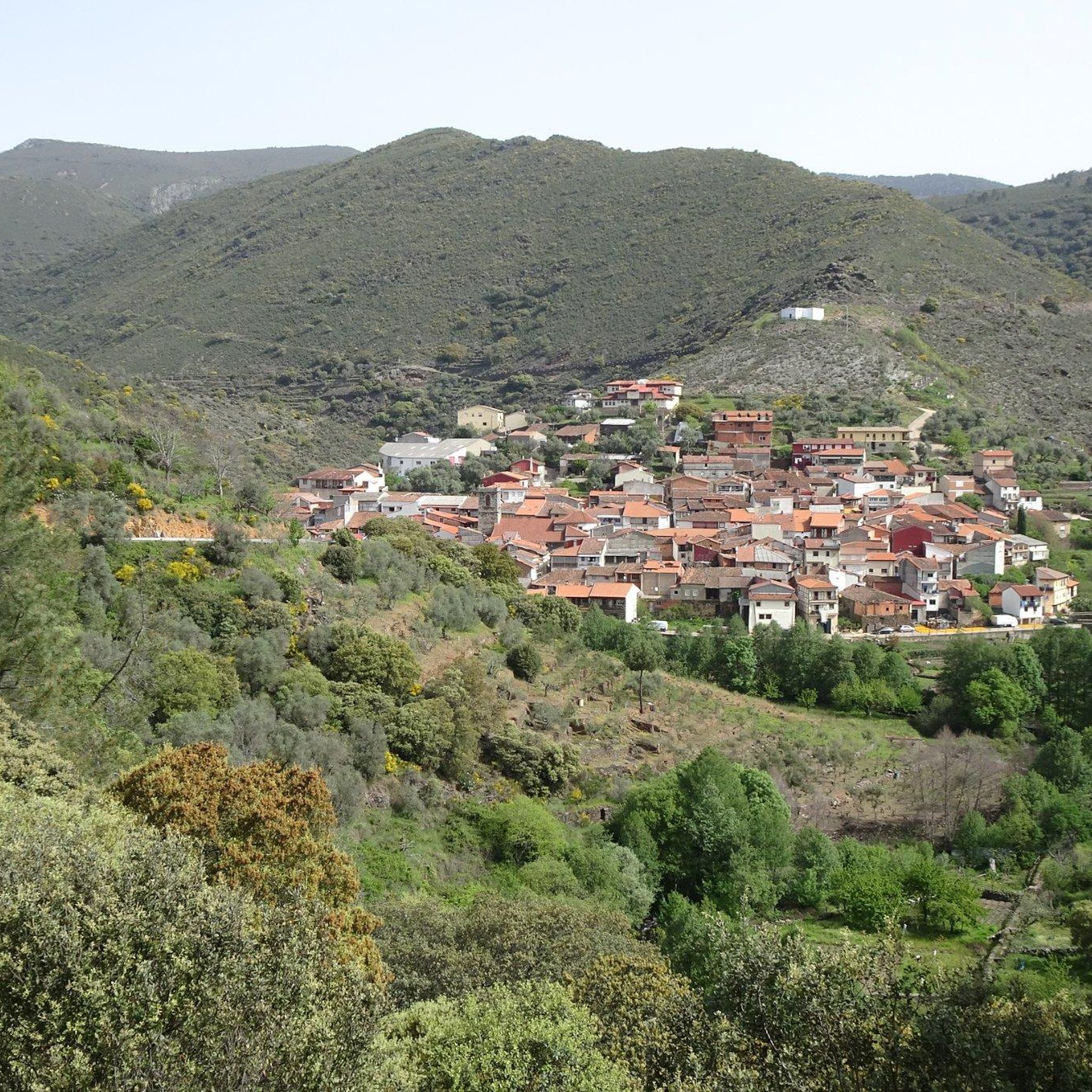
What to see in Garcibuey Mural Route – Graffitibuey Since 2019, Garcibuey has become the “graffiti village,” with more than 18 murals by national and international artists integrated into its traditional architecture. The highlight is the mural “El Tritón de Miguelón,” covering 1,600 m², considered the largest in Europe and awarded best mural in the world in 2023. Old Town Cobblestone streets, traditional stone and wood houses, and the Church of San Pedro Apóstol (16th century) with a Baroque altarpiece. La Palla Pond An old irrigation system (1940), now a recreational area with a natural pool and a beach bar offering spectacular views. La Peña Viewpoint Panoramic views over the Alagón Valley and the Sierra de Francia mountain range.
8
0
Founded during the 13th-century repopulation of León by Alfonso IX, it was part of the district of Miranda del Castañar. Prehistoric remains can be found in the La Palla Valley, and legends abound about hidden treasures in the Cueva de la Mora (Cave of the Moorish Woman). The traditional economy is based on orchards, vineyards (Sierra de Salamanca Designation of Origin), and olive oil.
9
0
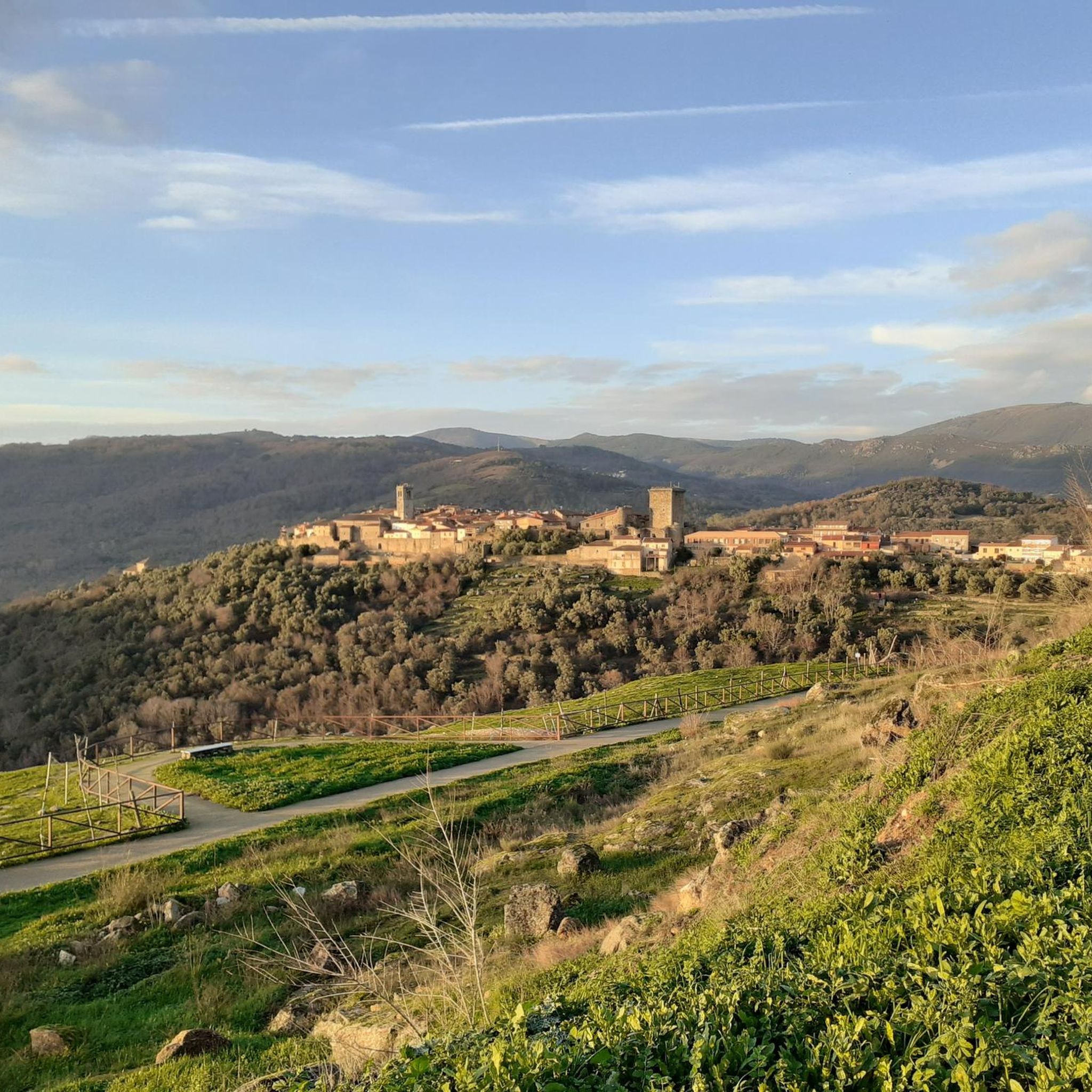
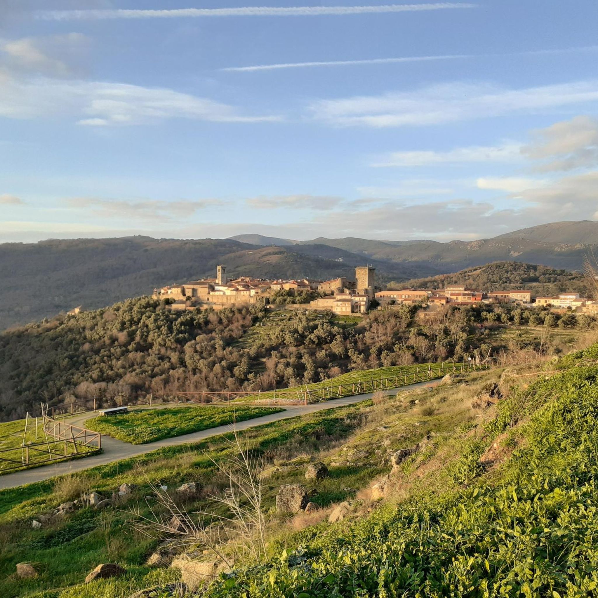
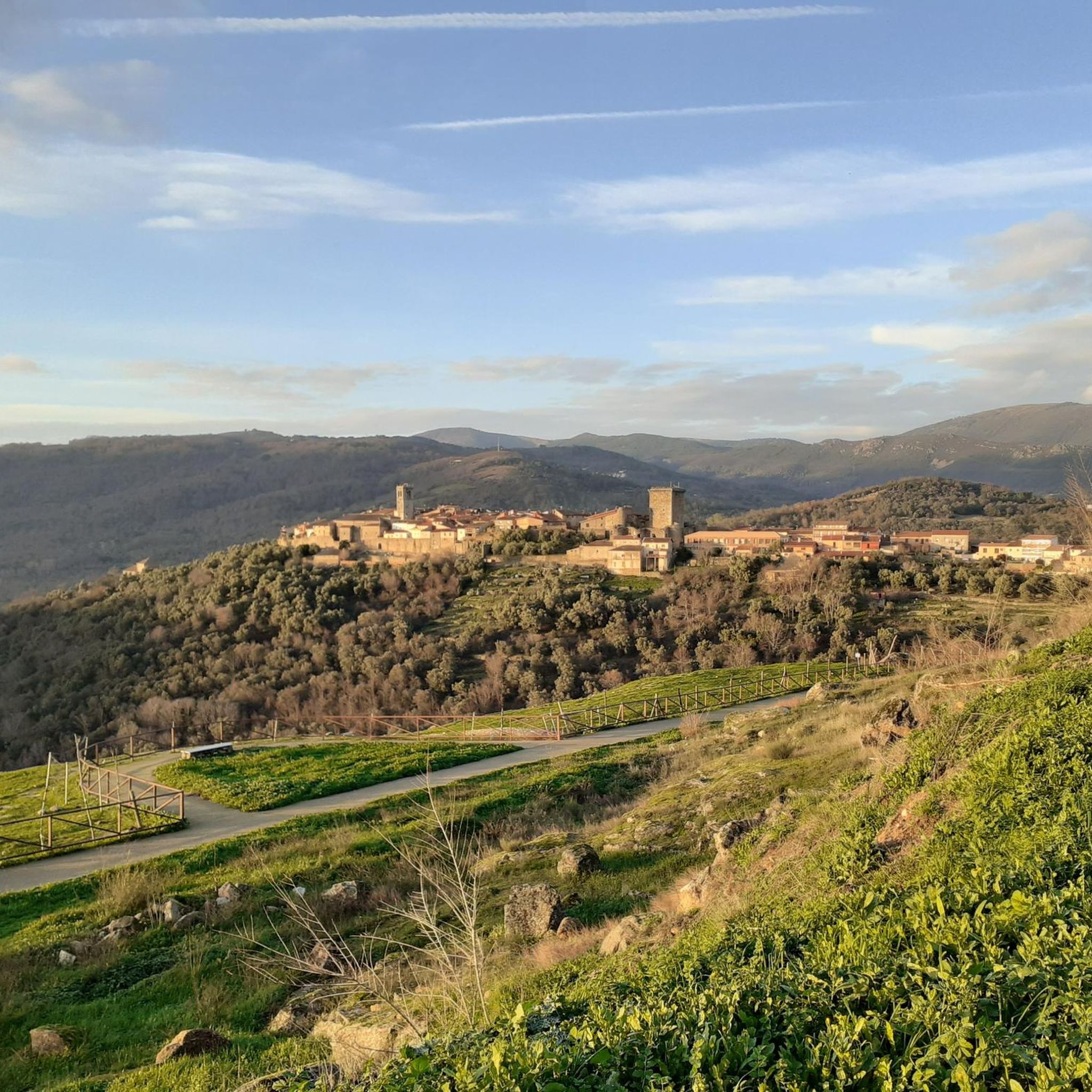
What to see in Miranda del Castañar Medieval Walls: Over 600 meters remain intact, with four gates facing the cardinal directions: San Ginés, Nuestra Señora, La Villa, and El Postigo. Zúñiga Castle: A 15th-century fortress, symbol of the former County of Miranda. Although the interior is not open to the public, its exterior and keep are impressive. Square Bullring: Considered one of the oldest in Spain, built in the 16th century on the site of the former parade ground. Church of Santiago and San Ginés: Gothic in style (13th-16th centuries), with a detached 17th-century bell tower. Houses with Coats of Arms: More than 80 noble coats of arms adorn the facades, reflecting the town's aristocratic past.
1
0
Miranda del Castañar, one of the most beautiful villages in Spain, is located in the Sierra de Francia (Salamanca): Founded in 1213 by Alfonso IX of León as a town and council, it was the administrative capital of the Sierra de Francia. In the 15th century, the County of Miranda was created under the control of the Zúñiga family, consolidating its strategic importance.
1
0
Zúñiga Castle: A 15th-century fortress, symbol of the former County of Miranda. Although it is not open to the public, its exterior and keep are impressive.
1
0
What to see in Miranda del Castañar Medieval Walls: Over 600 meters remain intact, with four gates facing the cardinal directions: San Ginés, Nuestra Señora, La Villa, and El Postigo. Zúñiga Castle: A 15th-century fortress, symbol of the former County of Miranda. Although the interior is not open to the public, its exterior and keep are impressive. Square Bullring: Considered one of the oldest in Spain, built in the 16th century on the site of the former parade ground. Church of Santiago and San Ginés: Gothic in style (13th-16th centuries), with a detached 17th-century bell tower. Houses with Coats of Arms: More than 80 noble coats of arms adorn the facades, reflecting the town's aristocratic past.
8
0
Miranda del Castañar, one of the most beautiful villages in Spain, is located in the Sierra de Francia (Salamanca): Founded in 1213 by Alfonso IX of León as a town and council, it was the administrative capital of the Sierra de Francia. In the 15th century, the County of Miranda was created under the control of the Zúñiga family, consolidating its strategic importance.
9
0

Frequently Asked Questions
How many running routes can I explore around Santibáñez de la Sierra?
There are currently 5 diverse running routes documented around Santibáñez de la Sierra on komoot. These routes offer a range of experiences, from moderate riverside paths to more challenging mountain ascents.
Are there any easy or beginner-friendly jogging routes in the area?
While many routes in Santibáñez de la Sierra feature varied terrain and elevation, the Miranda del Castañar – Miranda de Castañar loop from Miranda del Castañar is a moderate option at 4.9 miles (7.9 km) with less significant elevation gain, making it suitable for those looking for a less strenuous run. The "Sendero de los Miradores de las Sierras" is also known to be easily traversable and family-friendly.
What kind of scenery can I expect on the jogging trails in Santibáñez de la Sierra?
The routes offer incredibly diverse scenery, from lush river valleys along the Alagón and Saltillo rivers to mountain slopes crowned by peaks like Peñita Palomera. You'll run through a blend of Mediterranean and Atlantic-influenced forests, including Pyrenean oak, chestnut, holm oak, and vineyards. Many trails, like the "Ruta de los Miradores," provide stunning panoramic views of the surrounding Sierras.
Are there any historical points of interest along the running paths?
Absolutely! The region is rich in history. Some routes follow ancient paths, including sections of an old Roman road. You can find remnants of Roman paving and an ancient Roman bridge (1st century BC) near Puentes del Alagón, alongside a medieval bridge over the Saltillo River. The village of Santibáñez de la Sierra itself is a declared Historic-Artistic Site with traditional "arquitectura serrana" to admire.
Which running routes offer the best views or viewpoints?
For rewarding vistas, consider routes that ascend to higher elevations. The village is located on the slope of a mountain crowned by Peñita Palomera, offering elevated views. The "Ruta de los Miradores" (Viewpoints Route) is specifically designed to lead to scenic overlooks, providing stunning panoramic views of the surrounding Sierras, particularly towards San Esteban de la Sierra.
Can I find circular running routes in Santibáñez de la Sierra?
Yes, several routes are designed as loops, allowing you to start and finish in the same location. For example, the Miranda del Castañar – Miranda de Castañar loop from Miranda del Castañar is a popular circular option. The "Sendero de los Miradores de las Sierras" is also a circular route between Santibáñez de la Sierra and San Esteban de la Sierra.
What is the best time of year to go jogging in Santibáñez de la Sierra?
The region is beautiful year-round, but spring is particularly vibrant with the "Ruta de los Cerezos en Flor" (Cherry Blossom Route) offering a fragrant and colorful experience. The blend of Mediterranean and Atlantic influences means lush landscapes. Summers can be warm, so early mornings or late afternoons are ideal. Autumn brings beautiful foliage, while winter offers a different, often tranquil, running experience.
Are there any attractions or landmarks near the running trails?
Yes, the area boasts several interesting attractions. You can explore the charming village of Mogarraz or visit the Miranda del Castañar. For natural features, Cervero Peak offers a challenging ascent with great views, and the Soto Bridge - Alagón River is a notable natural monument. The Granite Theme Park is also nearby.
What do other runners say about jogging in Santibáñez de la Sierra?
The komoot community highly values the running experiences in Santibáñez de la Sierra. Runners often praise the diverse terrain, from gentle riverside paths to more demanding ascents, and the stunning natural beauty of the Sierra de Francia. The historical elements and well-preserved environment also receive positive feedback, making it a rewarding destination for outdoor enthusiasts.
Are there any long-distance running options for experienced runners?
Yes, for those seeking a greater challenge, routes like the Pico Cervero and Honfrías Trail cover 11.7 miles (18.8 km) with significant elevation gain. Another demanding option is the Garcibuey – Villanueva del Conde loop from Villanueva del Conde, which extends over 13.9 miles (22.3 km) and features substantial climbing, ideal for experienced runners looking for a long-distance workout.
Can I find routes that follow waterways or rivers?
Certainly. The municipality is traversed by the Alagón River and its tributary, the Saltillo, creating lush valleys. The Water Trail is a prime example, following waterways and offering a scenic experience through the region's valleys. The "Puentes del Alagón" area, with its natural bathing zones, also suggests picturesque riverside paths.
Most popular routes around Santibáñez De La Sierra
Most popular attractions around Santibáñez De La Sierra

Get inspired with the komoot mobile app


Explore more
Browse the best Running Trails & Routes in other regions.
