The best road cycling routes around Fuentes De Jiloca
61
riders
8
rides
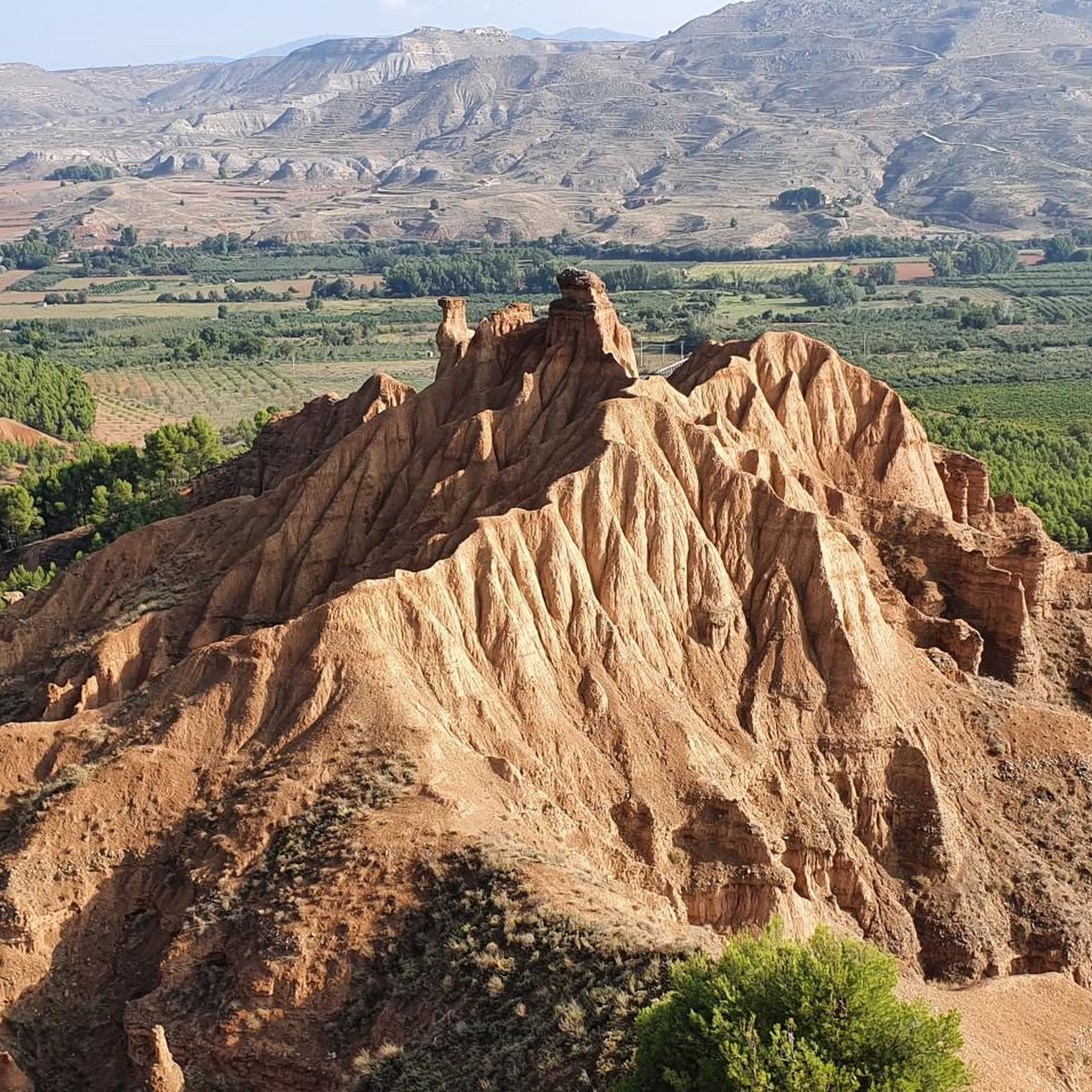
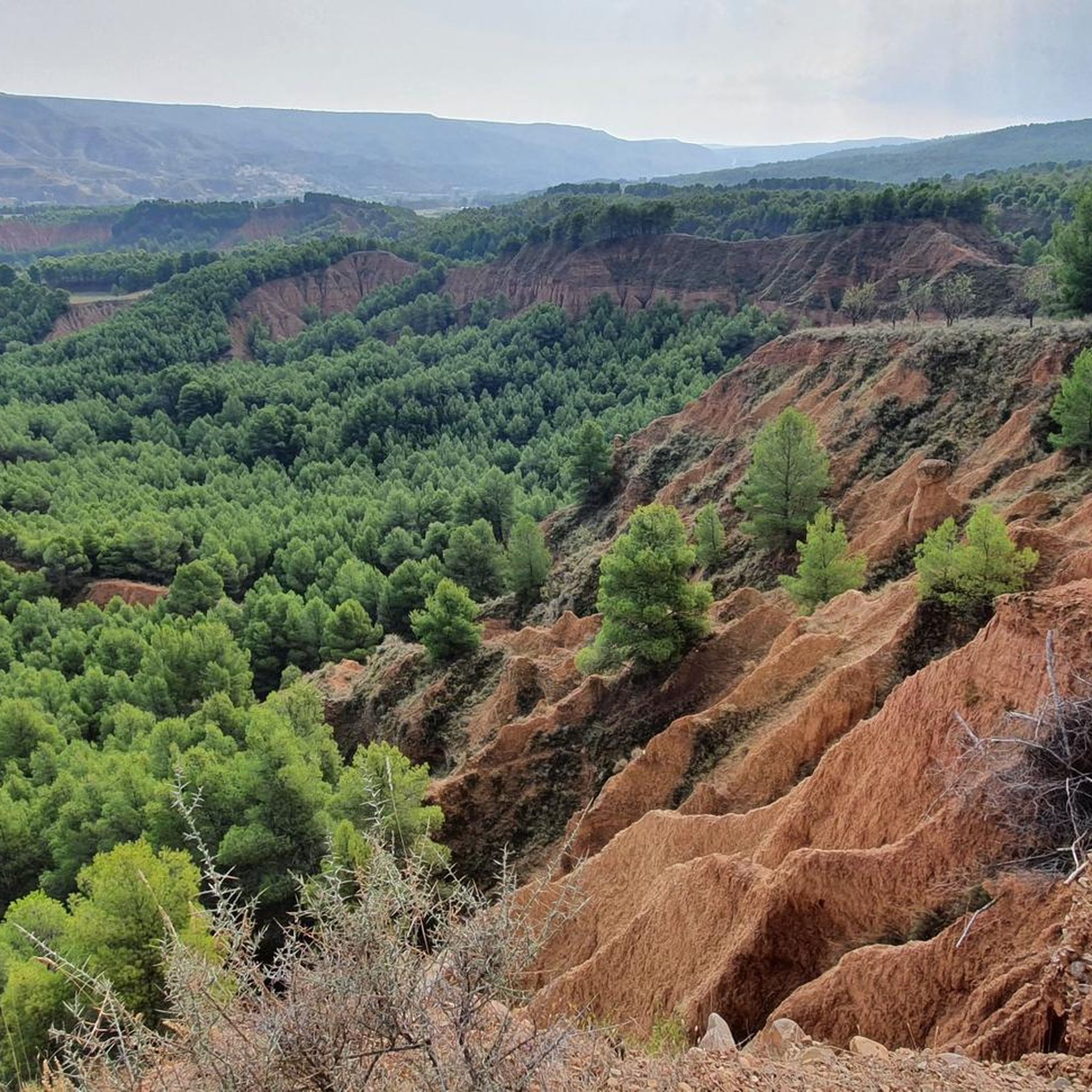
Road cycling around Fuentes De Jiloca, located in the Jiloca valley, offers diverse landscapes for cyclists. The region features a mix of cultivated fields, hills, and the Jiloca River, providing varied terrain. Repurposed ancient railway lines, known as greenways, offer long stretches of quiet cycling paths. The area is characterized by its position on the slopes of a small hill, with routes catering to various fitness levels, from moderate to difficult.
Best road cycling routes around Fuentes De Jiloca
- The…
Last updated: July 11, 2026
40
riders
91.0km
04:16
1,130m
1,130m
Hard road ride. Very good fitness required. Some segments of this route may be unpaved and difficult to ride.
9
riders
62.3km
03:00
890m
890m
Moderate road ride. Good fitness required. Mostly well-paved surfaces and easy to ride.

Sign up for free
4
riders
42.4km
02:05
660m
660m
Moderate road ride. Good fitness required. Mostly well-paved surfaces and easy to ride.
4
riders
83.0km
03:55
1,110m
1,110m
Hard road ride. Very good fitness required. Mostly well-paved surfaces and easy to ride.
4
riders
79.7km
03:40
770m
770m
Moderate road ride. Good fitness required. Some segments of this route may be unpaved and difficult to ride.
Get access to more routes and recommendations from other explorers.
Sign up for free
Already have an account?
Our route recommendations are based on thousands of hikes, rides, and runs completed by other people on komoot.
Start today with a free account
Your next adventure awaits.
Login or Signup
Popular around Fuentes De Jiloca
Tips from the Community

In addition to its natural value, the itinerary allows you to discover the historical richness of Daroca, one of the most emblematic medieval towns in Aragon, known for its walls, churches, and monumental legacy.
0
0

Town on the Tranquera reservoir, on the Mesa River, where we find places to eat and sleep, and the second checkpoint on the Madrid to Barcelona route.
0
0

The La Tranquera Reservoir in Nuévalos is a spectacular place to enjoy nature and panoramic views. Inaugurated in 1959, the reservoir was designed to regulate the flow of the Piedra River and ensure the water supply in the region.
2
0

This Castle corresponds to the Major Castle of Daroca, of Muslim origin and built in the 11th Century.
0
0

repair station and drinking water fountain
0
0

It is still under construction and only partially accessible (gravel road).
0
0

This town is the largest in the Gallocanta area, it has some noble buildings well preserved and worth seeing. It is definitely worth a visit if you are in the area.
0
0
This town is the largest in the Gallocanta area, it has some noble buildings well preserved and worth seeing. It is definitely worth a visit if you are in the area.
0
0
Frequently Asked Questions
What kind of terrain can I expect when road cycling around Fuentes De Jiloca?
The region around Fuentes De Jiloca offers diverse terrain, characterized by its position on the slopes of a small hill within the Jiloca River valley. You'll find a mix of cultivated fields, rolling hills, and paths alongside the Jiloca River. Some routes feature significant elevation changes, while others, particularly those on repurposed railway lines (Vías Verdes), offer long stretches of quiet, flatter cycling paths.
Are there road cycling routes suitable for different fitness levels in Fuentes De Jiloca?
Yes, Fuentes De Jiloca caters to various fitness levels. While many routes demand good to very good fitness with significant elevation changes, such as the difficult Alto de Codos – ⭐️ Church of San Pedro loop from Miedes de Aragón, there are also easier, mostly paved options with minimal elevation gain, ideal for a more leisurely ride. The area includes greenways like the Santander – Mediterranean Railway Greenway, which are generally flatter.
What natural features or viewpoints can I discover while cycling in the area?
Road cycling in Fuentes De Jiloca offers picturesque views, especially from elevated points like the ruins of the local castle. The Jiloca River is a central natural feature, with paths running alongside it. The surrounding landscape includes varied cultivated fields, forests, and hills providing panoramic vistas. Further afield, the Laguna de Gallocanta, a large natural salt lake, is ecologically significant and offers a circular cycling route.
Are there any historical landmarks or attractions to see along the road cycling routes?
Yes, the region is rich in history. Fuentes De Jiloca itself has remnants of its Moorish past, including a 13th-century castle ruin and the 16th-century Parish Church of Asunción with its Mudejar-style tower. Nearby towns like Maluenda and Villafeliche also boast historical ruins and Mudejar architecture. You might also encounter the Old Railway Bridge, a remnant of the repurposed railway lines.
What is the best time of year for road cycling in Fuentes De Jiloca?
The Aragon region, where Fuentes De Jiloca is located, is popular for cycling tourism. While specific seasonal advice isn't detailed, generally spring and autumn offer the most pleasant temperatures for cycling in Spain, avoiding the intense heat of summer and the colder, potentially wetter conditions of winter. The Laguna de Gallocanta is particularly notable in winter for migrating cranes.
Are there any long-distance or themed cycling routes that pass through Fuentes De Jiloca?
Yes, Fuentes De Jiloca is part of the Camino del Cid, a historical and cultural route that can be explored by bicycle. This route traces the footsteps of the legendary medieval knight El Cid through peaceful southern Aragon. Additionally, the region connects to greenways like the Santander – Mediterranean Railway Greenway, which links to the Ojos Negros Greenway, offering long stretches for extended rides.
What do other road cyclists say about the routes in Fuentes De Jiloca?
The road cycling routes in Fuentes De Jiloca are highly rated by the komoot community, with an average score of 4.0 stars. Cyclists often praise the varied terrain, from cultivated fields to challenging hills, and the opportunities to explore historical sites and natural beauty along the way.
Are there any circular road cycling routes available?
Yes, many of the routes in the area are designed as loops. For example, the moderate Alto de Miedes – ⭐️ Church of San Pedro loop from Mara offers a circular experience. The region also features a circular route around the Laguna de Gallocanta, providing a unique natural cycling experience.
How long do road cycling routes typically take in Fuentes De Jiloca?
The duration of road cycling routes varies depending on their length and difficulty. For instance, a difficult route like the Alto de Codos – Hermitage of the Virgin of the Eagle loop from Miedes de Aragón, which is 53.6 miles (86.2 km) long, typically takes about 4 hours and 25 minutes to complete. Shorter, moderate routes will naturally take less time.
Are there options for moderate road cycling routes in the area?
Yes, there are several moderate road cycling routes. An example is the Acered – Church of San Pedro, Used loop from Atea, which covers 43.2 km and involves a moderate elevation gain, making it suitable for cyclists looking for a less strenuous but still engaging ride.
What are the general characteristics of the road cycling routes in Fuentes De Jiloca?
Road cycling routes in Fuentes De Jiloca are defined by the Jiloca River valley, cultivated fields, and hills. They offer a mix of challenging climbs and more gentle stretches, often utilizing quiet roads and repurposed railway lines. The routes provide opportunities to explore both the natural beauty and the historical heritage of the region.
Can I find cafes or places to rest along the road cycling routes?
While specific cafes directly on every route are not detailed, Fuentes De Jiloca and nearby towns like Maluenda and Villafeliche offer amenities. As a popular cycling destination, you can expect to find places to rest, refuel, and enjoy local cuisine in the villages and towns you pass through.
Most popular routes around Fuentes De Jiloca
Most popular attractions around Fuentes De Jiloca

Get inspired with the komoot mobile app


Explore more
Browse the best Road cycling routes in other regions.
