The best walks and hikes around Lalueza
4.5
(6)
30
hikers
9
hikes
Hiking around Lalueza offers a distinctive semi-desert landscape within the Monegros region of Huesca province, Aragon. The area is characterized by arid terrain, expansive open spaces, and unique geological formations known as "tozales." The Sierra de Alcubierre mountain range further contributes to the diverse scenery, alongside the crucial wetland of Laguna de Sariñena.
Best hiking trails around Lalueza
- The most popular hiking route is Laguna de Sariñena Loop, a 4.7 miles (7.6 km) trail that takes 1 hour 56…
Last updated: June 28, 2026
5.0
(1)
4
hikers
7.56km
01:57
40m
40m
Easy 4.7-mile hike at Laguna de Sariñena, perfect for birdwatching in Aragón's significant wetland with 121 feet elevation gain.
5.0
(3)
8
hikers
7.13km
01:58
120m
120m
Easy hike. Great for any fitness level. Easily-accessible paths. Suitable for all skill levels.

Sign up for free
3.0
(1)
7
hikers
2.52km
00:41
40m
40m
Easy hike. Great for any fitness level. Easily-accessible paths. Suitable for all skill levels.
5.0
(1)
5
hikers
10.5km
02:47
100m
100m
Moderate hike. Good fitness required. Easily-accessible paths. Suitable for all skill levels.
6
hikers
7.00km
01:56
120m
120m
Easy hike. Great for any fitness level. Easily-accessible paths. Suitable for all skill levels.
Get access to more routes and recommendations from other explorers.
Sign up for free
Already have an account?
Our route recommendations are based on thousands of hikes, rides, and runs completed by other people on komoot.
Start today with a free account
Your next adventure awaits.
Login or Signup


Tips from the Community

Sariñena is located at 281 meters above sea level, north of the Sierra de Alcubierre and in a transition zone between the central part of the Ebro depression and the southern part of the Huesca plain. The town is located between the basins of the Alcanadre and Flumen rivers, which join a few kilometers south of the municipality.
0
0

From the car park you can access an observatory to observe the famous birds of the Sariñena lagoon.
1
0
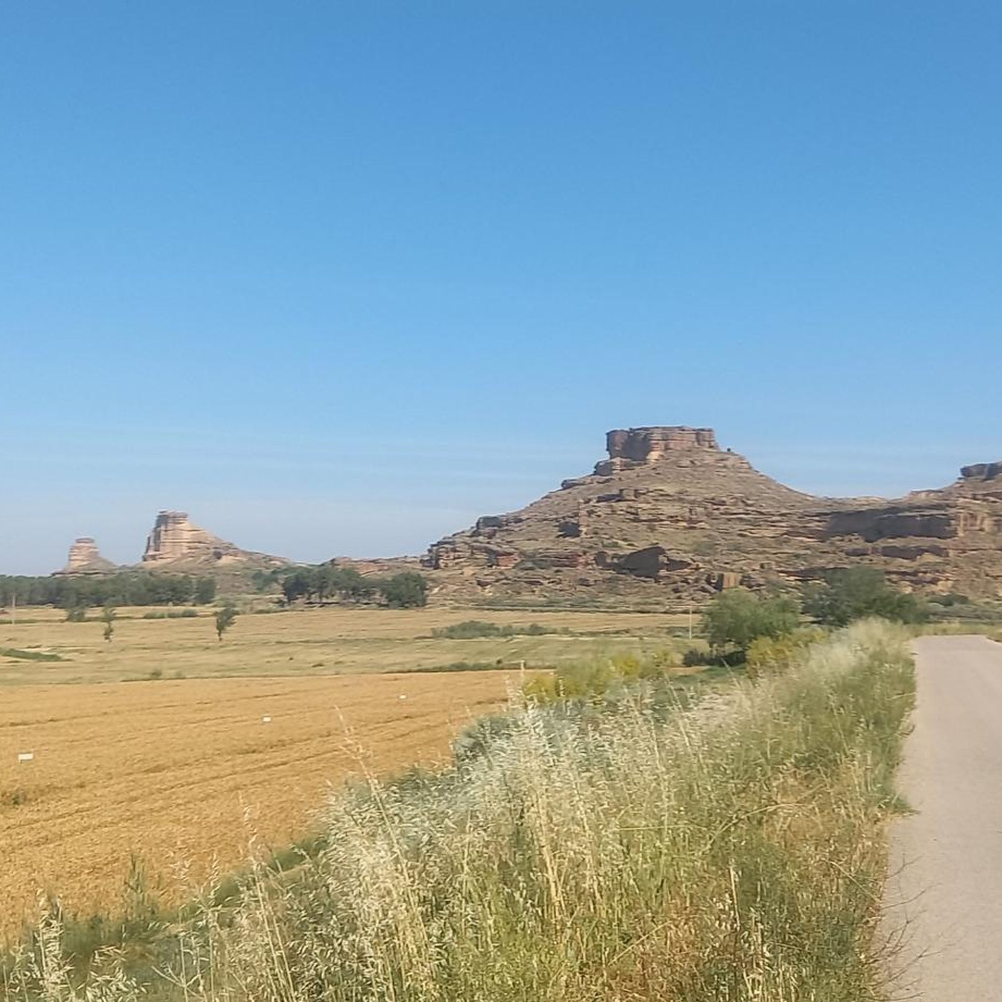
Geological formation 25m high and 80m long that served as a watchtower to control the road between Huesca and Lleida. From this point you can access on foot or by pushing the bike.
0
0

It receives this name because the sun's rays illuminate it at noon. It is a rocky platform, an immense sandstone bank 80 meters long and 25 meters high. It is worth climbing to its top to be able to contemplate, from its strategic position, the panoramic views of the entire plain that unfolds around it. In fact, this site was used as a watchtower for the construction of an Arab fortress between the 9th and 10th centuries. Once at the top of the rock we will check the traces of this function in its hollows and cavities, even in the remains of an ancient fireplace.
0
0
Muslim fortification from the 10th century located on a sandstone bank 80 meters long and 25 meters high. It is worth stopping and climbing to the top to enjoy incredible views of the Hoya de Huesca.
0
0
Frequently Asked Questions
How many hiking trails are available around Lalueza?
There are 9 hiking routes around Lalueza, offering a variety of experiences. Most of these, 8 to be exact, are considered easy, with one moderate option for those seeking a bit more challenge.
What kind of terrain can I expect on hikes in Lalueza?
Lalueza is situated in the Monegros region, characterized by a distinctive semi-desert landscape. You'll encounter arid terrain, vast open spaces, and unique geological formations known as 'tozales'. The Laguna de Sariñena Loop, for example, offers flat paths around a significant wetland, while other routes might feature gentle ascents through more arid areas.
Are there any family-friendly hiking options in Lalueza?
Yes, many of the trails around Lalueza are suitable for families. The region offers easy walks, some lasting up to two hours, which are perfect for all ages. A good example is the Sodeto Arch – Olive Grove Corner loop from Alberuela de Tubo, which is highlighted as an easy route.
Can I bring my dog on the hiking trails in Lalueza?
Generally, dogs are welcome on trails in the Lalueza area. However, always ensure your dog is under control, especially around wildlife, and check for any specific local regulations, particularly near nature reserves like the Laguna de Sariñena, which is a Special Protection Area for Birds.
What are some notable natural features or landmarks to see while hiking?
The region boasts several unique natural and historical landmarks. You can explore the impressive Peña Mediodía de Piracés, a 25-meter high geological formation with historical significance, or visit the Hermitage of the Virgin of Puyal with its ancient necropolis. The Laguna de Sariñena is also a crucial wetland, perfect for birdwatching.
Are there any circular hiking routes in Lalueza?
Yes, several routes in the area are circular, allowing you to start and end at the same point. Examples include the Laguna de Sariñena Loop, the Peña Mediodía – Peña Mediodía de Piracés loop, and the Sodeto Arch – Olive Grove Corner loop.
What is the best time of year to go hiking in Lalueza?
Given the semi-desert climate, spring and autumn are generally the most pleasant seasons for hiking in Lalueza. Temperatures are milder, and the landscape can be particularly beautiful. Summers can be very hot, and winters can be chilly, so plan accordingly and check weather forecasts.
How long do hikes around Lalueza typically take?
Hikes around Lalueza vary in duration. Easy walks can take up to two hours, while more challenging expeditions might require up to five hours or more. For instance, the Sodeto Arch – Fertility Stone loop is a moderate route that can take over 2.5 hours to complete.
Are there any challenging hikes near Lalueza?
While most routes are easy, there is one moderate hike available: the Sodeto Arch – Fertility Stone loop from Alberuela de Tubo. This route covers over 10 km and involves a bit more elevation gain, offering a slightly more demanding experience than the easier trails.
What do other hikers say about the trails in Lalueza?
The hiking experiences around Lalueza are highly rated by the komoot community, with an average score of 4.5 out of 5 stars. Reviewers often praise the unique semi-desert landscapes, the tranquility of the routes, and the opportunities for birdwatching, especially around the Laguna de Sariñena.
Is public transport available to reach hiking trailheads in Lalueza?
Information on specific public transport links directly to trailheads is limited. It is generally recommended to have a car to access many of the hiking starting points in the Monegros region, as public transport options can be infrequent or not directly serve rural trailheads.
Are there any easy hikes with good parking access?
Many of the easy hikes in the area, such as the Sodeto Arch – Olive Grove Corner loop from Alberuela de Tubo, typically have parking available near their starting points in the surrounding villages. It's always a good idea to check the specific route details for parking information before you go.
Most popular attractions around Lalueza

Get inspired with the komoot mobile app


Explore more
Browse the best Hikes in other regions.
