The best running trails around Nyord Strandenge
4.6
(25)
345
runners
54
runs
Jogging around Nyord Strandenge offers a unique experience across expansive natural landscapes. The region is characterized by vast beach meadows, covering approximately 400 hectares, which are regularly influenced by seawater. A moraine hill in the western part provides varied terrain, rising up to 13 meters. Nyord's largely car-free environment ensures a peaceful setting for running, with generally easy and accessible trails.
Best jogging routes around Nyord Strandenge
- The most popular jogging route is Møn–Nyord Bridge loop from Nymarksnakke, a…
Last updated: June 24, 2026
12
runners
8.27km
00:53
20m
20m
Moderate run. Good fitness required. Mostly paved surfaces. Suitable for all skill levels.
5.0
(1)
29
runners
10.6km
01:13
10m
10m
Moderate run. Good fitness required. Mostly paved surfaces. Suitable for all skill levels.

Sign up for free
3
runners
4.38km
00:30
10m
0m
Easy run. Great for any fitness level. Mostly paved surfaces. Suitable for all skill levels.
5.0
(2)
20
runners
16.8km
01:51
30m
30m
Hard run. Very good fitness required. Mostly paved surfaces. Suitable for all skill levels.
4.5
(2)
14
runners
14.7km
01:37
20m
20m
Moderate run. Good fitness required. Mostly paved surfaces. Suitable for all skill levels.
Get access to more routes and recommendations from other explorers.
Sign up for free
Already have an account?
Our route recommendations are based on thousands of hikes, rides, and runs completed by other people on komoot.
Start today with a free account
Your next adventure awaits.
Login or Signup
Tips from the Community

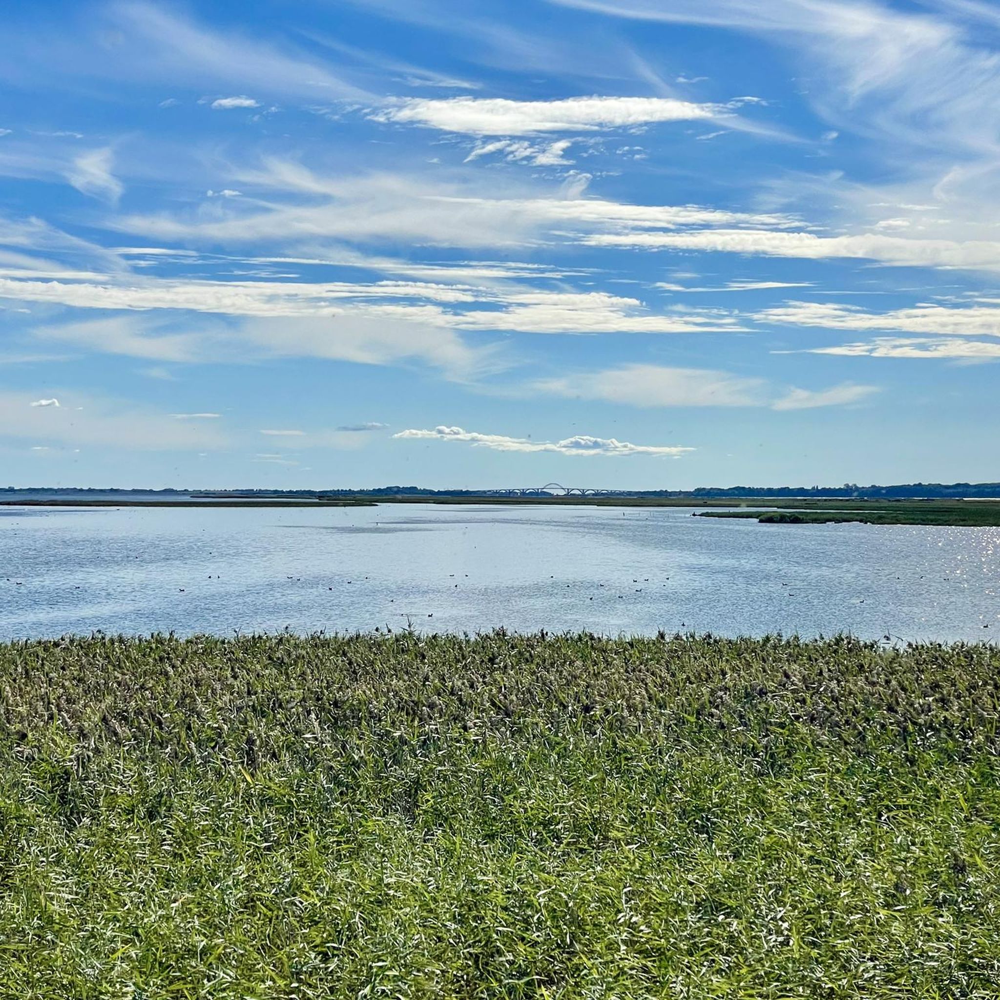
Don't forget your binoculars, for from the tower you can overlook one of the most important resting grounds for wading birds and waterfowl in all of Denmark—an area boasting exceptional biodiversity. This is due to the unique landscape of the small island of Nyord, with its numerous salt marshes—some of which are grazed.
0
0

Soft and white sands meet sparkling turquoise waters, where gentle waves whisper to the shore under a bright sun. It's a place of pure, tranquil beauty.
0
0

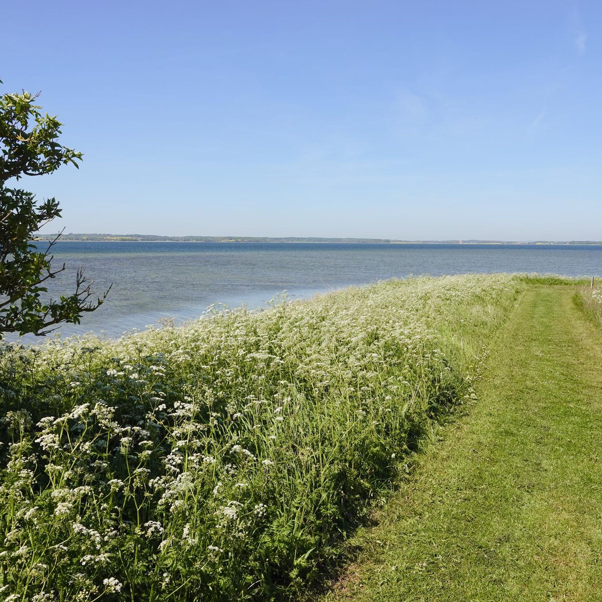
Beautiful narrow path through a heathland nature reserve with a horse pasture and wild pastures for cattle.
0
0

Horse paddock on the edge of a beautiful nature cycle path
0
0

Westernmost point on the island of Nyord
0
0

Definitely worth a detour for those interested in birds. Don't forget your binoculars!
1
0

Nyord is approximately 5 km2 in size and consists of approximately 120 hectares of moraine soil, on which Nyord Town and the farmland are located. In addition, the island consists of 400 hectares of salt meadows, which are flooded with salt water every winter and grazed in the summer. The meadows are home to very rich plant and bird life and are considered one of the best habitats for wading and swimming birds in Denmark. The bird life can be observed from the bird tower on the road in the middle of the meadows. You can also visit the Hyldevang Nature Center, Nyord's only mobile farm, which now belongs to Skov and the Danish Nature Agency. Here you will find a campfire hut, shelters, a sensory garden, and an accessible view of the meadows. https://www.danischeostseeinseln.de/urlaub/planen-sie-ihre-reise/nyord-enge-naturreservat-gdk615260
2
0

From this tower you can see countless birds and other animals. At night with cloudless skies you have the best starry sky in Europe as they say because there is no light smog here.
1
0
Frequently Asked Questions
How many running routes are available in Nyord Strandenge?
Nyord Strandenge offers a wide selection of running routes, with over 50 trails available for exploration. These routes cater to various fitness levels, including easy, moderate, and difficult options.
What kind of terrain can I expect when jogging in Nyord Strandenge?
The terrain in Nyord Strandenge is predominantly flat and open, characterized by extensive beach meadows. There's also a 13-meter-high moraine hill in the western part, adding some varied topography. You'll encounter reed beds and former beach ridges made of sand and flint stone, providing a diverse natural landscape.
Are there any easy running routes suitable for beginners or a relaxed jog?
Yes, Nyord Strandenge has several easy running routes. For instance, the Pilebugt loop from Ulvshaleskoven is a 2.7-mile (4.4 km) trail that leads through coastal areas and is generally completed in about 30 minutes, making it a great option for an easy run.
What natural features or landmarks can I see along the jogging routes?
Nyord Strandenge is rich in natural beauty and points of interest. You can expect to see vast beach meadows, which are among the largest in Eastern Denmark, and observe abundant birdlife from strategically placed bird-watching towers. The area is also part of a Dark Sky Park, offering stunning night sky views. You might also pass by the historic Nyord village or the Hyldevang Nature Center.
Is Nyord Strandenge a good place for birdwatching while running?
Absolutely. Nyord Strandenge is renowned for its abundant birdlife and is an internationally protected area under the Ramsar Convention. Thousands of geese, ducks, and wading birds use the meadows as a crucial stopover. Joggers can often spot rare species like white-tailed eagles, peregrine falcons, and Montagu's harriers, especially during spring and autumn migrations.
Are there any longer running trails for more experienced runners?
For those seeking a longer challenge, the Møn–Nyord Bridge – Nyord Bridge loop from Rødeled is a difficult 10.5-mile (16.9 km) route. Another substantial option is the Møn–Nyord Bridge loop from Rødeled, which is a moderate 9-mile (14.6 km) trail.
What do other runners say about the trails in Nyord Strandenge?
The running routes in Nyord Strandenge are highly rated by the komoot community, with an average score of 4.6 stars from over 20 reviews. Runners often praise the expansive natural landscapes, the peaceful car-free environment, and the rich birdlife that defines the area.
Are there any circular running routes in the area?
Yes, many of the routes in Nyord Strandenge are designed as loops, offering a convenient circular experience. For example, the popular Møn–Nyord Bridge loop from Nymarksnakke is a 5.1-mile (8.2 km) trail that provides scenic views and brings you back to your starting point.
What are the best times of year to go jogging in Nyord Strandenge?
Spring and autumn are particularly rewarding for jogging in Nyord Strandenge, as these seasons offer the best opportunities for birdwatching during migration. However, the area is beautiful year-round. Be aware that the beach meadows are regularly flooded in winter, which can affect accessibility on some trails.
Is Nyord Strandenge suitable for family-friendly running or walks?
Yes, the generally flat and open terrain, combined with the car-free environment on much of the island, makes Nyord Strandenge very suitable for family outings. Many of the trails are easy, and attractions like the Hyldevang Nature Center and informative walking paths about wild bees add an educational and engaging element for all ages.
Are dogs allowed on the running trails in Nyord Strandenge?
While the region is very natural, specific rules for dogs on trails can vary. It's generally advisable to keep dogs on a leash, especially given the abundant birdlife and grazing animals in the meadows, to protect the wildlife and ensure a pleasant experience for everyone. Always check local signage for any specific restrictions.
Where can I park when visiting Nyord Strandenge for a run?
Parking options are available, particularly near common starting points for routes. For example, routes like the Pilebugt – Ulvshale Skov loop from Nymarksnakke often have designated parking areas nearby. It's recommended to check the specific route details on komoot for the most convenient parking information.
Most popular routes around Nyord Strandenge

Get inspired with the komoot mobile app


Explore more
Browse the best Running Trails & Routes in other regions.
