The best MTB trails around Villarquemado
5.0
(1)
26
riders
17
rides
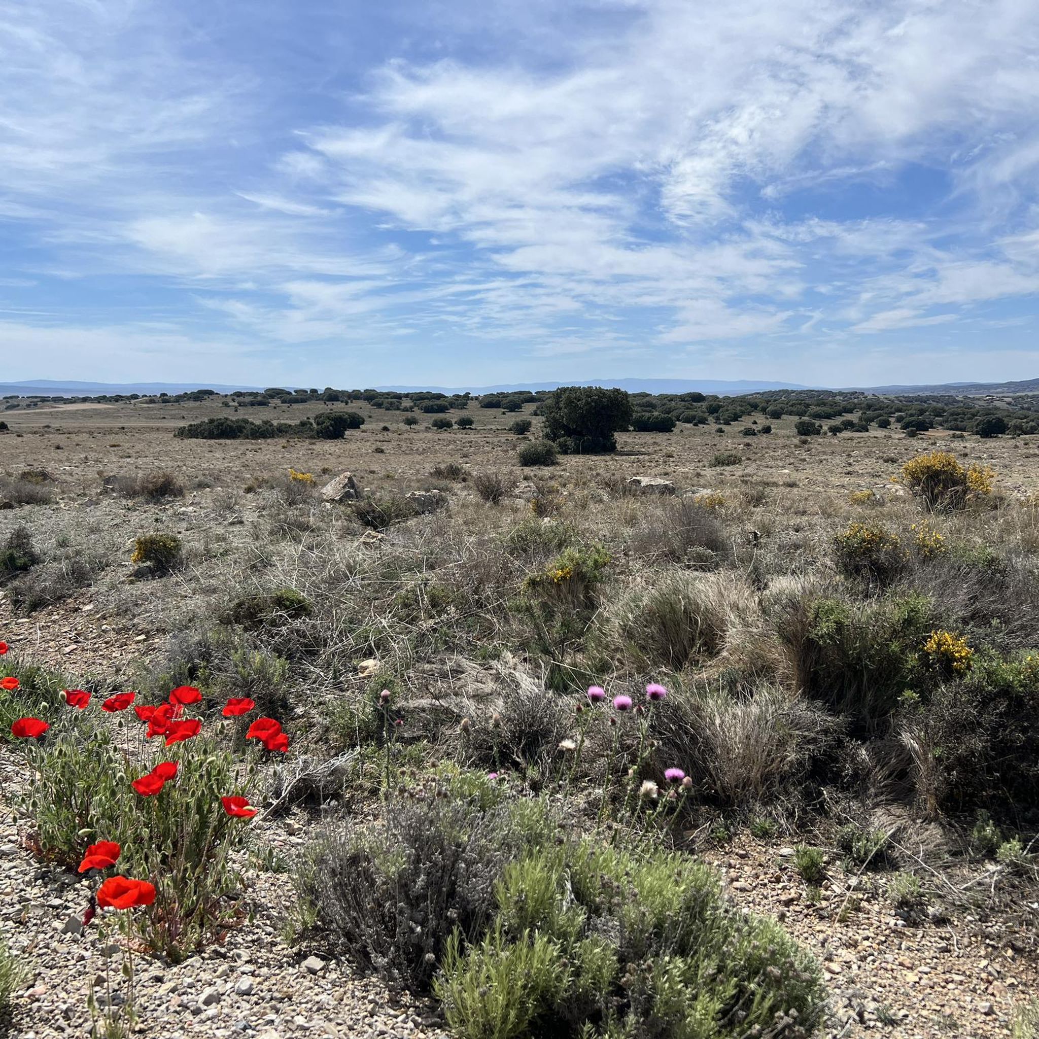
Mountain biking around Villarquemado offers diverse landscapes, from freshwater wetlands to pine forests and high mountain meadows. The region, located in the province of Teruel, Spain, features varied terrain suitable for different mountain biking disciplines. Cyclists can explore routes near the significant Laguna del Cañizar, or venture towards the Montes Universales and Sierra de Albarracín ranges. The area provides a network of trails with varying elevations and technical challenges.
Best mountain bike trails around Villarquemado
- The most popular mountain bike…
Last updated: May 16, 2026
5.0
(1)
2
riders
26.1km
01:58
200m
200m
Easy mountain bike ride. Great for any fitness level. Suitable for all skill levels.
24.1km
01:43
80m
80m
This easy 14.9-mile mountain biking route circles the Laguna del Cañizar and Fuente de Cella, offering wetland views and historical features

Sign up for free
12
riders
71.8km
06:37
1,390m
1,390m
Hard mountain bike ride. Very good fitness required. Suitable for all skill levels.
4
riders
49.7km
03:45
450m
450m
Moderate mountain bike ride. Good fitness required. Advanced riding skills necessary.
5
riders
150km
10:51
2,320m
2,320m
Hard mountain bike ride. Very good fitness required. Advanced riding skills necessary.
Get access to more routes and recommendations from other explorers.
Sign up for free
Already have an account?
Our route recommendations are based on thousands of hikes, rides, and runs completed by other people on komoot.
Start today with a free account
Your next adventure awaits.
Login or Signup
Popular around Villarquemado

Tips from the Community

Viewpoint for the church offers a great view over the valley
0
0

The entrance to Ródenas via the TE-V-9022 road offers very picturesque views, especially if you come from Pozondón.
3
0
The Sword Fountain in Ródenas (Teruel) is a very unique urban sculpture that has become one of the town's symbols. It represents a polished metal sword emerging from a stone base, surrounded by water. The sculpture is approximately 3 meters tall. Its shape is reminiscent of the legendary Excalibur, King Arthur's sword, embedded in the stone.
3
0
The official source of water is located at Fuente de García, in the Montes Universales, within the municipality of Frías de Albarracín (Teruel). It is located at an altitude of approximately 1,590 meters, surrounded by pine forests and high mountain meadows. Access is very easy and well signposted. Take the A-1704 highway, which connects Frías de Albarracín with Huélamo (Cuenca). From the highway, a paved detour of approximately 2 km takes you directly to the recreational area and the monument. There is free parking next to the monument.
10
0
Access is very easy and well signposted. Take the A-1704 highway, which connects Frías de Albarracín with Huélamo (Cuenca). From the highway, a paved detour of approximately 2 km takes you directly to the recreational area and the monument. There is free parking next to the monument.
5
0
The official source is located at Fuente de García, in the Montes Universales, within the municipality of Frías de Albarracín (Teruel). It is located at an altitude of approximately 1,590 meters, surrounded by pine forests and high mountain meadows.
5
0

It is a reference to the place where the longest river in Spain originates, stretching over 1,000 km and flowing into neighboring Portugal. These statues symbolize this point in the Albarracín mountain range.
8
0

The landscape gives a great feeling of being filmed in the last century... in 2025!!
0
0
Frequently Asked Questions
How many mountain bike trails are available around Villarquemado?
There are over 15 mountain bike trails around Villarquemado, catering to various skill levels. You'll find a good mix, with 3 easy routes, 12 moderate options, and 2 more challenging trails for experienced riders.
What kind of terrain can I expect on mountain bike trails in Villarquemado?
The terrain around Villarquemado is quite diverse. You can expect everything from smooth, former railway lines like the Vía Verde Ojos Negros to paths through farmland, and more technical sections with significant elevation changes as you venture towards the Montes Universales or Sierra de Albarracín. The region also features routes exploring freshwater wetlands and pine forests.
Are there any easy or family-friendly mountain bike trails in Villarquemado?
Yes, Villarquemado offers several easy and family-friendly mountain bike trails. The Vía Verde Ojos Negros — circular desde Santa Eulalia del Campo is an excellent choice, following a smooth, former railway line. Another great option is the Laguna del Cañizar and Cella Spring Loop, which explores the accessible paths around the wetland.
What are the best trails for experienced mountain bikers looking for a challenge?
For experienced mountain bikers seeking a challenge, consider routes like the Path Through Farmland – Peracense Castle loop from Santa Eulalia del Campo, which covers 71.8 km with significant elevation. Another demanding option is the extensive Albarracín – Main Square loop from Cella, a 149 km route that traverses stunning natural sites and offers substantial climbs.
What natural features or landmarks can I see along the mountain bike trails?
Many trails offer access to significant natural features. The Laguna del Cañizar, a large freshwater wetland known for its biodiversity, is a central attraction. You can also ride along the Cella Canal and explore the Ojos Negros Greenway. Further afield, the region boasts picturesque pine forests, high mountain meadows, and the sources of major rivers like the Tagus.
Are there any circular mountain bike routes in the area?
Yes, many of the mountain bike trails around Villarquemado are circular. Popular options include the easy Vía Verde Ojos Negros — circular desde Santa Eulalia del Campo and the scenic Laguna del Cañizar and Cella Spring Loop. For a longer ride, the Cella Canal – Cella Spring loop from Cella is a moderate circular route.
What is the best season for mountain biking in Villarquemado?
Villarquemado offers good mountain biking conditions for much of the year. Spring and autumn generally provide the most pleasant temperatures for riding. Summer can be warm, so early morning or late afternoon rides are advisable. While winter riding is possible, it's best to check local weather conditions, especially at higher elevations.
Are there any facilities or resting points along the trails?
Yes, the region provides several amenities that support outdoor activities. The Fuente de la Carrasca is an emblematic local spot with a picnic area, tables, and a children's play area. Other picnic areas like El Aljibe de Cañete and Los Ances are also available, offering ideal resting points for cyclists. You might also find facilities near the Santa Eulalia del Campo Station.
What do other mountain bikers enjoy most about the trails in Villarquemado?
The mountain bike trails around Villarquemado are highly rated by the komoot community, with an average score of 5.0 stars. Riders often praise the diverse landscapes, from the unique wetland environment of Laguna del Cañizar to the varied terrain of pine forests and farmlands. The network of trails offers options for all abilities, making it enjoyable for many.
Can I find trails that offer panoramic views or viewpoints?
While specific viewpoints are not detailed for every trail, the varied terrain, especially as you gain elevation towards areas like the Montes Universales or Sierra de Albarracín, will naturally offer scenic vistas. The region is known for its picturesque landscapes, including canyons and gorges, providing many opportunities for expansive views.
Are there options for longer, multi-hour mountain bike tours?
Absolutely. For those looking for longer rides, the Path Through Farmland – Peracense Castle loop from Santa Eulalia del Campo is a difficult 71.8 km trail that typically takes over 6 hours. The most extensive option is the Albarracín – Main Square loop from Cella, a challenging 149 km route that can take over 10 hours to complete.
Most popular routes around Villarquemado
Most popular attractions around Villarquemado

Get inspired with the komoot mobile app


Explore more
Browse the best MTB trails in other regions.
