The best road cycling routes around Garciotum
5.0
(3)
433
riders
13
rides
Road cycling routes around Garciotum are situated in the southeast of the Sierra de San Vicente in Toledo, Spain. The region features rolling foothills and diverse terrain, providing varied landscapes for cyclists. Well-maintained asphalt roads in the Toledo province offer smooth surfaces for endurance rides, often including demanding climbs. This area is characterized by significant elevations and streams that feed into the Alberche River.
Best road cycling routes around Garciotum
- The most popular road cycling route is El Piélago Pass…
Last updated: May 15, 2026
5.0
(1)
130
riders
75.5km
03:57
1,360m
1,360m
Hard road ride. Very good fitness required. Mostly well-paved surfaces and easy to ride.
53
riders
74.3km
03:39
1,150m
1,150m
Hard road ride. Very good fitness required. Mostly well-paved surfaces and easy to ride.

Sign up for free
22
riders
48.3km
02:46
1,130m
1,130m
Hard road ride. Very good fitness required. Mostly well-paved surfaces and easy to ride.
5.0
(1)
19
riders
Moderate road ride. Good fitness required. Some segments of this route may be unpaved and difficult to ride.
11
riders
102km
05:32
2,110m
2,110m
Hard road ride. Very good fitness required. Mostly well-paved surfaces and easy to ride.
Get access to more routes and recommendations from other explorers.
Sign up for free
Already have an account?
Our route recommendations are based on thousands of hikes, rides, and runs completed by other people on komoot.
Start today with a free account
Your next adventure awaits.
Login or Signup

Tips from the Community

El Real de San Vicente is located at the foot of the mountain range from which it takes its name, in a prime setting for outdoor activities. Its location is associated with military settlements in the 11th and 12th centuries. Remains of its millennia-long occupation are preserved in the village.
0
0
Cervera de los Montes is a town in Toledo located in the foothills of the Sierra de San Vicente mountains, in the middle of the dehesa (pasture). Its traditional town center is very well preserved and exudes a distinctly rural atmosphere.
0
0

The place name Pelahustán seems to derive from the activity related to looms and the sale of linen that the population had in the past. In documents from the 18th century, it appears as Pelafustan. According to the dictionary of the Royal Spanish Academy, the concept of pelafustán is equated with that of pelagatos, which in turn means “insignificant or mediocre person, without social or economic position.” The town also had several water mills worked by Salamancan teleworkers. Pelahustán is located at an altitude of 673 meters above sea level and borders the terms of Higuera de las Dueñas in the province of Ávila, Nombela, Nuño Gómez, Garciotum and El Real de San Vicente in the province of Toledo, and Ceniientos in the Community of Madrid 😊
2
0

Mijares is located on the southern slope of the Villafranca mountain range, near the Tiétar river. The town is surrounded by a natural environment with forests and mountains, which makes it an attractive place for nature and hiking lovers. The most important points of the town are the parish church of San Bartolomé Apóstol, rebuilt in the 18th century, and the Plaza Mayor, the nerve center of the municipality, where various businesses are located and local events and activities are held.
2
0
The Church of St. Mary Magdalene in Garciotum is a 15th-century Gothic-Renaissance church. You'll probably notice that the tower is in a different style; it dates back to the 17th century.
1
0
Castillo de Bayuela is a town in the Sierra de San Vicente region that has monuments that prove its historical importance, such as the Gothic-Renaissance church of San Andrés, the jurisdictional roll or some vetone boars. In addition, it has a series of ideal services for the traveler.
2
0
Almendral de la Cañada is a small town on the Toledo slope of the Tiétar valley surrounded by olive and almond groves. It has several bars near the road and a public fountain, ideal for a good stop on the route.
0
0

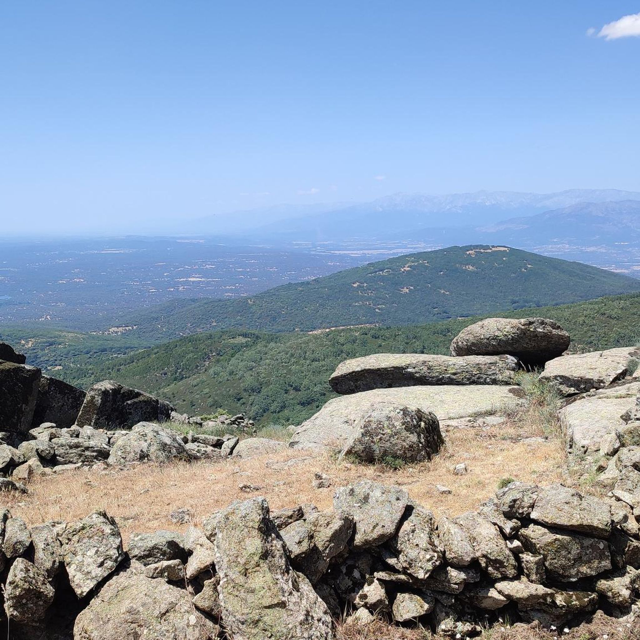
Port with beautiful views over El Real de San Vicente.
1
0
Frequently Asked Questions
How many road cycling routes are available around Garciotum?
There are 13 road cycling routes around Garciotum, offering a range of experiences from easy to difficult. You'll find 1 easy route, 5 moderate routes, and 7 difficult routes, catering to various fitness levels.
What kind of terrain can I expect on road cycling routes in Garciotum?
Road cycling routes around Garciotum are characterized by rolling foothills and the diverse terrain of the Sierra de San Vicente. You can expect well-maintained asphalt roads in the Toledo province, providing smooth surfaces for speed and endurance, often including demanding climbs and scenic stretches through mountainous landscapes.
What are some of the most challenging road cycling routes in the area?
For those seeking a challenge, routes like the El Piélago Pass – Puerto del Piélago loop from Garciotum offer significant elevation gains, with over 1,500 meters of ascent over 64.2 km. Another demanding option is the El Piélago Pass – Mijares loop from Castillo de Bayuela, which covers over 102 km with more than 2,100 meters of climbing.
Are there any easy or beginner-friendly road cycling routes near Garciotum?
Yes, while many routes feature climbs, there is at least one easy road cycling route available. The network offers options for various ability levels, so beginners can find suitable paths to enjoy the scenery without excessive difficulty.
What natural features or landmarks can I see along the road cycling routes?
The routes often pass through the picturesque Sierra de San Vicente, offering stunning vistas. You might encounter historical points of interest like the Puente de los Pilones over the Saucedoso stream or the Puente Romano over the Las Cañadillas stream. Notable viewpoints include San Vicente Hill (1320m) and El Piélago Pass, which provide panoramic views of the surrounding landscape.
What is the best time of year for road cycling in Garciotum?
The region's diverse natural environment makes it appealing throughout the year. However, for optimal road cycling conditions, spring and autumn generally offer milder temperatures and pleasant weather, avoiding the intense heat of summer and potential chill of winter.
Is Garciotum a good destination for family-friendly road cycling?
While many routes include significant climbs, there are options for various fitness levels, including easier routes. For family-friendly cycling, it's best to choose the less challenging routes and ensure they are suitable for all participants. Always check the route's difficulty and elevation profile before heading out.
What do other road cyclists enjoy most about cycling in Garciotum?
The area is highly rated by the komoot community, with an average score of 5.0 stars from 3 reviews. Cyclists often praise the varied terrain, the challenging climbs, and the scenic stretches through the Sierra de San Vicente, as well as the generally low traffic on many rural roads.
Are there any circular road cycling routes available?
Yes, many of the routes around Garciotum are designed as loops, allowing you to start and finish in the same location. Examples include the El Piélago Pass – Hinojosa de San Vicente loop from Garciotum and the Main Square of Pelahustán – El Real de San Vicente loop from El Real de San Vicente.
Where can I find parking for road cycling in Garciotum?
While specific parking areas for cyclists are not detailed, Garciotum is a small town. You can typically find parking in or near the town center, or at the start points of specific routes, such as Castillo de Bayuela for some loops. It's advisable to check local parking regulations upon arrival.
Are there cafes or pubs in Garciotum for cyclists?
Garciotum, being a small town, will have local amenities. While specific cyclist-friendly cafes or pubs are not highlighted, you can expect to find establishments in the town center where you can refuel and rest after your ride. Larger nearby towns may offer more options.
What are the traffic conditions like on road cycling routes in the region?
Many rural roads in the Toledo province, especially former main roads where new motorways have been built, tend to have little traffic. This enhances safety and enjoyment for cyclists, allowing for a more peaceful riding experience through the scenic landscapes.
Most popular attractions around Garciotum

Get inspired with the komoot mobile app


Explore more
Browse the best Road cycling routes in other regions.
