The best MTB trails around Cervera De La Cañada
4.6
(38)
1,779
riders
51
rides
Mountain biking around Cervera De La Cañada offers varied landscapes characterized by dramatic geological formations and dynamic terrain. The region, situated between the Sierra de Armantes and the Ribota valley, provides diverse and engaging routes for riders. This area is known for its "flowtrails," offering a unique riding experience. The landscape includes a mix of open spaces and features suitable for mountain biking.
Best mountain bike trails around Cervera De La Cañada
- The most popular mountain bike trail is Far…
Last updated: July 1, 2026
5.0
(4)
35
riders
44.5km
05:03
880m
880m
Hard mountain bike ride. Very good fitness required. Advanced riding skills necessary. Some portions of the route may require you to push your bike.
70
riders
43.5km
04:39
720m
720m
Moderate mountain bike ride. Good fitness required. Advanced riding skills necessary.

Sign up for free
5.0
(1)
39
riders
47.5km
04:44
970m
970m
Hard mountain bike ride. Very good fitness required. Advanced riding skills necessary. Some portions of the route may require you to push your bike.
5.0
(1)
23
riders
44.5km
04:15
620m
620m
Hard mountain bike ride. Good fitness required. Advanced riding skills necessary. Some portions of the route may require you to push your bike.
5.0
(1)
22
riders
20.0km
01:34
200m
200m
Easy mountain bike ride. Great for any fitness level. Suitable for all skill levels.
Get access to more routes and recommendations from other explorers.
Sign up for free
Already have an account?
Our route recommendations are based on thousands of hikes, rides, and runs completed by other people on komoot.
Start today with a free account
Your next adventure awaits.
Login or Signup

Tips from the Community


La Vega del Jalón has traditionally been an orchard. Especially the cultivation of almond trees has been very popular, although you can also find cherry, pomegranate and other fruit trees.
0
0

Beautiful basilica in the city of Calatayud where the interior stands out with an altar and impressive baroque wooden altarpieces. It is the most important basilica of the order of the Holy Sepulcher of Jerusalem in Spain.
1
0
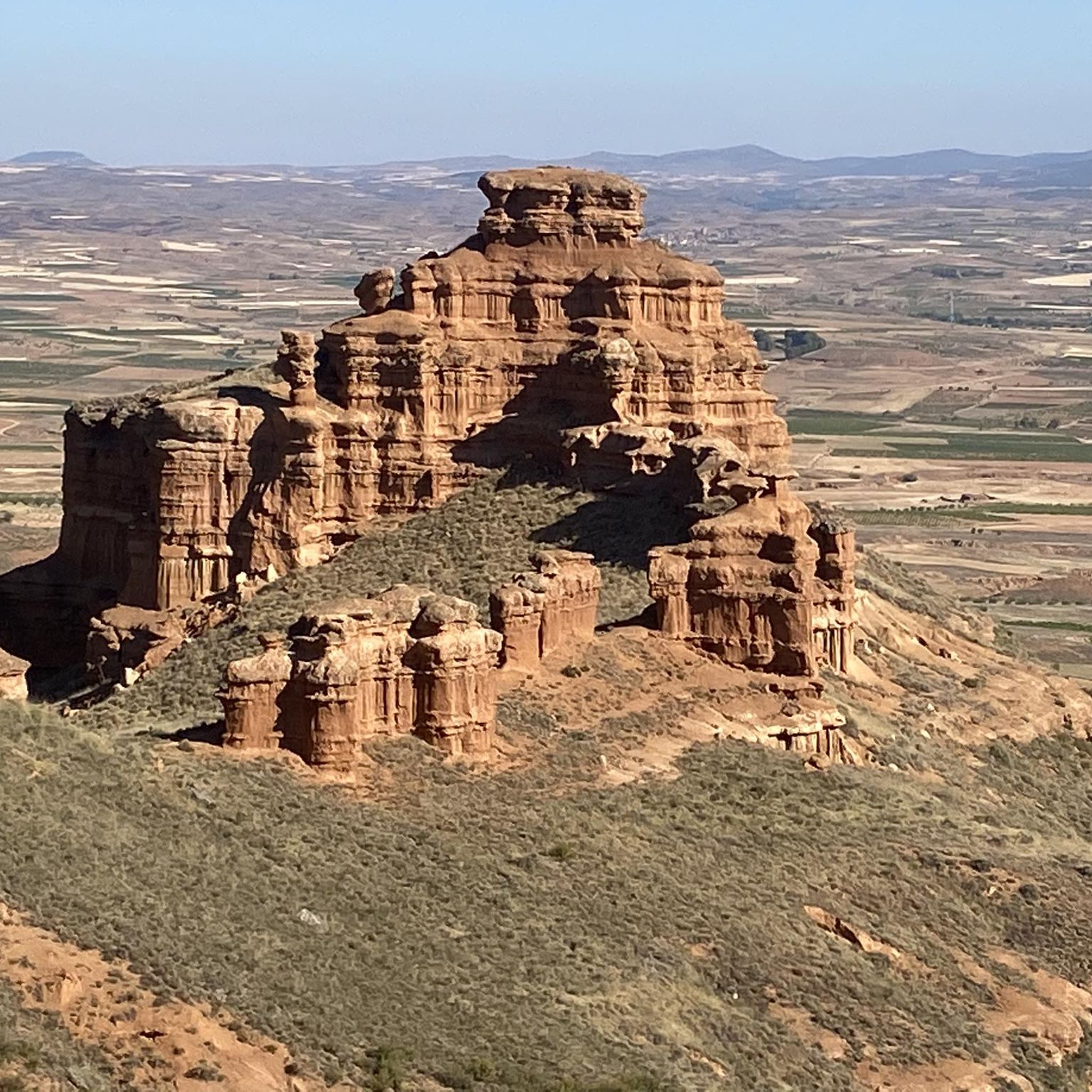
Impressive views on our way through the Far West trail as it could not bear another name. Without a doubt we will take out our camera to take some magazine photos in the also known as the Far West Bilbilitano
3
1
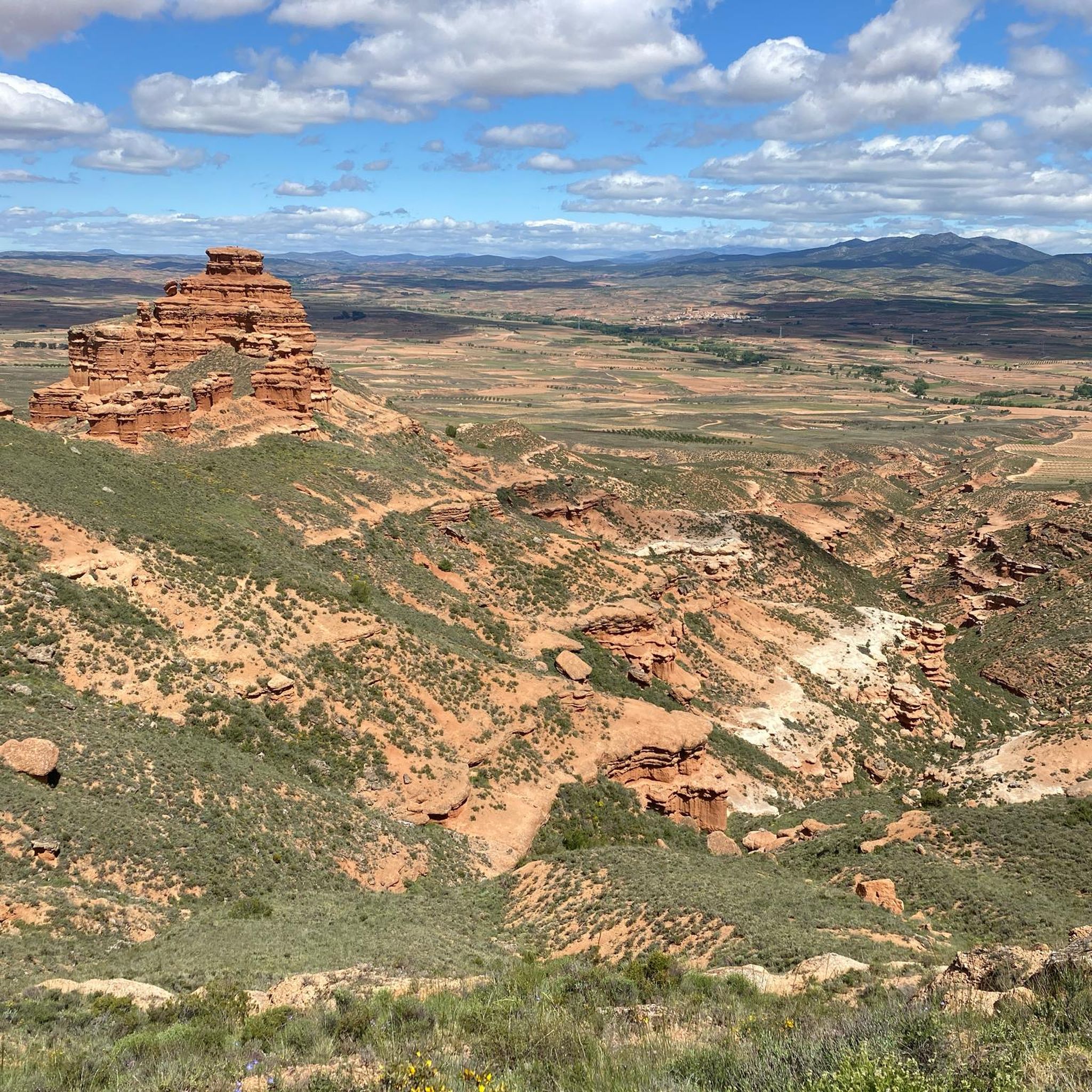
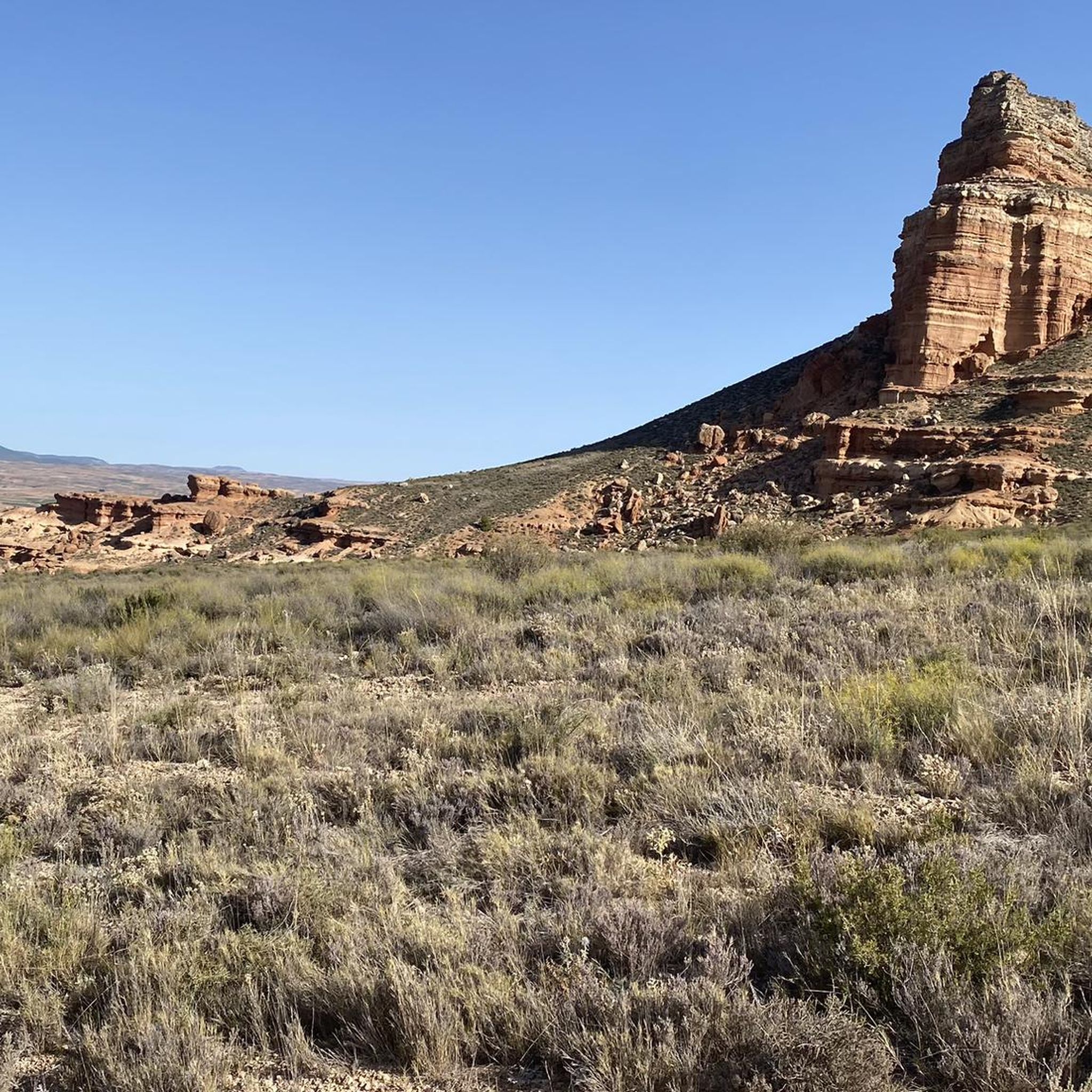
We are in the Sierra de Armantes, in a place shaped by wind and water. We would not say that we are in Zaragoza! What a beautiful print and what contrasts of colors, apart from some impressive views. It will remind us of the Far West, what's more, in Zaragoza they call it the Bilbilitano Far West.
4
1
On our arrival at Cruz de Armantes, we will be surrounded by a beautiful landscape of the Ribota valleys. A picture that will surely force us to take out our cameras to photograph.
2
1

The landmark of the city of Calatayud, which was under Muslim rule until the 12th century, are clearly the two towers of the churches of Santa María la Mayor and San Andrés, which together form the unmistakable silhouette of the city, especially beautiful at sunset. Many buildings are in the Mudejar architectural style, declared a World Heritage Site.
1
0
Frequently Asked Questions
How many mountain bike trails are available around Cervera De La Cañada?
There are over 50 mountain bike routes available around Cervera De La Cañada, offering a wide range of options for different skill levels. The komoot community has explored more than 50 tours in the area.
What kind of terrain can I expect on mountain bike trails in Cervera De La Cañada?
The region is known for its varied landscapes, often described as having 'Flowtrails galore in European Utah.' You can expect dynamic terrain with dramatic geological formations, particularly within the Sierra de Armantes and the Ribota valley. This provides a mix of challenging climbs, descents, and open spaces.
Are there any easy mountain bike trails suitable for beginners in Cervera De La Cañada?
Yes, there are easy mountain bike trails available. For instance, the Calatayud loop from Calatayud is an easy 12.4-mile (20 km) route that takes about 1 hour 34 minutes to complete, offering a less strenuous option.
What are some challenging mountain bike routes for experienced riders?
Experienced riders can tackle routes like Far West Bilbilitano — circular por la Sierra de Armantes desde Calatayud, a difficult 27.6-mile (44.5 km) trail exploring the Sierra de Armantes. Another challenging option is the Castillo de Ayud – Calatayud loop from Calatayud, which is 29.5 miles (47.5 km) long and features varied landscapes.
Are there any mountain bike trails that pass by interesting landmarks or viewpoints?
Yes, many trails offer scenic views and pass by notable landmarks. The region is home to the UNESCO World Heritage Site, the Church of Santa Tecla (Nuestra Señora de la Asunción), a 15th-century Mudejar fortress-church. You can also find natural highlights such as the Far West Bilbilitano Rock Formations and the Castillejos Viewpoint (Sierra de Armantes).
What is the best time of year to go mountain biking in Cervera De La Cañada?
While specific seasonal recommendations are not detailed, the region's 'European Utah' comparison suggests that spring and autumn would likely offer the most pleasant temperatures for mountain biking, avoiding the intense heat of summer and potential colder conditions in winter. Always check local weather forecasts before heading out.
Are there any loop mountain bike routes in the area?
Yes, several routes are designed as loops. Examples include the Desagüe Barranco de las Pozas – Refugio de Armantes loop from Calatayud, a moderate 27.0-mile (43.5 km) path, and the Calatayud – Cruz de Armantes loop from Ateca, a difficult 27.3-mile (44 km) route.
What do other mountain bikers say about the trails in Cervera De La Cañada?
The mountain bike routes in Cervera De La Cañada are highly rated by the komoot community, with an average score of 4.7 stars from more than 20 reviews. Riders often praise the varied terrain and the unique 'flowtrail' experience offered by the dramatic geological formations.
Are there any towns nearby where I can find cafes or accommodation?
Yes, the town of Ateca, located in the broader region, is noted for its Mudejar tower and serves as a convenient stop for cyclists, offering bars and shops. Calatayud is also a common starting point for many routes, suggesting amenities are available there.
What are the typical distances and elevations for mountain bike trails here?
Trail distances vary significantly, from shorter easy routes around 12 miles (20 km) to longer, more challenging ones exceeding 29 miles (47 km). Elevation gains can also be substantial on difficult routes, with some featuring over 3,000 feet (900 meters) of ascent, such as the Castillo de Ayud – Calatayud loop from Calatayud.
Is public transport available to access the mountain bike trails?
While specific public transport options directly to trailheads in Cervera De La Cañada are not detailed, the proximity to towns like Calatayud and Ateca, which serve as starting points for many routes, suggests that these larger hubs may offer public transport connections that could facilitate access to the wider trail network.
Most popular routes around Cervera De La Cañada
Most popular attractions around Cervera De La Cañada

Get inspired with the komoot mobile app


Explore more
Browse the best MTB trails in other regions.
