The best MTB trails around Sierro
4.5
(17)
331
riders
25
rides
Mountain bike trails around Sierro traverse a region characterized by diverse and challenging landscapes. The area features dramatic geological formations, including canyons and natural monuments, alongside significant mountain views. Riders can expect varied terrain, from single-track paths to forest tracks, often passing through oak forests and diverse ecosystems. This blend of features provides a compelling environment for mountain biking.
Best mountain bike trails around Sierro
- The most popular mountain bike trail is Climb to Alto de Velefique – Velefique climb…
Last updated: August 23, 2026
5.0
(1)
17
riders
33.8km
02:06
320m
320m
Moderate mountain bike ride. Good fitness required. Suitable for all skill levels.
15
riders
105km
09:55
2,190m
2,190m
Hard mountain bike ride. Very good fitness required. Suitable for all skill levels.

Sign up for free
12
riders
46.9km
04:39
1,190m
1,190m
Hard mountain bike ride. Very good fitness required. Suitable for all skill levels.
11
riders
41.1km
03:31
770m
770m
Moderate mountain bike ride. Good fitness required. Suitable for all skill levels.
4.0
(2)
11
riders
18.5km
01:16
160m
160m
Easy mountain bike ride. Great for any fitness level. Suitable for all skill levels.
Get access to more routes and recommendations from other explorers.
Sign up for free
Already have an account?
Our route recommendations are based on thousands of hikes, rides, and runs completed by other people on komoot.
Start today with a free account
Your next adventure awaits.
Login or Signup
Tips from the Community

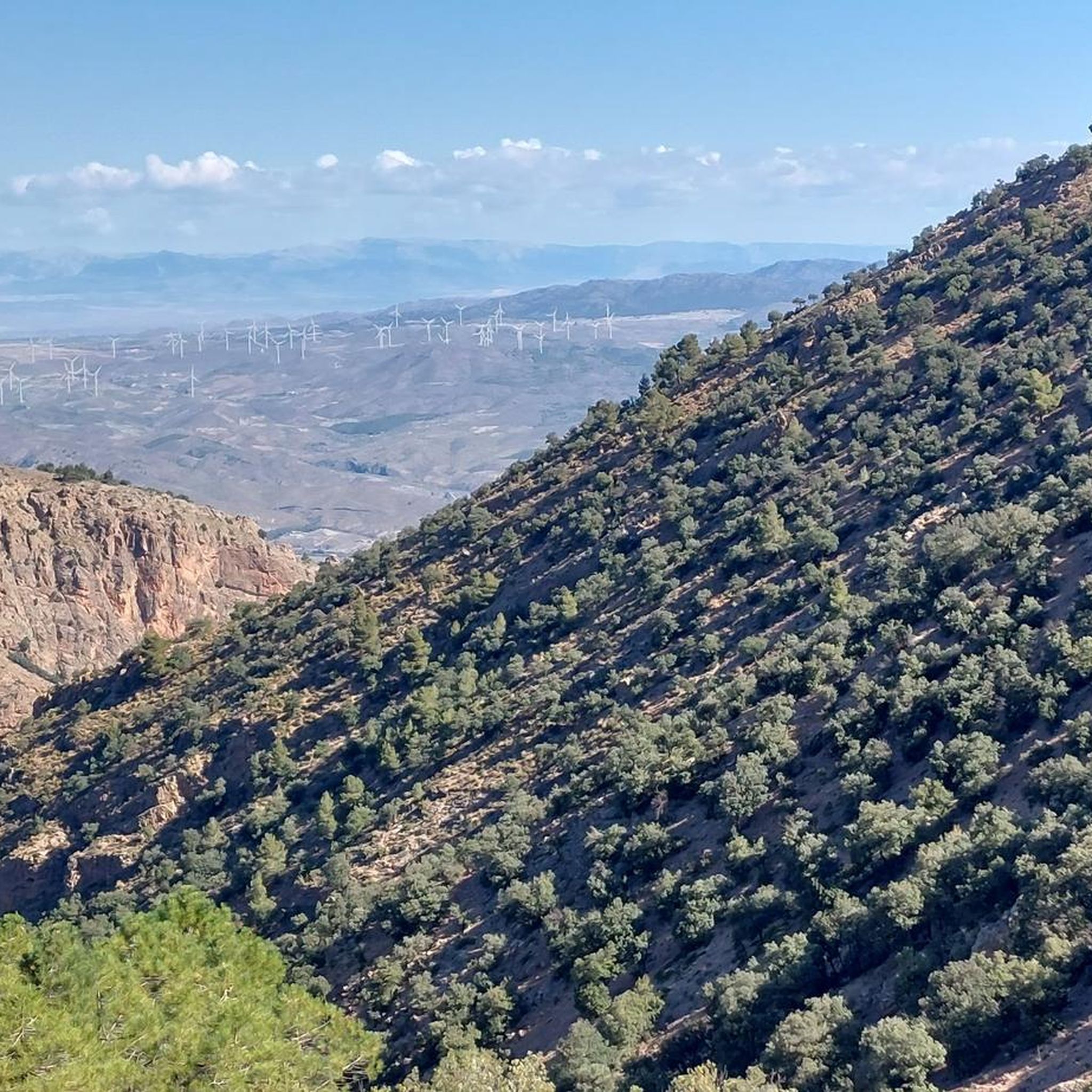
At 1,870 meters above sea level, the Collado de Conde marks a total change in the Almería landscape, moving from the arid environment, known for Western films, to a much cooler setting of mountains and pine forests. This point also functions as a crossroads, with roads, trails, and gravel tracks opening up in various directions.
0
0

Both mountain ranges ensure that it hardly rains in this semi-desert area.
1
0
The beautiful and quiet village of Bacares lives from agriculture and a little from tourism, the area has beautiful nature, many hiking and MTB trails.
0
0
A spectacular route through the southeast of the peninsula between the highlands of Granada in the Baza area towards the Almendricos district, already in the Murcia region, and passes through the Almanzora Valley in Almería. A route that for decades crossed a railway line that transported tons of iron and other merchandise
1
0

breathtaking place ... so extraterrestrialy beautiful and interesting ..also totally isolated
0
0

The stage ends in Serón, a mountain town famous for drying hams, sausages, traditional sweets, cheeses, oil and other products of local gastronomy. The old train station is the best example of mining railway architecture on the Vía Verde Natural Trail of the Almanzora Valley, it has the passenger lobby building, with the characteristic British-style canopy, remains of the rails, loading docks, warehouses goods, rotating platform for trains, mineral loading, water tanks and garages. And it also has a modern planetarium and Interpretation Center. Local services are a couple of kilometers away from the road.
0
0
The towns of Fines and Olula del Río are an encounter with the culture of marble; figures and pieces of marble with inscriptions and inspiring phrases appear on the old railroad track. In Olula there is the famous giant head of a woman, on the other side of the road, you have to be careful not to pass it by. And nearby is the town of Macael for those interested in visiting the “white gold” quarries of the Almanzora Valley. Purchena is far from the road, it is a town with an Andalusian feel, with narrow streets with whitewashed facades at the foot of the remains of an old Muslim fortress from the Nasrid era. The railway continues to trace the slopes of the valley and cross seasonal boulevards over imposing stone bridges to the Tíjola station, which preserves a train engine from the glorious era of the mining railway and the railway buildings. The station is a bar with food service and a terrace on one of the platforms. In Los Canos there are remains of the old iron ore loading dock. The carts arrived loaded with material by aerial cables from the mining sites and by simple gravity they filled the train cars that were in the tunnels located under the loading dock.
0
0

Bring lots of sunscreen
0
0
Frequently Asked Questions
How many mountain bike trails are available around Sierro?
There are over 15 mountain bike trails around Sierro, offering a diverse range of experiences. These include routes suitable for various skill levels, from easy to difficult.
What kind of terrain can I expect on mountain bike trails in Sierro?
The terrain in Sierro is varied and challenging, featuring natural, ungroomed single-track paths, double-tracks, and forest tracks. You'll also encounter occasional linking sections of quiet roads. The region is known for its dramatic geological formations, mountain views, and diverse ecosystems, including oak forests.
Are there mountain bike trails suitable for beginners in Sierro?
Yes, Sierro offers some trails suitable for beginners. These routes typically require up to 2 hours and around 1,000 ft. of elevation gain, corresponding to STS S0-S1 difficulty levels. One easy route is available, and several moderate routes can also be approached by those looking to build their skills.
Are there challenging mountain bike trails for experienced riders in Sierro?
Absolutely. For experienced riders, Sierro provides challenging trails that can take more than 5 hours or involve over 3,000 ft. of elevation gain. These routes require very good fitness and advanced riding skills, often reaching STS S3-S6 difficulty, with some portions potentially requiring riders to push their bikes. An example of a difficult route is the Lúcar Village – Old Tíjola train Station loop from Tíjola, which features over 1,100 meters of elevation gain.
What natural features or landmarks can I see while mountain biking near Sierro?
Sierro's mountain bike trails often pass through areas with spectacular geological formations, including canyons and natural monuments shaped by wind. You can also discover highlights such as the El Estrecho de Urrácal gorge, the Fuente del Huevo Waterfall, and the Cueva de la Paloma cave. The region also features diverse ecosystems, including pine, fir, and oak forests.
Are there any scenic viewpoints along the mountain bike trails in Sierro?
Many trails in Sierro offer spectacular mountain views. El Sierro Peak itself provides panoramic vistas of the surrounding Serra area and Náquera. You can also find routes that lead to or pass by mountain passes like Climb to Alto de Velefique or Tetica de Bacares Summit, offering elevated perspectives of the dramatic landscapes.
Can I find routes that pass through charming villages or historical sites?
Yes, several mountain bike routes in Sierro pass through picturesque 'pueblos blancos' (white villages), offering opportunities for cultural immersion. Some trails also incorporate historical elements, such as sections that follow former railway lines, now converted into greenways. For example, the Old Tíjola train Station – Aqueduct near Purchena loop from Tíjola passes by an old train station that has been repurposed.
Are there circular mountain bike routes available in Sierro?
Yes, many of the mountain bike trails around Sierro are designed as circular routes, allowing you to start and end at the same point. Examples include the Climb to Alto de Velefique – Velefique climb loop from Alto de Velefique and the World's largest mortar – Aqueduct near Purchena loop from Macael.
What is the best time of year to go mountain biking in Sierro?
The Sierro region offers good mountain biking conditions for much of the year. However, spring and autumn generally provide the most pleasant temperatures for riding. Summers can be hot, especially at lower elevations, while winters can bring cooler temperatures and potentially some precipitation in higher areas. Always check local weather conditions before heading out.
Are there any family-friendly mountain bike trails in Sierro?
While many trails in Sierro can be challenging, there are options suitable for families or those looking for an easier ride. These routes typically have less elevation gain and smoother terrain (STS S0-S1). Look for trails designated as 'easy' to ensure a comfortable experience for all family members.
What do other mountain bikers enjoy the most about mountain biking in Sierro?
The mountain biking trails in Sierro are highly rated by the komoot community, with an average score of 4.4 stars from over 10 reviews. Riders often praise the diverse and challenging landscapes, the dramatic geological formations, and the stunning mountain views. The blend of varied terrain and natural beauty makes for a compelling outdoor experience.
Are there any specific permits required for mountain biking on trails near Sierro?
Mountain biking in Sierro often takes place within natural parks, such as the Sierra de Grazalema Natural Park and the Natural Park Sierra de Huétor. While many paths are freely accessible, it's always advisable to check with local park authorities for any specific permit requirements or regulations, especially for certain protected areas or during specific seasons.
Most popular attractions around Sierro

Get inspired with the komoot mobile app


Explore more
Browse the best MTB trails in other regions.
